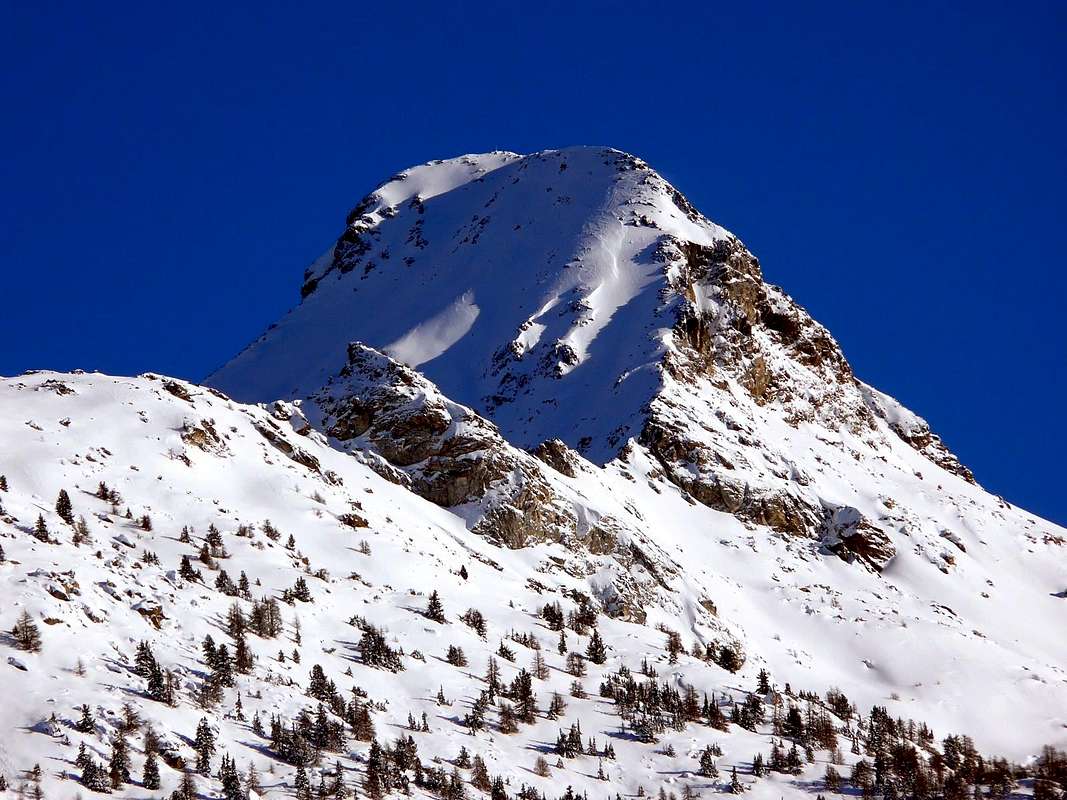
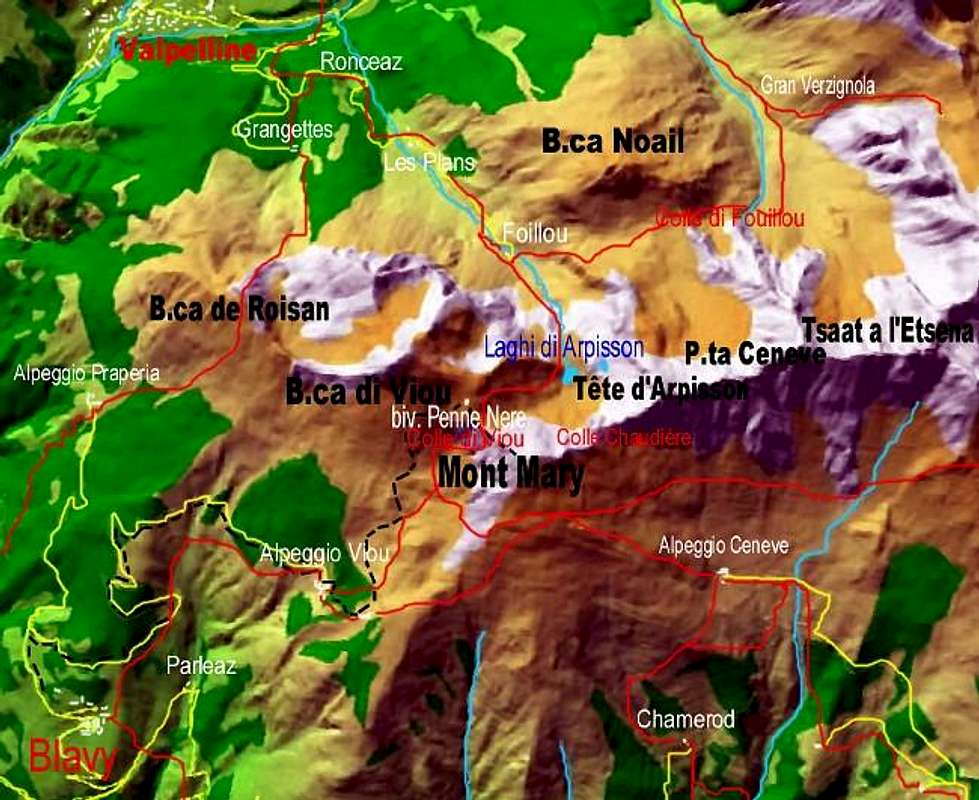
The Town of Aosta is dominated by the massive shape of Becca di Nona (3.142m), standing south of the town. Another summit closely related to Aosta is Becca di Viou, a prominent peak standing NE, more than 2000m above the town. It belongs to a small mountain group, including (starting from West):
Tête de Valfreyde(2.638m)
Becca de Roisan(2.546m)
Quota (2.494m)
Becca di Viou(2.856m)
Mont Mary(2.815m)
Tête di Arpisson (2.856m)
Pointe de Senevé (2.928m)
Tsaat à l'Etsena (Punta W. 2.971m, Punta E. 2.974/5m around)
Becchi di Fana (2.951m)
Croce di Fana(2.212m)
Pointe Henry (2.918m)
Becca Conge(2.914m)
Becca Morion(2.719m)
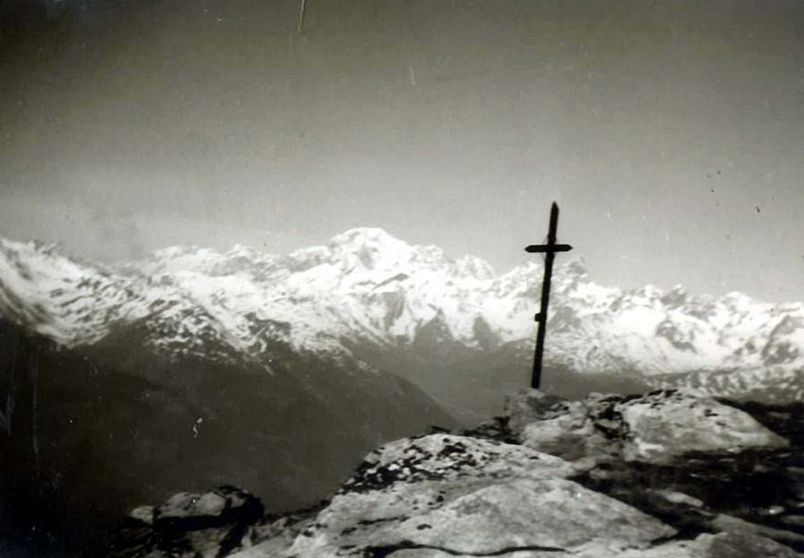
ANCIENT VIOU & OLD CROSS
The Town of Aosta is dominated by the massive shape of Becca di Nona (3.142m), standing south of the town. The last part of the normal route leading to the top of Becca di Viou is rather steep, but it is worth to face up it, because of the great view from the summit into every direction towards the principal mountain groups of the Valle d'Aosta:
ENE: Monte Rosa Group
NE: Matterhorn (Cervino)
N: Grand Combin
NW: Mont Vèlan
W: Mont Blanc Group
SW: Rutor and M. Paramont Group
S-SW: Grande Sassiére and Grande Rousse Group
S: Emilius, Gran Paradiso Group and Grivola
SE: Punta Tersiva, Mont Glacier, M. Avic and M. Ruvic
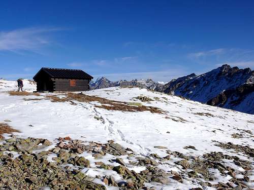
Its ascent can be combined with the one of Mont Mary, since only Col di Viou (2.716m) separates the two mountains. One can also take advantage of the fixed Bivouac, named "Penne Nere", placed recently (July 16th, 2005) in proximity of the pass.
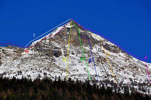
First Ascents
First on the summit (E-SE Arête?): Unknown.
In winter (S Face in the form of cone): Osvaldo Cardellina, Armando and Rino Poli, (Jan 21th, 1968), in ascent by the Variant C and descent through the E-SE Ridge to Viou Hill (Standard Route); * second in winter: Ilario Antonio Garzotto and Osvaldo Cardellina, through the variant B, after with crossing to Mount Mary (First winter), Mar 19th, 1968.
E-SE Ridge: Unknown ("since or ab immemorabilis").
South Slope (Winter Variant): Ilario Antonio Garzotto and Osvaldo Cardellina, through the variant B, Mar 19th, 1968, in ascent.
S-SW Face (in the form of cone): Osvaldo Cardellina, Armando and Rino Poli, (Jan 21th, 1968), in ascent by the Variant C.
S-SE Wall: Osvaldo Cardellina, lone (May 04th, 1967), in ascent.
S-SW Edge: Osvaldo Cardellina, lone (May 04th, 1967), in descent.
S-SW Wall: Ilario Antonio Garzotto with Osvaldo Cardellina up to the midst wall and after in solo, (May 04th, 1967), the both in ascent.
W-SW Pillar: Osvaldo Cardellina and Camillo Roberto Ferronato, (Nov 21th, 1976), in ascent.
W Arête (from the base of crest): Marco Cossard and Giuseppe Lamazzi, (Nov 21th, 1976), in ascent.
W Arête (integral from Roisan Pass and Quota 2.508m): Osvaldo Cardellina, and Camillo Roberto Ferronato, (Nov 28th, 1976), in ascent.
NW Slope (Valfreyde's small Valley): unknown.
N Arête: Osvaldo Cardellina, solo, (Nov 11th, 1999), in ascent.
N-NE Wall: Osvaldo Cardellina, solo (Nov 11th, 1999), in ascent.
Getting There
BY CAR:
From Torino, Milano, etc: Motorway A5. Exit at Aosta Est.
From Switzerland: through the Grand Saint Bernard Tunnel or the namesake pass.
From France: through the Mont Blanc Tunnel or Petit Saint Bernard Pass: It is not necessary to take Motorway A5: you can drive on SS.26, in the direction of Aosta.
BY PLANE:
Aeroporto "Corrado Gex" Saint Christophe (Aosta).
From the Aosta Est exit of the motorway, go towards the City of Aosta. Soon after the Corrado Gex Airport turn right toward the Village of Saint Christophe (615m). Follow the signs for Sorreley (790m). Past Sorreley, continue to the Village of Parleaz (1.214m) and on to the Village of Blavy (1.471m). (Be warned that the road, although paved, is very narrow and twisty).
Routes to Summit
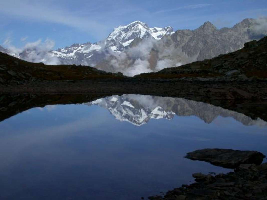
The NORMAL ROUTE is in common with the route leading to Mont Mary as far as Col di Viou. From here reach the summit climbing the wide ridge. ALTERNATIVE ROUTE: descend northwards from Col di Viou (2.698m): after the Lac d'Arpisson (2.480m) (enchanting reflection of Grand Combin) follow towards Fouillou ruines (2.092m), Alpe Neuve (2.026m), Arpisson (1.882m). A further long descent will lead you to the valley bottom, not far from Valpelline (1.022m).
TOUR of Becca di Viou: follow the previous routes as far as Alpe Neuve. Near Arpisson, turn left going westwards and after the Alpage of Chante des Meyes (1.847m) placed in a clearing, enter in the wood along the old trail named "Ru de Mort". The circular trail turns southwards arriving at Praperia Alpage (1.737m). From here one can descend along an unpaved road returning to Blavy (1.471m). A further alternative consist in completing the circular path returning at Viou Pastures, placed along the ascending trail from Blavy.
Difficulties
The route can be considered from EE/F.
Equipment
Normal hiking equipment.
When To Climb
For Hikings the best season is from May to October.
"Guida della Valpelline" de l'Abbè Joseph-Marie Henry - Societè Editrice Valdotaine 1925 II Edition e Collana Reprint Musumeci (1986).
"Guida dei Monti d'Italia - Alpi Pennine (Vol. 2)" di Gino Buscaini - Club Alpino Italiano/Turing Club Italiano, Luglio 1970 (In Italian).
"80 itinerari di Escursionismo Alpinismo e Sci Alpinismo in Valle d'Aosta", di Osvaldo Cardellina, Ed. Musumeci, Giugno 1977 (in Italian); seconda Ed. Luglio 1981; terza Ed. Luglio 1984; (in French), prima Ed. Febbraio 1978; seconda Ed. Marzo 1980.
"Dove andiamo in montagna? in Valle d'Aosta" di Domenico Caresio Edit. Tipografia Ferraro Ivrea, Marzo 1996.
"Ascensioni 1964-1969" Diario Alpinistico di Ilario Antonio Garzotto (unpublished).
"Diari Alpinistici" di Osvaldo Cardellina e Indice Generale accompagnato da Schedario Relazioni Ascensioni 1964-2019 (unpublished).
Children refers to the set of objects that logically fall under a given object. For example, the
Aconcagua mountain page is a child of the 'Aconcagua Group' and the 'Seven Summits.' The
Aconcagua mountain itself has many routes, photos, and trip reports as children.
Parents refers to a larger category under which an object falls. For example, theAconcagua mountain page has the 'Aconcagua Group' and the 'Seven Summits' asparents and is a parent itself to many routes, photos, and Trip Reports.

 19290 Hits
 93.54% Score
 45 Votes