
-
 22643 Hits
-
 84.27% Score
-
 18 Votes
|
|
Mountain/Rock |
|---|---|
|
|
39.85600°N / 105.962°W |
|
|
12703 ft / 3872 m |
|
|
Vasquez Mountains Overview
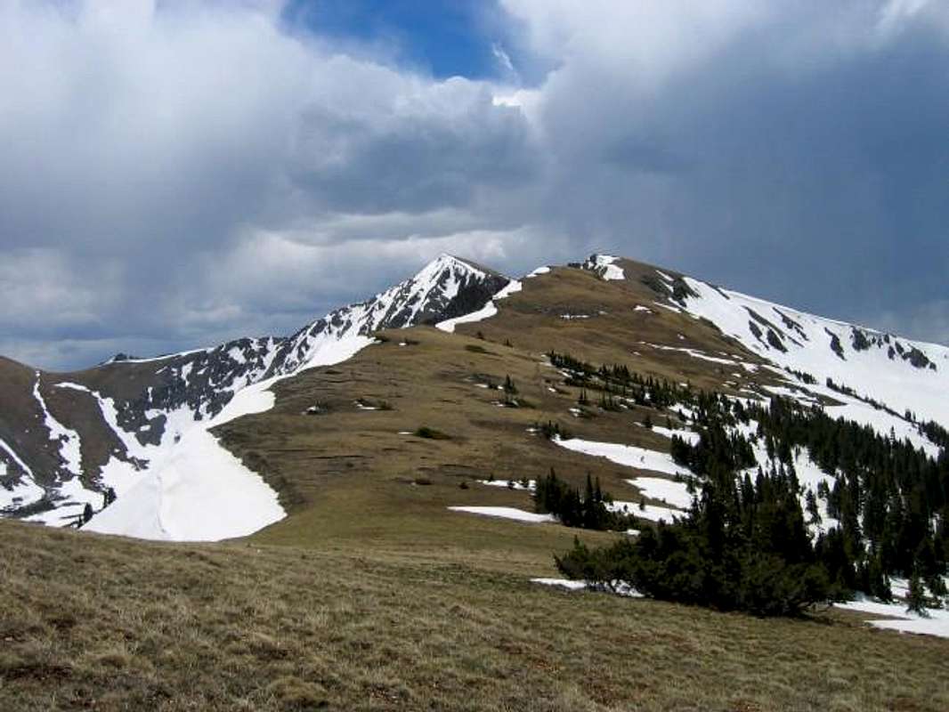
View of Bills Peak from along the St. Luis Divide Trail.
 The Vasquez Mountains are an indistinct subrange of Colorado's Front Range. Extending from Berthoud Pass's west side and running north for 16 miles along the Fraser River Valley, the Vasqueze Mountains are a small L shaped range. They are connected to higher mountains by both Burthoud Pass and Jones Pass. The Williams Fork River on the west seperates them from the still milder Williams Fork Mountains. The slopes of Mary Jane Ski Area occupies the lower slopes of around North Twin Cone.
 The summits of the Vasquez Mountains are generaly in the twelve thousand foot range. Although the terrain of these mountains consists of much rolling tundra; glaciation has carved some impressive cirques in the eastern aspects of many of the ridges and mountains in the area. The Vasquez Mountains are home to two of Colorado's wilderness areas: the Vasquez Peak Wilderness in the south and the Byers Peak Wilderness in the north. The intervening Fraser Experimental Forest lends a deep wilderness feel to these mountains as the forest seperates the summits from civilization with a thick blanket of Engleman Spruce and Lodgepole Pine.
Although less dramatic then the nearby Indian Peaks and Gore Range, of which they offer superb vantages, the Vasquez Mountains offer a quite and intimate mountain experience. An extensive trail system offers excellent acess to these mountains: The Continental Divide Trail follows the southern slopes of these mountains, the Mount Nystrom Trail enters the heart of the Vasquez Peak Wilderness, and the St. Luis Divide Trail links the Byers Peak Wilderness with the Vasquez Peak Wilderness.
The named Vasquez Mountains are (from north to south, then west to east): Bottle Peak (11,584 ft), Byers Peak (12,804 ft), Bills Peak (12,703 ft), St. Luis Peak (12,246 ft), Mount Nystrom (12,652 ft), Vasquez Peak (12,947 ft), Stanley Mountain (12,521 ft), and the Twin Cones (12,058 & 12,060 ft).
Bills Peak Overview
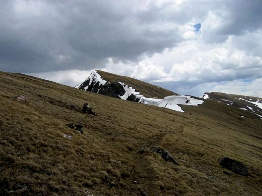
The summit of Bills Peak rising above the cornices which grace the eastern edge of the north ridge.
Bills Peak is the second highest summit in the Byers Peak Wilderness. It is located just a mile west of the higher wilderness namesake, Byers Peak. Although similiar to Byers it is nonethless distinct with an eastern face and north eastern ridge that stand out as rugged decorations in this secret wilderness.
Bills Peak is easy to ascend and possibly could be feasible year round. Bills Peak offers expansive scenery. From the intimate tundra of the ridges hosting the St. Luis Divide Trail to the expansive views of The Gore Range Bills Peak delights the senses. It is worthwhile.
Directions & Maps
The primary access to Bills Peak is via the Kinney Creek Trailhead. This trailhead is located on the west side of the Vasquez Mountains. To get to there take I-70 to the Silverthorne exit and travel north on CO-9 for nealy 13 miles. Turn Right at Ute Pass Road (Summit County 15). Follow the road over Ute Pass past the Henderson Mine into Grand County. Take a right at Grand County 302. Follow this 3.6 miles to the Kinney Creek Trailhead. The signed trai;head is located just to the right of the road after it crosses Kinney Creek.
 |
Red Tape
Byers Peak Wilderness Regulations Apply. Please treat this area with respect.
The wilderness is in the Sulphur Ranger District.
Contact information:
Sulpher Ranger District
9 Ten Mile Drive
Granby, CO 80446
970-887-4100
Mountain Conditions
Current Weather Conditions: Western United States
Click image to enlarge

For a detailed seven day forecast for the nearby town of Fraser CO please click the provided NOAA link.