
-
 18673 Hits
-
 75.63% Score
-
 8 Votes
|
|
Mountain/Rock |
|---|---|
|
|
39.83700°N / 105.786°W |
|
|
Hiking, Skiing |
|
|
Spring, Summer, Fall, Winter |
|
|
12060 ft / 3676 m |
|
|
Overview
The Twin Cones are the in the Vasquez Mountains, a subrange of Colorado's Front Range. The southern Cone is the highest at 12,060'. The northern Cone is only 0.5 miles away at 12,058'. The Twin Cones are located about 4 miles north of Berthoud Pass in Northern Colorado. The north side of both cones border Winter Park Ski Resort. Accessing the Twin Cones via Winter Park Ski Resort while the resort is open would be the easiest way to climb the Twin Cones. Accessing via Winter Park Ski Resort while the resort is closed will be not be enjoyable due to the chairlifts. The Twin Cones are a popular summer hike from Berthoud Pass as outlined in Dave Muller's "Colorado Summit Hikes For Everyone."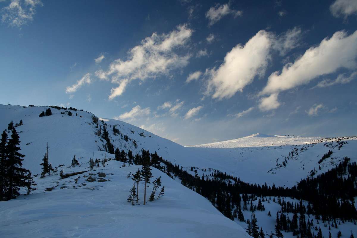
The Twin Cones from Elevation Point 11,527'
The summer hike from Berthoud Pass (11,315') is second class with 8.0 miles roundtrip and 1,645 feet of elevation gain including 340 feet extra on the ascent and 560 feet extra during the return. It should take about 120 minutes to reach the southern Cone, 20 minutes to reach the northern Cone and 115 minutes to return to the trailhead. This route follows the Continental Divide National Scenic Trail and the Mt. Nystom Trail.
The Twin Cones can also be reached during snow months from First Creek only covering 3 miles roundtrip and 1,618 feet of elevation gain. This route is only recommended when snow is present because there is no established trail and snow reduces environmental impact.
Getting There
Berthoud Pass:Berthoud Pass is on the west side of Berthoud Pass, which is at mile marker 243 on US 40. Berthoud Pass can be accessed from the north via Winter Park and Fraser or from the south via Empire. To access Berthoud Pass from the south, exit I-70 at exit #233. Park on the east side of Berthoud Pass. US 40 is plowed regularly allowing easy year-round accessibility.
Roundtrip Distance: 8.0 miles
Elevation Gain: 1,645 feet
Recommended Climbing Season: Summer
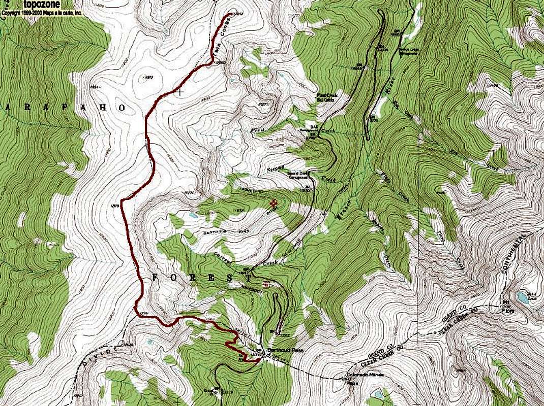
Twin Cones' Berthoud Pass Route
First Creek:
First Creek intersects US 40 about 4 miles north of Berthoud Pass on US 40. It is the third turnoff after Berthoud Pass and the first after Mary Jane ski area.
Roundtrip Distance: 3 miles
Elevation Gain: 1,618 feet
Recommended Climbing Season: Winter
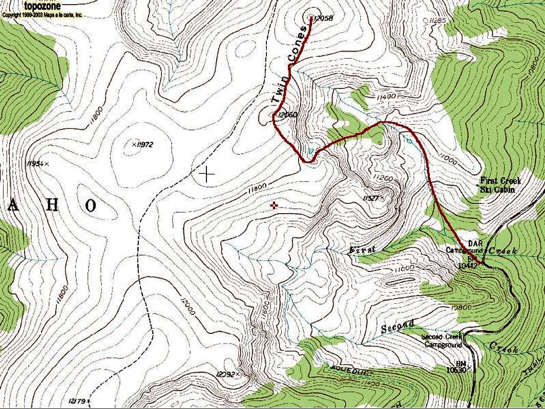
Twin Cones' First Creek Route
Red Tape
The Twin Cones are located in Arapaho National Forest, Sulphur Ranger District. No permits required.External Links
Summits of Colorado's Vasquez MountainsSouth Twin Cone
North Twin Cone
Camping
Campgrounds in order from Berthoud Pass to Winter Park:Second Creek Campground
DAR Campground
Spruce Lodge Campground
Midland Campground
Idlewild Campground
For more info on these call 970-887-4100.
Floral Park Campground is south of Berthoud Pass on US 40: 303-567-2901.
Mountain Conditions
7 Day Forecast for Winter Park, COColorado Avalanche Information Center (CAIC)