
-
 16528 Hits
-
 73.89% Score
-
 7 Votes
|
|
Area/Range |
|---|---|
|
|
39.79600°N / 105.854°W |
|
|
Hiking, Skiing |
|
|
Spring, Summer, Fall, Winter |
|
|
12947 ft / 3946 m |
|
|
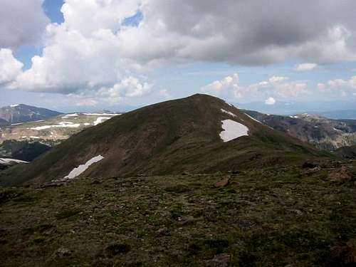
Overview
The Vasquez Mountains are an indistinct subrange of Colorado's Front Range. The Vasquez Mountains extend west of U.S. 40 near Berthoud Pass and the Fraser River Valley & north of Woods Creek east of the Continental Divide to the Williams Fork on the west and then north to the Colorado River near Hot Sulphur Springs, they are a small L shaped range. The summits of the Vasquez Mountains are generally in the twelve thousand foot range. Although the terrain of these mountains consists of much rolling tundra; glaciation has carved some impressive cirques in the eastern aspects of many of the ridges and mountains in the area. The Vasquez Mountains are home to two of Colorado's wilderness areas: the Vasquez Peak Wilderness in the south and the Byers Peak Wilderness in the north. The intervening Fraser Experimental Forest lends a deep wilderness feel to these mountains as the forest separates the summits from civilization with a thick blanket of Engleman Spruce and Lodgepole Pine.Although less dramatic then the nearby Indian Peaks and Gore Range, which offer superb vantages, the Vasquez Mountains offer a quiet and intimate mountain experience. An extensive trail system offers excellent access to these mountains: The Continental Divide Trail follows the southern slopes of these mountains, the Mount Nystrom Trail enters the heart of the Vasquez Peak Wilderness, and the St. Louis Divide Trail links the Byers Peak Wilderness with the Vasquez Peak Wilderness.
List
| Peak Name | Parent | Quadrangle | Land Use Designation | ||||||
| Vasquez Peak | "Hassell Peak" | Berthoud Pass | Vasquez Peak Wilderness Area | ||||||
| Byers Peak | Vasquez Peak | Byers Peak | Byers Peak Wilderness Area | ||||||
| Bobtail Benchmark | Vasquez Peak | Byers Peak | Vasquez Peak Wilderness Area | ||||||
| 12763 | Vasquez Peak | Berthoud Pass | Vasquez Peak Wilderness Area | ||||||
| Bills Peak | Byers Peak | Byers Peak | Byers Peak Wilderness Area | ||||||
| 12686 | Bills Peak | Byers Peak | Byers Peak Wilderness Area | ||||||
| Mount Nystrom | Bobtail Benchmark | Byers Peak | Vasquez Peak Wilderness Area | ||||||
| 12580 | Bills Peak | Byers Peak | Byers Peak Wilderness Area | ||||||
| Stanley Mountain | Vasquez Peak | Berthoud Pass | Vasquez Peak Wilderness Area | ||||||
| 12420 | S | 12420 | Byers Peak | 0.8 | 280 | 39.8276 | -105.9515 | Byers Peak | Byers Peak Wilderness Area |
| "Harrison Mountain" | Woods Mountain | Berthoud Pass | Henderson Mine Property | ||||||
| 12316 | S | 12316 | Bobtail Benchmark | 0.9 | 296 | 39.7968 | -105.8725 | Berthoud Pass | Vasquez Peak Wilderness Area |
| "Russell Peak" | 12300 | Stanley Mountain | 1.7 | 40 | 39.8018 | -105.7940 | Berthoud Pass | Arapaho National Forest | |
| St. Louis Peak | 9 | 12246 | Bobtail Benchmark | 2.7 | 346 | 39.7948 | -105.9385 | Byers Peak | Arapaho National Forest |
| Red Mountain | "Harrison Mountain" | Berthoud Pass | Henderson Mine Property | ||||||
| South Twin Cone | Colorado Mines Peak | Berthoud Pass | Vasquez Peak Wilderness Area | ||||||
| North Twin Cone | Colorado Mines Peak | Berthoud Pass | Vasquez Peak Wilderness Area | ||||||
| Ptarmigan Peak | Byers Peak | Bottle Pass | Byers Peak Wilderness Area | ||||||
| 11642 | 12 | 11642 | Bills Peak | 2.8 | 382 | 39.8316 | -106.0047 | Ute Peak | Byers Peak Wilderness Area |
| Bottle Peak | S | Ptarmigan Peak | Bottle Pass | Byers Peak Wilderness Area | |||||
| "Lunch Rock" | 11260 | Stanley Mountain | 3.5 | 80 | 39.8579 | -105.7731 | Berthoud Pass | Arapaho National Forest | |
| Green Ridge | 11122 | Ptarmigan Peak | 1.0 | 22 | 39.9149 | -105.9334 | Bottle Pass | Bureau of Land Management | |
| 10874 | 13 | Bills Peak | 3.6 | 334 | 39.8788 | -106.0323 | Sylvan Reservoir | Arapaho National Forest | |
| "Vasquez Ridge" | 10740 | Stanley Mountain | 4.4 | 56 | 39.8686 | -105.7854 | Berthoud Pass | Arapaho National Forest | |
| Blue Ridge | 14 | 10731 | Ptarmigan Peak | 3.7 | 831 | 39.9544 | -105.9786 | Bottle Pass | Private Land |
| Sheep Mountain | 15 | 10671 | Blue Ridge | 3.0 | 931 | 39.9533 | -105.9216 | Bottle Pass | Bureau of Land Management |
| White Cliffs | S | 10620 | Blue Ridge | 1.9 | 280 | 39.9755 | -106.0002 | Bottle Pass | Arapaho National Forest |
| Morse Mountain | 16 | 10351 | Ptarmigan Peak | 2.6 | 331 | 39.9210 | -105.8976 | Bottle Pass | Arapaho National Forest |
| 10265 | 17 | 10265 | Blue Ridge | 2.6 | 405 | 39.9159 | -105.9949 | Bottle Pass | Arapaho National Forest |
| Cottonwood Benchmark | 18 | 10119 | Blue Ridge | 6.9 | 419 | 40.0414 | -106.0424 | Hot Sulphur Springs | Arapaho National Forest |
| 9905 | 19 | 9905 | Cottonwood Benchmark | 1.8 | 1001 | 40.0554 | -106.0134 | Hot Sulphur Springs | Private Land |
| 9810 | 20 | 9810 | Blue Ridge | 1.4 | 350 | 39.9625 | -105.9450 | Bottle Pass | Private Land |
| 9755 | 21 | 9755 | Blue Ridge | 5.4 | 415 | 39.9483 | -106.0869 | Sylvan Reservoir | Arapaho National Forest |
| Rocky Point | 9750 | Sheep Mountain | 0.8 | 50 | 39.9436 | -105.9313 | Bottle Pass | Arapaho National Forest | |
| Ninemile Mountain | 22 | 9681 | Blue Ridge | 2.5 | 621 | 39.9983 | -105.9531 | Bottle Pass | Private Land |
| 9617 | 23 | 9617 | 9905 | 1.2 | 397 | 40.0721 | -106.0135 | Hot Sulphur Springs | Private Land |
| Mount Chauncey | 24 | 9575 | 9617 | 0.9 | 355 | 40.0786 | -105.9995 | Granby | Bureau of Land Management |
| 9398 | 25 | 9398 | Ninemile Mountain | 3.2 | 749 | 40.0187 | -105.9000 | Granby | Private Land |
| 9118 | 26 | 9118 | 9398 | 1.7 | 458 | 40.0397 | -105.9174 | Granby | Private Land |
| 9100 | S | 9100 | 9755 | 1.6 | 280 | 39.9693 | -106.1015 | Sylvan Reservoir | Arapaho National Forest |
| 8911 | 27 | 8911 | 9398 | 2.2 | 411 | 40.0565 | -105.8833 | Granby | Bureau of Land Management |
| Curtis Ridge | S | 8860 | 9755 | 2.3 | 280 | 39.9585 | -106.1279 | Battle Mountain | Private Land |
| 8820 | 28 | 8820 | Blue Ridge | 2.0 | 320 | 40.0157 | -105.9831 | Granby | Private Land |
External Links
Map of Vasquez MountainsList of Vasquez Mountains
Lists of John Member Progress
Credits
JonBradfordSummit Sight