
|
|
Mountain/Rock |
|---|---|
|
|
41.57880°N / 123.092°W |
|
|
Siskiyou |
|
|
8299 ft / 2530 m |
|
|
Overview
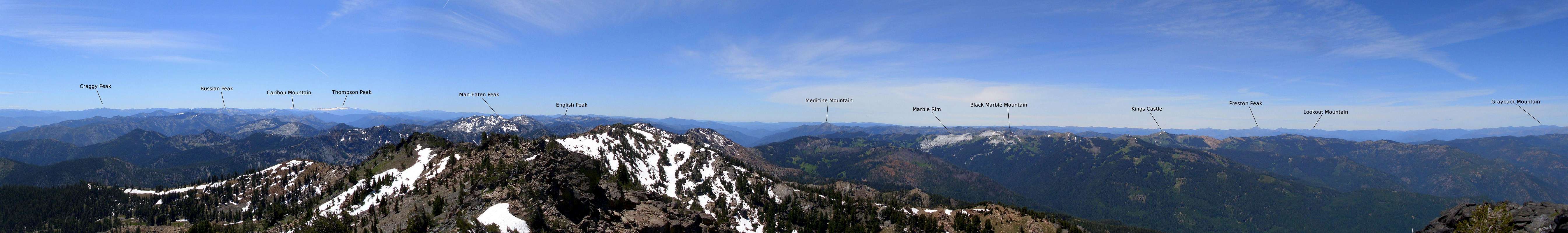
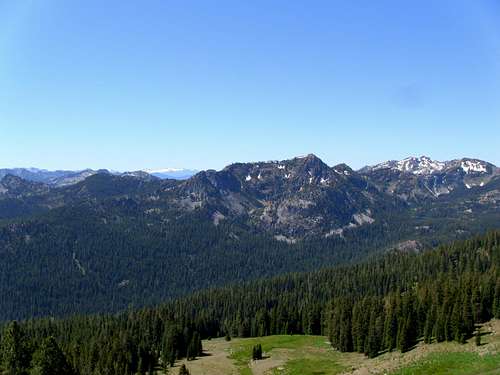
Boulder Peak is the highpoint of the rugged Marble Mountain Wilderness in Northern California. The Marble Mountain Wilderness is one of the finest tracts of pristine mountains in the state of California. Containing nearly a quarter million acres this wilderness is home to countless rugged peaks, beautiful alpine meadows, rich old growth forests and dozens deep subalpine lakes. Despite these fantastic qualities the Marble Mountains see relatively light use, due in large part to their isolation from most population centers. This area is truly wild in every sense of the word! An extensive network of over 400 miles of trails make this an ideal place for a long backcounty trip with tremendous solitude potential.Boulder Peak stands guard over the northeast corner of the wilderness with its north face thrusting 1500 feet out of Lower Wright Lake. To the east scenic Back Meadows hangs 1500 feet below the summit of Boulder Peak, witch in turn appears to hover above the Scott Valley 4000 feet lower. To the west the stark white cliffs of the Marble Rim stand out, while further off the massive Preston Peak dominates the skyline. Immediately to the south are the rugged cluster of un-named peaks containing the bizarrely named Man-Eaten and Wooley Lakes.
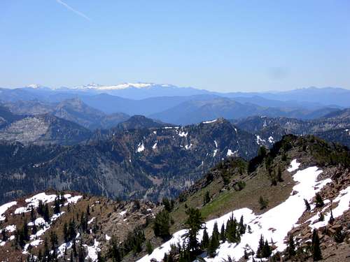
Trintiy Alps in the background from the summit of Boulder Peak
As with most sub-ranges within the Klamath mountains, the geology of the Marble Mountains is highly complex and varied. The Marble components of the Marble Mountains are the result of metamorphosed calcium from fossilized marine invertebrates. Boulder Peak itself if composed of ultramafic rock that was driven upward from an ancient sea by volcanic episodes. The most recent geologic chapter for this region includes the glacial activity that shaped these mountains. This is evidenced in the many sub-alpine lakes and u-shaped valleys found here.
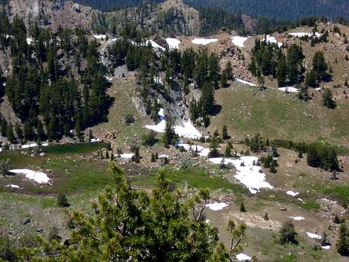 Second Valley from the Summit of Boulder Peak | 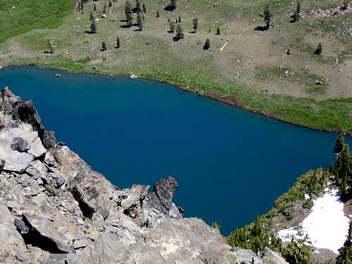 Upper Wright Lake from Boulder Peak |
The Marble Mountain Wilderness features some of the most botanically diverse coniferous forests in the world. Here vegetation native to the great basin can be found growing along side ferns and other coastal species. Specific Species include: Brewer's Spruce, Incense Cedar, Dwarf Juniper, White, Subalpine, and Shasta Red Fir, Engelmann Spruce, Western Hemlock, Pacific Yew and Whitebark, Knobcone, Foxtail, Lodgepole, Sugar, Ponderosa, and Western White Pine.
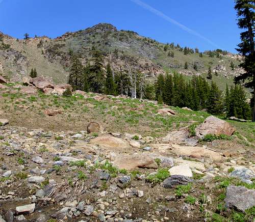
View from the pass leading into Back Meadows.
Of special note to peak baggers, Boulder Peak is ranked 51st on the California prominence list with 2,899 ft of prominence, landing it a spot on the California 2000 foot Prominence peaks list.
  Summit View |
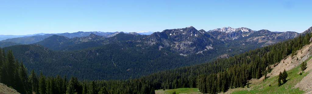
Overview of Summit Routes
Route Overview Map Showing 3 Approaches
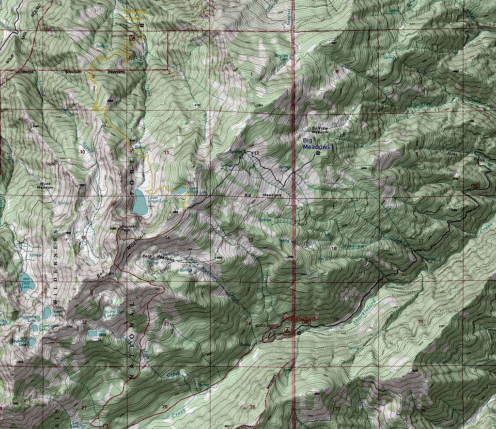
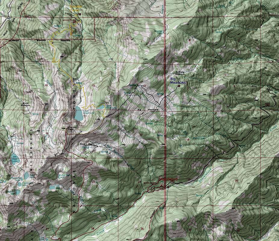
Boulder Creek Approach:
trailhead elevation 3800 feetThis is the most frequently used approach for Boulder Peak. The appraoch is mostly forested but eventually gives way to scenic Wright Lakes at the foot of Boulder Peak's impressive north face.
6.7 miles and 4,500 feet elevation gain one-way
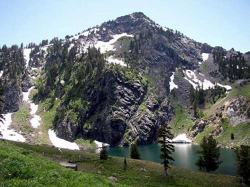
Boulder Peak from Lower Wright Lake
Getting There:
At the south end of Yreka is an exit for California Highway 3. Take this exit and go west towards Fort Jones. Fort Jones is 16 miles from Yreka and at the south end of Fort Jones take a right turn on the paved Scott River Road. Follow this road for 14.1 miles (stay to the right where Quartz Valley Road forks to the left). There is a pointer for a road (44N45) to Indian Scotty Campground and Lovers Camp, turn left here and cross the Scott River. Continue on this paved narrow road past Indian Scotty Campground for 1.6 miles. Turn left on the gravel road 44N53Y and climb up 2.2 miles to the Boulder Creek Trailhead. Several cars can park at the trailhead. The trailhead is accessible to low clearance vehicles.
Route Description:
This approach begins in the forest by climbing to an old logging road, then following the logging road for a short while before branching off as a trail again. Eventually the trail enters the Marble Mountain Wilderness. After a long forested walk gaining much elevation you reach a junction signed with forks heading to Second Valley and Wright Lakes. Take the fork to Wright Lakes. From Upper Wright Lake the trail climbs up to a ridgeline where the trail forks. Take the fork heading west along the ridge toward Boulder Peak. Follow this trail along the ridge to with in a hundred feet of the summit of Boulder Peak, then scramble the last hundred feet to the summit. A more detailed description of the route can be found here.
 |  |  |  |
Shackleford Creek Approach:
trailhead elevation 4500 feetThis is probably the most scenic approach to Boulder Peak. The first several miles follow Shackleford Creek through a lush forested canyon. Further up the hike crosses a number of meadows including the hanging valley of Back Meadows. Views toward the most rugged section of the wilderness are expansive once past Shackleford Creek canyon.
7.8 miles and 3800 feet elevation gain one-way
Shackleford Creek Drainage
Getting There:
From Yreka follow California Highway 3 west for 16 miles towards Fort Jones. From Fort Jones continue 4 miles on Highway 3 and turn on Quartz Valley Road. Follow Quartz Valley Road for 5.7 miles to the junction with forest route 43N21. Turn on Forest Route 43N21 and follow it for 6.9 miles to the Shackleford Creek Trailhead. The Trailhead has space for many vehicles and even has a few campsites with picnic tables and fire rings.
Route Description:
Follow the Shackleford Creek trail for 3 miles to the junction with the trail to Calf Lake and Back Meadows. Up to this junction this route favors an westerly direction but now double back on itself in one long switchback as seen on the route map. Follow this trail for a mile to another junction. This junction is signed with the trails to Calf Lake and Shackleford Creek marked. Continue past this sign taking the trail heading in a northeasterly direction, you will soon come to the crossing of Long High Creek and enter a meadow. Look for large cairns to cross the meadow and enter a pocket of forest. The pocket forest doesn't last long and soon you enter a larger meadow.
Once you enter this meadow the trail is very difficult to follow due to a number of cow paths left here form grazing cattle. At the location where the trail enters the meadow is a large fallen log. Memorize this log, you can see it form far up on the ridge. If you loose the trail coming down, you can simply head for this log an hit the trail without too much searching. Follow the trail up to the ridge and cross into the valley containing Back Meadows. The ridge featuring Boulder Peak is now visible, although the summit is not. Cross Back Meadows and climb to the base of the ridge. Ascend the ridge in a gully left of the false summit. From here follow the ridge to the summit of Boulder Peak.
 |  |  |  |
Big Meadows Approach:
trailhead elevation 6400 feetThis is shortest approach for Boulder Peak, but getting to the trailhead requires a long drive on rough logging roads subject to closure during times of timber harvest. High clearance vehicles are required to reach the trailhead, inquire with the local ranger station about any closures in affect.
3.3 miles and 1900 feet elevation gain one-way
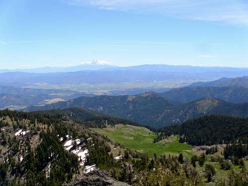
View east from Big Meadows
Getting There:
Driving to the Big Meadows tralhead is a complicated affair. The trailhead is completely unsigned but is shown on maps. Due to the maze of logging roads immediately east of the Marble Mountain Wilderness there may be more than one way to reach the trailhead. For this reason providing driving directions is impractical. Please see the following maps to navigate to this trailhead and inquire with the local ranger station about any closures. Map1 Map2 Map3
Route Description:
From the trailhead hike a short distance to Big Meadows as indicated on the route map until you meet up with the Back Meadows trail. Turn right here and head up the ridge. Follow this trail along the ridge to within a hundred feet of the summit of Boulder Peak, then scramble the last hundred feet to the summit. The trails in this area are difficult to follow due to grazing cattle that create many paths in the meadows, be sure to pay attention to landmarks and check your maps often.
Additional information provided by FarNorCal:
Getting to this TH was quite a trek. I was able to traverse the rough roads (Forest Rte. 43N23) in 2-wheel drive but prepare for a bumpy ride. My biggest assistance in getting there was 'Google Earth'. The TH coordinates are: 41degrees 35' 38.34"N and 123degrees 02' 35.73"W. Elevation at the TH is roughly 6148'. The forest service map of the Marbles and Russians were not much help in getting there. Also, the area is often used for ranging Spring and Summer cattle but the trail is well established and (thanks to responsible hikers) well marked by small trail cairns. After approximately one mile from the TH, there is a 3-way junction sign. The quickest route to Boulder Peak is to take the 'Wright Lakes' trail which is the start of the ascent. Also, behold the beautiful Aspen grove to the left of the 'Wright Lakes' trail. Several miles of ascent will lead you to a saddle. From here, take the faint trail to the south (left) to get to Boulder Peak. If you continue over the saddle, it'll take you to the Wright Lakes and the established 'Boulder Peak' TH.
 |
 |
 |
 |
Red Tape

Wright Lake

North Face
Access to this wilderness is relatively easy. No visitor permit is required but you will need a campfire permit if you plan to have a fire or use an open flame stove.
Note that cattle grazing is allowed in some regions within the Marble Mountain Wilderness, so take extra precautions when choosing water sources.
When To Climb and Conditions
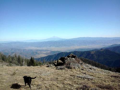
Scott Valley and Shasta
Boulder Peak is best approached as a summer hike, June through October. This is also a Wilderness Area, therefore, snowmobiles are not allowed in the winter. Go to the following link for more information.
Ranger Station
You can probably drive to the Boulder Creek trailhead for this hike during the winter because the trailhead is at only about 3,800 ft. Beyond the trailhead you are on your own.
There are lots of black bears in this area, but they are usually very shy and run away as soon as they see you. If you have a bear phobia, be prepared to deal with them. They usually don’t ransack vehicles and campsites looking for goodies either. In the early mornings, it is not unusual to see fresh bear prints on the trail as you hike up towards the lakes.
Camping

Upper Wright Lake

Second Valley
There are lots of places to camp in and around the Marble Mountain Wilderness area. The closest campground is at the bottom of the hill that leads up to the Boulder Creek trailhead. Indian Scotty Campground is right on the Scott River and has 28 campsites. Dispersed camping on National Forest land is permitted most places as well
If starting from the Shackleford Trailhead there are several campsites present at the trailhead complete with fire rings and picnic tables.
If you want to backpack into the Wilderness and make this hike an overnight affair, there are unimproved campsites at the north end of Lower Wright Lake. If you want to climb a little further, there are sites at either end of Upper Wright Lake also.
Contanct and Links
False Summit from Back Meadows
Klamath National Forest
1312 Fairlane Road
Yreka, CA 96097-9549 Phone:
(530) 842-6131
Happy Camp Ranger District
63822 Highway 96
P.O. Box 377
Happy Camp, CA 96039-0377 (530) 493-2243
FAX (530) 493-2212
TDD (530) 493-2894
Salmon River & Scott River Ranger Districts
11263 N. Highway 3
Fort Jones, CA 96032-9702 (530) 468-5351
FAX (530) 468-1290
TDD (530) 468-2783
Ukonom Ranger District
Highway 96 & Ishi Pishi Road
P.O. Drawer Box 410
Orleans, CA 95556-0410 (530) 627-3291
FAX (530) 627-3401
TDD (530) 627-3291
Klamath National Forest