-
 1078 Hits
-
 81.18% Score
-
 13 Votes
|
|
Mountain/Rock |
|---|---|
|
|
61.88370°N / 9.68043°E |
|
|
Innlandet |
|
|
Hiking, Mountaineering, Scrambling, Skiing |
|
|
Summer |
|
|
6283 ft / 1915 m |
|
|
Overview
Geographical classification: The Scandes > Rondane > Bråkdalsbelgen
Bråkdalsbelgen 1915 m
The Rondane National Park, in Innlandet Norwegian county, includes the namesake mountain range, counting nine peaks exceeding the altitude of 2000 meters above sea level, a magical threshold in Norway! In fact there are no peaks reaching 3000 meters of altitude in the whole Scandinavia, with the highest peak being the Galdhøpiggen (Jotunheimen) getting the altitude of 2469 m. These nine summits are divided in three groups, being situated within three different areas of the Rondane park. The Northernmost group includes Høgronden 2117 m, Midtronden 2060 m and Digerronden 2016 m; the West side of Rondane includes Trolltinden 2018 m, Storsmeden 2016 m and Veslesmeden 2015 m. The East group includes the highest summits, with Rondslottet 2178 m, Storronden 2138 m and Vinjeronden 2044 m.
Even if lacking a few tens of meters to reach the important threshold of 2000 meters, and for this reason little frequented as compared to the nearby two thousanders, Bråkdalsbelgen is actually an extremely interesting muntain to climb.
Getting There
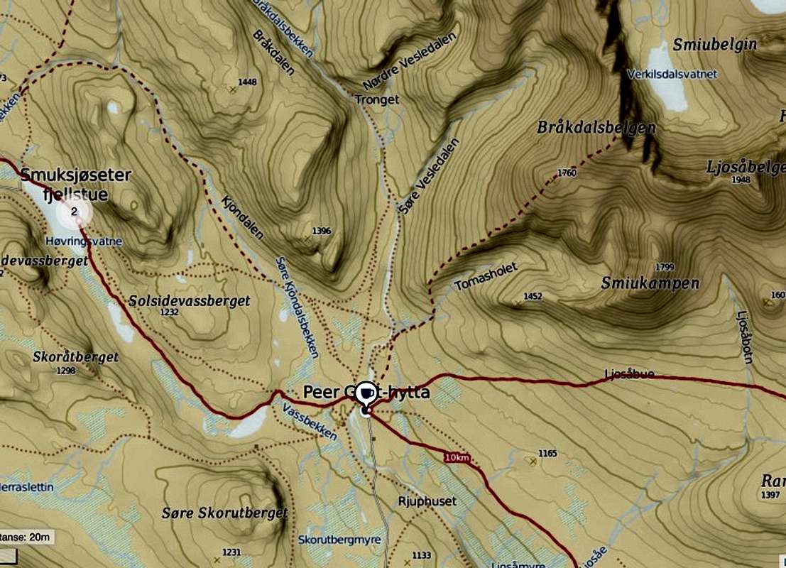
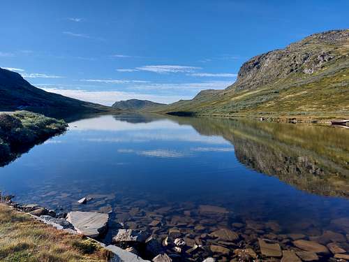
From Otta follow the E6 in a Northerly direction and exit Høvringen about 15-20 km after passing Otta. When you pass Høvringen fjellstue, follow the signposts to Smuksjøseter fjellstue (an automatic toll road - NOK 50), located on the shore of the lake named Hovringsvatnet. Parking lot near the hut.
Route
Bråkdalsbelgen Normal route from Smuksjøseter fjellstue
Summit altitude: 1915 m
Difficulty: hike and easy scramble
Vertical gain: 860 m
Starting point: Smuksjøseter fjellstue
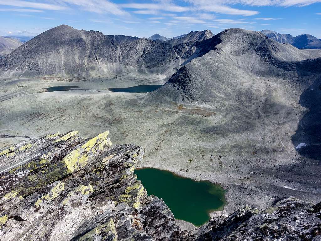
A spectacular itinerary among the colored lichens and mosses of the Rondane National Park.
From the hut take near the lake the path on the North side of the Solsidevassberget (the mountain behind the hut) in the direction of Kjondalsbekken. The vegetation is scarce and beautiful carpets of lichens and mosses of various colors dominate. Skirt the lake and continue for a long time on false plains.
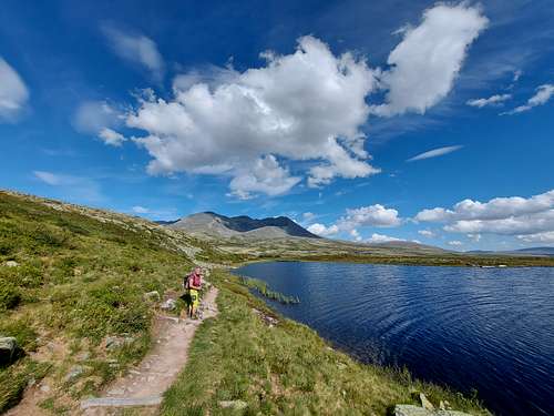
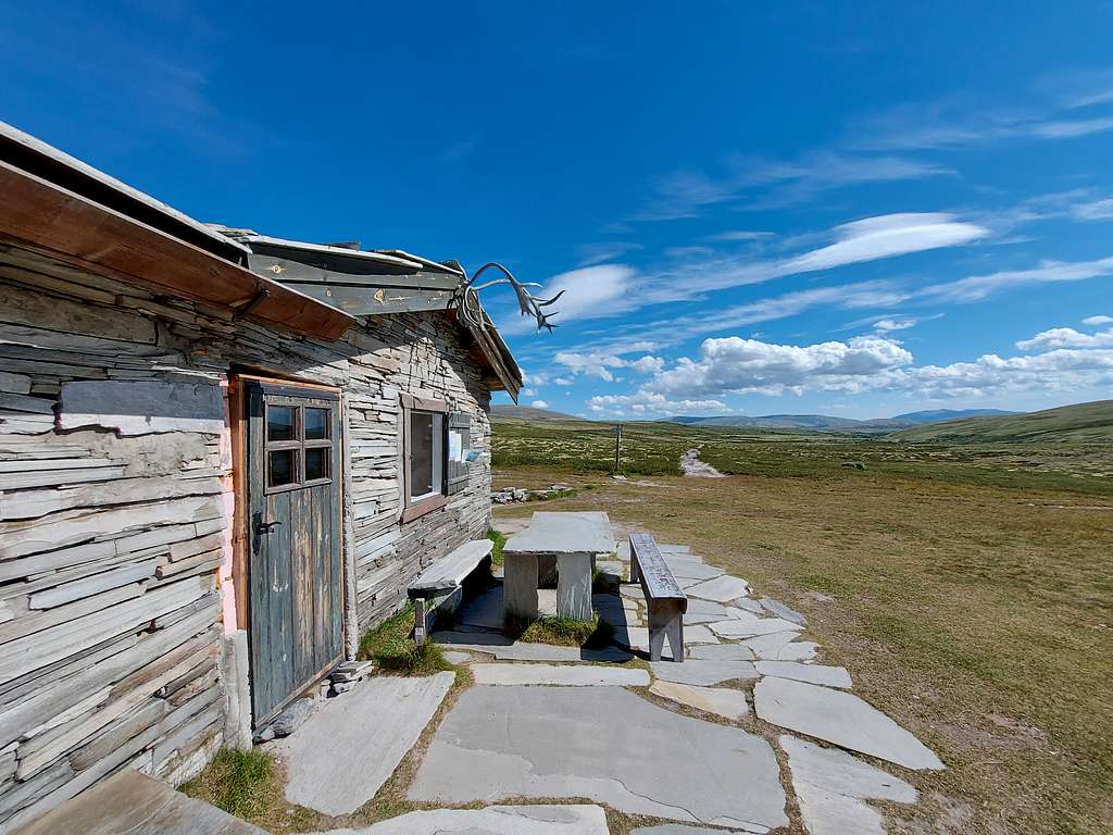
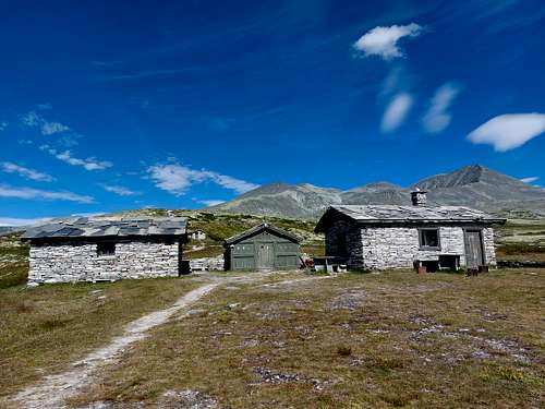
After about an hour's walk, cross Søre Kjondalsbekken and follow the signposts to the Peer Gynt hut. You can see a fine waterfall down the side of the valley. Cross the river over the bridge to Peer Gynt cottage.
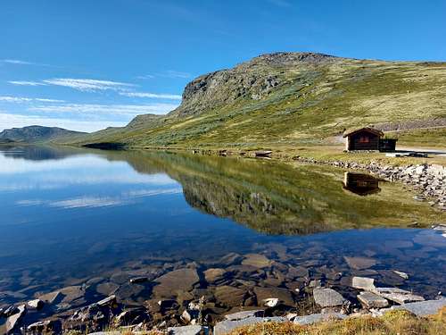
Peer Gynt hytta is a DNT cabin with food and beverage options in high season.The cabin itself is incredibly charming and well worth a visit.
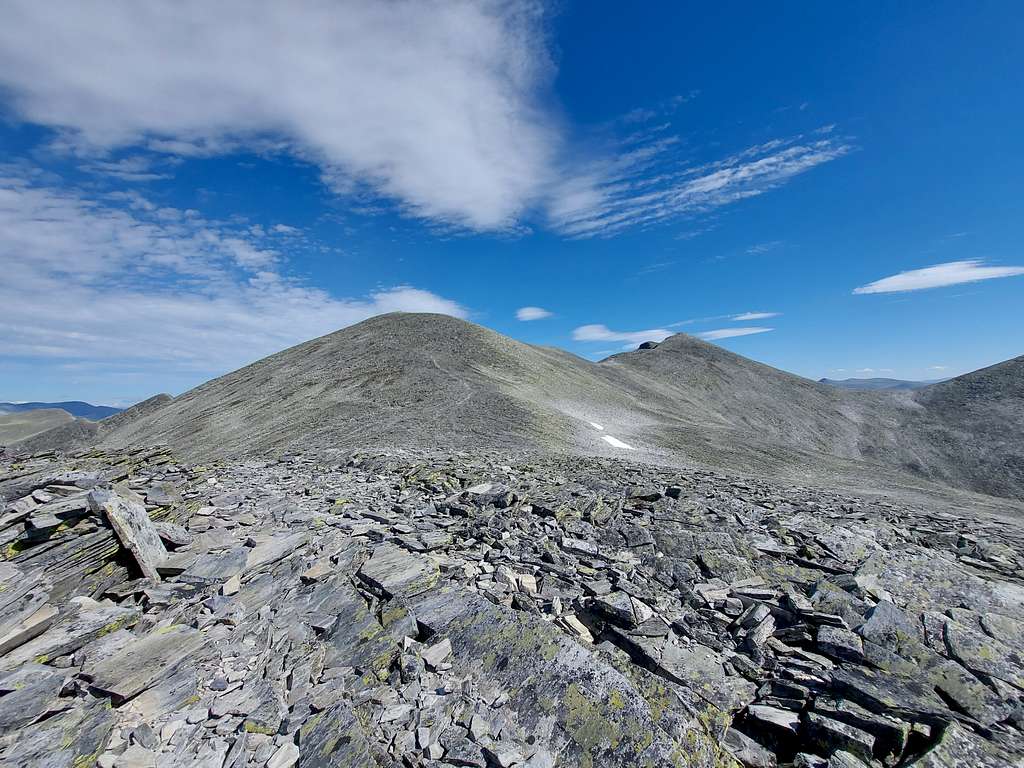
From the Peer Gynt refuge head sharply to the left and follow a track above the refuge along the Vesle Ula stream. Cross a stream at Tomasholet before starting the real climb to the top along a bump that you follow for a long time.
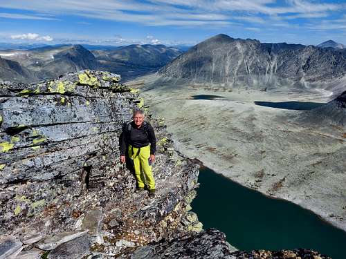
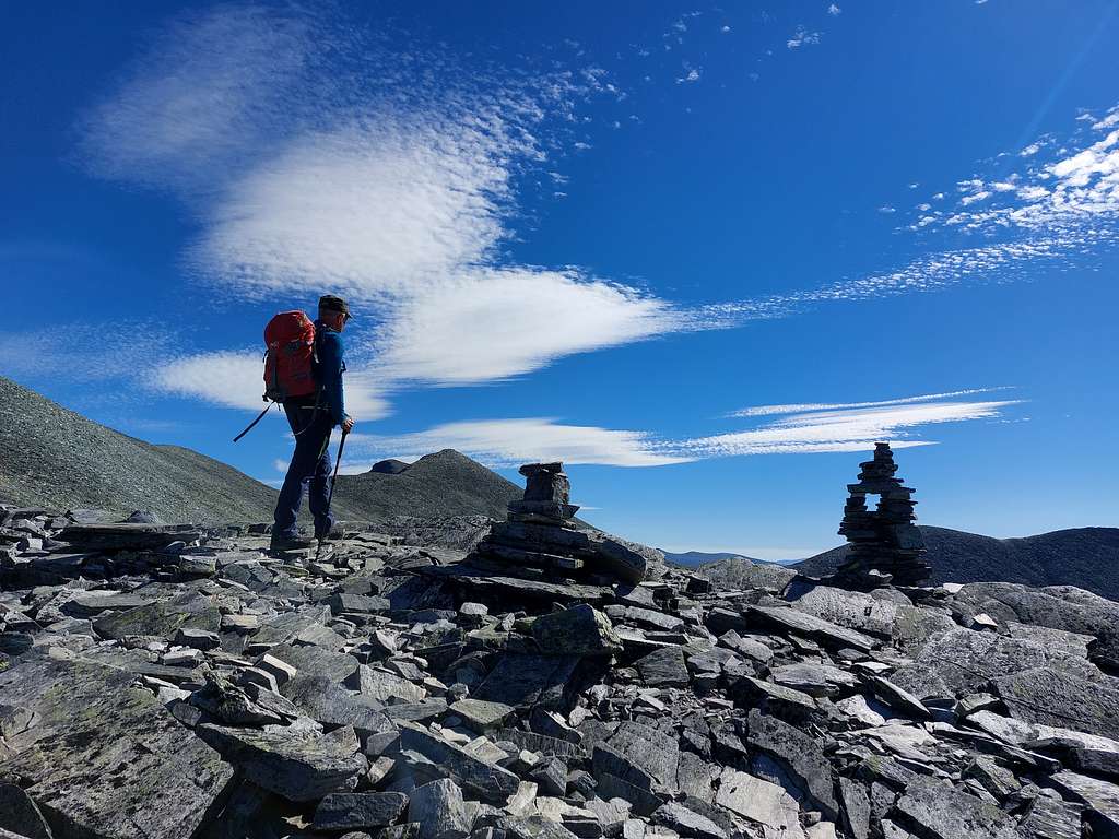
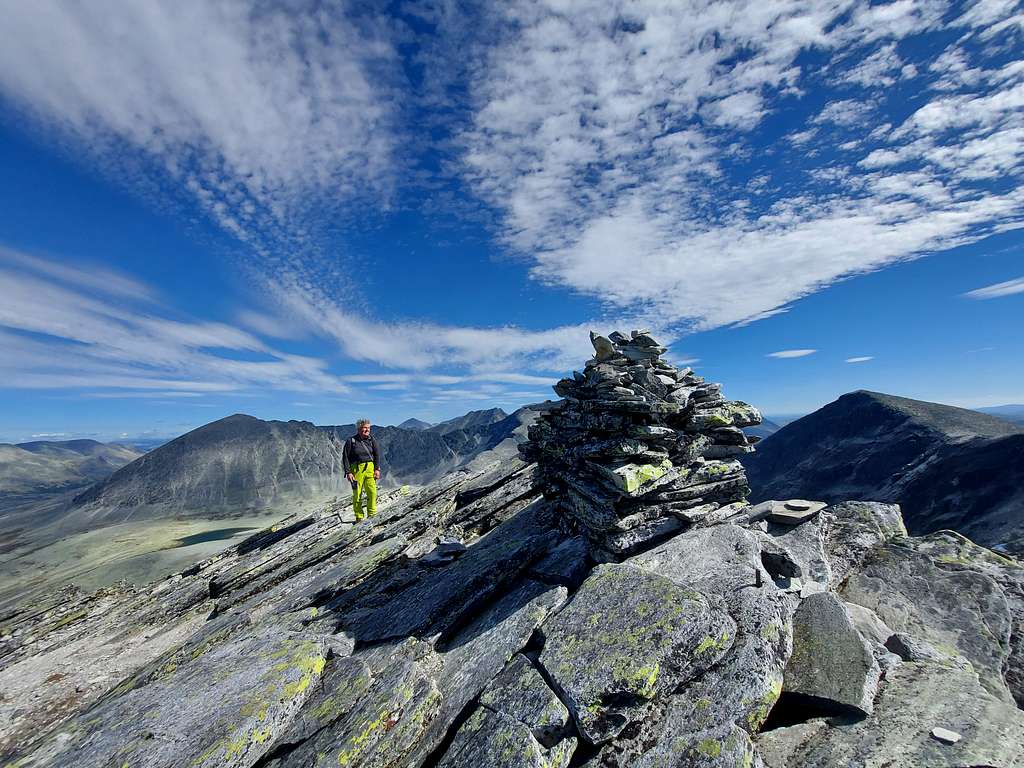
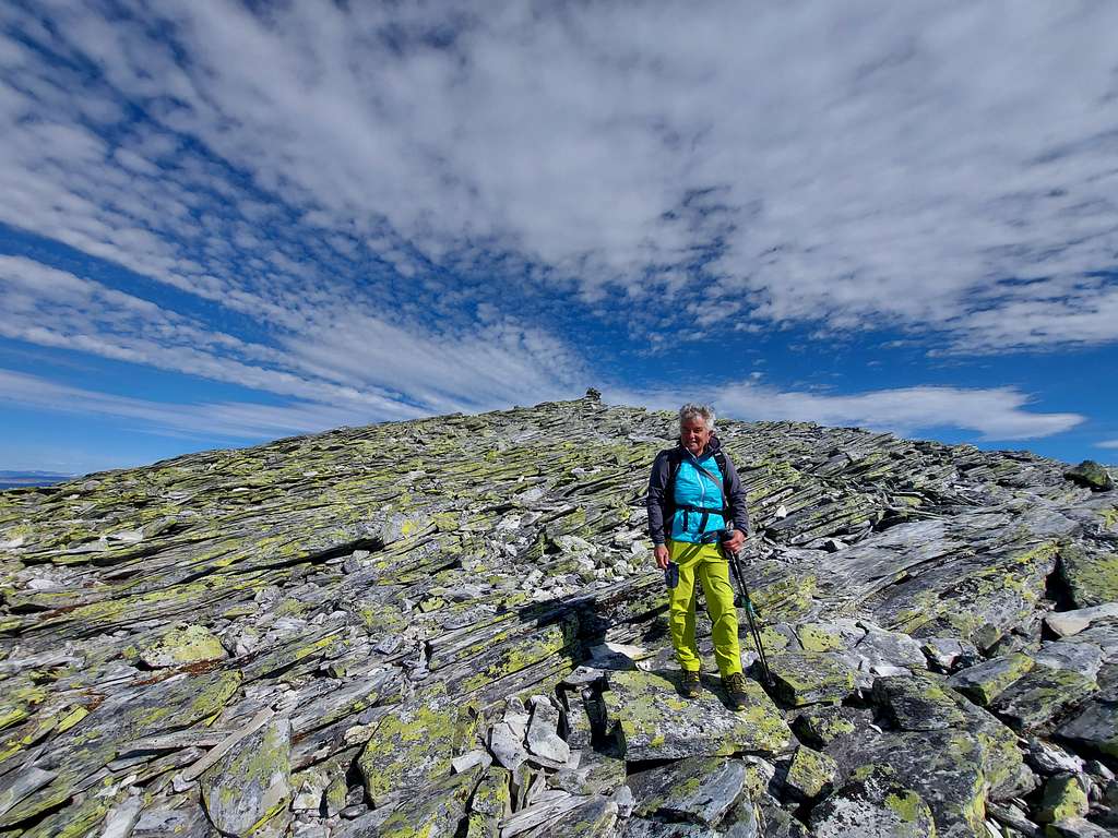
The first plateau is 1760 m above sea level,cross it before starting the last steep climb among blocks with intense yellow-green lichens to the top of Bråkdalsbelgen at 1915 m above sea level.
The summit offers fantastic views towards the nearby 2000m peaks of Rondane and further afield the beautiful Jotunheimen.
Descent: reversing the same route.
Red Tape

No particulary restrictions. The route is situated inside the superb Rondane National Park, established in 1962, the oldest national park in Norway. The park was extended in 2003, and now covers an area of 963 km2 in Innlandet county. The park includes 9 peaks above 2.000 metres, with the highest being Rondeslottet at an altitude of 2178 m. Rondane lies just to the East of Gudbrandsdal and nearby Dovre and Jotunheimen, two other important mountain areas.
In Rondane National Park all vegetation is protected and there are 240 species of tall trees and over 300 types of mosses and lichens of various colours.
Nature and climate
Rondane is one of the few places in Scandinavia and Europe where the wild reindeer lives. There is a certain shortage of plants species in the region, on the contrary Rondane is very rich in lichens, so much that it's possible to say that Rondane is the kingdom of lichen. This plant forms the characteristic lichen mats that serve as food for the reindeer during the winter months. Rondane has a reputation for relatively dry weather in summer, especially if compared to the mountain ranges located nearby.
When to Climb
The best season is Summer.
Accomodation
Smuksjoseter fjellstue 1130 m - Located on the shore of the lake Hovringsvatnet, a few meters from the border of Rondane National Park.
Meteo
Guidebooks and maps


-Guidebooks
"Walks and Scrambles in Norway" by Anthony Dyer, John Baddeley, Ian H. Robertson - Hiking, Scrambling and Mountaineering in Norway, an English guidebook covering Jotuheimen and several other areas in the Scandes - Ripping Yarns 2006
"Norway South" - Bernhard Pollmann
- Map "Rondane Nord" - Turkart 1:50.000