
-
 689 Hits
-
 82.48% Score
-
 15 Votes
|
|
Mountain/Rock |
|---|---|
|
|
61.27935°N / 8.56501°E |
|
|
Innlandet |
|
|
Hiking, Mountaineering, Scrambling |
|
|
Summer |
|
|
5699 ft / 1737 m |
|
|
Overview
Geographical classification: The Scandes > Jotunheimen > Mugnetinden
Mugnetinden 1737 m
Mugnetinden 1737 m is a beautiful peak located in the South Eastern sector of Jotunheimen National Park, located 350 km North to Oslo, in the middle of Southern Norway. In Norwegian Jotunheimen means "Giants Home" and the reason of this nickname is that the highest mountains in Norway lie here. The peak is located on the border of Vang and Vaga Municipalities in Innlandet county.
Mugnetinden Normal route is a fine and moderately demanding ascent. The summit views in the direction of Valdres and Jotunheimen are absolutely rewarding.
Getting There
From Fagernes drive in the direction of Beitostølen. Once you reach Beitostølen drive to Beito and follow the signpost to Slettefjellvegen (toll road). Drive past the toll station, continue past Fleinsendin and turn left at the intersection. Parking area on the left side of the road, near Mugnestølen, at about 3.5 km from the toll station, in a large clearing near the bridge over the Mugna stream (signposts).
Normal route from Slettafjellet
Mugnetinden Normal route report
Summit altitude: 1737 m
Difficulty: hiking and scrambling
Vertical gain: 720 m
Starting point: Slettafjellvegen, parking lot near the bridge over the Mugna stream
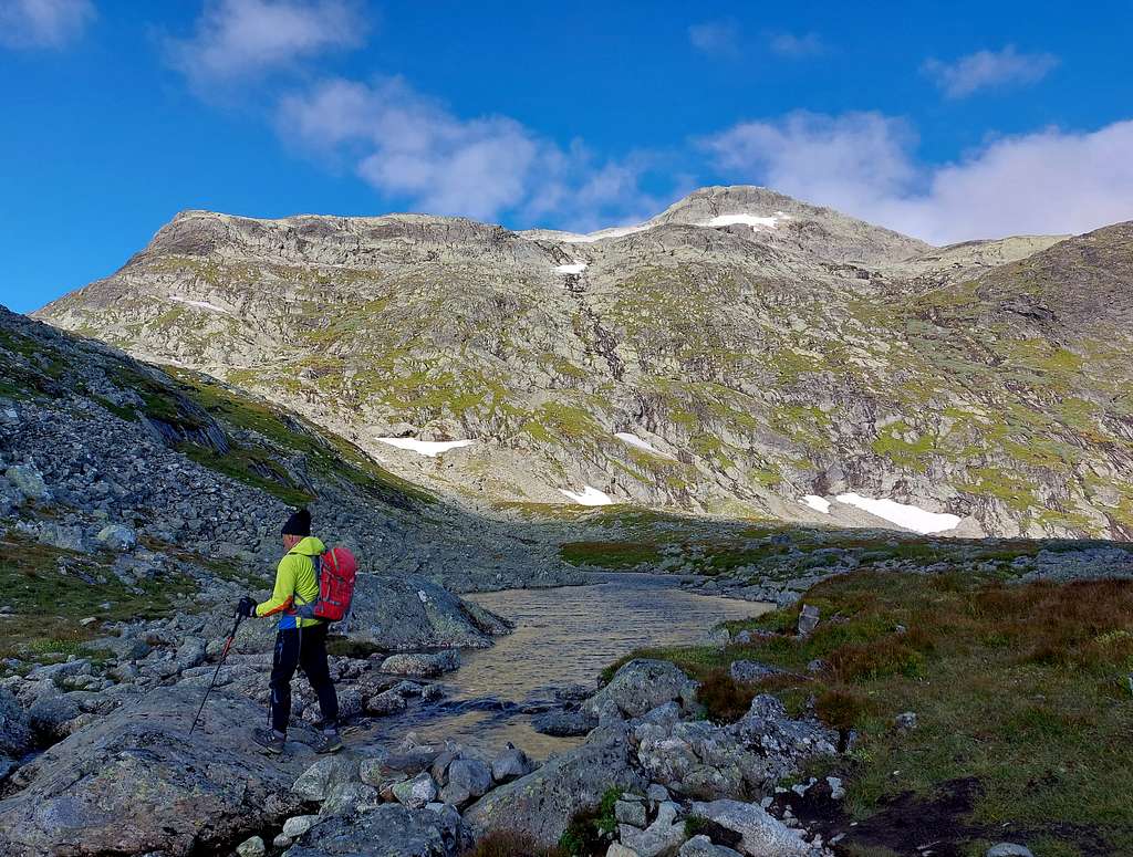
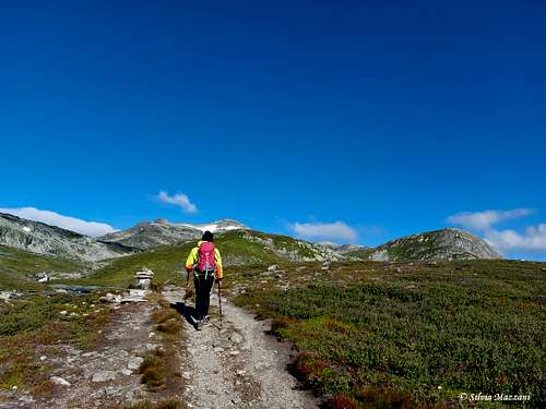
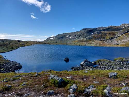
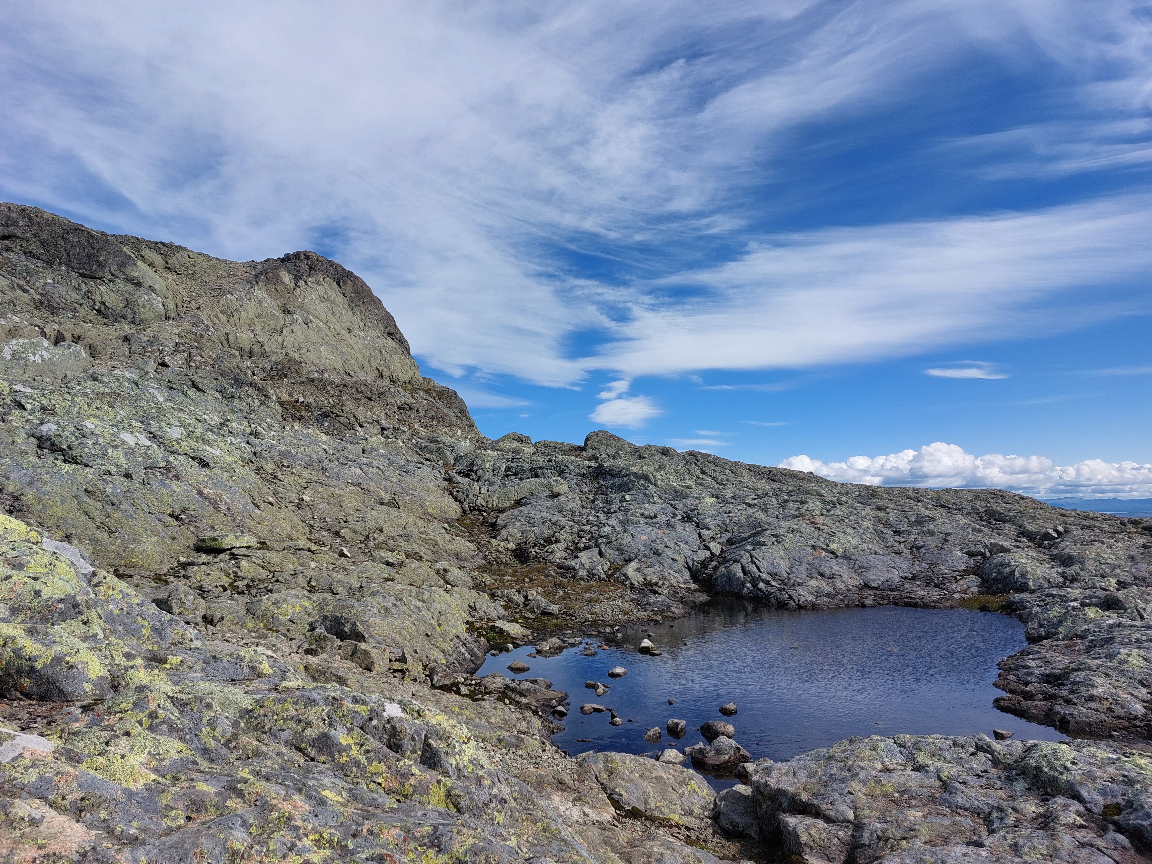
The first part of the itinerary is a marked path with cairns and white V, the highest part of the itinerary is on rocky terrain but equally marked. The path starts on the opposite side of the road and rises up the right shore (left orographic) of the stream, then it crosses a small flat shelf. Gently the path starts to climb again crossing a wider plateau and finally skirting the Mugnebottjernet, a magnificent lake.
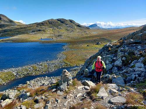
At the end of the lake, head to the left, crossing a small stream near another largest lake. Go up a steep slope close to a rocky outcrop to reach a section with undulating and less steep terrain, which you follow up to the bottom of the mountain wall.
At a signal on a boulder you have two options. The steeper and more demanding route turns right, while the main route continues straight ahead for another 300 meters and then turns to the right and uphill, too.
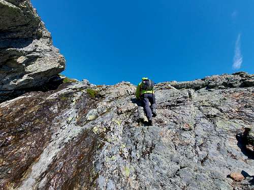
The more demanding route climb up on steep terrain with a stretch of easy climb.
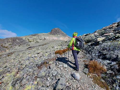
Successively the route reachs a stony plateau under a rock tower, where it joins the easier main route, which you follow with a wide turn first to the right, then to the left reaching a second plateau of large stones.
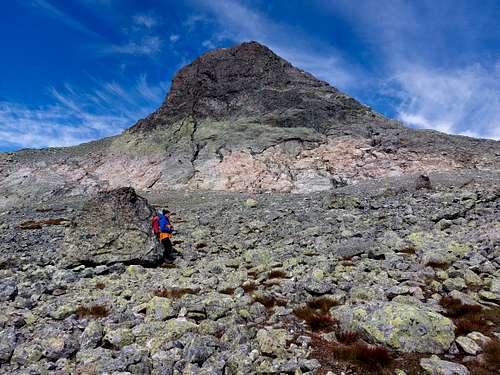
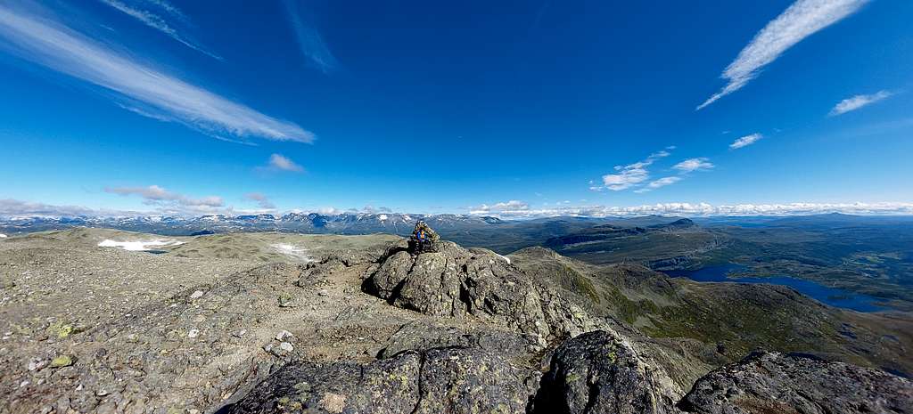
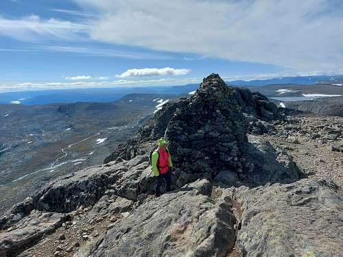
On rocky terrain and following a last rocky gully reach the big summit cairn, located a few meters away from the actual summit.
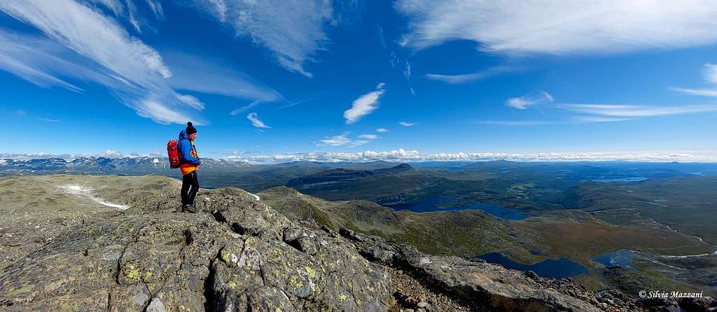
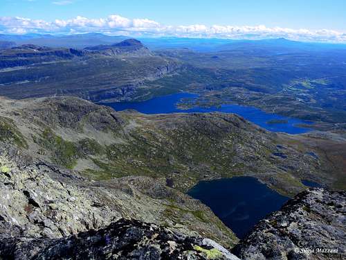
Vast panorama of countless lakes, the nearby Bitihorn and towards the north the farthest peaks of the Jotunheimen.
Descent: follow the same route as the outward journey, possibly preferring the easier route
Red Tape

There are no particular restrictions in climbing and hiking. Mugnetinden is lying within the superb Jotunheimen National Park, established in 1980, covering an area of 1140 km² and including the 27 highest peaks in Norway. Jotunheimen is located between Oppland and Sogn og Fjordane counties and it's bordered by the great lake called Vågåvatnet, the valleys of Bøverdalen and Leirdalen and the road No. 55 (the mytical Sognefjellveg) to the N and NW, by the Road 51 to the East, by Bygdin, Tyin and Årdal to the South and by the mountain road between Årdal and Turtagrø to the West.
When to Climb
- Mountaineering: the best period to climb goes from the end of June to middle September.
- Ski-mountaineering: april - may
Accomodation
Various different possibilities of accomodation in Beitostølen.
Meteo
Guidebooks and maps
Guidebooks


- "Opptur Jotunheimen" 125 selected itinerary on Jotunheimen - Finn Loftesnes - Selja Forlag 2009
- "Turkart Jotunheimen Aust"