

-
 17373 Hits
-
 86.85% Score
-
 23 Votes
|
|
Mountain/Rock |
|---|---|
|
|
61.38452°N / 8.09538°E |
|
|
Årdal |
|
|
Hiking |
|
|
Spring, Summer, Fall |
|
|
6782 ft / 2067 m |
|
|
Overview
Falketind 2067 m
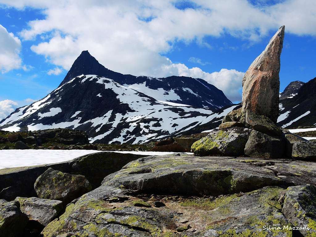
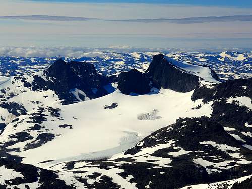
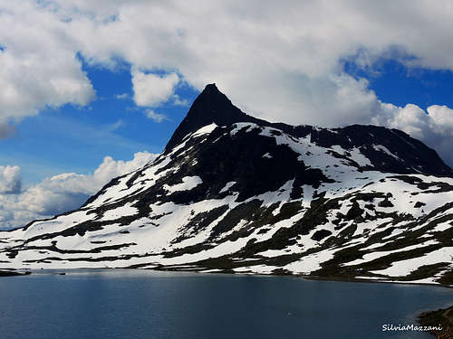
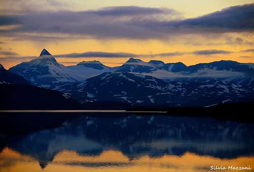
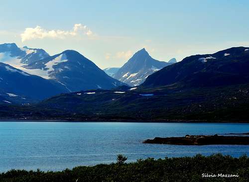
Falketind 2067 m is one of those mountains very difficult to forget! Its majestic shape and its profile are incomparable and as soon as you see it, it arises the desire to climb it. When approaching the Jotunheimen Area from the South, driving along the shore of the Lake Koldedals, it appears a great panorama of distant peaks over the line of the water. Falketind is one of these, a mountain crossing the threshold of 2000 meters, forming a massif located in the SW of the Jotunheimen area together with Stølsnostinden.
Falketind - meaning Falcon's Peak - is one of the more coveted summits in the Jotunheimen area. Located in the municipality of Årdal in Vestland county, Falketind belongs to the Jotunheimen mountain range inside the Utladalen Landscape Protection Area, but it's located outside of the borders of the Jotunheimen National Park.
Falketind was the first mountain having an "alpine character" to be climbed in Norway. Its fascination was such that it was climbed in first ascent very early, already in the year 1820, before the beginning of mountaineering in Norway.
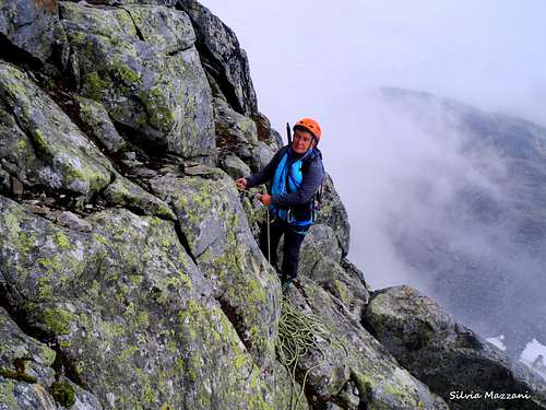
Falketind first ascent was performed unusually early for such an alpine peak! In fact Cecil Slingsby, the father of the Norwegian mountaineering, made his first visit to Norway in 1872, several years later. The first summiters were the botanist Christian Boeck, O. Urden and the geologist Baltazar Keilhau (July, 14th 1820). The first climbers found a steep route from Falkbreen and up the East side, which involves overcoming a steep rock wall about 200 meters high wall, then a scramble along the North ridge. Afterwards, this expedition has been seen as "Jotunheimen discovery". This route is named Pionerruta. Over fifty years later Aasmund Olavson Vinje gave the mountain the name Falketind. Pionerruta is not the Normal one to summit Falketind and involves some climbing. Another route involving a long approach across the Morka Koldedalen Valley is considered now the Normal route. It crosses some snow-fields (steep and exposed), and follows some slabs which might be difficult. Some parts of the route cross a glacier.
Getting There
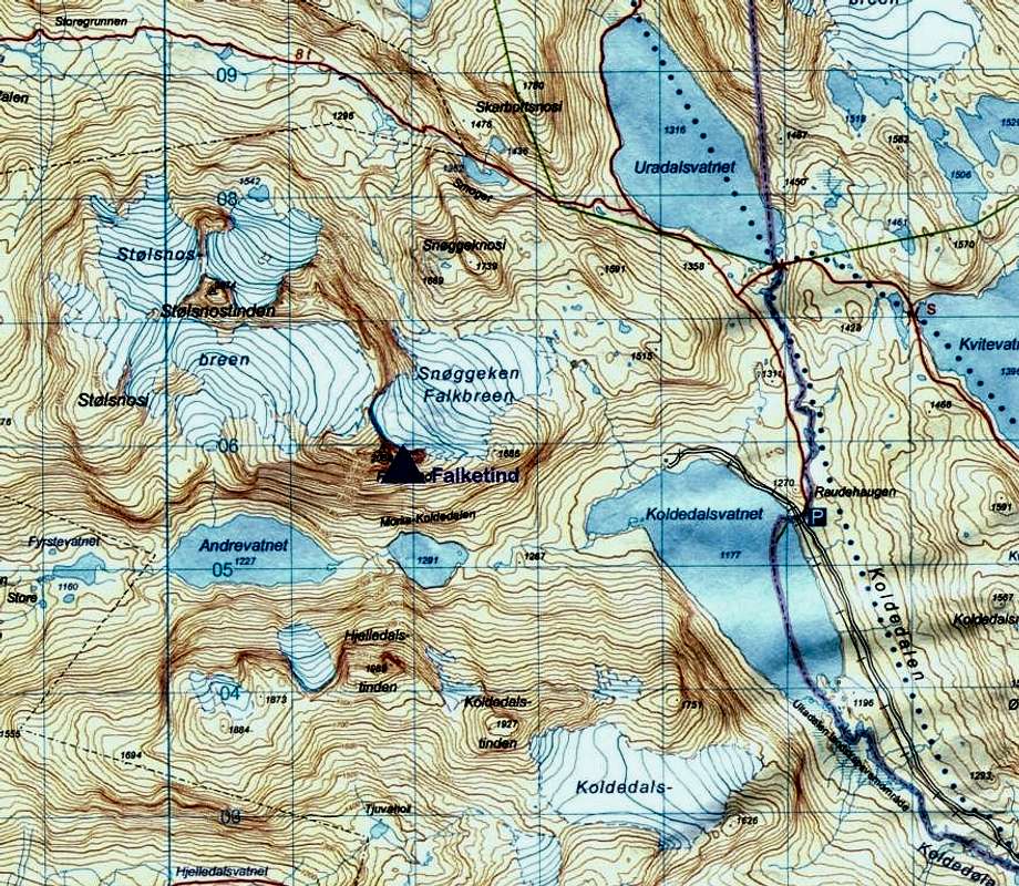
From Oslo (or Bergen) take the E16 to Tyinkrysset. At the junction in Tyinkrysset leave the E16 and take the Road 252 from Tyin to Eidsbugarden. At the following junction take the minor right road (open from mid June to mid October) and drive along the Eastern side of the vaste Lake Tyin, getting the Tyinholmen Hoyfjellshytter, where there's another junction. Turn to left and take another minor construction road running long on the shores of a second lake, the Lake Koldedal, towards the Koldedalen valley, getting a road-bar in the locality Raudehaugen near a small waterfall. Park the car roadside. This latter road has not a good standard, and cars with low profile tyres are not recommended.
Normal Route
Falketind Normal route
Summit altitude: 2067 m
Difficulty: Alpine PD
Vertical gain: 930 meters
Starting point: road-bar at Raudehaugen 1130 m
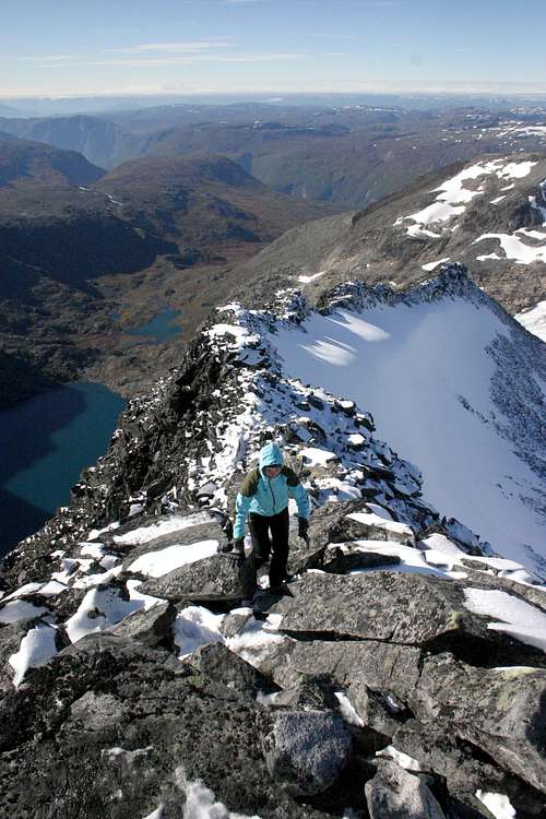
From the road-bar at Raudehaugen follow the dirt road that continues to skirt the lake beyond the bar, quickly reaching a private cabin (Koldedalshytta). From this cabin proceed straight, cross a stream and start to follow the North shore of Koldedalsvatnet Lake for about 1 km to its western tip. Continue to follow the path leading Westward up to a small lake at 1291 m. The path continues along the Northern side of this lake and a bit above the water initially on some slabs, then it levels out at about 10 m over the lake. After a while you need to cross a steep snow-field. In case of ice an ice axe might come in handy at this point. This snow field extends right down to the water. It can either be crossed just above the waters edge or higher up. After this delicate crossing skirt the Lake Andrevatnet until you cross the river exiting from Stølsnosbreen glacier. Walk upwards on the left side of the river and cross some slabs. It's not easy to find the path at all times. Be careful if it's wet or icy.
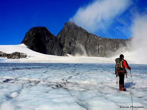
When you're past the steep part, you'll see the glacier. You might follow the glacier if you have the correct equipement (crampons, ice axe, rope) or just walk besides it on its right side.
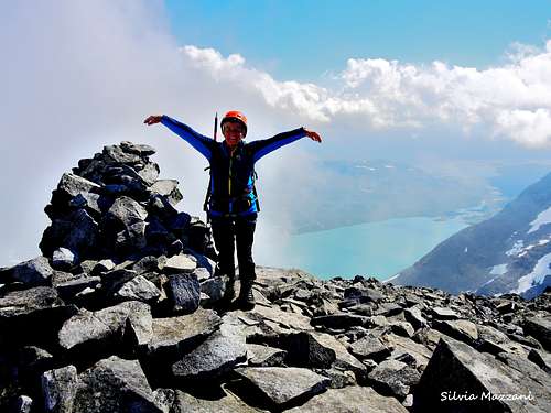
When you approach the top, follow the ridge from the north side. Enjoy the view!
Descent: follow the same route on your way back
Pionerruta
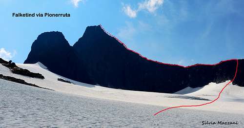
Falketind Pionerruta
Summit altitude: m. 2067
Difficulty: Alpine AD inf
Difference in level: 930 m
Exposition: East then North
Starting point: road-bar at Raudehaugen m 1130 in Koldedalen
A route involving a glacier crossing, a rock climb about 150 meters long on an exposed wall and then an aesthetic and easy ridge facing North up to the top. A satisfactory and advisable route up a great aesthetic peak, which should only be undertaken by alpinists provided by rock climb and glacier experience and equipped by full glacier gear. The itinerary goes straight up on the right of Koldedalshytta at the end of the road in Koldedalen and onto Snøggeken (Falkebreen).
See here on SP the full description of this route, which is the itinerary followed by the first summiters: Falketind Via Pionerruta
Red Tape
No particulary restrictions. The summit is relatively far southwest in Jotunheimen, outside the Jotunheimen National Park, but within the Utladalen landscape conservation area. The superb Jotunheimen National Park, was established in the year 1980 and covers an area of 1150 square km, including the 27 highest peaks in Norway. Jotunheimen is located between Oppland and Vestland counties and it's bordered by the great lake called Vågåvatnet, the valleys of Bøverdalen and Leirdalen and the road No. 55 (the mytical Sognefjellveg) to the N and NW, by the Road 51 to the East, by Bygdin, Tyin and Årdal to the South and by the mountain road between Årdal and Turtagrø to the West. Visit Jotunheimen.
Camping and accomodation
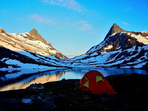
Camping allowed. As usual in Norway not closer than 150 meters from houses or huts. The terrain in Koldedalen is quite rough, anyhow there are some places with vegetation where you can put your tent. We found a nice campsite at the southern end of the lake. There also some good sites where you cross the river.
Accomodation in the area:
Fondsbu + 47 97 07 42 18
Tyinholmen Fjellstove + 47 61 36 78 88
Tyinstølen + 47 61 36 77 38
Ingjerdbu + 47 57 66 30 24
Meteo
Guidebooks and maps

Guidebooks
- "Walks and scrambles in Norway" Hiking, Scrambling and Mountaineering in Norway guidedebook by Anthony Dyer - John Baddeley - Ian H. Robertson - Ripping Yarns 2006
Maps
- "Jotunheimen Vest" - Turkart 1:50.000 - 2505
- “Hurrungane” or “Jotunheimen Vest” - 1517 IV
Maps
"Jotunheimen Vest" - Turkart 1:50.000 - 2505
External Links
- Scandinavian Mountains
- Jotunheimen
- D.N.T. Den Norske Turistforening
- Norwegian trekking association