
|
|
Route |
|---|---|
|
|
36.48544°N / 121.19798°W |
|
|
Trad Climbing |
|
|
Summer, Fall |
|
|
Half a day |
|
|
5.8 (YDS) |
|
|
5.8 |
|
|
4 |
|
|
II |
|
|
Overview
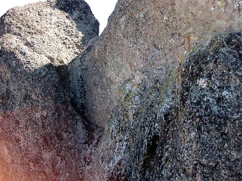
Condor Crag is at about 2600' on the High Peaks Trail. This route ascends its shady north face, so it is nice on warmer days.It merits a single star in Brad Young's guidebook. We found the rock to be mostly excellent, with a few loose spots. It's a nice adventure, if you have sampled some of the out of the way spots at Pinnacles and want to do a longer route.
The area can be subject to climbing closures for raptor nesting, from late January until summer. Check the Friends of Pinnacles site, or contact the National Park Service.
Getting There
Start hiking from the east side of the Monument from the Bear Gulch parking area. Stay right at the junction for the Moses Spring Trail and continue up the High Peaks trail. After switchbacking up 2 miles and 1200' elevation gain, come to a junction with an overlook and a nearby National Park Service outhouse.From here, continue on the High Peaks trail. Descend for a bit, then back up steeply, though steps cut into the volcanic rock, with the occasional railing. The first formation you come to on the left is Long's Folly, which has some fun routes on it, such as Regular Route (5.8) and Abnur Bear is Everywhere (5.10a).
Condor Crag is the first major formation past Long's Folly on the left. You will pass a gully in between the north and south summits -- this is your descent / rappel route (though it has some climbing routes as well).
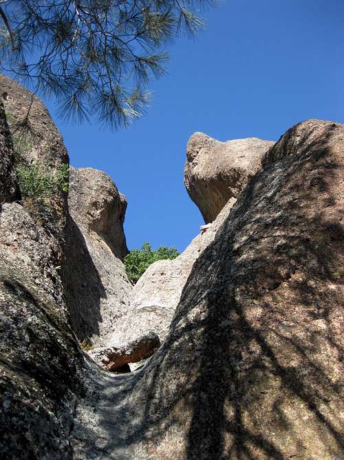
Continue north on the High Peaks trail, along more steps and railings, down some steep steps, back to the trail. Keep walking about 50-100' until you can cut left, then descend through brush along the north side of the formation. Some third class scrambling may be required.
When you come to a flattish spot just uphill from a prominent chimney/gully that you would have to rappel to get to, you have probably found the start of the route. Total distance from trailhead: ~2.5 miles.
Alternatively start from the Condor Gulch trailhead and hike up to the High Peaks trail via the same approach as Dragonfly Dome. Continue past Dragonfly and turn left onto the High Peaks trail. This is a little bit longer, but allows for more warmup options, and you could descend back via Bear Gulch.
Route Description
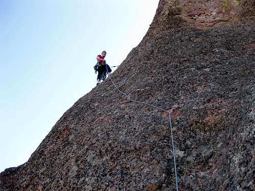
Pitch 1 (165', 5.8): follow a line of nine bolts to a 2-bolt belay just below a small roof.
Pitch 2 (100', 5.8): traverse left past a bolt and then head up through an area with holes suitable for cams and tricams, and finally trend left with some thrilling exposure and three more bolts. 2-bolt belay.
Pitch 3 (100', 5.7 or 5.10a): head up past a bolt and some more holes. You eventually want to gain a ridge. The guidebook said going more to the left is 5.7R, while heading straight up past a bolt is 5.10a. I did the "5.10a" way and didn't think it was that hard, but use good judgment here.
Once on the ridge (probably back in the sun), clip another bolt, then belay at a one-bolt anchor, supplemented with gear.
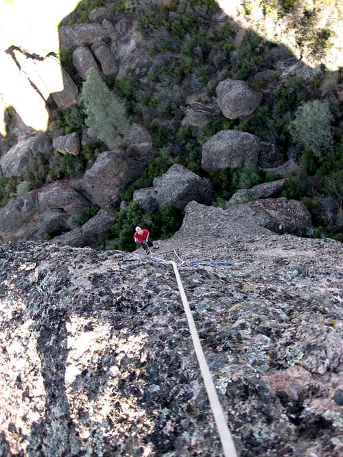
Pitch 4 (200' to the summit, fourth class): traverse right, then atop ridge past a couple more bolts. We downclimbed a bit, then up a gully. Two bolt belay with rap rings.
The route ends on the north summit of Condor Crag.
Descend by rappel, but be careful: stop at the first rap station, near the tree. If you go all the way to the rap station at the chockstone, your rope may get stuck. The last rap puts you on the High Peaks trail. Also, make sure nobody is climbing up any of the routes in the gully before throwing your rope down.
Essential Gear
Nine draws (preferably a mix of quickdraws and longer slings), cams from 0.6-4" (can probably leave out the #3 though), tricams helpful, maybe a few nuts. 60m rope.Guidebook
This route and others in the High Peaks are listed in A Climber's Guide to Pinnacles National Monument, Brad Young, 2007.History
FA Jack Holmgren, Bob Walton, Keith Vandevere, 12/1989.In November 2009 a pair of climbers were benighted on this route, and had to be rescued by the National Park Service.