![Eagle Canyon Pinnacle -- Sunrise]()
![Eagle Canyon Pinnacle]()
If America has a more scenic stretch of interstate than that of I-70 through the San Rafael Swell, I have yet to see it. For about 30 miles, the highway cuts through a slickrock heaven. Although there are many impressive features, those that dominate the scenery are the numerous sandstone monoliths, many of which appear unclimbable and some of which may in fact still be unclimbed.
“Eagle Canyon Pinnacle” is neither an official nor an unofficial name, though I would be glad to learn either if it exists, and it is really more a monolith than a true pinnacle. Nor is it the highest, largest, or most challenging (to climb) monolith in the Swell. It is, however, one of the closest to the highway; specifically, it is the monolith visible just northwest of the highway from the bridge spanning Eagle Canyon.
“Eagle Canyon Pinnacle” also has this distinction, uncommon among desert towers: there is a non-technical route to the summit. There are technical routes, too, of course, and this page will cover three routes I climbed on this peak: a Class 3 route and two Class 5 routes.
Because of the existence of a non-technical route and at least two Class 5 routes that an experienced climber will have no trouble managing unroped, this peak is excellent for the following reasons (in addition to the nice views):
* The Class 3 route, though a little exposed, is a friendly introduction to scrambling on Utah sandstone, which is in its own little category.
* The Class 5 routes covered here fall into the “easy” category and are great for practice and training.
* Accomplished rock climbers after harder objectives in the area but in need of a rest day entailing a little more than watching TV can stay fresh here without expending too much valuable energy.
* It’s just a lot of fun spending a few hours seeing and climbing this peak from different sides. (It’s a little like that thing that begins with “S” and ends with “X”-- no, not “Sussex”-- but without all the red tape.)
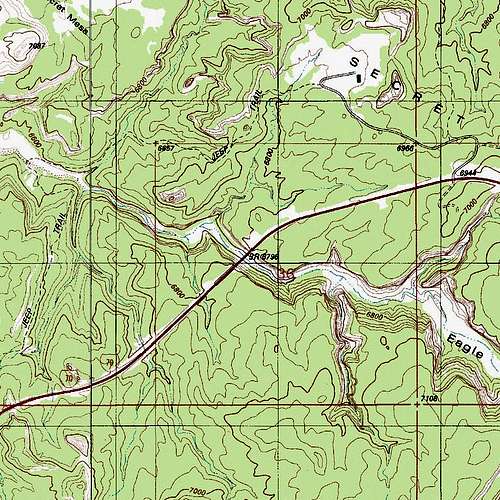
Access-- From the interstate, the approach is less than a mile, and climbing the peak itself only entails about 200' of elevation gain. However, the fact that the easiest way up is Class 3 and that harder routes exist makes this trip worth it. Park on the shoulder between the bridge (west) and the road to Secret Mesa (east, probably gated). Specifically, I parked off the westbound lanes at Milepost 120. If you are eastbound, park shortly after crossing the bridge and then cross the highway. FAIR WARNING: It may be illegal in Utah to leave your car on the shoulder of an interstate, so make yourself aware of regulations or just accept the risks. Drop a short distance and then climb some slopes (Class 2) and find a 4wd road leading toward the monolith. The road ends, and you have to travel a short distance cross-country to reach the monolith itself.
Class 3 route (east ridge)-- The easiest way up seemed to be a short, somewhat serpentine route that was Class 3 with some exposure. The biggest danger was the especially sandy nature of this sandstone, making footing quite slick. Once up top, walk over to the summit block and scramble up it via one of a few good ways available. Pictures below illustrate the route.
Class 5.4 route (northwest face)-- This goes at 5.4 in just one spot (a crack in a corner), and that spot can be bypassed with 5.2ish climbing on the left. Use the same approach but then traverse around the right (north) side of the monolith. Find a long, prominent gully/chimney on the northwestern side of the peak. If you were placing protection, this climb, which is about 150', would be two pitches, maybe three. However, most experienced climbers are going to be perfectly comfortable on this route without gear. Ascend the bottom of the gully (Class 3 and 4) to a short wall where the 5.4 crack can be found in a corner. Climb the crack or bypass it on the left and then climb the rest (mostly Class 4 with maybe a spot or two of easy 5). Then scramble up the summit block. Pictures below illustrate the route.
Class 5.3 route (south face)-- This one is pretty tight in places and will probably require some stemming or chimneying at the crux. It is mostly Class 3 and 4 with some harder moves at and shortly below the crux. If one were roping up, this 150' route would probably be two pitches out of rope-length concerns, but nowhere along the route (except the start, of course) struck me as a decent place to set up a belay. Use the same approach as for the other routes but then traverse all the way around the right (north) side of the monolith and over to the south side. There, near the middle of the face, you will see an obvious gully/chimney going all the way to the top. The crux is a very narrow section with some chockstones making movement even more difficult. I got through this by chimneying up a bit until I could pull myself over the chockstones. The rest of the way was loose but easy scrambling, and then it is a quick scramble up the summit block itself.
Note: The Class 5 ratings are best guesses based on my experiences on similar grades. They are not based on published routes or any kind of consensus. It is highly unlikely that anyone will consider them to be harder than I have listed, but experienced climbers may find them one or two grades easier.
![Eagle Canyon Pinnacle -- Summit Block]() Summit block...
Summit block... | | | |
Use this if you are worried about the legality of parking off the interstate or if Eagle Canyon is a base camp for other adventures.
You can use Exit 116 to access Eagle Canyon itself, but you will need 4wd. Head south from the exit, going north takes you to a picnic area and overlook. Drive 1.2 mi and turn left at a junction. Next, the road passes beneath the interstate, and from this point on, it is a true 4wd affair, with rock obstacles, off-camber spots, and deep sand. It is not a difficult road, but it is not for beginners.
There is often standing water beneath the bridge, and if there is, it is wise to get out and check it first, for I have found it knee-deep before. After the bridge, drive a little over two miles to another junction. From here, it is less than a mile to the monolith and to the bridge. Climbing from here will add about 200 vertical feet (conditions unknown, but they appeared to be no harder than Class 3 from above).
This junction is also, by the way, the starting point for a very nice hike down Eagle Canyon. There is no trail, but you follow a wash until it narrows into a slot, which you stay above, before reaching a very tall pouroff (over 100') unless you are equipped to rappel down. There is a sturdy tree there that climbers use as an anchor, or at least there was in 2006 when I was there.
There is no official red tape, but do your best not to trample the
biological crust.

 5925 Hits
 89.39% Score
 29 Votes


 Summit block...