
-
 3498 Hits
-
 78.27% Score
-
 9 Votes
|
|
Mountain/Rock |
|---|---|
|
|
38.89330°N / 110.7517°W |
|
|
Emery |
|
|
Hiking, Scrambling |
|
|
Spring, Summer, Fall, Winter |
|
|
7562 ft / 2305 m |
|
|
Overview
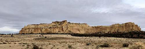 Train Robbers Mesa as seen from the south
Saddle Point or Saddle Benchmark also known as Train Robbers Mesa is a nice summit with spectacular views - one of the best in the San Rafael Swell. The hike is pretty short and mostly class 2 hiking. There is a section of class 3, but this part is very short and not very exposed.
The mesa offers 360 degree views in all directions over to San Rafael Knob, Locomotive Point, Chimney Rock, Pinnacle 1 etc. The summit has from USGS survey team mark and there is a nice summit register.
The Saddle Point AKA Train Robbers Mesa is close to the Interstate 70, just about one mile north of I-70 to be precise, the access is more complicated and requires more than 10 miles of driving on slow 4 WD roads. The formation is visible from the Interstate.
You can also visit nearby Dutchman Arch and Indian Rock art.
Class: 2+
Length: 2-3 hrs
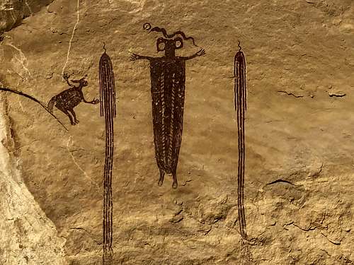 Indian Rock Art
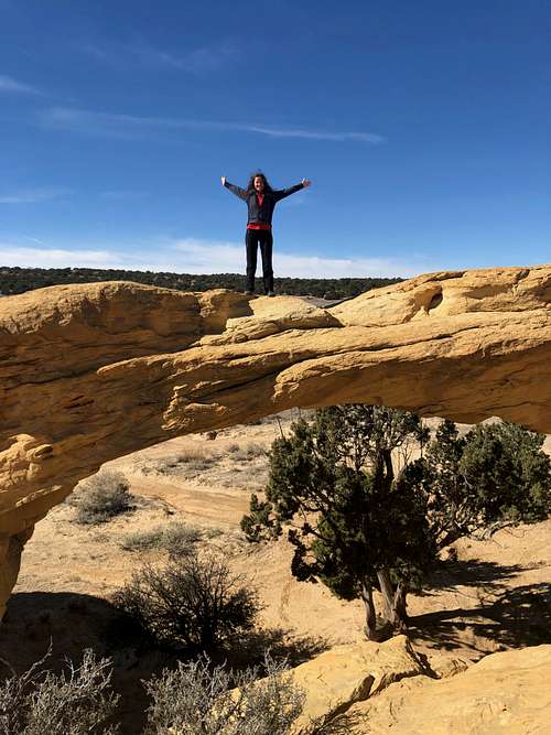 Dutchman's Arch
Getting There
Take exit 131 from I-70, it is about 30 miles west of Green River, well signed for Temple Road. Drive on the south side if I-70, this section of the road is nice and easily passable by any vehicle. You will pass a small stock pond on the right. After 4.4 miles you will get to a junction - follow directions for Dutchman Arch. High clearance 4 WD vehicle is needed at this point. Go right, and cross under the freeway to its north side. Here, you can either go first and visit Dutchman arch or drive straight north and visit Indian Art panel (2 locations close to each other). Then continue east to a signed road for Cane Wash. You will see your objective - Saddle Benchmark or Train Robbers Mesa - on your right. Park near a pull out with a primitive campsite, or continue on this pull out road for a short distance - there is a 2nd campsite and after that the road ends with a small parking lot.
Route
Hike from the campsites on a road until it ends along the southern cliffs of Train Robbers Mesa. Continue east until you find an open easy gully going up the mesa, less than 5 min. Hike up finding the easiest path up this gully until you get to a ledge. Take this ledge left and hike up towards the summit. At some point you will cross a drywall, short scramble. Then continue up to the top. Try to avoid cryptobiotic soil. The summit has a summit cairn and USGS mark. Return the same way. There are a few cairns marking the path.
Red Tape
Hiking, driving 4 WD roads and camping are free.
When to Climb
Summers can be hot - start early and bring plenty of water. Fall, winter and spring are excellent times to visit the area.
Camping
There are several beautiful campsites at the base of Saddle Benchmark. This camping is primitive, in the pinon trees, no water nearby.
External Links