-
 6299 Hits
-
 89.77% Score
-
 30 Votes
|
|
Mountain/Rock |
|---|---|
|
|
38.88785°N / 110.67507°W |
|
|
Scrambling |
|
|
Spring, Summer, Fall, Winter |
|
|
7143 ft / 2177 m |
|
|

Overview and Climbing Information
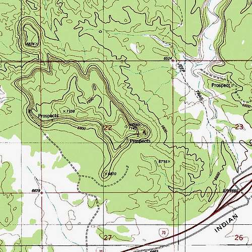
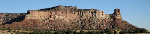
Seemingly within rock-throwing distance of the colorful, eye-catching formation called the Wickiup is “Indian Mesa,” denoted as “Indian” on the USGS The Wickiup topo map. Closer to I-70 and also easier to reach than the Wickiup is (no 4wd necessary), Indian Mesa provides far-ranging views in all directions of the spectacular San Rafael Swell and delights the visitor on a smaller scale as well; the careful observer will note interesting rock formations, petrified wood, and tree trunks polished and twisted by the forces of the desert. Also, the mesa features a prominent tower (rock quality probably highly suspect) that may entice technical climbers.
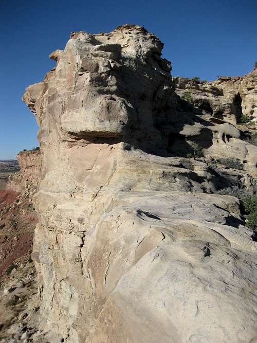
On all sides, sheer cliffs wrap Indian Mesa, making it unclimbable for most people. There is, however, a weakness, and it is accessed from the saddle between the tower and the main body of the mesa. Hike up a loose gully to the saddle or follow a ridge to the base of the tower (easier) and then make an ascending traverse to the saddle (look for pieces of petrified wood).
From the saddle, Class 3 scrambling will get you to the top of the mesa, and from there you can wander to the actual highest point or simply wander the mesa and its rims, taking in the views. A minor saddle divides the mesa into two sections, and exploring the northwestern, slightly lower one will get you closer to the Wickiup and will afford better views to the north and northwest; a second, much longer route up the mesa from the vicinity of the Wickiup also appeared to exist from this vantage point. Atop the mesa, I found petrified wood, from shards to small stumps, in several different spots. Much of it was partially buried.
From road to summit, my route was about 1.5 mi with 600’ of elevation gain.
Getting There
Leave I-70 at Exit 131, about 30 miles west of Green River, and head north. You will be on the road to the San Rafael Bridge Recreation Area and Buckhorn Wash. Both are worth visiting for the hiking, climbing, scenery, and pictographs.
Immediately after getting on this road, you will see a board with information about the area. There is a large parking area here, and the spot is popular with RVers and as a staging site for ATV users. Look for an unpaved road going off in the direction of the Wickiup (there are actually two roads, and they converge later). Most passenger cars can handle this road with no trouble for about a mile, and that is all one needs to get as close as desired to Indian Mesa before parking and striking out cross-country for the peak. Make sure you do not block the road, and park in a rocky spot, not the cryptobiotic crust.
 |  |  |
Red Tape and Camping
No fees or permits. Recognize the biological crust and do your best to avoid stepping on it.
"Indian Mesa" is not within a federal wilderness or wilderness study area, so collecting rock specimens, including petrified wood, is legal, but that doesn't mean you should.
There is no developed or primitive campground in the immediate vicinity, but dispersed camping is legal and widely available.