
-
 14215 Hits
-
 79.04% Score
-
 10 Votes
|
|
Route |
|---|---|
|
|
40.81381°N / 122.98748°W |
|
|
Hiking, Scrambling |
|
|
Spring, Summer, Fall |
|
|
Overview
Monument Peak is an excellent granite summit at the southern end of the Trinity Alps. It is one of the few peaks visible from Weaverville, although the view does little to reveal the granite wonderland that exists on the north side of the mountain. The route is not long, but it is steep and requires off trail route finding. The summit provides what may be the best views in northern California.Getting There
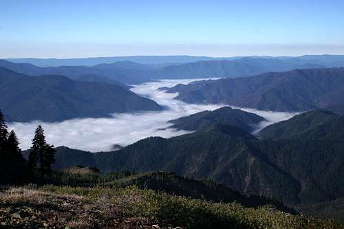 The fog enshrouded Trinity River from the Weaver Bally trailhead
The trailhead for Monument Peak is located near the summit of Weaver Bally, a prominent peak high above Weaverville. From Weaverville, drive west on Highway 299. Just before the end of town, turn veer right off the highway onto Black Bear Road. The pavement quickly disappears and Black Bear eventually becomes a lesser road that splits off the main route. The main road becomes Weaver Bally Road. There are signs pointing the way to Weaver Bally and stating the distance one must go. After 9 miles the road terminates at a US Forest Service lookout tower, although the road is gated just before the tower. The trailhead is about a quarter miles before the gate. The trailhead sign has been knocked over and propped up against a tree so the trailhead may be heard to spot. Look for a yellow wilderness sign nailed to a tree to mark the trailhead. The trail is easy to follow.
Be sure to head up to the lookout tower since the view of Canyon Creek is better there than from the summit of Monument Peak. The reason for this is that Monument is further east and closer to the canyon. While all the peaks are visible, the canyon bottom is partially obscured by Little Granite Peak. From the lookout, one has an unobstructed view into the gaping maw of Canyon Creek. For those who have ventured into the canyon, it is neat to be able to spot the various landmark one encounters from this perch.
Route Description
 The ridge route to the summit, seen from above East Weaver Lake
The climb to Monument Peak is a 7 mile trip, eight if one makes the descent down to the Rush Creek Lakes. There is about 2,300 feet in elevation gain. Unfortunately, the trail is a testimony to wacky and unnecessary trail engineering.
The trail begins around 6,900 feet. It traverses the south flank of the Weaver Bally ridge. After about 0.8 of a mile it reaches a shoulder and Monument Peak and East Weaver Lake come into view. Sawtooth Peak can be seen in the distance. From this vantage the rest of the route can be seen. The well maintained trail switchbacks down 1,000 feet to the shore of tiny East Weaver Lake. This is the only water to be found on the trip. Campsites can be had near the lake. From the East Weaver Lake, the 1,000 feet lost must now be regained. The objective of the climb is the saddle between the Weaver Bally Ridge and Monument Peak. The climb is steep, gaining 1,000 feet in 0.5 miles. The trail coming from the East Weaver campground joins the East Weaver trail just before the climbing starts.
This is the wacky part of the trail engineering. From the shoulder above East Weaver Lake and the saddle between Weaver Bally and Monument Peak it appears to be an easy traverse along the wall of the cirque. Every guide book (there are four on the Trinity Alps) vehemently urge people from attempting the traverse. The reason for this is the dense brush that covers parts of the wall. It may be dense but it seems like a route could be navigated. The other option is to follow the trail and lose and immediately gain back 1,000 feet. It is curious why trail engineers decided to drop the trail down to the lake and leave no other option for trips to Monument Peak. Obviously people will want to go to the lake, but it seems ridiculous to leave the lake as the only option.
 The summit of Monument Peak from the ridge
Once the saddle between Weaver Bally and Monument Peak is reached, the official trail continues east, dropping into Bear Gulch. An unmaintained use trail leads along the crest of the saddle. Views are spectacular from here. There are numerous stumps and downed trees along the route, remnants of work by fire crews who prepared to set a backfire from the ridge during a 1989 wildfire. The fire was stopped before it reached the ridge, so the backfire was not necessary. The lack of canopy seems natural enough anyway, and it improves the view.
Once the route reenters the trees it begins to climb in earnest. The route is steep but easy to follow. Upon reaching the ridge, the views are spectacular. The stark granite of the north face of Monument Peak is a contrast to the wooded south face one just climbed up. Follow the ridge left a short distance to the base of the summit knob. It is an easy scramble up the boulders to the top. To reach the Rush Creek Lakes far below, head down one of the two obvious chutes, continually veering left (west). There is no trail along this stretch. It is a steep scramble but not too difficult for the experienced hiker.
Map
