
-
 8416 Hits
-
 89.01% Score
-
 28 Votes
|
|
Mountain/Rock |
|---|---|
|
|
61.65810°N / 6.53875°E |
|
|
Sogn og Fjordane |
|
|
Hiking, Mountaineering, Scrambling, Via Ferrata |
|
|
Summer |
|
|
4390 ft / 1338 m |
|
|
Overview
Eggjenibba 1338 m
Eggjenibba is located close to Byrkjelo, a small town along the E39 Highway in Sogn og Fjordane county, central Norway. It's a charming pyramidal peak, surrounded by beautiful mountain lakes and green valleys. A fine route is running on its NNW ridge, nothing more than a very pleasant scrambling Class 2 - or Class 3 without using the fixed ropes - but involving an interesting climb with spectacular views all around. Well visible from Byrkjelo, when you’re looking to its North side from the town, Eggjenibba seems a lot harder to climb than it actually is.

The only sections needing an easy climb are short and equipped with iron chains and fixed ropes between 960 m and 1080 m elevation. Notwithstanding the low difficulty, the crossing of the mountain (ascent along the North-North-West ridge and descent along the South side towards Lake Heggheimsvatnet and Øvredalen valley) is quite a worthwhile adventure. It's a very popular route amongst Norwegian mountaineers, giving a satisfactory experience and a gratifying sensation of seclusion in spite of its closeness to the town. A very pleasant, soft and advisable introduction to the ineffable wilderness of Norwegian greatest mountains!

Getting There


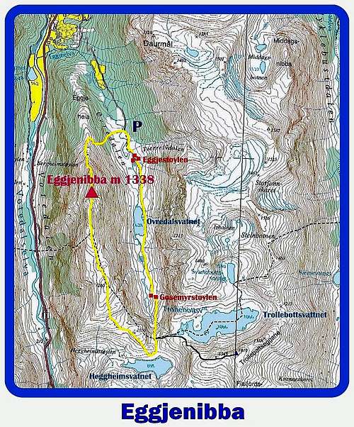
The shortest approach is from Byrkjelo, by following the highway E39 towards Skei along the Vatedalen. Pass the Bergheim Lake and reach the little village of Egge, between Byrkjelo and Skei. Here you must leave the main road and look for an unsurfaced toll-road towards "Øvredalen" (signposts) on the left, not very obvious. Take the road and follow it, entering the Øvredalen Valley for about 3,5 km. Parking on the left, just near the T-Trail starting towards Eggjenibba.
Eggjenibba NNW Ridge - South Side Crossing
Eggjenibba NNW - S Crossing
Summit Altitude: 1338 m
Difficulty: Class 2, Class 3 without using the iron chains
Vertical gain: about 790 m.
Exposure: North-North-West and South for the descent


This route is a worthwhile scramble up the NNW ridge of Eggjenibba - not the Normal route to the summit - as a matter of fact the easiest route to climb Eggenjbba is running on the easy slopes along the South Side, starting from the Trollebottsegane Pass, a notch located between Eggjenibba and Trollebottseggane, at the head of the Øvredalen Valley. The combination of these two routes is quite satisfactory.
Route report
Once getting to the parking at about 3,5 km. from the gravel road’s beginning (altitude m. 542), don’t follow the road (getting soon the hamlet of Eggjestøylen), but take on the right-hand side the T-Trail – marked with some red T (the marks of Den Norske Turistforening, in practice the Norwegian Alpine Club) reaching immediately a little wood bridge crossing a stream, then rising steeply across the wood towards the NNW Ridge and getting to the base of the rocks.


Start to climb the NNW ridge; soon there’s a steep rocky section equipped with some chains and fixed ropes. After this starting climb, the ridge becomes less steep; scramble along easy rocks, climb up a steep snow slope, leading to a panoramic ridge and then to the last rocky pyramid.


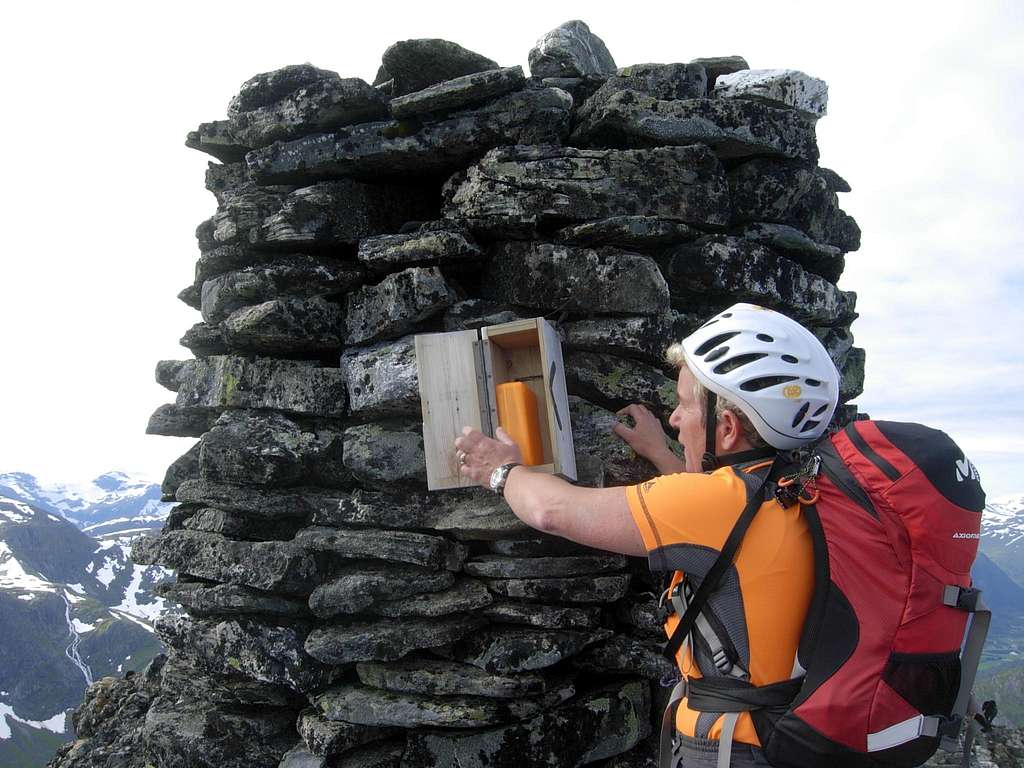
Climb it getting to the huge summit cairn (about 2 hours from the starting point), a few meters below the summit. Summit book.
From the top heads to the opposite side, walking down along easy rocks and wide snow fields and reaching at first two magnificent lakes named Heggheimsvatnet and Trollebottsvatnet, then the Trollebottsegganepass, a notch between Eggjenibba and Trollebottseggane (mt. 1419), a peak some meters higher than Eggjenibba. From the notch downclimb on a steep snow slope, reaching the Øvredalen Valley and the little cabins of Gosemyrstøylen. After this small hamlet, cross the river running on the valley via a little treestle-bridge which must be put in place. We found the treestle – bridge on the opposite side of the river, so we forded one hundred meters lower, where the river was more quiet. After the ford, follow the good trail to another nice lake, named Øvredalsvatnet, then to the little picturesque hamlet of Eggjestøylen, reaching quickly the starting point of the crossing.
Red Tape
Eggjenibba is located just outside the Western boundary of Jostedalsbreen National Park. There are not particular restrictions in climbing and hiking. Pay attention: a toll is due to drive on the road to Øvredalen.
Accomodation
In Byrkjelo there are some different accomodations, amongst those there's a nice campsite. If you have not a tent, you may rent a Norwegian typical “hytta” (wooden cabin).
When to climb
Best months are June, July, August and September
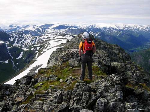
Summit view |
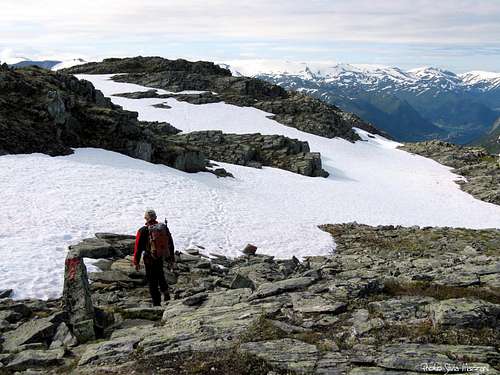
Down South standard route |
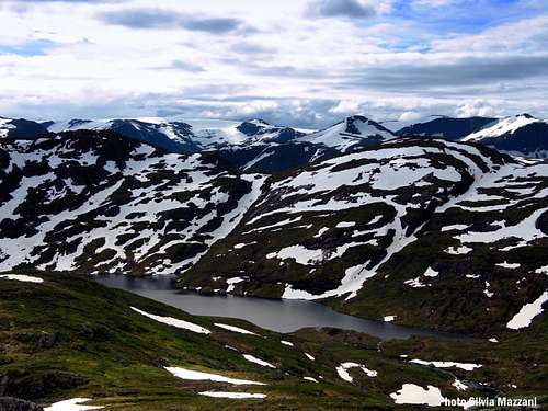
Trollebottsvatnet |
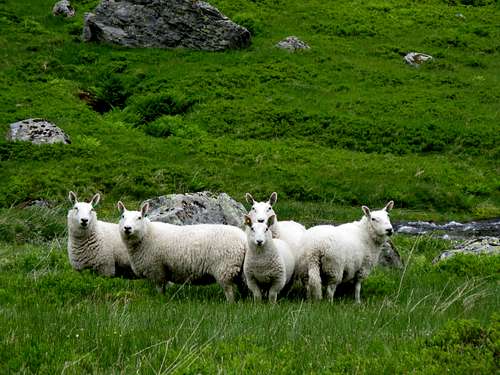
Sheep on Øvredalen |
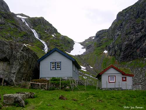
Gosemyrstøylen small cabins" |
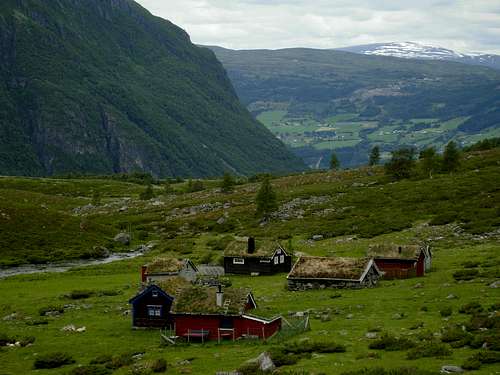
The picturesque village of Eggjestoylen |
Meteo
Gloppen/Byrkjelo weather forecast
Norway Weatheronline
Guidebooks and maps
Maps
1318-III Breim - Statens Kartverk, Norge 1:50 000