


Comments
No comments posted yet.
|
|
Trip Report |
|---|---|
|
|
36.12199°N / 112.12472°W |
|
|
May 19, 2013 |
|
|
Hiking |
|
|
Spring |
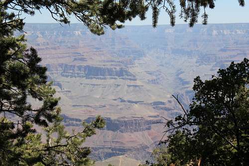
The Grand Canyon receives upwards of 5 million visitors a year. Most of the visitors never venture from the rims. When visitors do venture from the rims, a common goal is to reach the Colorado River. Every year a number of visitors try to reach the Colorado River who are unprepared and wind up needing a rescue or worse. I suspect this is why the information that exists about backpacking is somewhat sparse in terms of real planning and advice, and long on cautionary tales and warnings. So much so, that I think it can be quite misleading. Hence the format for this trip report.
Let me start with some givens. The distance from the South Rim to Phantom Ranch (where there is food, water and restrooms) is 7.4 miles, which includes a crossing of the Colorado River and ends up half a mile north of the Colorado River. The distance from Phantom Ranch to the North Rim is 14 miles, and another 1.8 to the North Rim overlook at the North Rim Lodge. A return trip to the South Rim via a different path (common for rim to rim to rim hikes, also known as “R2R2R”) is to take the Bright Angel Trail.
Some people trail run from rim to rim to rim in one day, and others go rim to rim in one day, and then back to the other rim the next day (I saw many of both on my first trip described in this trip report). These people are in shape, start early, are not backpacking, do not have to worry about an overnight permit (which must be gotten in a lottery), and will not be taking their time along the way. That was not our goal.
So we made our backpacking plan taking into consideration that there are three campgrounds along the main trails—Bright Angel campground at the Colorado River, Cottonwood Campground 7.2 miles north of Phantom Ranch and Indian Gardens Campground which is about midway between the South Rim and Phantom Ranch along the Bright Angel Plan, and you are required to camp in only these locations on the main trails we would be covering. Our plan, which we followed and which I can also highly recommend, was as follows:
Day 0: Drive from Los Angeles to the South Rim.
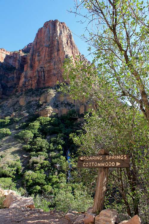
Day 1: Take the South Kaibab trail to Cottonwood Campground (which is in the North Kaibab Trail).
Day 2: Leave gear at Cottonwood Campground and hike up to the North Rim and then return on the North Kaibab Trail, there being an extra 1.7 miles each way on the North Rim to the North Rim facility.
Day 3: Hike to Indian Gardens (taking the North Kaibab Trail to the River Trail to the Bright Angel Trail) and then watch the sunset at Plateau Point.
Day 4: Hike up the remaining 4.8 miles to the South Rim and drive back to Los Angeles.
As it turned out, this was a perfect plan. It was not too far on any day and, in fact, was quite leisurely, allowing plenty of time to take pictures, soak in the scenery, and enjoy ourselves. I did my first trip from May 18-22, 2013 with my brother Ed and my second trip May 30-June 3, 2013 with my hiking buddy Mark J, his son Paul, and my stepdaughter Arley. We had applied for our permits on January 1, 2013 and won the lottery for each of the trips. (When you apply in the lottery you must specify each campground you will be staying at each night and if you receive a permit you can only camp in the specified campgrounds on the specified nights set forth in your permit, so you do not have the luxury of changing your schedule if you have planned poorly.) The temperatures on both trips were relatively mild, the high at Phantom Ranch being about 95F the first trip and a little higher on the second trip. On the first trip it was cold on the North Rim, but on the second trip it was positively hot sitting on the deck chairs in North Rim lodge facility looking out over the rim.
I have organized the rest of this report into discreet sections along with some commentary and additional commentary being provided with the individual pictures. I have included times of the photographs taken on my first trip for reference; pictures from the second trip are lacking times.
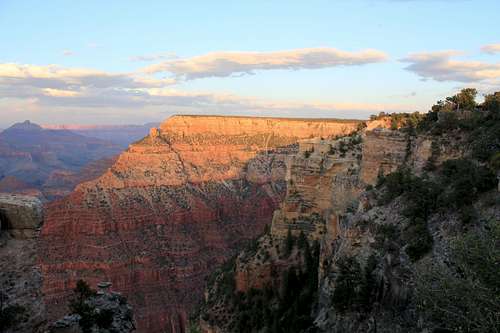
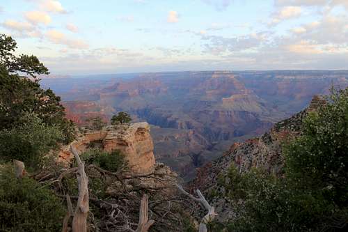
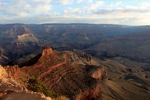
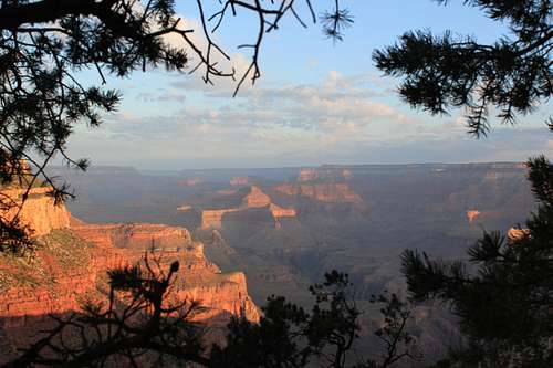
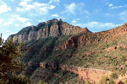
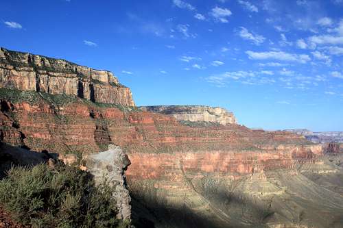
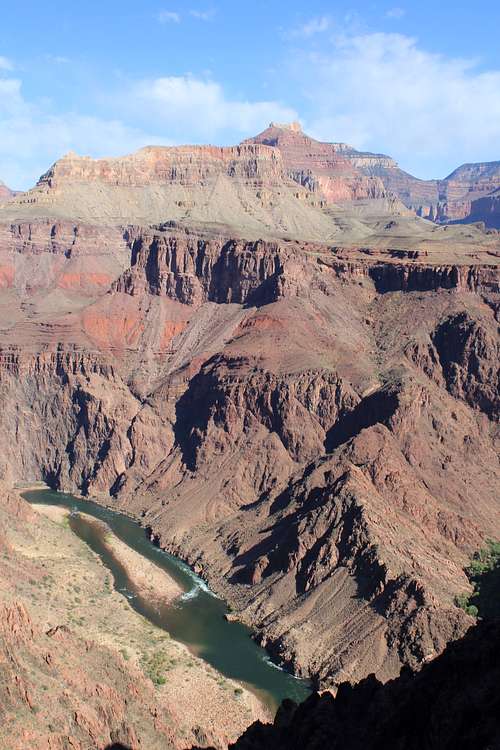
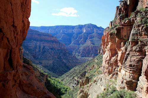
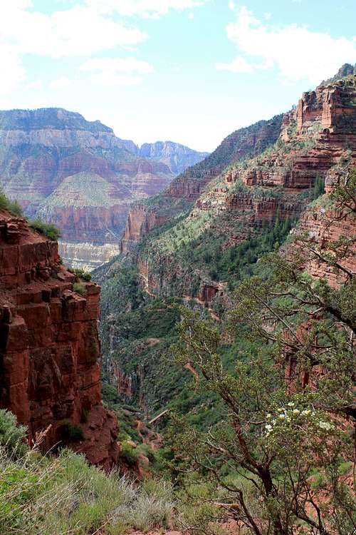
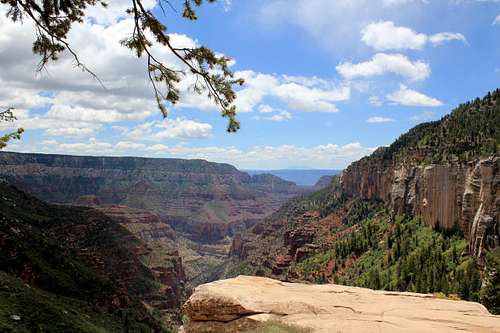
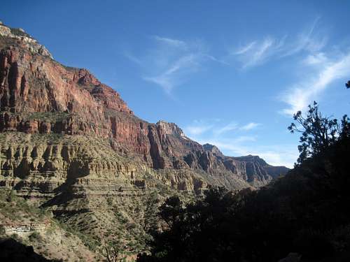
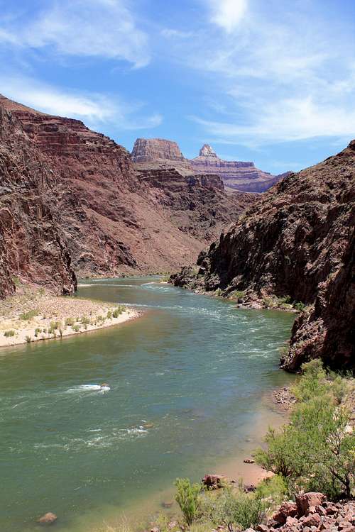
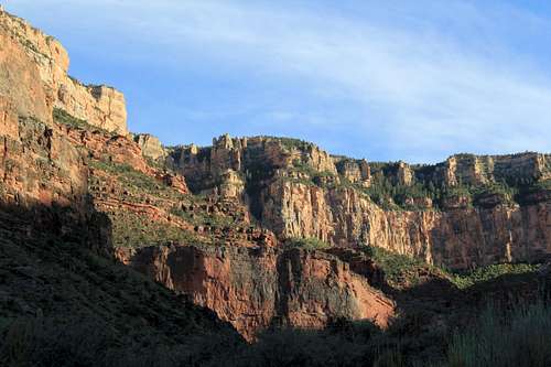
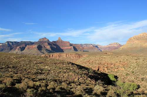
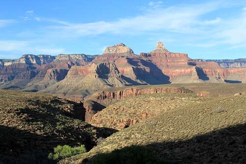
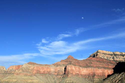
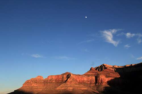
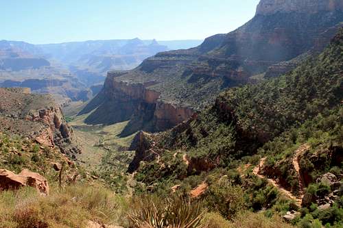
You can get a bus to the trail head from various locations at the South Rim. We started at the Visitor Center and caught the first bus that was there after 5 am. The bus takes you to the trail head where there are toilet facilities but no parking for visitors. The South Kaibab Trail is billed as the steepest trail in R2R2R, but it is not really that steep. It covers 6.9 miles from the South Rim to the Colorado River, with a loss in elevation of 4860 ft. over 6.3 miles.
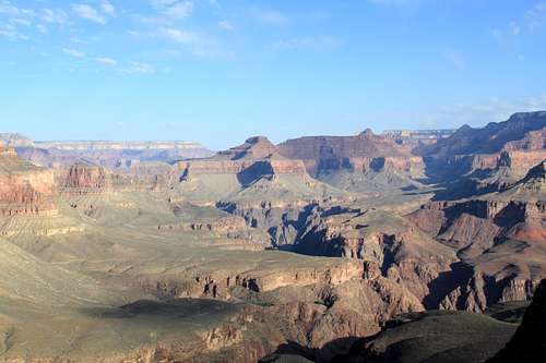
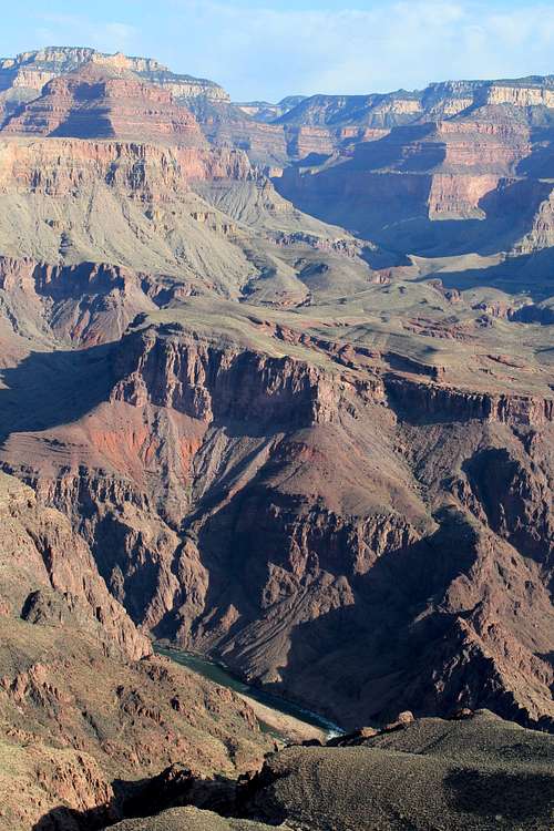
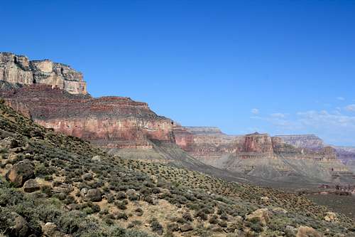
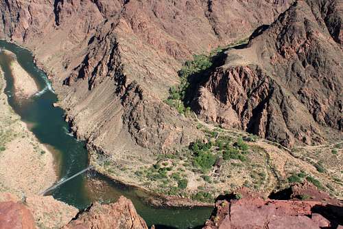
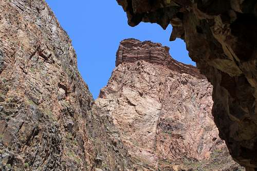
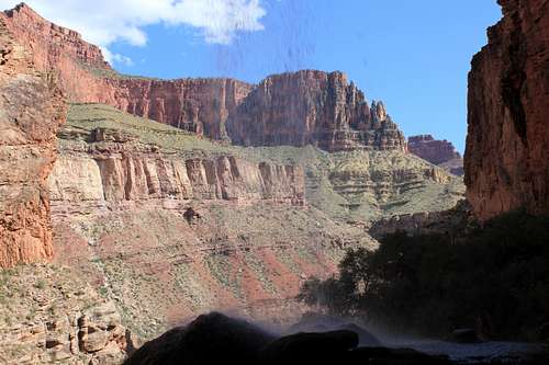
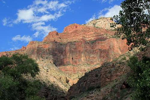
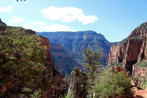
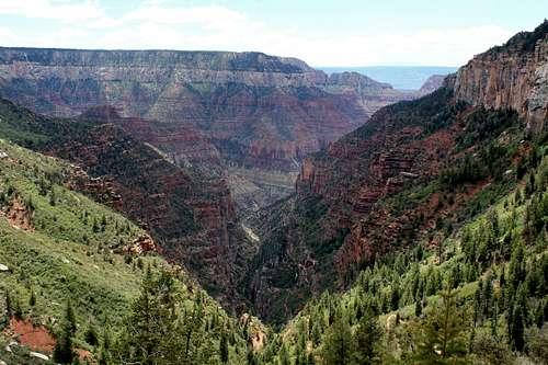
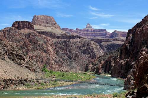
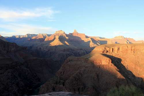
This trail starts descending from the South Rim with impressive views from the beginning, and more views constantly coming into view. The trail eventually proceeds along a ridgeline and then goes down a path not really visible until you get there, and then crosses the Colorado River via a bridge. Once across the Colorado River, Bright Angel Campground is on the west, and the trail proceeds up to Phantom Ranch. This trail has the most wide open views of the trails in this hike, with vast vistas along long portions of the trail. I really liked this trail.
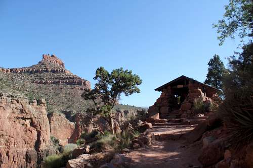
This trail has toilet facilities at Cedar Ridge (1.5 miles from the start) and at Tip Off (4.4 miles from the start), but no water along the way. When you get to Phantom Ranch there are toilets and an air-conditioned cantina with snacks and drinks. I had approximately five 16 ounce glasses of tea and/or lemonade (with ice) each time I passed through this cantina.
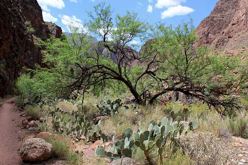
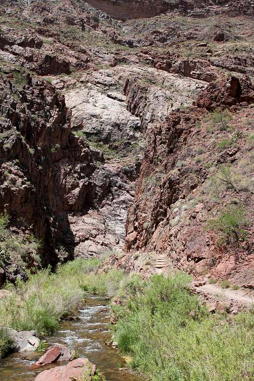
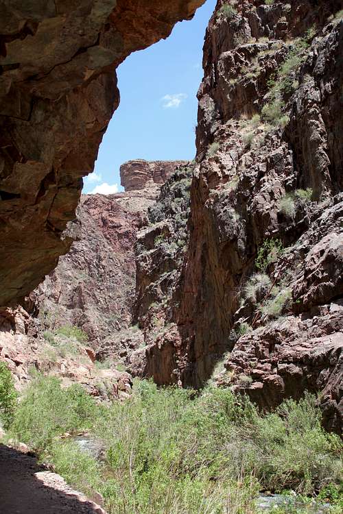
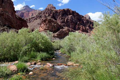
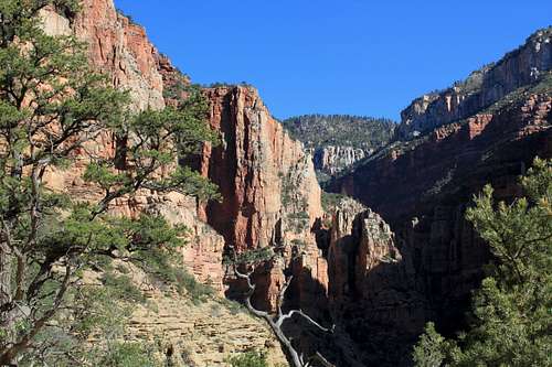
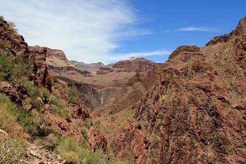
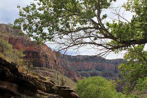
Shortly after leaving Phantom Ranch this trail turns into narrow canyons and becomes far different from the wide open vistas seen in the morning. I am not sure what I was expecting, but this was not it. Some of the canyons are relatively narrow. The materials from the Park Service say this portion of the trail can get very hot, and this is undoubtedly true. But given the narrowness of the trail, sun only hits the trail during limited times of the day, and the Kaibab Creek is available at many points along the trail for wetting your hat and shirt to help keep you cool, which we did about every half hour or so. Also, the elevation gain on this leg of the trip is slight, which means this section has no real elevation gain to slow you down.
During parts of this hike I thought it seemed like I was somewhere else instead of in the Grand Canyon, given the rushing water and all of the greenery around it. On my first trip there were flowers in bloom everywhere (see a separate photo album also posted on SummitPost showing the flora seen on my first trip). We decided to stop and enjoy ourselves, and cool down, at several points along this trip. There is plenty of time for such stops, and no reason to become overheated. Over time we all started to enjoy our stops when we soaked our shirts and hats in the cold stream water.
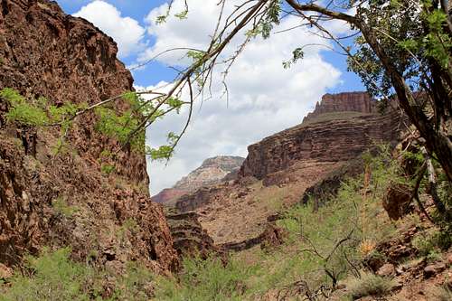
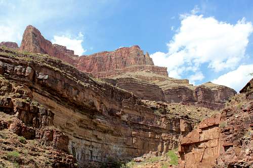
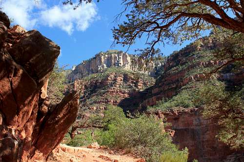
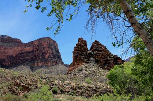
When you eventually come out of the narrows area, the trail starts to open up and go through a plateau or plains like area that will eventually lead up to Ribbon Falls, described in its own section below. After Ribbon Falls, the trail goes about a mile and a half until it reaches Cottonwood Campground, and there are some pretty impressive views between the narrows and Cottonwood Campground.
There are no toilet facilities along this route, but there is plenty of stream water.
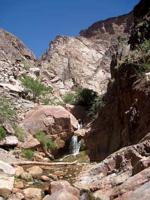
On both trips we stopped at Ribbon Falls on our first day. On the first trip, because I did not know where Ribbon Falls was, I kept going along the trail at a sign marking a fork in the road, which means going up a hill and then back down it and then backtracking across a bridge and back to the Falls. On the second trip, we crossed Kaibab Creek and proceeded directly to Ribbon Falls, which was the better option (although our two younger members had some difficulty crossing the stream). The stream crossing is not difficult for anyone with any experience in crossing streams on rocks. Even if you go in the stream, there is not much to worry about because you can dry off pretty quickly at Ribbon Falls.
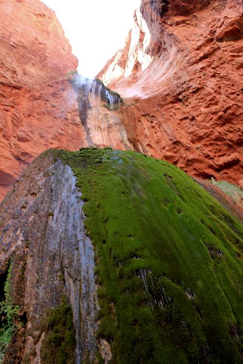
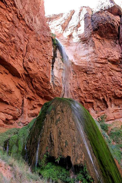
Ribbon Falls is a side trip not to be missed. The Falls are located in an area protected from the sun most of the day. That is why you see this enormous rock with moss on it, where the water from the falls runs down. I saw pictures of this area from the early nineteenth century (albeit in black and white) where the same moss covered rock was easily identifiable. The water pool by the falls is fairly shallow and you can go in it and cross to a hole in the rock where the water runs down. You can also take a trail up behind the falls.
There is plenty of time to spend an hour or so enjoying this area, especially if you have members of your group who need to change socks and dry out their shoes or boots from an imperfect stream crossing. And, after all, why rush when you should still have plenty of time to Cottonwood Campground.
This campground has toilet facilities and running water, when it works. On my first trip we had running water. On my second trip the water was not running on the first night here, but was on the second. So you want to make sure somebody in your group has water treatment pills or drops. The campsites here are numbered and laid out, each of which has a picnic table, large ammo boxes for food storage, and racks for hanging your packs. Many of the sites have some tree coverage. One thing to remember about such sites, especially if you doing the R2R2R backpack described here, is that trees interfere with star gazing at night, which was one of the more enjoyable aspects of this campground. The stars are incredible. Also, as was pointed out to me by a ranger on my second trip, if you know where to look, you can see a light at the North Rim facility at night from this campground. (If you are at the trial at campsite 4 and around that area, look left up the large canyon to the rim and you can see the light.)
Before describing the hike for this day, it is worth noting that you can leave your tent, extra food, and sleeping gear at your campsite today, which means you will not be carrying this weight on the ascent, and your campsite will be waiting you upon your return later in the day, which makes this day much less strenuous, especially since you can buy your lunch (when the North Rim Lodge is open) on the North Rim.
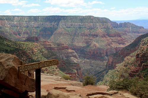
The North Kaibab Trail starts off slow with little elevation gain, but good scenery, up to the Pumphouse Ranger Station 1.4 miles north of Cottonwood Campground (there is a toilet facility and water, when it is working, and a stream at this point). From Pumphouse Ranger Station up to Roaring Springs (another 0.7 miles) the trail starts to turn a little steeper. Roaring Springs is somewhat of an unusual place. The Springs appear to be coming right out of the rock, and the water pours out from Roaring Springs, where there is a pumping facility. After Roaring Springs, the trail winds upwardly and goes through some really interesting areas, with very interesting trees and views, and some steep drop offs over the side, until you go down in elevation to cross a bridge. Once you cross the bridge, it is switchbacks up to the Supai Tunnel, which is 3 miles from Roaring Springs. This is the hardest (but not that difficult) portion of this hike, but very scenic, and it is nice to be doing this portion of the hike in the morning when light is good for enjoying the scenery. There are toilet facilities and running water (when it is working) at Supai Tunnel. From Supai Tunnel, it is relatively easy long uphill switchback trails up to the trailhead, there being a very scenic overlook at Coconino Overlook. From this overlook, we could see San Francisco Peaks to the south.
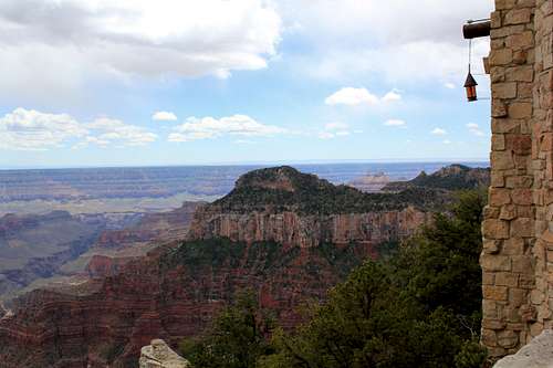
When you get to the trailhead at the end of North Kaibab Trail, there is running water and toilet facilities. From the trailhead it is another 1.7 miles along a designated walking trail to reach the Grand Canyon Lodge, which is definitely worth the walk. At the Grand Canyon Lodge there is a gift shop, regular toilets, a sit-down formal restaurant, a saloon, and a cafeteria where we had pizza and cold drinks. The Grand Canyon Lodge has outside terraces where you can sit in lounge chairs and soak up the view as the terraces have a steep drop-off beneath them for a fantastic view of the Grand Canyon.
Once you have slaked yourself with food and enjoyed the view at Grand Canyon Lodge, you turn around and retrace your trip to Cottonwood Campground. As this is going downhill, it is a very easy and enjoyable hike, especially since you left gear at your waiting campsite.
This portion of the trip retraces ground from Day 1, but now early in the morning. One thing to consider, which I did on my second trip, is a side excursion up Phantom Canyon. You can cross Kaibab Creek right above where Phantom Creek joins it on an easy rock crossing. The trail up Phantom Canyon is very narrow, but easy, with small waterfalls coming into view in about 5-10 minutes. You can easily climb up above the waterfalls to the left.
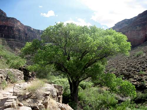
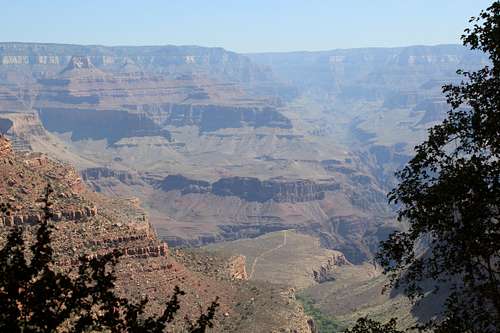
From Phantom Ranch you proceed back toward the Colorado River and then tak e a trail west that crosses a second bridge and then proceed along the River Trail. The distance between Bright Angel Campground and the River Resthouse (where there are toilet facilities but no running water) is 1.5 miles. This path, as it will be traveled midday, can be hot. It has nice views of the Colorado River. Portions of the path are through sandy areas, but the trail is well maintained. Just above the River Resthouse you will find pools of water from a stream where you can soak your shirt and hat, which you will want to do before heading up through Devil’s Corkscrew which is a winding switchback trail that sounds much worse than it is, but which is now being taken in midday when it is hot. Above Devil’s Corkscrew you will come into a short area that is now flat and then, as you turn left, you suddenly pass into a green area with water running literally alongside the trail, a real desert oasis. This is a good spot to again wet your shirt and hat. From here, the trail travels up through a canyon area, so the views are limited, past a small waterfall, and then you will approach an enormous and beautiful Cottonwood tree. From this tree, you are probably about a mile from your campsite at Indian Gardens. There are some very beautiful views of the South Rim along this route, as you are now getting back into an area with vegetation.
There are a lot of people at this campground, some of which have just come down from the South Rim. It can be noisy, and the ground is hard as cement in the campsites, so it is best not to have to use stakes to pitch a tent. Almost all of the campsites are protected by trees, which makes nighttime stargazing more difficult. It is easy to see lights from the South Rim from Indian Gardens. This is not a wilderness campground. By the time you set up your campsite and rest a bit, the thing to remember is that you want to get to Plateau Point for sunset, and almost everybody at Indian Gardens Campground will be there right with you.
Plateau Point is 1.5 miles, one way, from Indian Gardens Campground. It is an easy trail. Just take a little water, your camera, maybe your dinner, and be prepared to watch the sun go down with a couple dozen other
people once you reach Plateau Point. The views are great. On the first trip we saw condors flying about; on the second trip we met a professional guide who was there with some clients and watched him making a great pasta dinner, for which I got the recipe. The point is to enjoy the view, as this is your last night and there is not much else to do, although there is a library at Indian Gardens Campground with books you can check out if you are inclined to reading.
Indian Gardens Campground has toilet facilities and fairly reliable running water.
The first stretch of this final segment has little elevation gain and then starts to gain on your way to Three-Mile Resthouse which has toilet facilities and water. The next stretch goes up to Mile-and-a-Half Resthouse which also has toilet facilities and water. Then one more stretch to the South Rim. Given that this is all you have to hike on this segment, you have eaten most of your food, and water requirements are slim if the water is on, this is a fairly easy finish to the trip. We did not start until 7 am on both trips, and were at the South Rim mid morning, with plenty of time to take the shuttle to our car, change, and be plenty early for lunch, and then a drive home. No need to rush and an easy finish to the trip.
On my first trip I was not entirely sure what to expect or what I would see, so the second trip was much more relaxed and enjoyable. Also, on my second trip, I really minimized what I took, and my backpack with 3.25 liters of water, a 19 oz. container of tea/lemonade (i.e., mostly sugar), a 5 oz. pillow (since I had no jacket or extra clothes for a pillow), a tent and sleeping bag liner, weighed in just under 26 pounds. (I also did not take a rain cover for my tent since the weather forecast for rain was 0%).
This is a very nice and enjoyable backpacking trip. It is not a wilderness trip, and you will not be alone. But you will enjoy great vistas and be able to soak in a variety of things that millions of people miss on a visit to the Grand Canyon. And it is not difficult, as long as you are prepared, have some decent equipment, somebody with some experience, and have a reasonable degree of physical fitness. For somebody with mountain hiking experience, especially with backpacking trips, you might call this Club Med backpacking, given all of the toilet facilities and daily access to cold drinks and food. But, remember, I did this before the summer heat, and that could make things much different. That is why planning is essential, and you must get a permit via the lottery.