Overview
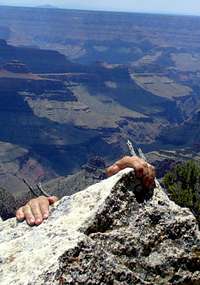
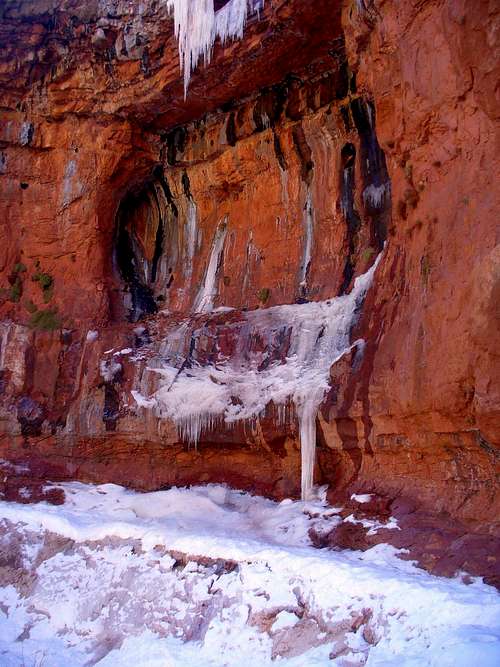
![Dangling from the North Rim]() North Rim in summer
North Rim in summer
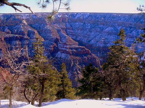
Having visited the Grand Canyon for the first time the previous summer, I was awestruck by its majesty, and by people's accounts of speedy crossings. I knew that my body won't appreciate doing it in the warmer months, and so I was quite elated to discover
a trip report by two Phoenix guys outlining how it can be done on skis (the trick is that the winter closure of the North Rim adds over 40 miles one way to the trip!). Another source of inspiration have been
the old TRs of the founding fathers of Utah ultrarunning who were also experimenting, decades ago, with what they called "
fastpacking" in my favorite Uinta Mountains. Adding two and two together, I got all fired up about a possibility of skiing + fastpacking across the Grand Canyon.
With the potential partners all peeling off, I figured that the weather and the Moon would be my most reliable friends for a solo recon trip. I wasn't quite sure what I will find out about the terrain and about myself, but I had 10 days to spare & ended up doing a full R2R2R in 5 days, for a grand total of approximately 150 miles. 100 miles of skiing and 50 on foot give or take.
![Upper section of North Kaibab in January]() North Kaibab Trail: suncrust is my friend
North Kaibab Trail: suncrust is my friend
So I had warmer weather and full Moon at my advantage, but a water main break at Phantom Ranch kept me from getting a good dinner they way the Phoenix crew did :/. The route was
figure-8 shaped, I got Rte 67 in, Camp 1 in the storage shed at N Entrance, C2 Phantom, S Kaibab up (and a couple mile of rim run to add cuz it was a beautiful sunrise ... generally I was starting each day several hours before dawn, so the first light of the morning would meet me miles into the day). After gorging on food and some shopping, down Bright Angel Trail. C3 near Roaring and (after a detour to N Rim Lodge and Bright Angel Point, and to get the FS snowmobile tracks directions from the N Rim rangers) C4 again in the storage shed at N Entrance. The return on FS roads of Kaibab Plateau was the most enjoable of the sections (it's only 6 miles longer than the hwy 67, but with a lot of narrow beautiful forest tracks and little meadows and very little burnt-out forest and vast meadow parks you get on the main road).
Also low on fuel like the Phoenix guys have been but I relied on campfires outside of the park boundaries, and collected meltwater from the roof at N entrance to save on fuel. Also carried crampons for no reasons - real heavy crampons in my case cuz some folks got me scared about Redwall conditions ... but just like them, I only faced one easy icy section in that one cove of Redwall's. My pace was marginally faster but now I think, with the additional beta I picked along the way, it should be doable at an even faster clip!
Timeline
Day 1: Hwy 67 to N Entrance, 34 miles, 16 hours, +2,000 ft, -1000 ft
![De Motte Meadows and Kaibab Highpoint]() View from Vermont Hill across De Motte Park
View from Vermont Hill across De Motte Park
The first day actually started before midnight. After a Friday night drive from Salt Lake, I pulled to the end of half-mile plowed section of Hwy 67. The car thermometer read 16 degrees outside, and it looked certain that the temps will drop some more as the night wears on and the elevations rise. Hmm, with 15 degrees rated sleeping bag, I better not count on hunkering down for the night! But the Moon was high and bright, nothing should interfere with my skiing progress through the darkness.
At first the roadbed had just some tentative snowshoe track, but some snowmobile tracks joined from the West, from FR 628. At the time I didn't yet realize that the Forest Service discourages snowmobile traffic on the paved highway, to make spring plowing easier, so I won't have many tracks along my route. Indeed the fresh track exited to the West on FR 212 some 8 miles down the road (the Phoenix guys' TR observed the same). It was past 1 am and I stopped to sip some hot tea and add some layers. The forest ahead was mostly burnt out; the road gradually gained altitude. At last, 14 miles into the trip, came a glide down from Telephone Hill. The cold was getting brutal, and I stopped to rummage for some more layers and to crack open handwarmers, and for another gulp of tea. No good! The thermos lid was frozen shut!
The next 8 miles stretched into a nasty blur. North breeze pushed the waves of frozen mist over the glades of Pleasant Valley (some pleasure!), and my windbreaker and pack grew a half-inch layer of fine hoarfrost in this 100% humid atmosphere. For miles on end the snow was wind-scoured into hardboard and the stretches of highway asphalt lay bare, yet I could scarcely use my poles for more than a few minutes at a time before beginning clumping and wiggling the freezing fingers. Toes too. The pace was dying down yet I could only keep warm by pushing ahead. The East was growing lighter yet the Sun wasn't in a hurry to rise. Finally at the crest of Vermont Hill the Sun burst up, and the night chill retreated. Time for a campfire and a good hot breakfast!
I thought to set a camp in the daylight, especially if the snow becomes too sticky, but after the previous night I wasn't clamoring for another one at this elevation. Better to push forward some more. Besides, the North wind kept blowing, and the snow at the meadows never softened at all. I skied the mix of roadbed and meadows, looking for firmer crusts / less deep drifts. Interesting hunt but often elusive.
![Trail breaking across De Motte Park]() Breaking trail across the meadows of De Motte
Breaking trail across the meadows of De Motte![Winter view to Humphreys]() View to Humphreys from North Rim Lookout Tower
View to Humphreys from North Rim Lookout Tower
Passing by Kaibab Lodge, I saw a caretaker on a porch on the far side of the meadow; some snowmobile tracks stretched away from the lodge, but I didn't know well enough to cross there. Just kept breaking trail on the East edge of De Motte Park, casting doubtful glances at the tracks on the West edge. Like, yeah, suppose I cross there and of course the track will then turn around. Some of these tracks indeed went just for highmarking the enormous snowdrifts, up to two stories high, which the wind carved out of the meadow. There were some other interesting big holes in the snow, the evidence of coyote hunt. In one case the prey was a porcupine, too big to devour at once; a carcass haul track stretched to the woods.
It was early afternoon but my pace started dying down again, and I was darn glad when I finally pulled into North Entrance and discovered that the shed from the 2002 TR was still there and unlocked (someone dug out just enough snow from under the door to let it crack open. I would have had hard time doing it myself without a shovel in hard-crusted snow!). OK, this is the place as they say over in Utah :) !
Before calling it a day, I made a side trip to North Rim Lookout, less than two mile on a gently winding service road. I thought I could send some text message from the lookout, but, even though my Verizon phone showed two bars, I had no luck. The view towards Humphreys Peak, 75 miles away, was a good inspiration though, and the gentle glide back was fun. Now gimme lots of food and sleep!
Day 2: N Entrance to Phantom Ranch, 25 miles, 9 hours, +500 ft, -6,500 ft
I ended up sleeping 14 hours straight that night, but if I were to hurry down, I thought I might still get the coveted steak dinner @ Phantom Ranch. The highway now had a fresh biletrack, which joined from the West edge of the meadows, crossing into the park around a big sign saying "No Snowmobiling". And some 9 miles down the road, I met one of these snowmachines, a quiet 4 stroke cruiser towing a cargo sled to Jacob Lake. Ranger KJ explained me that they are using the forest roads West of the highway, to make spring plowing easier for the FS colleagues. She warned me of postholing on N Kaibab, and of the rangers down below out to fine me for no-permit camping, and said that I would be better off camping at N Rim CG next to their place. But the lure of the steak was too great to resist.
Soon I reached the summer trailhead and headed down on skis on a wide path descending through the conifers. It was mostly crusted and my skinny 210s were a poor match to the incline, so after first switchback I figured I may as well leave them (if the snow was any softer, the balance would have tipped in favor of skis, of course). Just then I heard someone hollering, but didn't pay much attention, cuz I just had my share of invisible-partner hallucinations in the previous day / night (although not as vivid!). But now, a minute later a real human being showed up from down below. It was a pair from Colorado on a more conventional R2R2R quest, first to break trail up here after the December storms (thanks!), and probably the only people in the area to become fully aware of my grandiose plans.
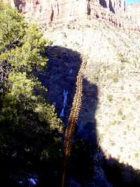
![Roaring Spring Canyon in winter]() Roaring Spring Canyon seen from upper N Kaibab
Roaring Spring Canyon seen from upper N Kaibab
Actually noontime Sun was softening the snow fast, and in a few places I ended up postholing where the Coloradans breezed over morning crusts. Still in a nick of time I was at Supai Tunnel, and the trail was no longer snowbound.
![Trail from Supai to Redwall]() Trail from Supai to Redwall ... see the footbridge below?
Trail from Supai to Redwall ... see the footbridge below?![Supai Tunnel in January]() Supai Tunnel
Supai Tunnel![Water Ice on North Kaibab Trail]() Nice-looking water ice below Supai Tunnel
Nice-looking water ice below Supai Tunnel
Redwall rose ominously in the shadows below, but I already knew that crampons won't be necessary there. Whatever water ice was present there was mostly to make the trail look prettier.
![Meltwater mini-shower on N Kaibab]() Waterfall or rather drizzle from the Supai Capstone overhangs
Waterfall or rather drizzle from the Supai Capstone overhangs
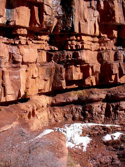
The snow on Redwall section of the trail was mostly piling up along the dropoff, with a ribbon of bare dirt running along the West side of the trail. The one small-ice section was a walk-over.
![Redwall Icicles]() Icy alcove of Redwall
Icy alcove of Redwall![Trailside agave on Redwall]() A strip of melted out ground runs along the mountain side of Redwall ledges
A strip of melted out ground runs along the mountain side of Redwall ledges![Roaring Spring in January]() Roaring Spring
Roaring Spring
The last snowpatches ended and I took off gaiters near the turnoff to Roaring Spring (which really does make a lot of noise!). Soon the trail brought me to the banks of Bright Angel Creek, which was a natural spot to stash some more gear. The tent and the stove and crampons and some more stuff went under a bush; gaiters and socks were left hanging to dry. It would have been a nice spot for breakfast or lunch for that matter, it was almost 3 pm and all I had to eat so far was some dry fruit. But with nearly 9 miles left to Phantom, the fear to be late for dinner was too great to shrug off, so I kept on hiking.
![View near Roaring Spring]() Bright Angel Canyon below Roaring Spring
Bright Angel Canyon below Roaring Spring
I passed the Coloradans' tent at Cottonwood, then the wide grassy valley made a bit more lively by the distant shady alcove of Ribbon Falls, and finally long winding narrows with four footbridges over beautiful clear creek (I was out of water by then too, but wouldn't bother to stop). And at 5:30 I knocked at the kitchen window at Phantom.
Alas, no steak. They had some problems with the water main, and they restricted dinner to the guests of the ranch. White tablecloth and candlelight and stuff. At least I quickly talked them into refilling my thermos with hot water, called home from the payphone, and sat there under the cottonwoods munching the leftover handful of raisins with hot tea & evaluating my options. The soles of my feet really didn't appreciate the forced march of the last few hours, and my energy level wasn't high at all.
I figured that even though they are serving dinner up on the South Rim, I have a real chance to be late if I head there right now. And that I haven't got gear to camp at the rim if by any chance I can't find lodging there at night. So my next meal ought to be breakfast, and I gotta spend the night at the canyon's bottom. The kitchen staff told me that I can sign up for 8:30 breakfast at the ranch, but in all likelihood I can as well have it at the South Rim.
Day 3: S Rim Loop & Back to Roaring, 27 miles, 14 hours, +7,000 ft, -5,000 ft
With a sleeping bag and a mat, a night's rest in the bushes wasn't all that uncomfortable. But when I clicked the GPS on to check time and found out it was 3 am, I wasn't about to lounge much longer. The valley was lit by bright moonlight and the silhouette of South Rim cliffs beckoned. For a minute I wondered if I could stash away some more gear, like sleeping bag. but the area of the ranch looked uncomfortably crowded by day & I just couldn't afford to loose my stuff now. So I just packed everything and hit the trail.
![First hue of dawn light up the canyon]() First colors of dawn on S Kaiab TH
First colors of dawn on S Kaiab TH![Dawn light on Cedar Ridge]() Cedar Ridge, the path of S Kaibab
Cedar Ridge, the path of S Kaibab
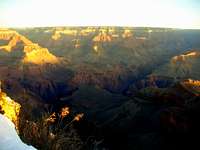
Colorado river surprised me with its vastness. The water splashed under stars far beneath the Black Bridge. South Kaibab trail started out wide and dusty & probably not loosing anything from the lack of sunlight. The 36 hours of dry fruit diet didn't quite get me reenergized, but the pace wasn't that bad. In the Moon shadow of the Skeleton Point cliffs I met the only other person on the trail that morning, a runner. The snow zone started, but just as before, it was more to make the trail look nicer than to make crampons worthwhile. I figured that if I keep my pace up then I may be able to text my daughter before classes; it felt good. And indeed minutes after 7 I was at the TH, and had cell phone transmission for the first time on the trip. And the first pale hues of dawn just started their play on the canyon cliffs. It was rather beautiful, and I wasn't about to miss the unfolding of the sunrise, so I kept on walking on the Rim Trail to Mather Point. The Sun peeked above the plateau at last, and the colors changed from ethereal lavenders into yellow and orange, and I had to remember that I was really up here to eat and shop - and get out.
![Winter dawn at the S Rim]() January Dawn at the South Rim
January Dawn at the South Rim![Confluence of Bright Angel Ck with Colorado]() Looking at Bright Angel Canyon from Mather Point
Looking at Bright Angel Canyon from Mather Point![On the snowbound switchbacks of Bright Angel Trail]() Down the icy switchbacks of Bright Angel Trail
Down the icy switchbacks of Bright Angel Trail
The shopping turned out to be a disappointment, their huge general store didn't have Campingaz fuel (which was running low) or fleece undermittens (I lost one the previous day). But in addition to ramen and chips, I got a 6-ouncer of ham and a couple cheese sticks, cuz I was getting suspicions that with as little protein as my ration had, I just might not be getting enough muscle energy restoration overnight (what kinds of thoughts cross your mind when you only have raisins for R2R sustenance :) !). And a can of Heineken (I had a bad history with it before, something involving Olympic policies, smuggling, and secret services, but I guess I will have to keep the tale for another occasion LOL; in the meantime, I just liked the fact that I can fashion the empty can into a snow scoop for melting snow).
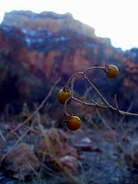
![Winter fruit of the Indian Garden]() Indian Garden's winter fruit
Indian Garden's winter fruit![Colorado River is green in winter]() Colorado River!
Colorado River!
And they had a deli counter, which of course was out of most everything in the morning, but I got an all-American breakfast and generously sprinkled it with parmesan from the pizza counter. The weird American fare never tasted this good! I figured I'd board the shuttle and head for Maswik Lodge cafeteria for seconds, cuz the breakfast selection would be better there. But the bus driver wouldn't understand a word of my English, insisting all the time that I'm going to Bright Angel TH and he will show me exactly where it is. Eventually I decided that it was my fate, to head down Bright Anglel without breakfast #2. It was past 10 am already, after all, and I had to hike 18 more miles before I could crack open the beer!
I sat for a few minutes in the Sun at the TH, sipping my tea and treating the most threatening blisters. It didn't look good in the daylight. Sigh. Am I really going to... But of course the moment I walked into the shadow of the snowbound trail and kicked the working pace, everything rolled fine again. Bright Angel trail was icy and bumpy and a couple times I was even tempted to use the poles (I usually try to avoid it at all costs ... it's bad for your sense of balance). And then I was in the marvel of the lush Indian Garden. Even brushed my teeth there, the task originally planned for Maswik Lodge :) Clear water ran through the rushes, verdant sprigs of grass pocked through the mud, and emerald moss shone on the rocks, it felt great to be in this spring oasis before heading into the winter again! I stopped for a lunch break on a sunny creekbank just shy of Colorado River & enjoyed my time.
![Silver Bridge of Bright Angel]() Silver Bridge of Bright Angel Trail. View to Zoroaster Temple
Silver Bridge of Bright Angel Trail. View to Zoroaster Temple
The mighty river was flowing faster here, and its sound was a lot more intimidating. I slogged through deep sand before Silver Bridge, then took another sunny break near the ranger station water tap. OK, it's all uphill from now!
![Winter at Bright Angel Ranger Station]() Indian Summer in January near Bright Angel GS
Indian Summer in January near Bright Angel GS
Compared to the shady South Side, North Kaibab Trail was basking in sunlight. I already took off my shirt, and after clearing Phantom Ranch, I figured that there is nobody on the trail beyond, and I can as well take off the ski pants and keep hiking in the boxers. Wrong! The first few miles were full of hikers returning from Ribbon Falls. I decided to feign the National Parks' ubiquitous European Pervert, you know the kind, the ones who go into motel swimming pools in their speedos LOL. Just smiled and greeted everyone in my best accented English. Then it got worse cuz the next pair I met turned out to be the Coloradans whom I met near the trailhead the previous day :) We chatted some more; they let me know that they spotted my lost mitt and let it out to dry, and where to look for it. Kudos to you nice people! Of course the underwear things were bound to get worse yet, but by then I was too desensitized to care. For about a mile we've been overtaking one another with a herd of khaki-clad, wide brim-hatted, picture-snapping backpackers bound for Cottonwood CG. Then the incline got steeper and they were off my tail. I even got a few skinnydipping minutes in a creek, washing off the grime of the previous 3 days. Finally, just as the shadows started creeping across the valley, I reached my stash, opened the beer, finished the last slice of ham, and put a pot of creekwater on the burner. No use saving on gas anymore; I will try avoiding melting snow, but if I do run out, then I figured I would just use the grill on the porch of North Entrance residence for cooking :)
Day 4: Roaring Spring to North Entrance, 20 miles, 11 hours, +4,500 ft, -500 ft
![Dawn view of Humphreys Peak]() Dawn view of Humphreys Peak near Supai Tunnel
Dawn view of Humphreys Peak near Supai Tunnel![First rays of wintry dawn on N Kaibab]() First rays of morning Sun on North Kaibab Trail
First rays of morning Sun on North Kaibab Trail
It was supposed to be the shortest day of the trip but going up, and with the heavier pack, and after some tough days, so I wouldn't wager about the pace. Started out in moonlight at 4:30 am, it was below freezing but the going was fast and I quickly shed the extra layers. The entire Redwall was in Moon shadows and it was rather beautiful to see the towers of the opposite wall highlighted by the Moon. I stopped to put on gaiters and windbreaker just before the tunnel; the snowbound trail beyond was frozen solid and it was easy going compared to my descent in the softened snow the other day. The East horizon was already alight, and by the time I reached the ski stash, the sunbeams were already caressing the slopes.
![Back at the ski stash at last!]() Back at the ski stash after 44 hours
Back at the ski stash after 44 hours![Closed for the winter: N Rim Lodge]() The funny roof overhang of the closed lodge
The funny roof overhang of the closed lodge![Bright Angel Point Trail in January]() Bright Angel Point
Bright Angel Point
A short distance up the trail I picked a sunny sheltered spot for a relaxed hot breakfast, then skied out to the summer trailhead and left the pack there. I had plenty of time left for the remaining 11-miler to North Entrance, and I was going to visit the rangers first, to find out some more details about the FS roads they use for snowmobile access to Jacob Lake.
![Self-portrait, Bright Angel Point]() January View from Bright Angel Point Trail
January View from Bright Angel Point Trail
It was a shining bluebird morning. We photocopied FS maps and directions in the Unit Office and chatted some, and I made a bunch of phone calls (to my pleasant surprise, there was a cellular signal extender in the building), and of course I couldn't resist skiing down to the lodge and taking pictures from Bright Angel Point trail. The trail itself was a patchwork of tall drifts, bare pavement, and hard crust, so I didn't go very far before backtracking to the road and to my backpack.
![Roaring Spring Canyon in winter]() My day started down there... View into Roaring Spring Canyon from Bright Angel Pt Trail
My day started down there... View into Roaring Spring Canyon from Bright Angel Pt Trail
Then it was 11 more miles on the soggy track to the park boundary, where I hang my stuff for drying on the porch and collected meltwater from the roof for cooking, before retiring to the shed. The fuel didn't run out after all :)
There was one brief but not so funny crazy moment that night. I guess I put at least a double dose of tea leaves in the thermos, and ended up with pounding heart, and against all reason I kept worrying that there must have been some toxic runoff from the roof which I used for cooking :) Fortunately the tiredness of the day took over and soon I was sound asleep, with the couple bottles of the "toxic water" rolling by my side to keep them from freezing overnight.
Day 5: FS Roads to Jacob Lake, 36 miles, 12 hours, +1,000 ft, -2,000 ft
I hit the road at 3:30 that morning, ready to meet the North wind into the face at the meadows with nearly all the layers on. The Moon shone bright, and the glide was easy, up and down hillocks on De Motte Park's Western edge. Soon the track pulled into the woods along FR 22 and started a winding ascent to nearly 9,200 elevation mark. At the crest of the hill, I turned to FR 462 (the sign said it was 48 miles straight ahead to Fredonia!). The horizon was gradually lighting up; at one point I glimpsed Navajo Mountain to the NE, but mostly it was just nearby hills and dales coming out of the veil of darkness. Some 4 hours into the day I reached the fork of the road, where FS suggested going right on FR 641, while the North Rim rangers said to keep left on the wider road. I wasn't that excited about the wide throughfare and took my chance with the old singletrack going right. It was a beautiful narrow forest track, all scattered with coyote scats and scent marks and old and new tracks. Alas, my camera's zoom froze jammed and I couldn't get it to work to photograph this beautiful and serene wood country. The sunlight first lit up the crowns of tall pines, and then the ground itself. I was taking off one layer after another. Some 8 miles later, the track pulled into Moquitch Canyon with its burnt out slopes and groves of surviving trees near the creek. Now it was getting real warm, and my water was out, time for a relaxing hot breakfast.
With my beat-up feet resisting any activity other than skiing, I was looking for a spot where I'd sit in melted-out grass and feed the fire and fill the kettle with snow without ever having to stand up and walk. Sure enough, in another mile I found just such a spot, almost too hot in the Sun, and took a good rest. Sunblock and glide wax were properly applied, and minutes before noon I continued my journey down the overblown track.
Soon I got back to the NPS sled route, and out of the burnt forest into the beautiful chain of little glades of West Fork Warm Springs Canyon. These pine-fringed meadows were fairy-tale pretty! Some 4 miles later, the track pulled away from the creek to the North-West, and started winding between the hills, closer and closer to Jacob Lake. This is where I met the second snowmobiler in 5 days, another NPS ranger, parka, gloves, and goggles ... while I was plowing ahead barechested on the sogging up track. Finally the descending twists of the forest road brought me back to Warm Springs Canyon, and after a couple switchbacks through the pines of the other side, the historic Jacob Lake Ranger Station came into view! And by 3:30 pm I was gulping down mineral water from the car stash, slowly coming to terms with my trip-end pregnancy-like food cravings ... it was still two hours drive before the spicy meatball sub with lemonade / fanta mix became a reality :) Phew did I ever obsess about American fast food before?
Q&A
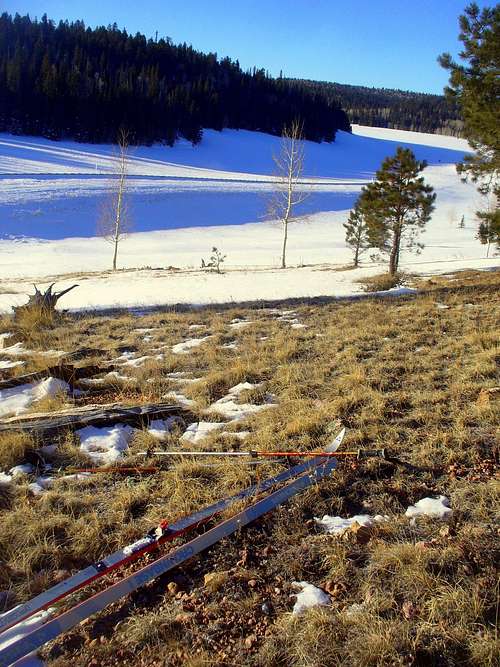
![First hot meal break of the tour on VT Hill]() The gear, day 1
The gear, day 1How heavy was the pack ? Tent, stove...?
I didn't weigh the pack but heavier than I like. To the usual winter camping stuff, add hiking boots, crampons (which I didn't need $%&#$%#), my faithful metal thermos, and an unwieldy multi-tool (no counting on Larry's repair set this time :) ). But I stashed like half of the gear mid-ways down on North Kaibab trail (it still remained heavier than I wanted for the canyon crossings though!)
Did you stash your skis at the rim ?
A short way below the rim. The skinny 210s were no match for that incline in the morning crusts.
Could you have benefited from snowshoes for the rim to rim part ?
Ain't worth the trouble. The snowed-in sections of North Kaibab total less than 3 miles, and most of it on supportive crusts (early in the day) or with very manageable postholing. Just a few hundred yards may approach knee-deep level, but I was even more lucky because the first crew after the December snowstorms has been breaking trail up from Supai just I was starting down :)
Did you follow a snowmobile or snocat track in from Jacobs Lake ?
I counted on sun crusts but there is too much drifting on the plateau; trailbreaking in the open areas ain't bad but it is still a serious chore. I had some old overblown and some fresh biletracks almost all the way; less than half fresh tracks going in but 80% fresh on the way back (cuz I consulted with the rangers and chose to return on the most snowmobile-trafficked route in the beautiful backwoods West of the summer highway ... which came to the grand total of 1 snowmobiler per 49 miles of the track). BTW these NPS-issue 4-stroke sleds are amazingly quiet and stinkless machines!
![Route Map]() Route map
Route mapHow much flowing water was on the trail, versus how much did you have to melt ?
Flowing water is an interesting term :) I only used creek water once, at C3, but I also filled from the CG taps at Indian Garden and Bright Angel; filled my thermos at the eateries of South Rim and Phantom Ranch; and collected meltwater from the roof of the dorm at North Entrance. I was running low on gas, partly by design, the plan was to burn wood outside of the NP and to buy a new canister on South Rim, only they didn't have the compatible gas for my stove :/ and I had to break my wow by making one little snow-melting campfire in the upper reaches of North Kaibab (no pictures as with all other breaks of legal rules! Actually it wasn't needed at all, there is water at the Unit Office but I didn't know it yet).
At 50 km per day for 5 days, that requires much fluid intake, and attention to electolyte balance
It looks like I may have been playing with fire with electrolytes, the way I often do, despite my best intentions to do better. It wouldn't be hard to do even better. Every long day was punctuated by a fairly long rest with a hot meal, which replenished the liquids and a good deal of electrolytes. My taste for salt was getting weirded out, and I started developing food cravings which made me remember pregnancy stories, but I didn't get strong aversion to the kinds of food and drink I did have, so I guess it's OK. I started getting a feeling that relative lack of protein in my diet is interfering with nightly restoration of muscle power ... I hate these nutrient beliefs but couldn't help succumbing to one myself this time :) ... but it wasn't hard to remedy, I just stocked up on cheese and ham (and some chips and beer) at the South Rim grocery, before returning to the usual spicy noodle, porridge, butter, and dry fruit diet of the final two days.
What about doing it faster?
Faster means lighter. One would have to exclude the need for higher-elevation Kaibab Plateau camps to be able to cut on gear. One possibility is a camp near Supai Tunnel, with 7,000 ft el and away from the plateau winds, and with a strong possibility of finding flowing water. Would it be possibile to cut the time to four days with a Supai camp / gear stash? You decide.
Another possibility is of course "One Way in One Day", probably with an extended rest stop at the warmer, lower elevation ground in Bright Angel Canyon.
Appendix: Map & FS vs. NPS snowbile directions
From North Entrance, head across De Motte Park to FR 22, thence to BM 9158; right (N) to FR 462; right (N) to 641 for about 8 miles, then left (NE) on FR 429 along partly-burned Moquitch Canyon (as suggested by the FS; NPS avoids this narrow section with drifts and blowdowns by staying on 462 for about 10 more miles, heading NW, then turning sharply right (East) into Moquitch Creek along FR 429). Both road variations briefly meet near Moquitch Tank (marked 8384 ft el on the topo) and ascent a burnt-up hillside to the North on FR 282. From the top of the hill FS-recommended route follows FR 282 to the right (East) and then North until it merges into FR 212 and turns West (left), while NPS sleds continue straight North along the beautiful glades of West Fork Warm Springs Creek. The two routes merge again in about 3.5 miles where FR 212 crosses to the left bank of West Fork. (Note that FR 212 is usually tracked to the East as well, all the way to Hwy 67, which is only 1.5 miles East from West Fork crossing).
Both FS and NPS routes leave FR 212 to the North (right) very soon, first the NPS route along FR 217 and then along the West side of a forest clearing, and then the FS route along FR 282. to a point labeled 8367 ft el on the topo where the two tracks meet again, not to separate anymore. In another 6 or so miles FR 282 drops to the bottom of Warm Springs Canyon in a series of switchbacks, and reascends to its East base to the historic Jacob Lake Ranger Station. The paved road is now less than a mile away. At the North side of the Ranger Station clearing, FR 282 merges into FR 461 for a short run right (East) to Hwy 67, just South of Jacob Lake junction (the mark on the topo reads 7911 ft el here).
(FR 628 from historic Ranger Sta merges into Hwy 67 less than a mile South of the barricade, and there is frequently a bile track for about 8 miles from there to FR 212)


Comments
Post a Comment