2009/2/13-14 Nankoweap Trail, Grand Canyon National Park Winter Solo Attempt
![Marion Point]() Marion Point
Marion PointAn Intriguing Find Many Years Ago
My introduction to the Nankoweap Trail occurred around fifteen years ago. I was drawn to a stack of Arizona Highways while visiting a family member in Tennessee. The cover picture was the Grand Canyon and was titled “The Nankoweap: A Tale From Grand Canyon’s Toughest Trail.” I read the article and even looked at the pictures. It made an impression on me that has lasted all these years.
![Early Switchbacks of Nankoweap]() Early Switchbacks on Nankoweap Trail
Early Switchbacks on Nankoweap TrailHistory and Gerneral Info
The Nankoweap Trail was originally forged by John Wesley Powell on expedition in 1882. The trails original intention was to allow geologist Charles Walcott to study the vast layers of rock in the Grand Canyon. The trail is off the North Rim close to the parks north and east boundaries. The trail followed an old Paiute route. All the information that I could find on the route agreed on one thing, difficulty. The Nankoweap Trail is the longest, hardest, steepest and driest route to the Colorado River. All sources warn against solo attempts and recommend only experienced persons make an attempt. At one spot the trail narrows to about a foot while simultaneously traversing above a cliff. I will confirm all the scary talk: The Nank is a BADASS (at least with heavy snow on the ground).
![John Wesley Powell]() John Wesley Powell
John Wesley PowellLocation and Approach
There are two usual ways to approach the Nankoweap Trailhead (3 miles in the backcountry via either route). Approaching via FS 610 south of Jacob Lake requires the road to be open. The North Rim access, Highway 67, is closed for winter. The other approach is via House Rock Valley and the Buffalo Ranch Road (FS 8910). Please note that I have repeatedly seen this road called FS445, which I believe is an error. The access to House Rock Valley is between mile markers 559 and 560 to the south. I did not know until my arrival that the road through House Rock Valley transects a 65,000 wildlife refuge. The refuge is home to a sizable heard of American Bison and several other critters. This 65,000 acres is a huge area bordered by Marble Canyon on the east, the Kaibab Plateau on the west and Saddle Mountain and the Grand Canyon on the south. To make things simple, if you turn south on the dirt road between 559 and 560 mile markers, and drive about 30 miles the Saddle Mountain TH (Trail #57) is on the right plainly marked with sign.
![Buffalo Ranch Road]() Buffalo Ranch Road (FS 8910)
Buffalo Ranch Road (FS 8910)Planning
I started making plans to do a winter attempt in December 2009. My original permit dates were for the MLK long weekend in January 2010. In the week preceding MLK, I was e-mailed by the National Park Service emphatically suggesting rescheduling due to a massive winter storm bearing down on northern Arizona. They said I would more than likely be stranded and loose my vehicle for the rest of the winter. I requested a new permit for Presidents Day weekend. I e-mailed the Park service for a conditions update. The NPS replied that there was a record amount of snow on the North Rim and they didn’t think that I could reach the Saddle Mountain Trailhead. If I reached the trailhead, they thought there would be a “spectacular amount” of snow on Saddle Mountain. They were right, it was a spectacular amount.
After a week of making a list and checking it 20 times, the time has finally come. As Saturday got closer, I found myself daydreaming and unable to sleep as I was getting psyched for the trip. All official invites for partners had now gone by with no one able or interested in joining. Solo it is.
![ATV Approach]() Used My ATV To Negotiate Road
Used My ATV To Negotiate RoadThe Start
I woke at two in the morning on Saturday February 13th. After pressing some hardcore coffee, I headed south then west from my home in Colorado. I figured the driving time between four and five hours. I had decided after the e-mail from the NPS that I was going to pull my ATV for the trip down Buffalo Ranch Road (FS 8910). This proved smart, as there was snow cover beyond the old ranch house. I found safe looking parking off the road in a pull-out and took of on my ATV for the remaining twenty plus miles. The snow depth increased the farther south I went. There was about eighteen inches at the Saddle Mountain TH. I donned my very heavy pack and took off up the trail. The weather was perfect. I wore short sleeves for the entire first days hike.
![First View of Grand Canyon]() First Views of Grand Canyon
First Views of Grand CanyonSaddle Mountain Trail
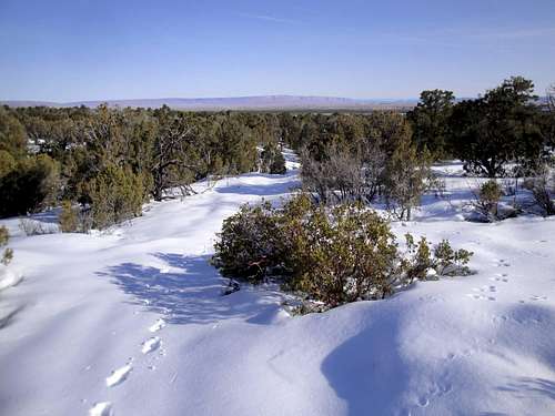
The Saddle Mountain Trail initially follows an old road grade for a short distance. The general direction of travel is S SW. Just past a sign announcing your on trail #57 and #31, you drop down on switchbacks into the ravine that is on your left/east. I noticed some very large mountain lion tracks before dropping into the ravine. At the bottom of the ravine, you continue uphill following the creek bed. Soon a sign announces #31 goes to the left and #57 continues up the drainage. The Saddle Mountain trail eventually heads up the prominent ridge to the right of the visible saddle. The snow by this point is very deep. I completely sank my ski pole trying to gauge snow depth on several occasions. I eventually stumbled upon the official start to the Nankoweap Trail. There was a sign stating that you are now entering the Grand Canyon National Park with a half buried kiosk. I was also greeted with one of the most spectacular views I have ever beheld. I was soaking wet from sweating, and needed a break so I sat on the first rock that was exposed and had lunch. It had taken over four hours of trail breaking to get to this point.
![Early on the Saddle Mountain Trail]() Early on the Saddle Mountain Trail
Early on the Saddle Mountain TrailThe Nankoweap Trail
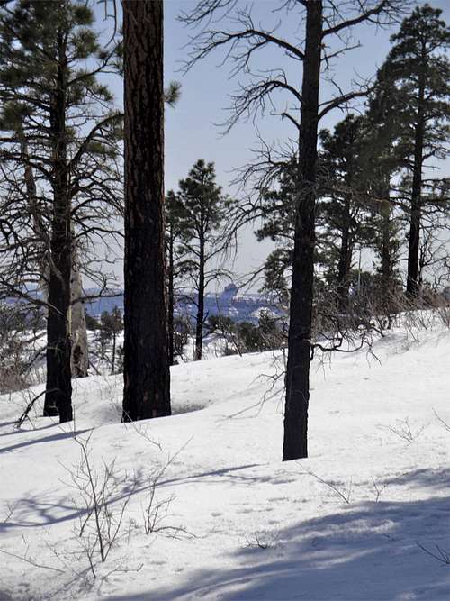
![Nankoweap Switchbacks]() Nankoweap Trail
Nankoweap TrailNext on the agenda is finding the trail down. I basically walked to the edge and traversed left until I found a weakness. These are some serious switchbacks, although they only drop a few hundred feet vertical. The snow complicates them. The trail then traverses along the side of boundary ridge to Marion point. There is one rockslide over the trail (which I saw pics of on nps.gov). The trail becomes mostly snow free with lots of mud. Water is dripping and running off of several points in the traverse. The temp has gone up to somewhere around sixty or so. I arrive at Marion point after three o’clock. I decide to set up camp here, even though I’d planned on going farther.
I find the most level mud free spot to pitch the tent. I set up a kitchen about fifty feet away complete with a tree to hang food and my pack. I decided to explore the trail around the bend beyond Marion Point. This is where the bad news comes. Major snow in the alcove just beyond Marion Point. As I’m trying to pick my way though the snow I notice a major rock slide has obliterated the trail at the apex of the alcove. This is the beginning of the trickiest part of the Nankoweap Trail, which traverses above a cliff on a very narrow trail. I start to work over to the area of the slide and right in front of me the hillside came alive. I had never seen a rock slide before. I immediately decided to return to the safety of Marion Point. I new this trip was at it’s terminus.
![Nankoweap Switchbacks]() Nankoweap Trail
Nankoweap TrailLoose "Ends"
As I sat on Marion Point having supper and watching a brilliant sunset, I realized I was seeing something very few people ever will: A magnificent sunset over a snow covered Grand Canyon from Marion Point in February. The early evening hours were filled with the sounds of rocks bouncing and crashing down my intended path.
The trip out the following day was much easier. Climbing the sketchy sections was much easier than descending them. The fact I could follow my own trail down the mountain was a bonus. I was loaded and on my way home before one in the afternoon.
I will be back.
![Rock Slide]() Trip ending Rock Slide
Trip ending Rock Slide![Marble Canyon]() Marble Canyon is behind you as you start up trail
Marble Canyon is behind you as you start up trail![Early Nankoweap Trail Conditions]() Early Nankoweap Trail Conditions
Early Nankoweap Trail Conditions![West of Nankoweap Trail]() West of Nankoweap Trail
West of Nankoweap Trail![B&W Nankoweap Drainage]() B&W Nankoweap Drainage
B&W Nankoweap Drainage![Ice Bush]() Ice Bush
Ice Bush![Sunrise]() Sunrise
Sunrise


Comments
Post a Comment