
-
 15675 Hits
-
 88.61% Score
-
 27 Votes
|
|
Route |
|---|---|
|
|
38.57501°N / 107.70996°W |
|
|
Hiking, Scrambling |
|
|
Spring, Summer, Fall |
|
|
Half a day |
|
|
moderate |
|
|
Overview

There are 3 inner canyon routes on the South Rim of the Black Canyon of the Gunnison National Park:
1. Gunnison Route
2. Tomichi Route
3. Warner Route
and 4.route located further north, accessible via private land approach - see Red Rock Canyon.
GUNNISON ROUTE is the most popular one, and also the easiest one from the above 3 routes.
You need to obtain a backcountry permit for all inner canyon hikes.
Red Rock Canyon route is based on reservation system only. Information
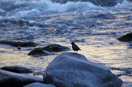 American Dipper American Dipper |
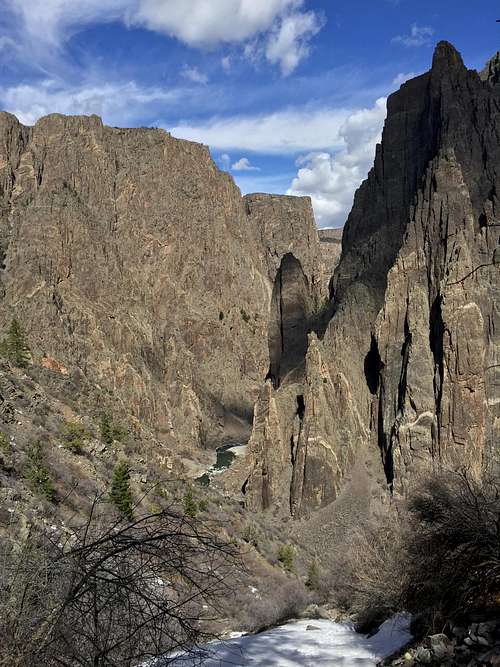 Gunnison Route Gunnison Route |
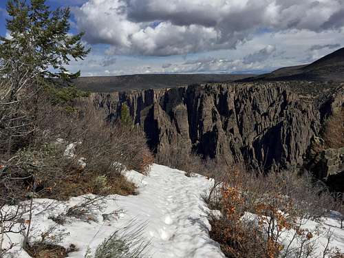 Gunnison Route Gunnison Route |
Getting There

Park at the South Rim Visitor Center = Gunnison overlook parking area. The trail starts right behind the visitor center building.
Route Description


At about a third of the way down, there is an 80-foot length of chain to hold on to (I did not find it very useful). Leaving the drainage near the bottom, angle diagonally to the right to the river bank. There are occasional small cairns marking the way, and the path is pretty obvious. You can explore about 300 yards in either direction along the river before being cut off by cliffs.
Turn around often and memorize the features and their relationship to the trail. There are a couple of places where there is a water runout and trail goes slightly sideways, but these are marked with cairns. There is no poison ivy on the way down.
There are three primitive campsites and an outhouse by the river.
Across the river are the Slide Rock and Poison Spring Routes, descending from the North Rim; and tall pinnacles and spires of gneiss and pegmatite called the Great Pillars.
Essential Gear
Good footwear, trekking poles not really useful - you may need to use your hands quite often, especially on the scramble up the canyon.Red Tape


You are required to obtain a permit for any inner canyon hike. The permit is very easy to obtain - you walk to the visitor center, and ask for it, OR if you are planning an early start, there are permits available just outside the visitor center - you fill it, take a yellow copy with you, and leave the white copy in the box. You are supposed to return the yellow copy to the box on your return. (the same permit applies to rock climbing).
I walked to the visitor center at 3:30 pm (got stuck in work, and was a little bit worried that the ranger may not give it to me since it was already late), but the ranger told me that it is too late to hike all the way down, and I should be aware that if something happens to me, they would not start my rescue till the following morning. That was it! He also gave me a description of the route on a paper handout, and warned me that most people need 6 hrs (2 hrs down and 4 up - I needed 25 min down and 50 min up).
I don't think that you need to spend any money on maps or guide books for this hike. The information from the park ranger and the handout are sufficient.
External Links


National Park information
Description of the route from The American Southwest
Description of some guy named Ben
Weather
 |
 |