

-
 40423 Hits
-
 99.04% Score
-
 96 Votes
|
|
Canyon |
|---|---|
|
|
38.57501°N / 107.70996°W |
|
|
Hiking, Trad Climbing, Bouldering, Ice Climbing, Aid Climbing, Big Wall, Scrambling |
|
|
Spring, Summer, Fall, Winter |
|
|
Black Canyon of the Gunnison is an incredible challenge, especially for hikers into the canyon itself, and for technical climbers (which I'm not). It didn't seem right that SP did not have a page for it, so I've prepared this one. Liba has graciously accepted to assist me in providing the best possible information for this geological wonder. --mark d.
Overview
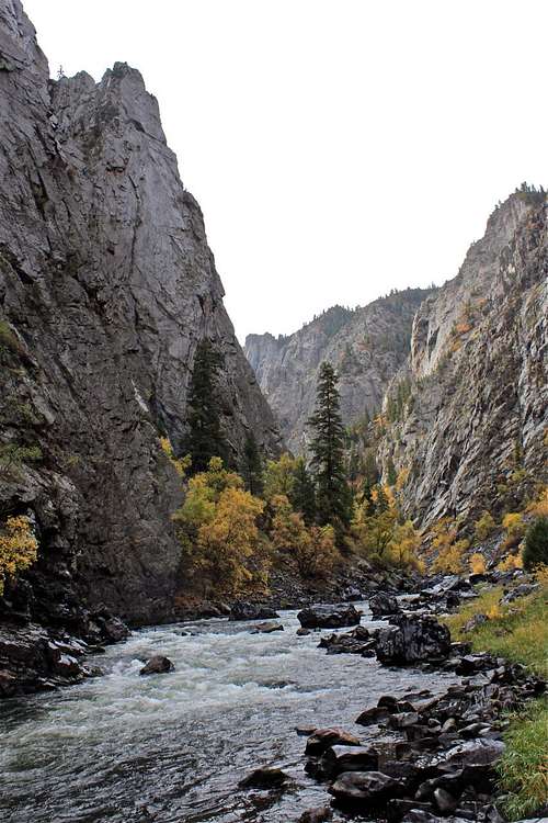
Black Canyon of the Gunnison by Liba Kopeckova.
| "Our surroundings were of the wildest possible description. The roar of the water … was constantly in our ears, and the walls of the canyon, towering half a mile in height above us, were seemingly vertical. Occasionally a rock would fall from one side or the other, with a roar and crash, exploding like a ton of dynamite when it struck bottom, making us think our last day had come." |
| – Abraham Lincoln Fellows, 1901, while floating the Black Canyon of the Gunnison on a rubber mattress |
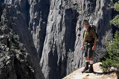
Lunch on the precipice.
Geological History
Two billion years ago, dark hues of gneiss and schist formed in the earth’s crust. As these dark rocks cracked beneath the surface, pink pegmatite squeeze into the fissures, creating patters that are clearly seen at Painted Wall in the canyon. Sediments were deposited above the rocks for another 1.5 billion years. In the Mesozoic era, color was added to the Precambrian rocks in the form of sand dunes turned to sandstone. Later, an inland sea left behind mud, which became Mancos shale, seen in the adobes on the edge of Gunnison Gorge. About 65 million years ago the Rocky Mountains were formed. This forced up the black and pink Precambrian rocks and the red Mesozoic layers in the Gunnison Uplift. From 18-30 million years ago volcanoes in West Elk and San Juan mountains spewed pewter-colored ash over the Gunnison Uplift, which trapped the water. The water then began to cut through this rainbow of sedimentary rocks on its way to the Colorado River. Today, dams upriver have slowed the rush of water through the canyon, thus reducing the rate of erosion to a fraction of its geological history.Getting There
Black Canyon of the Gunnison is located about 12 miles northeast of Montrose, CO. Visitors have two options: Visit the South Rim (most popular with tourists) or visit the North Rim (very popular with climbers). The driving time between the two is 2-3 hours. The South Rim Road is open to vehicles from early April to mid-November. In winter, the South Rim Road is open to Gunnison Point. The remainder of the road is closed to vehicles, but open to cross country skiing and snowshoeing.North Rim Road and ranger station are closed in winter, typically closing in late November and reopening in mid-April. NPS area map.
South Rim
Find your way to U.S. Hwy 50. From Montrose (if arriving from the west) or Cimarron (from the east), take U.S. Hwy 50 until you come to State Hwy 347. Turn north on State Hwy 347 and drive until you reach the park entrance (6 miles).
North Rim
Find your way to Crawford, CO. If driving from the South Rim, the drive to the east around the Curecanti National Recreation Area provides some incredible scenery. From State Hwy 92 in Crawford you will find signs directing you to Black Canyon of the Gunnison National Park. Follow the signs. The road will become gravel, but it’s in good shape and easily traveled by low-clearance automobiles. Keep an eye out for small direction signs as the road wends its way through sharp turns around private property in several places. The driving distance from State Hwy 92 to the park is 11 miles. (Note: North Rim road and ranger station are closed in the winter).
Red Tape
An entrance fee of $20.00 per vehicle is charged at the South Rim entrance station, or at the North Rim ranger station of Black Canyon. It covers all persons in a single, private, noncommercial vehicle and is valid for seven calendar days. The entry fee for motorcycles is $15.00. For pedestrians and bicyclists, $10.00 per person. Various passes are also accepted for entrance to the park. All backcountry activities require a pass. For activities confined to the national park, these are generally free. However, hiking into Red Rock Canyon requires winning a lottery for a permit, and payment of a $20.00 fee at the entrance. You may learn more about the Red Rock Canyon lottery and access here. Paddlers exiting the national park into the adjacent Gunnison Gorge National Conservation Area will be required to pay a user fee there. You may learn more about that fee here. Specific procedures are described in the appropriate activity sections below.Weather
The weather can vary greatly between the canyon rim and floor. Summer daytime temperatures on the rim range from 65° to 95° F. Nights range from 30° to 50° F. Winter daytime temperatures range between 20° to 40° F, and nights from -10° to 20° F. Canyon floor temperatures can be 5 to 8 degrees warmer. Early summer precipitation is minimal, but late summer storms can bring rain and lightning. Snow is plentiful from November to late Match, with depths of 22 to 24 inches.o Qwikcast.com Five Day Weather Forecast for Black Canyon of the Gunnison![North Rim Campground]() North Rim CampgroundThere are three campgrounds available in (and through) the national park. In addition, there are backcountry campsites available in the canyon gorge. These latter sites are described in the Inner Canyon Hikes section below.
North Rim CampgroundThere are three campgrounds available in (and through) the national park. In addition, there are backcountry campsites available in the canyon gorge. These latter sites are described in the Inner Canyon Hikes section below.
Camping
 North Rim Campground
South Rim
The South Rim Campground has three loops, some with electricity, some without. There are 88 total sites. Vault toilets are provided. Water (for drinking only) is available mid-May to mid-November. The cost is $12.00/night (non-electrical) and $18.00/night (electrical, 30 and 50-amp only). RVs and trailers over 37-feet long are not recommended. The NPS says that the South Rim Campground has never filled up. However, if it would make you feel more comfortable, you can make advance reservations for loops A and B at Recreation.gov.
North Rim
Because the North Rim Campground has only 13 sites, it sometimes fills up in the summer months. Reservations are not taken. The 13 sites are small; limiting RV size to about 35 feet max. Water (for drinking only) is available mid-May to mid-November. The cost is $12.00/night. North Rim is closed in the winter months.
East Portal
The East Portal Campground is located at the Gunnison River’s edge just outside the eastern national park boundary (which means that some information sources about the park don't mention the existence of this campground). However, it is accessed through the national park by making an immediate right turn after passing the South Rim entry station (Note: This access road is closed in the winter). It is 5 miles to the campground from the park entrance. You will be crossing private property; watch out for the cows! This road is steep (16% grade), narrow, and winding; vehicles in excess of 22 feet (total length) are not permitted. If you're towing a trailer, you can leave it at the South Rim Campground before driving to East Portal. There are 15 campsites. Water is available. The cost is $12.00/night. ![Black Canyon of the Gunnison]()
![Black Canyon of the Gunnison Park Map (Extract)]() There are a number of good hiking trails within the Black Canyon of the Gunnison. Several are described below, both on the South and North Rims. Refer to the NPS park map to locate the trails within the park.
There are a number of good hiking trails within the Black Canyon of the Gunnison. Several are described below, both on the South and North Rims. Refer to the NPS park map to locate the trails within the park.
Canyon Rim Hikes
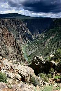
Storm clouds gather over Black Canyon of the Gunnison.

NPS park map (extract).
South Rim
Rim Rock Trail is a 1-mile round trip, guided nature trail along the canyon rim. The trailhead is near Loop C in the South Rim Campground.
Warner Point Trail let’s you view the San Juan Mountains as you hike through pinyon/juniper woodlands. The trail is 1.5 miles round trip, with a vertical elevation change of 100 feet. The trailhead is at the High Point Overlook.
Oak Flat Trail is a 2-miles round trip, 400-feet elevation change hike through oak shrublands, aspen and Douglas-fir forests. This trail allows exploration below the rim without actually hiking into the canyon. It is narrow and has steep drop-offs in places. The trailhead is near the visitor center.
North Rim
Deadhorse Trail, at 6.5 miles round trip, is one of the park’s longer trails. It offers views of steep cliffs and pinnacles as you change vertical elevation 120 feet. Park at Kneeling Camel Overlook and walk a few yards east to a spur road that leads to the old ranger station. Follow the old service road. After 3/4 of a mile the road comes to a stock pond. Pass on the right side of the pond. In another 1/4 mile you will arrive at a spur loop that leads to two canyon overlooks. Or you may continue another 1-1/2 miles to a stock fence. Turn right (south) and hike 1/4 mile along the fence until you arrive at the canyon rim. North Vista Trail leads to the summit of Green Mountain for an “aerial” perspective of the canyon. This 7-miles round trip trail starts at the North Rim ranger station. Be sure to take the side hike to Exclamation Point for a very dramatic view of the canyon! Vertical elevation change is 840 feet.![If You Ain t Living On the Edge ...]()
![End of Warner trail]() It felt so great to stand there and listen to the running water. The top of the canyon felt like a winter, and there was still autumn at the bottom of the canyon. Hiking in the inner canyon is not for beginning hikers. There are a number of routes to and along the river in the National Park. These routes do not have switchbacks; all are very steep, most dropping 1600 feet or more in 1 mile. None are maintained. The Gunnison is a very swift and cold river (38° F), with changing river flows based upon upstream dam releases. Swimming, wading or hiking across the river are not recommended. The park service cautions that it is your responsibility to find your own way and be prepared for self-rescue. The Trails Illustrated® map #245, Black Canyon of the Gunnison National Park may prove useful (though it does not include inner canyon campsites within most of the national park).
It felt so great to stand there and listen to the running water. The top of the canyon felt like a winter, and there was still autumn at the bottom of the canyon. Hiking in the inner canyon is not for beginning hikers. There are a number of routes to and along the river in the National Park. These routes do not have switchbacks; all are very steep, most dropping 1600 feet or more in 1 mile. None are maintained. The Gunnison is a very swift and cold river (38° F), with changing river flows based upon upstream dam releases. Swimming, wading or hiking across the river are not recommended. The park service cautions that it is your responsibility to find your own way and be prepared for self-rescue. The Trails Illustrated® map #245, Black Canyon of the Gunnison National Park may prove useful (though it does not include inner canyon campsites within most of the national park). ![Black Canyon of the Gunnison Backcountry Hiking Map (Extract)]() Hiking through the canyon is very difficult and not recommended. Many places have precipitous cliffs that impede any type of hiking along the river. There are no trails, and a trip of this type requires braving narrow ledges, and swimming or wading in the river between swift moving rapids. Visitors are strongly advised not to swim, wade or hike across the river except in a boat or kayak, and only in certain places. However, there are sections of the canyon where it is possible for the most experienced backcounty traveler to hike. Seek the advice of a ranger before attempting this type of experience. Some side canyons not described below may also offer hikes to the river. The NPS recommends taking the established routes (all described below) first. Check with a ranger for more information on alternative routes, and for detailed descriptions. All off route travel is difficult and navigation can be extremely challenging. Good LNT practices are to be followed. Some additional wilderness use rules:
Hiking through the canyon is very difficult and not recommended. Many places have precipitous cliffs that impede any type of hiking along the river. There are no trails, and a trip of this type requires braving narrow ledges, and swimming or wading in the river between swift moving rapids. Visitors are strongly advised not to swim, wade or hike across the river except in a boat or kayak, and only in certain places. However, there are sections of the canyon where it is possible for the most experienced backcounty traveler to hike. Seek the advice of a ranger before attempting this type of experience. Some side canyons not described below may also offer hikes to the river. The NPS recommends taking the established routes (all described below) first. Check with a ranger for more information on alternative routes, and for detailed descriptions. All off route travel is difficult and navigation can be extremely challenging. Good LNT practices are to be followed. Some additional wilderness use rules:
If you ain't living on the edge ...
Inner Canyon Hikes
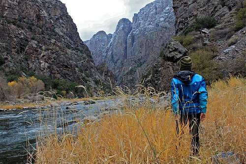 It felt so great to stand there and listen to the running water. The top of the canyon felt like a winter, and there was still autumn at the bottom of the canyon.
NPS backcountry hiking map (extract).
o Wood fires are prohibited. If a fire ring is found in the inner canyon, don't use it.
o Pets are not allowed.
o Use pit toilets, if available. If not, bury all human waste in 6” deep holes at least 100 feet from the river.
o Packing out all trash includes toilet paper, too. If hiking these routes in the winter, be prepared with snowshoes, crampons and an ice axe.
Most South Rim routes are snow-covered from November to April. North Rim routes can be snow free as early as February. Contact the park for current conditions. All use of the backcountry (including day hiking) requires a free permit. These are available at the South Rim visitor center, North Rim ranger station and at the East Portal registration board. Permits are issued on a first-come, first-served basis. At each location there are self-registration stations with instructions. Carry your permit while in the backcountry. Check out with a ranger, or by returning the permit to the self-registration box.
South Rim
Gunnison Route is the most popular route; however it is still strenuous. This route is recommended to persons attempting their first inner canyon hike. The route begins at the South Rim visitor center. Follow the Oak Flat Trail for 1/3 mile, down the first few switchbacks. When you come to a sign that says “River Access. Permit Required.”, continue the steep descent to the 80-foot chain located 1/3 of the way down the drainage. An outhouse and campsites are located a short distance upstream. One-way distance: 1 mile. Vertical drop: 1800 ft. Campsites: 3.
Tomichi Route is considered the steepest South Rim route and is difficult. To find this route, park near the South Rim Campground. Take the Rim Rock Nature Trail to post #13. This is the start of the Tomichi Route. Descend the route until the junction with another draw is reached. Continue to follow the main drainage down the slope to the river. The entire route is loose rock and receives full sun exposure. Use extra caution while descending. One-way distance: 1 mile. Vertical drop: 1960 feet. Campsites: 2.
Warner Route is the longest and overnight travel is highly suggested. To find this route, hike along the Warner Point Nature Trail and walk up the hill past post #13. Look for a large Utah serviceberry bush on the left that is marked with a small silver sign titled, “Serviceberry Bush”. This is the start of the Warner Route. The path leads off to the left. Avoid the first drainage and continue west to the lowest saddle on the ridge before descending. Campsites are located up and downstream. One-way distance: 2.75 miles. Vertical drop: 2722 ft. Campsites: 5.
North Rim Routes
Long Draw, formerly called Devil's Slide, brings the hiker into one of the narrowest parts of the canyon where the walls tower above the swiftly moving Gunnison River. To find this route, park at Balanced Rock Overlook, then walk northeast to the bend in the road. The descent begins at the road. ![Black Canyon of the Gunnison Bivouac]() Long Draw Bivouac.Pass through a small area of box elder trees at the rim and scramble down the gully to the river. There is plenty of poison ivy along the bottom of this route. There are also short ledges to climb (8-12 ft). One-way distance: 1 mile. Vertical drop: 1800 ft. Campsites: 1.
Long Draw Bivouac.Pass through a small area of box elder trees at the rim and scramble down the gully to the river. There is plenty of poison ivy along the bottom of this route. There are also short ledges to climb (8-12 ft). One-way distance: 1 mile. Vertical drop: 1800 ft. Campsites: 1.
 Long Draw Bivouac.
SOB Draw is suggested for the first time North Rim inner canyon hiker. To find this route, park vehicles in the pull-through near the campground registration board, or at the North Rim ranger station. The route begins at the access ladder along the fence line just east of the campground. This is on the right side of the road when traveling from the ranger station to the campground. Follow the path to the top of the drainage gully and descend on the far right of the route. The route has short ledges to climb (8-12 ft). The campsites are located downstream a short distance. SOB Draw is famous for its abundant poison ivy. Long pants are recommended. One-way distance: 1.75 miles. Vertical drop: 1800 ft. Campsites: 6.
Slide Draw is extremely steep and the most potentially dangerous route due to loose rock and poor footing. To find this route, park at Kneeling Camel View, then walk east until you reach the head of the draw. Slide Draw requires a 30-foot downward climb to start the route. Follow the draw to the river, taking extra caution due to the abundance of loose rock underfoot. A good camping area is found at the river. One-way distance: 1 mile. Vertical drop: 1620 ft. Campsites: 2. ![The Gunnison at East Portal]()

Devil's Backbone trailhead at East Portal.
East Portal Routes
Devil's Backbone Route is a hike along the river. Park at the East Portal Campground. Hike downstream on the south side for about 1/2 mile until you reach the ridge that runs down the cliff. The top 30 feet of this 400-foot scramble is a bit exposed and a rope could be useful. The rocks are slippery with gravel on top, and you are exposed to the edge of the cliff. The downstream side is more gentle. You can hike another mile downstream scrambling the smaller ridgelines.
North River Route is accessed after parking at the East Portal Campground. There is a small boat launch at the registration board that provides a good landing for boating access across the river for this route. Once across the river you can hike nearly 2 miles down river to the cliff at Flat Rock Rapid. There is one low ridge to scramble over at Deadhorse Gulch.
Red Rock CanyonThe hike into Red Rock Canyon at the western end of the park (map) is not easy, but it is significantly less steep than other inner canyon routes to the river. One-way distance: 3.4 miles. Vertical drop: 1330 feet.Reservations, which are awarded by lottery, are required for all persons entering Red Rock Canyon (including day hikers). Reservation lottery request forms must have been received at the park headquarters during the specified January to March time-frame for the upcoming hiking season (see link below for details). In the past, only about one-quarter to one-third of the lottery applications have been honored before the seasonal quota was filled, making first come, first serve access highly unlikely. Check the NPS Red Rock Canyon web page for the most current information and the form (when it becomes available). The permitted season runs from mid-May to early October; there is no public access at other times of the year. Maximum stay is limited to 3 days and 2 nights per visit. Group size is limited to 4 people, whether hiking or camping. Parking is limited to 3 vehicles at any given time. Carpooling is recommended. Part of the road and parking lot for the trailhead are located on private land. While on private property, please be respectful. Smoking is not allowed on the private road. An entrance fee of $7.00 per person will be charged at the trailhead, but read the NPS web page linked above for options when that fee is not required (passes, fee paid at South Rim, etc). ![Locating Marmot Rocks]()
![another nice crack]() Rated as # 28 on the bouldering guide (available for free at the visitor center).Marmot Rocks
Rated as # 28 on the bouldering guide (available for free at the visitor center).Marmot Rocks
Bouldering

Locating Marmot Rocks (Google® Earth image).
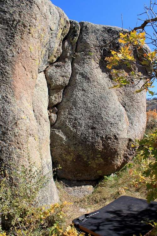 Rated as # 28 on the bouldering guide (available for free at the visitor center).
Marmot Rocks are an excellent set of boulders along the South Rim Drive between Painted Wall and Cedar Point Overlooks. Park at the Painted Wall Overlook, and then hike along the road until it bends to the right. Look for a worn path on the left (south). Follow this path to the boulders, about 100 feet south of the road. Marmot Rocks are not marked on the NPS or the Trails Illustrated® maps, but you can see them on the image to the right (See on Google® Earth: 38° 34' 40.43" N, 107° 43' 01.77" W). The rocks are clearly visible, as is the nearby road. The rock is generally very solid but rough. Easy routes tend to follow good crack systems, while the harder ones are usually steep to overhanging faces. The routes are from 10 to 20 feet high and, though some are excitingly high off the ground, the landings are almost always clear and level. Specific descriptions of the routes from the National Park Service are (based on this diagram of Marmot Rocks): ![Marmot Bouldering, Black Canyon of the Gunnison]()

NPS Marmot Rocks bouldering diagram.
Boulder A
1 - Moderate. The right edge or arete of the front (north) face has a line of holds up the arete, with a hard finish. The route is considerably easier if one stems over to the flake on route 2. This and the next route are identified by prominent black streaks.
2 - Difficult. Follow the strenuous, left-curving flake left of route 1. Finish straight up after the hard initial moves, or for a bigger challenge keep your hands on the flake and follow it left to its end.
3 - Difficult. A contrived route following small holds and vague seams just right of the obvious crack of route 2, staying away from the crack as long as possible.
4 - Easy. The right two cracks on the left side of the back wall.
Boulder B
5 - Difficult. The west face (overhanging and forming a chimney passage with boulder A) has an off-width crack starting from a horizontal crack halfway up its left side. Do not use the back wall (boulder A), of course, except to retreat when you've had enough.
6 - Difficult. The southwest corner of B has some holds that start a strenuous and tricky route, that inishes up the south face.
7 - Very Difficult. Perhaps the most difficult natural line here. The route climbs small flakes on the southeast corner to gain a righ facing flake/finger crack. Good luck getting off the ground!
8 - Moderate. Start as for route 5, but use the horizontal crack to reach around the corner left and climb the northwest arete.
Boulder C ![Bouldering at Marmot Rocks]()

Marmot Rocks bouldering.
9 - Moderate/Difficult. The left side of the west face (facing boulder B) has a continuous thin face with small flakes. There are several ways to climb it. Watch for the fragile holds.
10 - Difficult/Very Difficult. Another contrived route up the right side of the west face, avoiding the good holds to the left. Stay off the low-angle arete to the right as long as possible.
11 - Easy/Moderate. Follow the southwest arete, using the thin flaring crack and face holds.
12 - Easy. A crack/ramp 4 off the ground followed by a low angle face climbing presents a number of easy routes.
Boulder D
13 - Difficult. The climbs are directly up to and past an obvious white hold on the right side of the front face.
14 - Easy. A nice crack in a slight corner, becoming two cracks at the top.
15 - Difficult. Climb the subtly steeping face just right of route 14 (without using that crack) using a right-facing flake to get started. Then go straight up or right (easier). A fall at the top puts you in the oak tree!
16 - Difficult. The crack on the southwest corner of boulder D, overhanging at the bottom. Strenuous.
17 - Moderate. Right of route 16 is a ledge or ramp running up right above an overhanging section. Gain this (it helps if you're tall), then get your feet on it.
18 - Difficult. Climb the face immediately right of the route 17 crack, not using that crack or hold immediately next to it. The horizontal, thin flake/crack is used to make a move leading to the finish up and left.
19 - Easy/Moderate. A crack ramp five feet off the ground provides a number of routes starting with a mantle, then up rounded face holds to finish.
Bouldering at Other Than Marmot Rocks
You must notify park staff before any sustained bouldering activity in any area other than Marmot Rocks. They will then approve bouldering activity in the proposed area based on likely impacts to park resources, the proposed access route, and to other visitor activities and the overall visitor experience.![Painted Arete]()
![Layton Kor starting the first pitch of the Painted Arete]() Black Canyon of the Gunnison is known for its serious, traditional climbing values. Climbers have pioneered 145 big-wall routes. The main climbing walls are 1800 feet (550 meters) tall, and feature steep face climbing and cracks on often poor rock with difficult protection. They have from 3 to 26 pitches. They are rated from 5.8 to 5.13. Over 100 routes are rated between 5.10 and 5.13. Most climbs do not see significant climbing activity. Some are aid routes. All are committing, and many climbers say that the ratings at Black Canyon of the Gunnison can be deceiving. The National Park Service retains copies of topos and route information that have been turned in by first ascent parties. An ice climbing route, Gandalf’s Beard, is located in Headquarters Draw. Ask a ranger for current conditions. All climbers are to be prepared for self-rescue. Rescues, when necessary, are highly technical. Consider: A rescued person cannot be lowered to a waiting ambulance at the bottom! An overnight stay during a climb will not warrant a rescue; all climbers are to be prepared for an unexpected bivy. There are some easier climbs available; a ranger’s advice is recommended. Climbers would be well-advised to obtain a copy of the book Black Canyon Rock Climbs by Robbie Williams. It includes numerous photos, essays and routes. Most climbers descend at the North Rim after marshaling at the North Rim Campground. To help prevent multiple parties from piling up on a route, the North Rim visitor center has a white board for informal monitoring of who is climbing where. In addition, to assist climbers who descend at the North Rim for a South Rim climb, a Tyrolean traverse static line has been set up between the North and South Rim Chasm View walls. The alternative is a 2-3 hour drive, one way, between the two locations. The cliff walls are a designated wilderness area and thus require special procedures. All climbers should be familiar with the guidance in the Black Canyon of the Gunnison Interim Climbing Managment Plan (.pdf). A few highlights include:
Black Canyon of the Gunnison is known for its serious, traditional climbing values. Climbers have pioneered 145 big-wall routes. The main climbing walls are 1800 feet (550 meters) tall, and feature steep face climbing and cracks on often poor rock with difficult protection. They have from 3 to 26 pitches. They are rated from 5.8 to 5.13. Over 100 routes are rated between 5.10 and 5.13. Most climbs do not see significant climbing activity. Some are aid routes. All are committing, and many climbers say that the ratings at Black Canyon of the Gunnison can be deceiving. The National Park Service retains copies of topos and route information that have been turned in by first ascent parties. An ice climbing route, Gandalf’s Beard, is located in Headquarters Draw. Ask a ranger for current conditions. All climbers are to be prepared for self-rescue. Rescues, when necessary, are highly technical. Consider: A rescued person cannot be lowered to a waiting ambulance at the bottom! An overnight stay during a climb will not warrant a rescue; all climbers are to be prepared for an unexpected bivy. There are some easier climbs available; a ranger’s advice is recommended. Climbers would be well-advised to obtain a copy of the book Black Canyon Rock Climbs by Robbie Williams. It includes numerous photos, essays and routes. Most climbers descend at the North Rim after marshaling at the North Rim Campground. To help prevent multiple parties from piling up on a route, the North Rim visitor center has a white board for informal monitoring of who is climbing where. In addition, to assist climbers who descend at the North Rim for a South Rim climb, a Tyrolean traverse static line has been set up between the North and South Rim Chasm View walls. The alternative is a 2-3 hour drive, one way, between the two locations. The cliff walls are a designated wilderness area and thus require special procedures. All climbers should be familiar with the guidance in the Black Canyon of the Gunnison Interim Climbing Managment Plan (.pdf). A few highlights include:
Technical Climbing
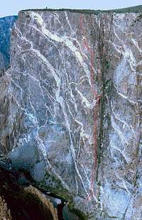
First ascent route of Painted Arete. Image by Mountain Jim.
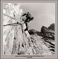
Layton Kor on the first ascent of Painted Arete. Image by Mountain Jim.
o Use removable protection to preserve the condition of the rock.
o Motorized drills are prohibited.
o Leave natural features undisturbed.
o Avoid sensitive animal habitats. Painted Wall climbs are usually closed March 15 through July 15 for the protection of nesting peregrine falcons.
o Wear a helmet: The rock can be loose, and visitors along the rim have been known to throw rocks over it (despite being told not to!).
o When climbing routes with no bivouac expected, climbers will follow standard LNT practices for human waste. When climbing routes where a bivuoac is expected, climbers will carry a container sufficient to contain human waste, and the container and contents will be removed from the park after the climb.All backcountry access, including climbing, requires a free permit. These are available from the North and South Rim visitor centers. When these facilities are closed, instructions are posted for self-registration.
Rock climbers may find the following useful:
o NPS List of Approved Guide Services for Black Canyon of the Gunnison (including technical climbing)![Rough Waters in Black Canyon of the Gunnison]() Rough waters.The national park section of the Gunnison River has Class IV/V rapids, along with some unrunnable sections. Most paddlers take two days to complete the trip. This is a very technical paddle and includes some difficult portages. The section of the river within the national park is only for the most experienced and well-equipped kayakers. Despite Abraham Lincoln Fellows remarkable achievement in 1901, it is not appropriate for rafts (the river in adjacent Gunnison Gorge National Conservation Area is, however) or canoes. Water temperature is usually around 50° F or less. The river is most runnable when flow is between 1,000 and 1,800 cubic feet per second. The following link provides current water flow information:
Rough waters.The national park section of the Gunnison River has Class IV/V rapids, along with some unrunnable sections. Most paddlers take two days to complete the trip. This is a very technical paddle and includes some difficult portages. The section of the river within the national park is only for the most experienced and well-equipped kayakers. Despite Abraham Lincoln Fellows remarkable achievement in 1901, it is not appropriate for rafts (the river in adjacent Gunnison Gorge National Conservation Area is, however) or canoes. Water temperature is usually around 50° F or less. The river is most runnable when flow is between 1,000 and 1,800 cubic feet per second. The following link provides current water flow information:
Paddling
 Rough waters.
Paddlers must complete a permit either at the East Portal registration board, or at the South Rim visitor center. There are additional fee and registration requirements at the take-outs in the Gunnison Gorge National Conservation Area (described below). Put-in is at East Portal (just outside the national park eastern boundary, but accessible through an access road within the national park). There are places where short portages can be expected. There is a "required" portage within the narrows from just past 18-foot high Torrence Falls to SOB Camp (this section of the river is almost always unrunnable). Plan on 1 to 2 hours to make this strenuous, 2/3-mile portage over slippery rock and through unavoidable poison ivy and ticks. Immediately past the portage is Beach Camp, a riverside campsite. The Trails Illustrated® map #245, Black Canyon of the Gunnison National Park may prove useful, but it does not show many river features within the national park, and shows only Margarittaville boater campsite at the far western end of the park.
Take-outs are in the Gunnison Gorge National Conservation Area (NCA). Because of this, paddlers will have additional registration requirements and must pay a user fee to the NCA. Take-outs include Chukar Trail (just outside the national park western boundary, 15 miles from the East Portal put-in) and Gunnison Forks (an additional 14-miles down-river). Kayakers exiting at Chukar Trail must sign the river register, haul their boats up the one mile trail, and pay the user fee at the trailhead. Boaters exiting at Gunnison Forks must stop at the Chukar put-in, sign the register at the river, paddle another 14 miles, then pay the user fee when exiting at Gunnison Forks. There is nearby vehicle access at Gunnison Forks. The Trails Illustrated® map #245, Black Canyon of the Gunnison National Park also includes Gunnison Gorge NCA. Here, it provides many more details for boaters, including named rapids and ten boater campsites. The following websites provide useful information for paddlers:
 | Sam Lindblom at the top of an 18-foot waterfall. Photographed by Will Crim on July 26, 2003 at 750 CFS. Image usedwith permission: American Whitewater. |
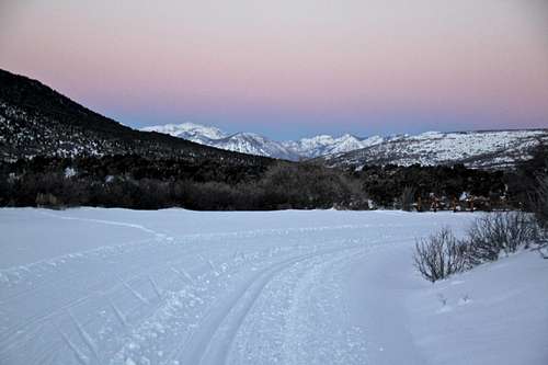
o BLM Boating the Gunnison Gorge![Evening sprint back]() XC skiing
XC skiing![Practicing skating]() The South Rim Drive is not plowed during the winter months, allowing the road to become a ski trail. The road=ski trail is 6 miles (one way), and allows access to the overlooks. Park at the South Rim Visitor Center, located at Gunnison Point. It is helpful to have a park map with you on this trail. It will help to guide you in your progress, e.g. I once turned around at Sunset Overlook and had no idea how far I went. It was just getting dark and late. I had less than a mile to go to the end, and finished my skiing when it was very dark. There are several viewpoints along the road and you can easily access them with your skis on. More information here.
The South Rim Drive is not plowed during the winter months, allowing the road to become a ski trail. The road=ski trail is 6 miles (one way), and allows access to the overlooks. Park at the South Rim Visitor Center, located at Gunnison Point. It is helpful to have a park map with you on this trail. It will help to guide you in your progress, e.g. I once turned around at Sunset Overlook and had no idea how far I went. It was just getting dark and late. I had less than a mile to go to the end, and finished my skiing when it was very dark. There are several viewpoints along the road and you can easily access them with your skis on. More information here.
Cross Country Skiing
 XC skiing
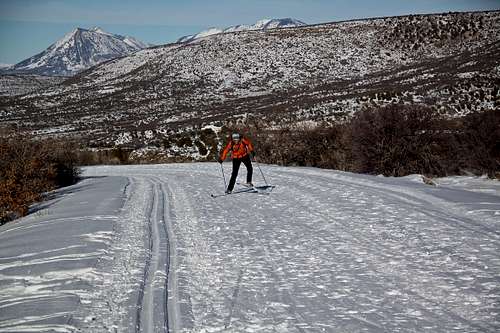
Additional Information
The following items could be useful for the prospective adventurer in the Black Canyon of the Gunnison:o Trails Illustrated® map #245, Black Canyon of the Gunnison National Park Very good topo map of Black Canyon of the Gunnison and the Gunnison Gorge National Conservation Area (NCA). Gunnison Gorge NCA is well-documented. However, this topo has limited info about inner canyon hiker and boater campsites, and river features within the national park. Marmot Rocks bouldering area is also not marked; use the info on this web page to locate it.
o Black Canyon Rock Climbs by Robbie Williams Describes many routes in Black Canyon of the Gunnison. Also includes excellent descriptions of the rich history and character of the area. A "must have" for the technical climber in the Black.
o National Geographic Guide to the National Parks of the United States This "tourist guide" is useful for planning a trip to any of the national parks. This is the book to take in the car with you as you visit each park. It will help you locate frontcountry campsites, make reservations, find a good restaurant, research phone numbers, etc. You'll still need to do additional research for more typical SP activities (backpacking, mountaineering, climbing, etc). Additional information may be obtained by calling the visitor center at (970) 249-1914, extension 423.A final note: A good "SP-themed" place to eat, recommended to me by two climbers who'd just completed their ascent out of the canyon, is Guru's Restaurant in Montrose (formerly Nepal Restaurant). You can find them at 448 East Main Street. The phone number is (970) 252-8777. It is indeed quite excellent Indian and Nepalese food, and the service outstanding.
External Links
o National Park Service Black Canyon of the Gunnison Home Page Lots of info about the park at this official website.o National Park Service Entrance Pass Program Info on the passes accepted to enter the national parks.
o Black Canyon of the Gunnison Red Rock Canyon Information and Reservations Information on the lottery reservation system used for Red Rock Canyon. Includes a reservation request form.
o Black Canyon of the Gunnison Book Store NPS bookstore has books and maps about the park.
o Black Canyon of the Gunnison Park Map (.pdf) Quick link to the NPS map.
o Black Canyon of the Gunnison Backcountry Map (.pdf) Quick link to the NPS backcountry map.
o Grizzly Ridge Quadrangle Topo Map (.tiff) Quick link to the USGS Grizzly Ridge quadrangle that includes most of Black Canyon of the Gunnison (large file).
o Red Rock Canyon Quadrangle Topo Map (.tiff) Quick link to the USGS Grizzly Ridge quadrangle that includes most the Red Rock Canyon area of Black Canyon of the Gunnison (large file).
o NPS Black Canyon of the Gunnison Rock Climbing Information Quick link to the NPS website climbing info.
o Recreation.com (South Rim Campground Loops A and B Reservation Service) Online reservation system.
o Black Canyon of the Gunnison Authorized Guides Quick link to the NPS authorized guide services.
o Black Canyon of the Gunnison Webcam Image Recent webcam image of the park.
o TopoZone - USGS Grizzly Ridge (CO) Topo Map Topo map of the Black Canyon of the Gunnison.
o Wikipedia Black Canyon of the Gunnison Article Background info on the park.
o Qwikcast.com Five Day Weather Forecast for Black Canyon of the Gunnison Current and forecast weather information.
o Climbing Magazine News Article on Tyrolean Traverse Upgrade Article describes the upgrade to the Tyrolean.
o American Whitewater River Description from Crystal Dam (Just up river from East Portal) to Chukar Very good description of the river, portages and camp locations. Includes some nice images.
o USGS Gunnison River Below Gunnison Tunnel (Black Canyon) Water Height and Flow Data Realtime and historical water flow info.
o NPS Black Canyon of the Gunnison Kayaking Page Quick link to the NPS kayaking page.
o BLM Boating the Gunnison Gorge Very good description of the Gunnison Gorge NCA part of the river.
MtnGuide - Dec 22, 2006 2:23 am - Hasn't voted
AAC Article & PhotosAmerican Alpine Club Journal 2005 has a great article on latest technical route accomplishments, including airy photos. There was also an article in one of the rock climbing magazines this year. Looks gnarly.
Mark Doiron - Dec 22, 2006 12:54 pm - Hasn't voted
Re: AAC Article & PhotosThanks, MtnGuide. I haven't been able to find anything online about it. AAC Journal will be online soon, but they plan to charge for most articles. Do you have any specific links that you were thinking I should add to the page? Thanks! mark d.
MtnGuide - Dec 23, 2006 9:23 pm - Hasn't voted
LinksI'll dig around. I saw the articles in print, at R.E.I. One might have been in "Climbing," or "Rock & Ice." PS. Good job on the webpage.