

-
 16332 Hits
-
 87.2% Score
-
 24 Votes
|
|
List |
|---|---|
|
|
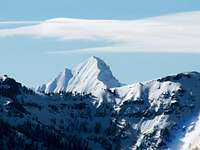 Devils Bedstead East
Browse Idaho Elevener pages on SummitPost: By Elevation | Newest Submissions | Most Popular
Overview
Idaho mountains that rise higher than 11,000 feet above sea level are spread throughout seven mountain ranges in the south-central part of the state. With the Sawtooth Range to the west, and the Greater Yellowstone area just to the east, these ranges have been largely overlooked by the crowds. Just north of the area lies the Frank Church - River of No Return Wilderness Area, but most of these high peaks are largely unprotected. McCaleb
Some of these summits are unclimbed, and most have only been climbed a handful of times. No one has yet claimed to have summited them all. Most of these peaks are rugged and provide a challenging ascent on even their least difficult routes. Anyone looking for a great alpine wilderness experience will easily find it on any of these peaks.
This page is meant to bring together the mountain pages that have been created on Summitpost. Only a small part of all of the Idaho Eleveners has had a mountain page created and submitted to Summitpost. To see a complete list of these peaks, including those that have not been posted here, see the Idaho's Highest Peaks page.
 Take a flight tour in Google Earth
Getting There
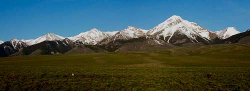 Lemhi Range
Gateway communities include:
More services are available in Twin Falls and Idaho Falls, a bit further from the peaks, but one will probably pass through these cities en route to the region.
Eastern Ranges
 Lost River Range
"Idaho's Lost River Range, it's probably the most spectacular unknown range in the lower 48. No one in Wisconsin,or pick a state, has heard of them. For that matter, many people in Idaho have not heard of them."
- Doug Lorain, guidebook author from Oregon
 Duncan Ridge from Cobb Peak
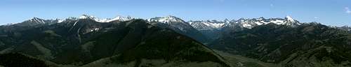 Pioneer Mountains
Western Ranges
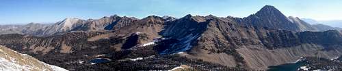 White Clouds
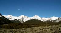 The Boulder Mountains
 11,272 of the White Clouds
Conditions
[img:106426:alignleft:small:The Boulder Mountains]Here are a few resources:
Webcam from Bald Mountain, Sun Valley Ski Resort
Current Modeled Snowdepth
Forecasts:
Ketchum - NOAA - Weather.com
Stanley - NOAA - Weather.com
Mackay - NOAA - Weather.com
Management
The following websites can direct you to more information on rules, regulations, conditions, and camping areas.National Forests:
[img:182095:alignright:medium:11,272 of the White Clouds]Salmon-Challis National Forest
Lost River Ranger District
Leadore Ranger District
Sawtooth National Forest
Sawtooth National Recreation Area
Ketchum Ranger District
Caribou-Targhee National Forest
Dubois Ranger District
BLM Offices:
Shoshone Field Office
Upper Snake Office
Challis Office
Salmon Field Office
More Information

Idaho: A Climbing Guide by Tom Lopez is a great resources for climbing in Idaho. There are many route and approach descriptions for nearly all of these peaks.
Idahosummits.com - A personal page that has trip reports for many of the Idaho Eleveners.
idahomtnhigh - Aug 3, 2014 11:56 pm - Hasn't voted
4 FinishersThere have been four people complete this list to date. More info can be found on http://www.idahoaclimbingguide.com/missing-eleveners-new-routes-judi-steciak-carl-hamke/