-
 9449 Hits
-
 77.48% Score
-
 8 Votes
|
|
Mountain/Rock |
|---|---|
|
|
44.04530°N / 113.6552°W |
|
|
Custer |
|
|
Hiking, Mountaineering, Scrambling |
|
|
Spring, Summer, Fall |
|
|
11930 ft / 3636 m |
|
|
Overview
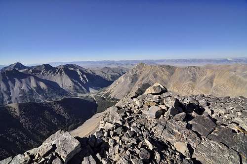
Location: South Central Lost River Range, just SE of the 12ers
Nearby Peaks: The Moat, Castle, Lost River Mountain, USGS, McCaleb, Little Mac
Linkups: Lost River Mountain (unverified)
Difficulty: Class 2-3 (bushwhacking, endurance)
Usage: scrambling
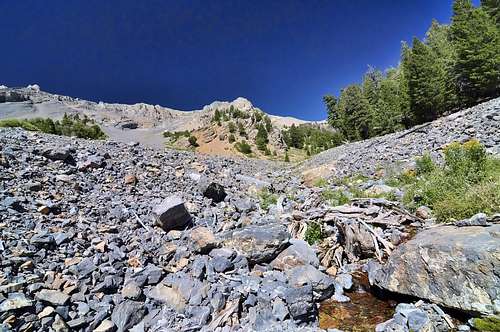
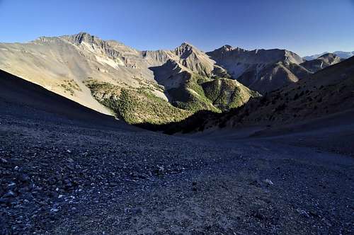
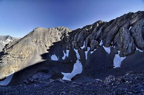
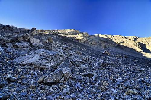
Terrain: Upper Cedar Creek requires some bushwhacking and route finding in a narrow canyon, upper slopes are broad open scree and talus
Traffic: Very Light
Summit Register: Yes- PVC tube placed 8-2010
History / Etymology: Named for the perception that this peak is remote and hard to reach
Getting There
Nearest Paved Roads: ID-93
Nearest Dirt Roads / Conditions: Upper Cedar Creek Road (Very Good)- there is one irrigation canal crossing and 3 gates
Approach Trails / Conditions: Upper Cedar Creek is a remnant trail that was once used to cross the range. Because of the narrowness and steep slopes of this canyon, much of this trail is washed out, although there have been some recent attempts to improve this trail. Be prepared to cross and even walk through the creek. Utilize the flats in the pines to find the trail.
Routes
Main Route: Upper Cedar Creek (Class 2-3)- Stay on the north side of Cedar Creek for 1 mile, then cross to the south side and find the intermittent trail. At the 8400 contour there is a prominent split- keep left but stay on the south side of the creek.. Around 8600 feet, the creek valley ends, and the broad open talus slopes begin. Near here can also be the last water source during dry times. Follow the steep talus slopes up the obvious valley toward the base of the peak. The talus is mostly football sized and can be somewhat tedious, yet careful route finding can provide decent upward travel. At the 10,600 mark there is a prominent bowl. From here climb north toward the summit ridge. These slopes are mostly scree and there is 1 cliff band to easily circumnavigate. Aim for a point just west of the summit and then climb to the summit. There was a large cairn at the top.
Main Route Stats: 9.3miles / 5903 (round trip)
Average RT Time: 7-9 hours
Other Routes: East Face from Dry Creek (see Lopez)

Red Tape
Jurisdiction: Salmon-Challis National Forest
Permit: None
Other Users / Issues: Hunters
Maps: USGS Quad- Leatherman Peak, Massacre Mountain
Guide Book: Tom Lopez, Idaho: A Climbing Guide
When To Climb
Climbing Season: Apr- Nov (year round opportunities in some years)
Ideal Climbing Time: May-Oct
Nearest Weather Station: Mackay
Weather Relative to Region: Drier, colder

Camping
Car Camping Sites: Mackay Reservoir, Upper Cedar Creek
Backpacking Sites: Not ideal because of the bushwhacking and lack of flat sites, although there are a few flat areas along Upper Cedar Creek
Flora & Fauna
Potential Wildlife: Badger, Beaver, Black Bear, Mule Deer, Pronghorn, Cougar, Coyote, Elk, Marmot, Marten, Moose, Mountain Goat, Rainbow Trout, Brook Trout, Grouse, Pika, Fox
Confirmed Wildlife: Pronghorn, Coyote, Elk
Vegetation: Stinging Nettles, Willow, Berry Brush, Pine (little vegetation above 8600 ft)