
|
|
Mountain/Rock |
|---|---|
|
|
36.03660°N / 51.63540°E |
|
|
12486 ft / 3806 m |
|
|
Overview
Click for Introduction to Central Alborz Mountains.Click for Introduction to Kholeno Massif.
Click for a detailed map of the Central Alborz Mountains.
Click for a detailed map of the Kholeno Massif.
GENERAL OVERVIEW:
A 40 Km drive out of northeastern Tehran, up the Jajrood River Valley will take you to the village of Garmabdar (2450 m). The peaks to the north of this village form a chain that starts at the 3100 m Yoonza Pass (to the east of the village) and stretch west to join the 4387 m Kholeno the Great Peak at the heart of the Middle Wall of Central Alborz (see the link above). East to west, these peaks include (there are many other high points and sub-peaks in between these peaks):
1) Oshtor 3673 m
2) Khatoon Bargah 3877 m
3) Kharsang Kooh 3930 m
4) North Kharsang Kooh 3806 m
5) Jahneston 3962 m
6) Peak 3979 m
7) Varzab 4036 m
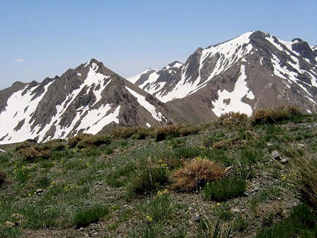
(L) North Kharsang Kooh (3806 m) & (R) Kharsang Kooh #1 (3930 m)
NORTH KHARSANG KOOH OVERVIEW:
Although lower than its neighbor peaks which are all in the 3900 m range, North Kharsang Kooh appears as a prominent peak that rises abruptly above its saddles on either side. To the southeast, a 3690 m saddle separates North Kharsang Kooh from the 3930 m Kharsang Kooh #1 and to the west, a 3650 m saddles separates North Kharsang Kooh from Peak 3905 m which is the easternmost of a series of peaks known as Jahneston.
North Kharsang Kooh is usually climbed along with Kharsang Kooh and Gizno Peaks. The usual route is via their common southern slopes that rise above the Abnik Village (just to the west of Garmabdar). I have not tried this route but the slopes seem to be very tedious. This route apparently goes by a couple of abandoned coal mines and a cave and gives you the option to go to the 3690 m or the 3650 m saddle. From the 3690 m saddle, the southeastern slopes of North Kharsang Kooh are a walk-up. The western slopes above the 3650 m saddle however, are more challenging and require some Class III hand and foot climbing in some places (I have climbed both of these slopes). A much longer option is to start at the Yoonza Pass and follow the ridge-top past the Oshtor, Khatoon Bargah and Kharsang Kooh/Gizno Peaks (see Route).
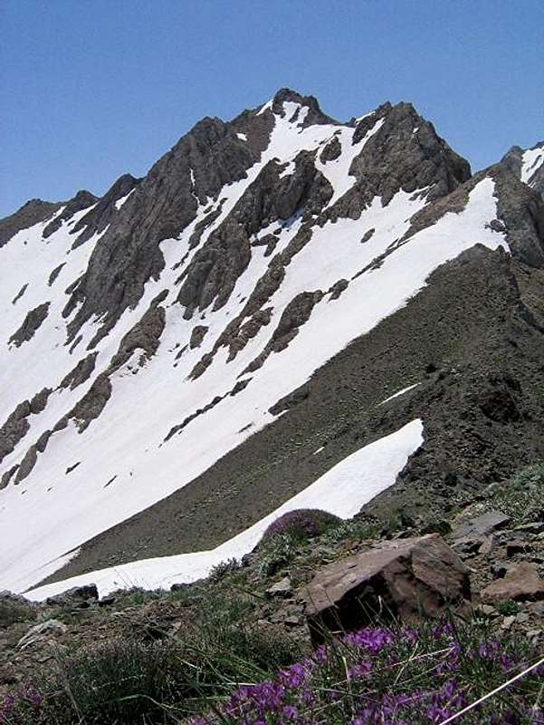
The west/northwestern slopes of North Kharsang Kooh
Getting There
From northeastern Tehran, take the Babai expressway east and then take the Lashgarak expressway north up to Ghoochak Pass (1950 m). Follow the road north down the many switchbacks to the bottom of the Jajrood River Valley (1700 m). Drive 20 Km north to the main square in the village of Fasham (1950 m). Left (west) will take you to the ski resorts of Shemshak and Dizin. Turn right (east) and drive 15 km to the villages of Abnik/Garmabdar (these two are very close. Abnik is further west). If you do not want to go to Yoonza Pass, you should start to the north of Abnik. The drainage to the north of Garmabdar seems to get you onto more difficult slopes.If you have obtained permission (See Red Tape below), you can drive past the gate up the dirt road east of Garmabdar (passable by most/any car) to the Yoonza Pass (3100 m).
 |  |  |  |  |