Page Type Page Type: Mountain/Rock
Location Lat/Lon: 36.10072°N / 51.58527°E
Activities Activities: Mountaineering
Seasons Season: Summer
Additional Information Elevation: 13800 ft / 4206 m
Sign the Climber's Log

Overview

Click for Introduction to the Central Alborz Mountains.

Click for Introduction to Kholeno Massif.

Click for a detailed map of the Central Alborz Mountains.

Click for a detailed map of the Kholeno Massif.


The Narges Peaks include:

1) Narges 4206 m
2) West Narges 4103 m
3) North Narges (two high points) 4073 m & 4069 m


Narges Peak 4206 m
From Varengeh Rood
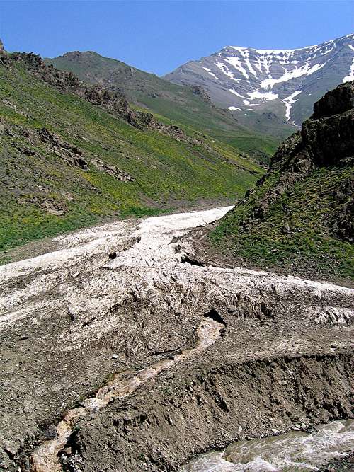
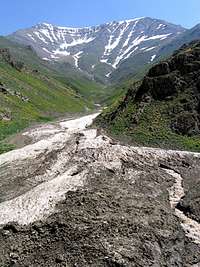
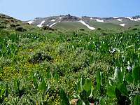
Varengeh Rood Valley
South Slopes Main PeakSouth view of summit

Narges is one of the 4000 m peaks of the Kholeno Massif and rises on the northeastern corner of the massif in the Central Alborz Mountains of northern Iran. To the south, a 4050 m saddle separates Narges from the 4256 m Paloon Gardan Peak. The southern slopes of Narges are gentle and drop only 350 m to form a valley that gives rise to the Varengeh Rood River. The northern slopes of Narges are in contrast, quite long and steep going down 1600 vertical meters to reach one of the branches of the Noor River.
North Face Main SummitThe north face of the main Narges Peak

SummitSummit
Near YakhchalNorth Slopes

A very long and slowly descending ridgeline starts at the summit of Narges and heads west creating the 4103 m West Narges Peak (see below) before dropping down to the 3650 m Gavan Poshteh Pass. This pass separates the Narges Peaks to the east from those of the Kaman Kooh (4234 m) group to the west. To the northeast of the summit of Narges, another ridgeline gives rise to a series of high points known as North Narges Peak 4073 m (see below).
In Kholeno Massif
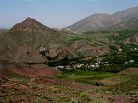
Narges and part of the Kholeno Massif

Narges is a long way from any trailhead. Reaching its summit will generally take more than a day. Three options are available:

1) Climb the Kholeno Peaks. From the summit of Kholeno the Great 4387 m follow a ridgetop past the Meesh Chal 4253 m, Sarkharsang 4203 m, Palvan 4126 m & Paloon Gardan Peaks 4256 m. This rocky ridgetop will require class III hiking.
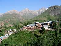
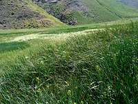
2) Start at the Varengeh Rood Village 2450 m and follow the river upstream to the end of it below the summit of Narges (see “Route”).
3) Although the north slopes of Narges are not suitable for climbing, it is possible to use the Gavan Poshteh Pass to descend to the branch of the Noor River and follow it to the village of Nahiyeh 2450 m which sits at the base of the North Narges Peak (see “route”).

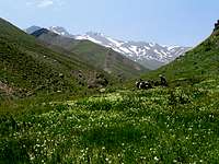
Views from the summit of Narges
KholenoKholeno


DamavandDamavand
Kaman/AzadKaman
Azad KoohAzad
Kharsang KoohKharsang
Paloon GardanPaloon


West Narges Peak 4103 m
North face West NargesThe north face of the West Narges Peak

West NargesWest Narges

West Narges Peak is a high point with a prominence of 80 m that rises on the crest of the ridgeline that descends to the west of the main Narges Peak. To the west of West Narges, the ridgeline creates another high point (4030 m) before descending to the 3650 m Gavan Poshteh Pass.

West Narges Peak is well visible from the upper portions of the branch of the Noor River to the north and can easily be confused with the main summit of the Narges Peak (which comes to view only at a particular spot).
West NargesWest Narges

North Narges Peak 4073 m
North face North NargesNorth face of North Narges Peak from Nahiyeh Village

Nahiyeh VillageNahiyeh Village

To the northeast of the main summit of Narges Peak, you will find a couple of high points known as North Narges Peak. This peak creates a beautiful background for the picturesque village of Nahiyeh that sits to the north of it.
South Slopes North NargesSummit North Narges

A few pictures from the branch of the Noor River Valley


Flower
Yakhchal/Koheno
Below Gavan Poshteh
Below Gavan Poshteh


Grasses
Noor River
Yakhchal & Koheno


A few pictures from upper Varengeh Rood River Valley


Snow
Sehchal/Sikno
Kaman Kooh
Upper Varengeh Rood


Getting There

Ditections to Varengeh Rood Village:

From downtown Tehran drive the Tehran-Karaj Freeway 40 Km west to the town of Karaj and take the Chalus Road exit. Drive the Chalus Road up the mountains roughly 70 Km till the junction of the road that goes to Dizin Ski Area (2250 m). Turn onto this road and follow it a few Km till you see a side road on the left that goes to Varengeh Rood Village (2325 m). Turn onto this road and follow it a few Km till the end of it at the village (2450 m).


Directions to the Nahiyeh Village:

From downtown Tehran drive the Tehran-Karaj Freeway 40 Km west to the town of Karaj and take the Chalus Road exit. Drive the Chalus Road up the mountains roughly 95 Km past the Kandovan Tunnel (2700 m) to a place known as Poleh Zangooleh (2350 m) where you will see a side road to the right (east). This is known as the Yoosh-Baladeh Road. Follow this road 40 Km east first up the Tarkeh Bashm Pass (2800 m) and then Labashm Pass (3170 m) to the village of Uz (2250 m). Turn south onto a side road and drive 8 Km up the valley to reach the village of Nahiyeh (2450 m).

Red Tape

No fees or permits needed.

Camping

Anywhere.

Children

Children

Children refers to the set of objects that logically fall under a given object. For example, the Aconcagua mountain page is a child of the 'Aconcagua Group' and the 'Seven Summits.' The Aconcagua mountain itself has many routes, photos, and trip reports as children.