
-
 33694 Hits
-
 95.18% Score
-
 51 Votes
|
|
Area/Range |
|---|---|
|
|
37.18001°N / 86.09367°W |
|
|
Hiking |
|
|
Spring, Summer, Fall, Winter |
|
|
747 ft / 228 m |
|
|
Overview
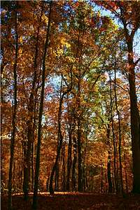
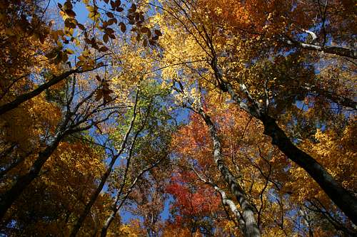
If you’ve never been to Kentucky before, I think you’ll be impressed by its beauty. Even as a jaded Westerner, I got an immediate schoolboy crush on the state the first time I saw it. I’ve introduced it to other people, who have had similar reactions. It’s really pretty hill country, especially in the fall.
The Cave

Cave Tour by Mark Didier

The Cave Cafe
The national park preserves Mammoth Cave, the longest cave in the world. Supposedly Mammoth Cave is as long as the second and third longest caves combined, with an extra 100 miles as insurance.
The basic geology of the region consists of alternating layers of sandstone and limestone, both laid down when this was an ancient sea. Uplifting has created the hills and cracked the rock layers, allowing water to flow here and there. Rainwater dissolves limestone but finds the sandstone relatively impermeable. So, water runs down, through or across the sandstone until it hits limestone, and then it dissolves that. Voila, instant cave where the limestone used to be.
This geology means that the cave doesn't usually look like many visitors expect. Water runs through the cave instead of dripping down into it. Drips make stalactites and stalagmites and such things, which are not all that common in Mammoth Cave. Rivers carve channels, including many big rooms and chambers. These are common in Mammoth Cave.
Cave tours

Too much cave infrastructure?

Cave crickets
To see the cave, you pretty much have to go on a guided cave tour. There are lots of options. For example, the “historic tour” strolls down a wide walkway at the historic entrance of the cave, lit by torches. There are more strenuous all-day caving tours that involve crawling and squeezing in tight places, and half-day options that require going up and down a lot of stairs.
With the partial exception of the wild cave tour, the tours are highly developed. The NPS and its predecessors have moved rocks, moved cave dirt to make trails, installed extensive lighting, and even installed bathrooms, picnic tables, and a small cafe. (Even the wild cave tour gets picnic tables, cafe and loos.)

Stalactites by Mark Didier
If you want to go on cave tours, consider going to the park in the winter. The caves are the same temperature year-round but the crowds are much smaller. Whenever you go, make reservations for cave tours in advance.
Cave Tour by Mark Didier

Cave Opening
Recreational caving
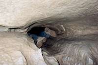
Outside the cave tours, your options are pretty limited. Recreational caving is officially permitted only in Ganter Cave, but you won’t find that information on the website. Only experienced cavers in a group of 4-9 people can get a permit for Ganter Cave, and I’d recommend calling the park to learn the details.
It’s possible to find other cave openings throughout the park. Many are sealed up but some are not (see adjacent photo). It’s against park regulations to enter these without a permit. Yes, that seems to contradict the claim that you can only enter Ganter Cave. In addition, Ganter Cave has been removed from the most recent Trails Illustrated map and other official maps, and the trail was blocked off and allowed to grow back.
There's no publicly available information about how to go exploring in the cave, but the NPS recognizes two caver associations as partners. Join one of them, get credentialed, and then you can join an expedition under a certified cave leader. With enough experience, you can become such a leader. Obviously there are issues about safety, liability, and protection of natural resources that are associated with allowing widespread access to the caves.
Not the Cave
When you want to preserve the world’s longest cave, you end up with a lot of land topside. It’s important to preserve the surface land because that’s where the rainwater comes from before trickling down to dissolve the limestone.
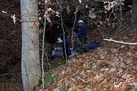
Turnhole Bend Campsite
The Mammoth Cave area consists of beautiful Kentucky hill country, with the Green River running through the middle of the park. The hills and hollows of the surface land, combined with the basic geology of the cave, means that you can find a lot of springs, seeps, and even cave openings in the sides of the hills - - wherever the water runs across a sandstone layer, more or less.
There are also quite a few sinks scattered about. Roughly speaking, in some places the water dissolves a patch of limestone and the sandstone and dirt above fall down on top of it. These run from about car-sized to farm-sized. Most are old, but some are clearly new, judging by the effects on the vegetation.
Kentucky Maples
Frontcountry activities.
The Green River cuts the park in half, running roughly east-west. The NPS manages the south side of the park more or less as frontcountry, and the north side as backcountry. The front country has the Visitor Center, the Mammoth Cave Hotel, cottages, a developed campground, light hiking trails and a gravel biking trail. That’s also where you catch the cave tours.
You can also float down about 30 miles of the Green River, though I haven’t done this. There are commercial outfitters who will help you out, follow the links on the park web site. Fishing is allowed without a license, but Kentucky creel limits and other regulations apply. There are also a wealth of horse concessionaires outside the park, if that’s your thing. If you have your own horse, call 270-758-2180 for information.
Backcountry: Overview.
Why backpack in Mammoth Cave National Park (MCNP)? The short answer is that you live in the Midwest, and it’s all you got. A longer answer is that many of your other backpacking options in the Midwest involve national forests, state forests, and other public lands that are popular with hunters. If you want to avoid hunters in the fall, you need a national park. MCNP is the place for you.
Since Kentucky is horse country, MCNP’s backcountry sees a lot of horse use. You’ll see horses on the weekends, and you’ll see evidence of horses everywhere. A single horse and rider causes an impact on trails equal to about 50 day hikers, and the truth of that fact will become very evident to you throughout the park. The horses have worn down some trails to hip or even chest depth. They have created large muddy patches near seeps, springs, and in low-lowing areas of the trails.
There’s also a network of mountain bike “trails” in part of the back country. These are really dirt roads without vehicles - - wide enough to drive a truck down, though I wouldn’t want to have to back the truck up to get out. Because the local geology involves a lot of dirt on top of impermeable sandstone, there can be a fair amount of muddy spots even after a very light rain. Maybe that’s a good thing.

Fall Trail
Bluffs campsite by CrazySanMan
Fortunately, the NPS has tried to design the trails and sites to segregate users. You’ll cross paths with bikes and horses when you’re close to the trailheads, but you can get away with them in some directions.
To do that, first understand that there are two clusters of backcountry. The northwestern corner of the park has a large loop trail with the Houchins Ferry Road down the middle. There are two trailheads and heavy horse use on the First Creek-McCoy Hollow Loop (13.5 miles).
For people on two legs, this is a doable day hike. You can also stretch it to a three-day outing by arriving Friday afternoon (and praying for a campsite), and then hiking a short distance in either direction to one of the four campsites close to the Temple Hill Trailhead (one at 0.8 miles, two at 1.1 miles, and one at 3.7 miles from the trailhead). Because of the short distance from the trailhead, these sites attract weekend party crowds. The campsites are close to the trail and lack privacy, except for McCoy Hollow. Saturday would be your long day, going around the loop to one of the other campsites. Hike out on Sunday morning and drive home.
There’s a more complex network of trails in the central part of the backcountry north of the Green River. There’s a Y-shaped network for mountain bikes, which is moderately flat because it follows the tops of ridges. Trails branch out from this in multiple directions. There’s also something like a loop around the entire network - - from Maple Springs, take the Sal Hollow Trail, then the Good Spring Trail, Spring Hollow Trail, and Raymer Hollow Trail (about 21-22 miles in all). There are seven campsites along this loop, each down a spur trail (except Sal Hollow).
The Trails: Important Warning

Sal Hollow Trail
The park is in the middle of rerouting many trails. Topo maps are outdated. Don’t use the Trails Illustrated Map, which is now incorrect. (Presumably it will be updated soon enough.) The trail map on the NPS website is also incorrect as of this writing (November 2008). The Park is planning extensive trail rerouting in summer 2009, which will add to the confusion. Pick up a map in person from the visitors’ center as this is currently the only source for up-to-date information.
Some of the campsites have also changed their names. The most important of these is the former “Waterfall” site, whose waterfall didn’t actually run that much most of the year. It’s now the “Homestead” site.
Wildlife

Stickbug
I always see white-tailed deer and wild turkey whenever I visit the park. Squirrels, raccoons, and chipmunks are also common, as are dead possums. (“Why did the chicken cross the road? To show the possum it could be done.”)
I’ve seen herons, bald eagles, hawks, and a surprising variety of insects in the park. The Green River also provides key habitat for freshwater mussels, which are an endangered animal group throughout the Midwest. Seven of the park’s 50 species of mussels are listed as endangered, and another four are being considered for listing.
Finally, the cave has its own unique collection of 130 cave species found nowhere else - - your tour guide will help you with those, depending on the tour.
Red Tape
Park regulations require that you obtain a permit before entering any of the park's caves. Inquire at the Visitor Center.
Caving by Yeti

Wild Cave Tour
Unfortunately you cannot make backcountry campsite reservations in advance, and there’s no backcountry office as such. Go to the information desk and ask to make a backcountry reservation. Be aware that most of the people at the desk are not very knowledgeable about the trails and campsites, as they spend their days answering questions about cave tours. Of course, there are exceptions. Unfortunately, one of the questions that I would most like answered - - how is the spring running at that site? - - has never been answered to my satisfaction.
As that last point suggests, water can sometimes be an issue, despite the fact that this is a wet place carved by erosion. The problem isn’t water as such, but whether you’ll have all you want at the campsite. Just fill up at streams along the trail, and make sure you carry enough for your overnight needs. Then, if the spring is running well, you’ll feel lucky.
McCoy Hollow is the only campsite without a spring. You could bushwhack down a steep hill to the Green River if you’re desperate.
Finally, it’s not “red tape” but be aware that this is a great tick and chigger country. There are also two poisonous snakes in the park, the timber rattlesnake and the copperhead.
Getting There

Green River Ferry: Plan Ahead
Mammoth Cave National Park is conveniently located close to many cities. It’s closest to the smaller city of Bowling Green, KY, but pretty close to Nashville, TN, and Louisville, KY. It’s a little farther from Indianapolis, Cincinnati, Evansville, Chattanooga, and Memphis - - and a reasonable weekend destination from those points, especially if you can make it a three-day trip.
The best way to get to the visitors’ center is to use one of the two marked exits off I-65 between Louisville and Nashville. There are several entrance roads but they all go to the same place. From other directions, you’ll need a good map to navigate the state and county roads. You’ll probably end up using one of the small ferries along the Green River if you use these unconventional directions of travel - - call ahead for their hours of operation, and to make sure that they haven’t been grounded by high water or low water.
The park is located in the Central Time Zone, but the next county to the north lies in the Eastern Time Zone. Locals may refer to these as “slow time” and “fast time,” respectively.
Get Involved
The trail restructuring is mostly finished. The horse lobby was heavily involved, so it's not necessarily good news for backpackers and mountain biking. If you're interested, the planning documents are here (November 2008).
Here's info on revamping the Green River ferry (February 2011).