
-
 5280 Hits
-
 84.27% Score
-
 18 Votes
|
|
Mountain/Rock |
|---|---|
|
|
46.25747°N / 14.81625°E |
|
|
Hiking, Skiing |
|
|
Spring, Summer, Fall, Winter |
|
|
4948 ft / 1508 m |
|
|
Topographic isolation: 9 km
Nearest higher peak: Veliki Rogatec (1557 m)
Prominence: 606 m
![Dreta valley]()
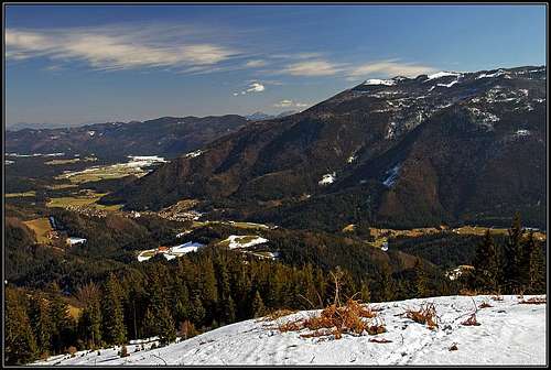
Menina planina above Dreta valleyThe Kamnik Alps have two "satellite" plateaus in southeast direction from the main mass of the mountain range. These two plateaus are Velika planina and Menina ![Karst land]()
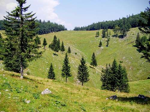
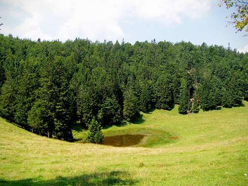
Karst landplanina. Menina planina is the farther one – it is 25 km far from Grintovec. And Menina planina is more separated – not only by its distance but also by its ![Lake Biba in summer]()
Jezero Bibaprominence. Its prominence is 606 meter. This value is determined by Črnivec Pass (902 m) that separates Velika planina and Menina planina from each other. Otherwise the prominence value of 606 m places Vivodnik into rank #25 on the prominence list of Slovenia. Vivodnik is the highpoint of the plateau with its 1508 m height.
![Afternoon on Biba planina]()
Biba planinaMenina planina covers an approximate area of 20 kilometer x 10 kilometer. Its top is a real karstic plateau with distinct rim almost in all directions – specifically on its northeast side. The height of the plateau is mostly between 1300 and 1500 meter. The uniform altitude can be seen from the fact that it has more than a dozen highpoints between 1400 and 1500 m. The highest peaks are the following:
![Vivodnik summit]()
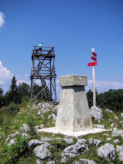
Vivodnik summit![Vivodnik - south view]()
View to southwest with Snežnik on the HorizonThere are several points on the rim of the plateau that offer good view. But these outlook points offer view only in one direction. The only hill of the plateau offering a 360 degree view is Vivodnik. This is the highest hill of the plateau of Menina planina. But not enough high in itself, so an outlook tower had been built here in order to provide the view that is demanded by the hikers. Without the help of the outlook tower not much would be seen from here but only the spruce trees of the hill. Otherwise the hill is not characteristic and not a specifically beautiful place. Neither is the outlook tower beautiful: it’s a cheap functional construction. But if ever you are on the top level of the tower, you can see the following distant or less distant peaks from here:
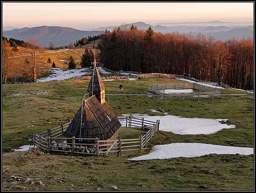
![On the plateau of Dobrovlje]()
On the plateau of DobrovljeEast of Menina, beyond the saddle (and road pass of Lipa, 723 m) there is a 'one flat lower' plateau, called Dobroveljska planota (Dobrovlje plateau), named by the hamlet of the same name - Dobrovlje. Dobrovlje can be also considered as the "smaller sister" of Menina. Their geological structure is similar, but on several places triassic limestone or dolomite is bordering with volcanic rocks (tufs from the neighbouring Smrekovec extinct volcano) so the nature of the plateau is quickly changing. Some areas are karstic, while some other few areas have water sources having more fertile soil. The plateau is mostly forested. The highest elevations are hardly exceeding 1000 m of altitude. The highest summit is Šentjoški vrh (1077 m). Still, it is a nice outing area. There are cute churches on exposed, panoramic high points, lonesome farms and a quite unspoiled nature. The area can be reached by a few mountain roads from the south (Vransko), from the north (Nazarje) and from the east (Polzela, Braslovče). Those who want to free their imagination with historical details, can also visit places like the Old castle of Žovnek, the churches of Sv. Jošt, Sv. Janez and Pavel Sv. Urban, Sv. Jeronim and others. There is even an official mountain hut: Planinski dom na Čreti.
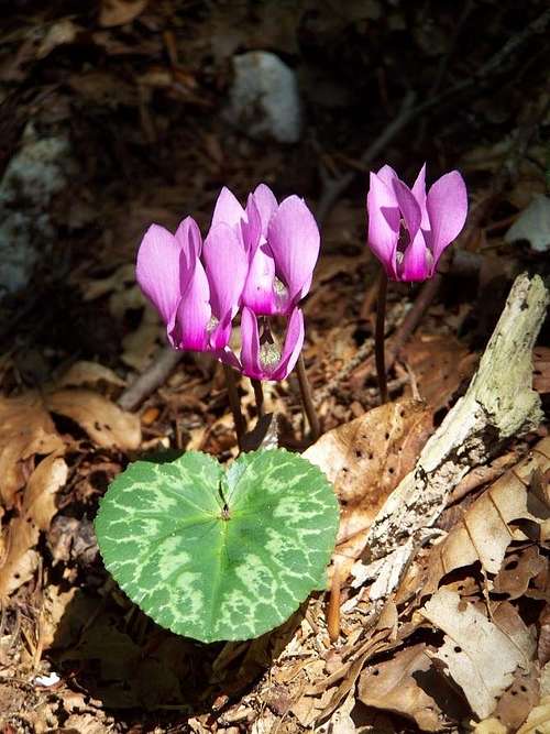
![Cyclamen purpurascens]()
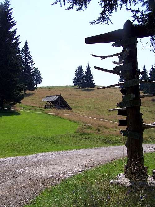
Cyclamen purpurascensMenina planina is covered by woods, but there are also large areas of meadows and mountain farms. Some internet sources cite the “unspoiled” beauty of the area. I can’t fully agree. According to me it is overgrazed by herds of cattle and horses. I was there in August, and the meadows looked disappointing. I suppose that it must be nice in winter when everything is covered by snow or at late spring when nature is very strong and there are a lot of flowers. Though some signs of beauty can be seen also in August: here is an example of a beautiful cyclamen, and at the bottom of the pages you can find some other photos about the flora.![A crossroad post on Menina planina]()
A crossroad post on Menina planina![Kamnik & Savinja Alps from Menina]()
Kamnik & Savinja Alps from MeninaThe plateau can be accessed from both sides - south and north. From the south you start in Tuhinj. The road is not paved, but it can be used by normal cars. In the beginning the road has a sign that it is prohibited for drive, but the plate below says you can proceed on your own responsibility. Above, the first big meadow is Biba planina, higher on, there's Menina planina.
![Along the road on Menina planina]()
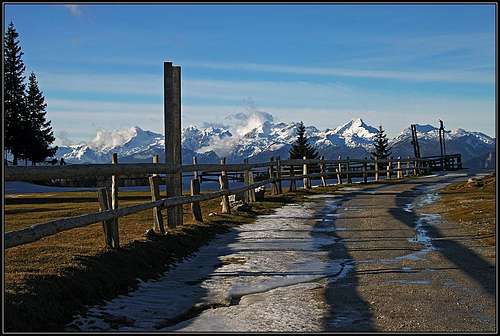
Fenced private landMountain farms and certain pasture lands belonging to them are enclosed by fences, and these areas shouldn’t be entered. Nevertheless the majority of the mountain is accessible without problems, and all attractions can be visited with no problem.
![Dom na Menini planini]()
Dom na Menini planiniThere are several choices:
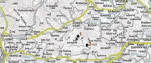
![Menina planina map]()
Menina planina overview map
Nearest higher peak: Veliki Rogatec (1557 m)
Prominence: 606 m
Overview
Menina planina above Dreta valley
Karst land
Jezero Biba
The name Menina derives from the fact that the area was property of monks (menihi in Slovenian language) of the Order of Saint Benedict.
Biba planina
xxxx- Vivodnik (1508 m)
xxxx- Špic (1499 m)
xxxx- Snežni vrh (1490 m)
xxxx- Veliki Medvedjek (1479 m)
xxxx- Kozlar (1467 m).
On the limestone and dolomite basis there several karstic phenomena were formed like caves, lakes and sinkholes. The most famous cave is Jespa. Jespa is a hole in the ground – a typical karstic phenomena that originated due to the collapse of the cave ceiling. There is a maintained path to the bottom which is approx. 30 metres deep. In summertime it’s cooler inside than outside. As a consequence, there is a vegetation inversion as only mosses and lichen grow at the bottom, although ice and snow remain throughout the entire year. The trailhead to the cave is at the hut Dom na Menini planini, and it requires 20 minutes’ walking.
What hikers can immediately notice is the big number of small ponds on the plateau. There natural and artificial ones. The biggest pond is called Biba.
Vivodnik
Vivodnik summit
View to southwest with Snežnik on the Horizon
xxxx- West: Triglav (2864 m)
xxxx- Northwest: Grintovec (2558 m)
xxxx- North: Raduha (2062 m)
xxxx- Northeast: Pohorje (1543 m)
xxxx- East: Ivanščica (1060 m)
xxxx- Southeast: Čemšeniška planina (1204 m) and Kum (1220 m)
xxxx- South: Risnjak (1528 m)
xxxx- Southwest: Snežnik (1796 m)
Vivodnik is in 15 minutes’ walking distance from Dom na Menini planini.
Dobrovlje
On the plateau of Dobrovlje
Nature
Cyclamen purpurascens
Access and Routes
A crossroad post on Menina planina
Kamnik & Savinja Alps from Menina
Due to the easy access to the plateau, Menina planina is a favourite destination for families with small children and for those who intend to do easy walks. It’s also very suitable for mountain bikers and for ski touring.
Traffic on the roads is very small so they are safe. The most recommended hiking routes connect
xxxx- Dom na Menini planini with Biba planina
xxxx- Dom na Menini planini with Vivodnik
xxxx- Dom na Menini planini with Šavnice (1427 m).
Those who prefer to do more physical performance while reaching the top of a mountain, they have several choices, too. They can climb the mountain from one of the villages at its foot:
xxxx- Golice – Vivodnik: 2 x 5.5 km with 850 m elevation gain
xxxx- Gornji Grad – Vivodnik: 2 x 5 km with 1070 m elevation gain; this route has two variants
xxxx- Šmiklavž – Vivodnik: 2 x 7.5 km with 990 m elevation gain.
Red Tape
Fenced private land
Please also take into consideration that you may be confronted with bear on Menina Planina. Sometimes they are witnessed here. For example one was noticed in February 2016.
Camping
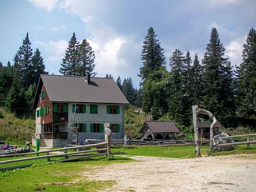
Dom na Menini planini
Campings
Camping Menina (380 m above see level)
Address: Varpolje 105, 3332 Rečica ob Savinji
Camp Loka (420 m above see level)
Address: 3333 Ljubno ob Savinji
Eco Terme Snovik (470 m above see level)
Address: Snovik 7, 1219 Laze v Tuhinju
Mountain Hut
Dom na Menini planini (1453 m above see level)
Address: Menina 1, 3342 Gornji Grad
Map
There are two excellent online toporgraphic maps here:
Menina planina overview map