
-
 12930 Hits
-
 78.27% Score
-
 9 Votes
|
|
Mountain/Rock |
|---|---|
|
|
34.75260°N / 98.5618°W |
|
|
2175 ft / 663 m |
|
|
Overview
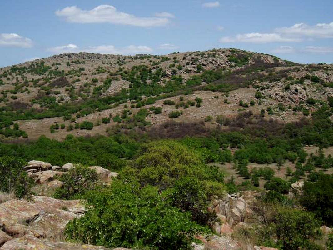
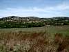
Mt. Wall is one of only a handful of 2000' peaks in the Wichita Mountains National Wildlife Refuge that is accessible to the general public. Located toward the eastern end of the Refuge, the peak is eclipsed in stature by nearby Mt. Scott and Mt. Sheridan. Its relative remoteness (lack of a road going to the top) means that you will likely run into few other parties during an ascent. If bushwacking and a lack of crowds suit your fancy, Mt. Wall provides a wonderful wilderness experience! The easiest route is Class 2+, but technical ascents are readily available if desired. Using a 300' prominence criteria, this peak is tied for 29th highest in the Wichita with nearby Hunting Horse Hill.
 |  |  |  |
Getting There
Mt. Wall is in the Wichita Mountains Wildlife Refuge just northwest of Ft. Sill in Lawton, OK. Please note that both access routes require driving on I-44, which is a toll highway ($1.25 from OKC to Lawton in a passenger car; $1.25 from Wichita Falls to Lawton in a passenger car).From Oklahoma City:
- Take I-44 south to Exit 45 for State Highway 49.
- Travel west through Medicine Park, and continue on SH-49 for ~9 mi to an unmarked right turn which leads to the trailhead parking. This lot is ~1.2 mi past the turnoff for Mt. Scott.
- If you intend on climbing one of the northern routes, continue on SH-49 another mile past the south TH turnoff to a right turn north toward Meers.
- Continue north for a few miles before reaching a dirt road with a few parking places on the right. The road is closed to motor vehicles, but hiking and mountain biking are allowed.
From Fort Worth, TX:
- Drive west on US-287 to Wichita Falls, TX.
- Exit onto I-44 and travel across the Red River and through Lawton, OK to Exit 45 for State Highway 49.
- Travel west through Medicine Park, and continue on SH-49 for ~9 mi to an unmarked right turn which leads to the trailhead parking. This lot is ~1.2 mi past the turnoff for Mt. Scott.
- If you intend on climbing one of the northern routes, continue on SH-49 another mile past the south TH turnoff to a right turn north toward Meers.
- Continue north for a few miles before reaching a dirt road with a few parking places on the right. The road is closed to motor vehicles, but hiking and mountain biking are allowed.
 |
Red Tape
Mt. Wall is located within the Public Use Area of the Wichita Mountains Wildlife Refuge, and as a result, no permits or fees are required to hike or climb. The area is only open from sunrise to sunset, so do not plan on backcountry camping outside of the specifically designated areas (Charons Garden Wilderness).A full list of regulations, as well as other important information, can be obtained at the WMNR website.
The daytime speed limit on SH-49 is 45 mph, dropping down to 35 mph at night. Please drive the speed limit not only to prevent your self from getting a ticket (the rangers are infamous), but also to avoid hitting the free-range wildlife present throughout the park.
CAUTION!! WMNR is home to several herds of Longhorn Cattle and Bison, which frequently saunter across the roadways. As always, use common sense and try to stay away from the wildlife if at all possible. During calving season (Spring and early Summer), the animals will likely be more defensive of their young.
Alcoholic beverages are not permitted within the refuge, though the historic Meers restaurant can provide LCRT (liquid carbohydrate replacement therapy) after your climb.
 |
When To Climb
Mt. Wall and its neighboring Wichita peaks can easily be climbed throughout the year, though, late Fall through early Spring are the best times for hiking.
Spring Pros/Cons
- Mild temps with 10-20 mph wind makes for comfortable climbing conditions;
- Streams run at their highest levels;
- Extreme tick & chigger season;
- Best chance of severe weather (tornadoes);
- Wildflowers will be in bloom;
- Trees & brush are thick with leaves, which makes off-trail hiking (bushwacking) more difficult.
Summer Pros/Cons
- Hot temps and little wind;
- Streams run low or dry;
- Rattlesnake season;
- Moderate tick & chigger season;
- Chance of severe weather (tornadoes);
- Trees & brush are thick with leaves, which makes off-trail hiking (bushwacking) more difficult.
Autumn Pros/Cons
- Mild temps with little wind;
- Streams dry;
- Moderate rattlesnake season;
- Low tick & chigger season;
- Fall colors;
- Trees & brush are moderately thick with leaves, which makes off-trail hiking (bushwacking) somewhat difficult..
Winter Pros/Cons
- Cool temps with little wind;
- Freezing precipitation possible;
- Streams run low or dry;
- Snakes and bugs at their lowest level of activity;
- Lack of foliage makes for easier cross-country hiking (bushwacking).
 |  |
Camping
The WMNR allows for the operation of Doris Campground near Quanah Parker Lake. The camp has 90 sites available on a first-come, first-served basis, which cost between $6 and $12 per night depending on if you require electricity. The camp has modern facilities including a central restroom/shower building that is available except during winter. Drinking water, dumpsters and chemical toilets are available throughout the campground. All refuge regulations remain in effect when staying in Camp Doris.Backcountry camping is available in the Charon's Garden Wilderness by permit. For a list of backcountry regulations and restrictions, please click here.
Mountain Conditions
Conditions for Mt. Wall will be very similar to forecast for Lawton, OK and Meers, OK. Meers is closer, and as such should have a more accurate forecast, however, Lawton has better meteorological data. Referencing both of these locations should give a good idea of potential weather conditions and hazards.

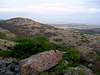
Point 2019'

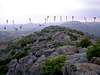
Unnamed Point 2019' is a subsidiary summit that forms the western edge of Mt. Wall's south-facing basin. With a little extra effort, this small peak provides a great vantage point of the Eastern Wichita.
From Mt. Wall's summit, descend along the West Ridge until an easy line down to the saddle becomes apparent. Your primary goal is to avoid as much of the brush as possible. Pick your way down the rocky slope, keeping an eye on your route up the slopes of Point 2019'. A short and relatively brush-free walk finds the climber at a wonderful panoramic vista of the Wichita Mountains. Seeing another soul on Mt. Wall is uncommon, but encountering another climber on Point 2019' is truly a rare circumstance.
Descent can be accomplished by reversing your route of ascent, or continuing south over Point 1751', if you are headed back to the south trailhead.
 |