
-
 26023 Hits
-
 87.76% Score
-
 25 Votes
|
|
Mountain/Rock |
|---|---|
|
|
34.73343°N / 98.75336°W |
|
|
Hiking, Mountaineering, Trad Climbing, Sport Climbing, Toprope |
|
|
Spring, Summer, Fall, Winter |
|
|
2180 ft / 664 m |
|
|
The signature image was shot by Mark Doiron.
Overview
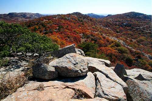
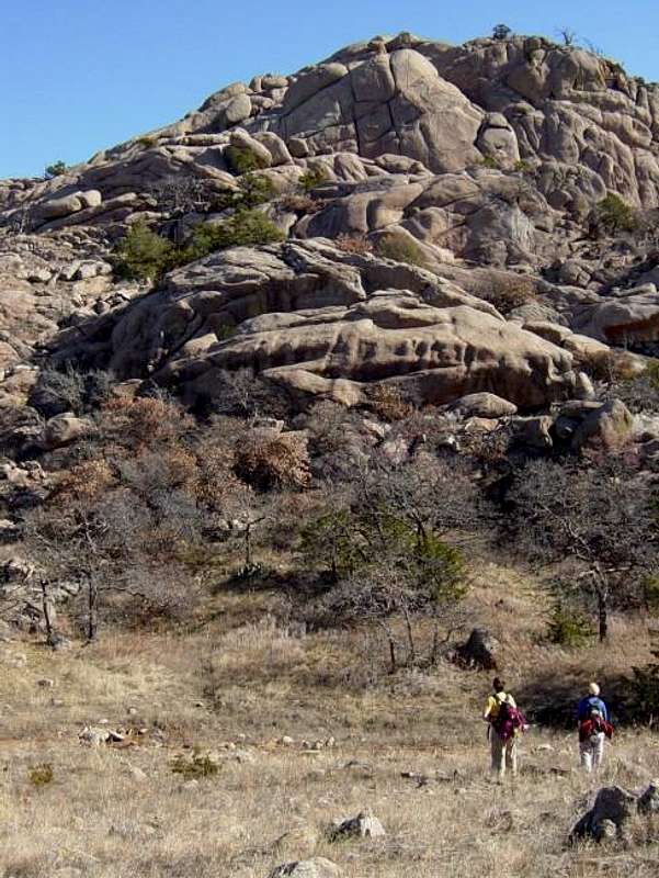
Within the relatively small area of Charon's Garden Wilderness, Sunset Peak is a gem of a day hike. Solitude, brought on by a lack of trails, is the attraction of this little peak in the Wichita Mountains of Oklahoma. The lack of trails means that a climb of Sunset Peak will involve a lot bushwhacking. Regardless, a hike to Sunset Peak is accompanied by the joy of meandering across the scrub oak prairie and granite domes of the wilderness, often with an occasional sighting of deer, bison and elk.
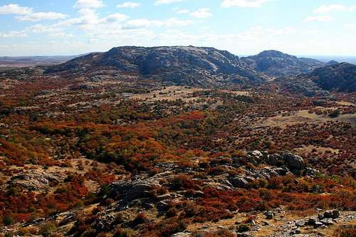
Like all of the Wichita Mountains, Sunset Peak is unique and has its own special place in the range. It is actually a small massif with three summits. The southern-most summit is the highest. While you’re in Charon's Garden, don’t miss the opportunity to explore the northern side and visit Sunset Peak. You won’t be disappointed.
North Summit from Middle Summit.
Middle and South Summits from North Summit.
Getting There
Sunset Peak is located in the Wichita Mountains Wildlife Refuge, approximately 25 miles northwest of Lawton, Oklahoma and 70 miles southwest of Oklahoma City. Follow the directions in the Charon's Garden Getting There section to the Sunset Picnic Area. Upon arrival, the first sign says "Hiker Parking." Ignore that sign and drive a little further and park in the lot that says "Picnic Parking."
Once at the parking lot, look for a gate blocking an old dirt road which runs behind the outhouses. Follow the dirt road for a short distance until reaching a creek. Cross the creek and turn right on the signed trail entering the Charon's Gardens Wilderness. Follow this trail for about a mile, crossing a large streambed. The trail climbs up onto a low plateau and the entire wilderness comes into view. Approximately one mile from the parking lot, you will now leave the trail to the northwest and begin a cross-country trek toward Sunset Peak. The GPS coordinates at the point for turning off the trail are: N34.72771 W98.73811 See the East Slope route for the description to the summit from here. An alternative route that takes you to all three summits is the six-mile Sunset Peak Traverse.
Red Tape
Sunset Peak is located in the Charon's Garden Wilderness Area of the Wichita Mountains Wildlife Refuge. It is managed by the U.S. Fish and Wildlife Service (USFWS). See the Charon's Garden Wilderness Red Tape section for detailed red tape information.
When To Hike
Fall, winter, and spring are the best times. Summer is hot, humid, windy, with a million bugs including ticks and chiggers. Poison ivy and greenbriar are also a bigger nuisance in the summer. Winter in Oklahoma can be cold and nasty, but can also have some very mild days with temps in the 50s and 60s. In winter, check the weather conditions before visiting, because it can be 60 and sunny one day, then 20 and snowing the next. Check here for current weather conditions.
Camping and Lodging
There are front country, backcountry and lodging opportunities during a visit to Sunset Peak. See the Charon's Garden Wilderness Camping section for camping and lodging details.
Technical Rock Climbing
Technical rock climbing opportunities exist on and near Sunset Peak.
Several very hard (5.11 and above) bolted routes are established on the wall of the west side of Sunset Peak. Other rock climbing areas have been established in the Charon's Garden Wilderness include: Echo Dome, Crab Eyes, Lost Dome, Hidden Dome, and Tiny Bubbles.
The guidebook, Oklahoma Select, by Tony Mayse is a must to fully enjoy the rock climbing areas around Sunset Peak. It may be available at the visitor center gift shop. Call the gift shop manager at (580) 429-3187 to check. You may also be able to purchase the guidebook at Backwoods gear stores in Oklahoma City and Norman.
Follow this link and scroll down for directions and route photos of Echo Dome.
Other Stuff
Lawton, Oklahoma is 25 miles southeast and has everything you need including hotels, restaurants, Wal-Mart, etc. Closer in, Medicine Park borders the refuge on the east side and has a small grocery/convenience store. Most get supplies/food at the Loves truck stop at exit 45. There is also a Burger King, Sonic and Sidewinder's bar (strip joint) at exit 45.
The refuge has a very nice visitor center about seven miles west of the refuge entrance on the main road. It is open 7 days a week from 8:00 am to 4:30 pm. The center is closed on major holidays, including Thanksgiving Day, Christmas Day, New Year's Day. It has a museum, information, rest rooms, and a gift shop. Admission is free and the gift shops sells guidebooks, maps and souvenirs.
Ft. Sill Army Base borders the south side of the refuge and there is a manned gate to the base a half mile west of exit 45. If you hear thunder on a clear day, it is not a freak of nature, but rather the Army firing cannon at the Ft. Sill artillery range.
Maps: The USGS 1/24 quad topos are very helpful to find your way around the wilderness area. Sunset Peak is split between Quanah Mountain and Odetta. Visit here to download high resolution copies of these topos under the Creative Commons License:
o Quanah Mountain Quad Topo
o Odetta Quad Topo
A custom concatenation of the above quads annotated with the six mile Sunset Peak Traverse is available here:
o Annotated Quanah Mountain and Odetta Quad Topos
External Links
o Oklahoma Select Guidebook
Outstanding guide book of Oklahoma rock climbing areas by Tony Mayse. This is the only guide book for Oklahoma rock climbing that is in print. It is available at the refuge gift shop, Backwoods gear store in Oklahoma City and Norman, or via the link.
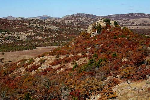
 The view from Sunset Peak. Elk Mountain and Mt. Lincoln are clearly visible on the horizon.