
-
 10406 Hits
-
 84.82% Score
-
 19 Votes
|
|
Mountain/Rock |
|---|---|
|
|
31.72800°N / 110.8479°W |
|
|
Santa Cruz |
|
|
Hiking |
|
|
Spring, Summer, Fall, Winter |
|
|
8357 ft / 2547 m |
|
|
Overview
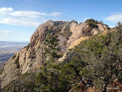
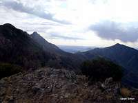
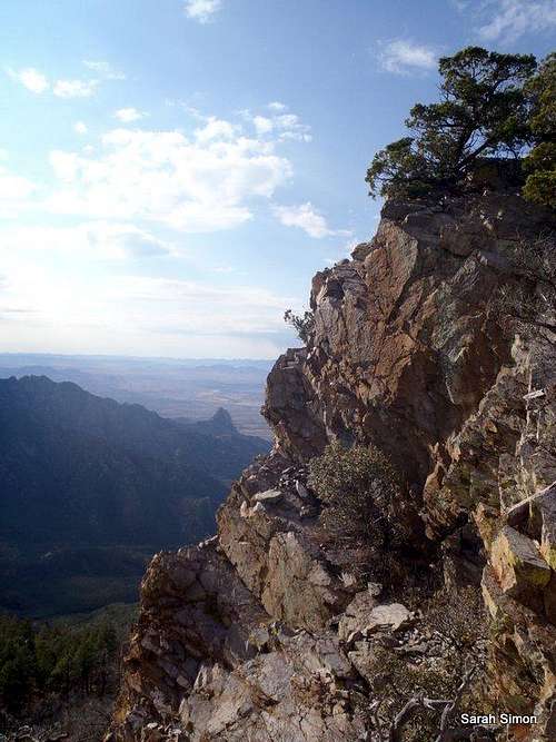 Views from the ridgeline
Admired often from afar, but more rarely appreciated close-up, McCleary Peak is a delightfully isolated Santa Rita Peak. The northern end-cap of the high Santa Ritas, McCleary’s summit is guarded by steep, crumbly cliffs on the south and an Arizona-style, Class 2+ bushwhack from the northern saddle. The three primary approaches to McCleary require 11-12 miles of roundtrip foot travel and 3,500 – 4,000 feet of vertical gain.
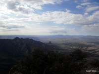
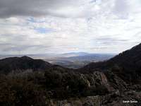
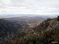
From the summit of McCleary peak, innumerable basin-and-range mountain ranges are visible, including the Santa Catalina Sky Island. Nearby neighboring peaks “88 Mac” and Mount Wrightson, highpoint of the Santa Ritas, dominate views to the south. The Whipple Observatory is clearly visible on the summit of Mount Hopkins. Baboquivari proudly rises to the southwest and ultra-prominence peak Mount Graham is visible to the north-northeast. While unranked, McCleary forms the northern endpoint of the formidable high Santa Rita skyline, the backdrop to the communities of Green Valley & Sahuarita and is a worthy excursion.
Rank: Unranked
Prominence: 217 feet
USGS Quad: Mount Wrightson
Planning Map: Green Trails Maps: Santa Rita Mountains
Rank & Prominence: Lists of John
 |  |  |
Getting There: Major Access Points
 Approaching the summit
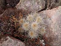 Cactus
 Pine tree oddity
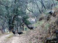 Thanksgiving Turkeys
 Hedgehog near summit
This peak is roughly 50 miles south of Tucson, Arizona. While the peak can be accessed from the more remote east side, most visitors to and residents of Tucson will access this peak from the more developed west side.
A few primary access points for this peak are available via the Madera Canyon area, accessible from I-19 on the west side of the Santa Rita Mountains, exiting at Continental and traveling toward Madera Canyon.
• Follow I-19 to Green Valley, Arizona
• Exit #63 Continental Road.
o From the exit, it is a good 12 miles to the trailhead
o Follow signs to Madera Canyon Recreation Area, they are plentiful
• Take the road to the east (if coming from northbound I-19, you will pass under the interstate)
• Keep an eye out for the plentiful signs to Madera Canyon! Don’t miss the right turn onto Whitehouse Canyon Road. You will leave the desert floor and enter the wooded canyon, heading toward the Santa Rita peaks.
Four Springs Trail:
1. Madera Trailhead Picnic Area: On the left just after the Bog Spring Campground. Paved road access.
2. Amphitheater parking area and trailhead: On the right side of the road after Bog Spring Campground (heading up-canyon), and just past the Santa Rita Lodge. Cross the road to reach the start of the trail. Paved road access.
3. Shortcut to Four Springs Trail: Follow the road to its very end, high up in Madera Canyon, where there are two lots, and upper and lower lot for parking. Look for the unofficial “pipeline trail” to shortcut to the trail to Kent Springs. Paved road access.
Crest Trail:
Super Trail or Old Baldy Trail to Crest Trail: Follow the road to its very end, high up in Madera Canyon, where there are two lots, and upper and lower lot for parking. Paved road access.
Florida (locally pronounced Flo ree’ da) Canyon Trail: Directions courtesy of the US Forest Service. Leave Interstate 19 at the Continental Exit (#63)/Madera Canyon Road. Turn east and follow the Madera Canyon road about 7.3 miles to the FR 62 cutoff then bear right onto FR 62A and continue about 3.6 miles to the Florida Canyon trailhead on the left, just outside the entrance to the Florida Work Center. Graded gravel road access.
Red Tape
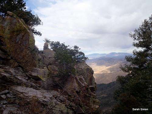
 Summit views
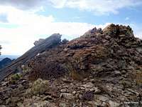 Rock outcrop on ridge
• There is a $5 per vehicle fee to access the Coronado National Forest Recreation Area.
• McCleary Peak resides within the Mount Wrightson Wilderness. Standard wilderness restrictions apply regarding motorized vehicles (no mountain bikes), hiking party size and pet leashes.
Camping
 Fellow Santa Rita Mountains
 UN 8863 "88 Mac"
The Bogs Spring Campground, operated by Coronado National Forest, is the nearest camping on the south side of the peak.
• 13 campsites with tables and fire grills
• Drinking water available
• Toilets
• Paved access road
• Elevation: 5,200 feet
• Season: Year-round
Weather & Seasons
 Views to the east from ridge
 | This is a dynamite peak to visit in the fall, when the weather is cooler and the leaves are changing. In the summer, the lower reaches of any route to this peak could be brutally hot in the scorching southern Arizona sun. These mountains see cold mountain weather and snowstorms in winter and early spring, and heavy snow could mean impassible trails or even a locked road gate. |  |