
|
|
Mountain/Rock |
|---|---|
|
|
46.45631°N / 13.64502°E |
|
|
Hiking, Mountaineering, Scrambling |
|
|
Summer, Fall |
|
|
6768 ft / 2063 m |
|
|
Overview
Geographical structure: Eastern Alps > Julian Alps > Mangart and Jalovec group.Picco di Mezzodi is important mountain in the Mangart and Jalovec group in the nearness of Mangart. It is located on the NW side of Mangart above Mangart Lakes (Laghi di Fusine, cca 900 m) on the NE from the top.
From the top of Mangart goes in the W direction border ridge (between Slovenia and Italia) over some mountains and comes on the lowest part of the ridge on the Mangartsko sedlo (pass)/ Forcella Mangart (2055m). Here comes from the Slovenian side the highest road in Slovenia. However from this point on the ridge goes in the N direction the second ridge that goes over Monte Buconig/Bukovnik (2076m), then descends on Rateska skrbina (1851m) and then finally reaches on Picco di Mezzodi.
Picco di Mezzodi is constituted of more small mountains. From the top of Picco di Mezzodi goes in the NW direction wild ridge where are many small peaks: Torre di Valromana (1972m), Breitkofel (1988m) and Schöneck (1787m). On the N side has Picco di Mezzodi very wild north face around 600 meters high where are many ravines, slopes, couloirs, towers… Picco di Mezzodi is nice approachable over NE ridge where the marked route also goes. On the E side falls steeply down in to the valley Valle della Lavina (Plazje). This valley is very nice for tour skiing and it ends on the Mangartsko sedlo (pass). From the summit of Picco di Mezzodi goes in S way the ridge that is connected with Monte Buconig. On this ridge goes another marked route on the summit of Picco di Mezzodi. It starts in the valley Valromana (Remsendol) that is located on the W and NW side of Picco di Mezzodi.
Picco di Mezzodi can be approachable over two marked routes from two sides. First marked route goes from Mangart Lakes over the Alpe de Lago (Jezerska dolina) and the on the NE ridge on the Sella Colrotondo and over the NE ridge on the top. The second possibilty for ascend over marked route is from Valromana. This approach starts on the end of Valromana and first goes through the valley of brook Rio Torer and then ascends on the S ridge and over the S ridge to the top of Picco di Mezzodi.
 |  |  |  |  |
View from Picco di Mezzodi
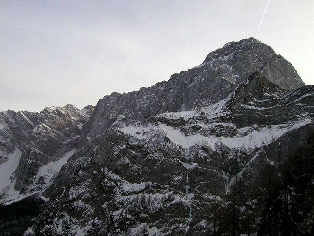
The powerful Mangart from Picco di Mezzodi.
From the top of Picco di Mezzodi you have a beauitful view on many mountains in Mangart and Jalovec group, Vis and Montaz group, Carnic Alps and many high mountain in Austria.
The most impressive view is the look on the north face of Mangart, Vevnica, Strmi Strug and Visoka Rateska ponca.
 |  |  |  |
Getting There

The map of Mangart and Jalovec group. You can see Picco di Mezzodi in the upper part of the photo.
From the highway Villach - Udine you turn in Tarvisio eastwards - towards Slovenia. Arriving in Fusine you follow the road to Mangart Lakes (Laghi di Fusine, cca 900 m). By the lakes (beautiful scenery!) the road is closed for public traffic. From there you continue first by the road then by a marked path towards south.
If you want to climb on Picco di Mezzodi from Valromana you drive into this valley from Trbiz over macadam road and then to the end of road where you park.
Maps:
 |  |
Routes Overview
On the summit of Picco di Mezzodi go two marked route. Each route goes from the different side.There are also possible some climbing routes in north face but I don`t have any data for routes there. There can particularly
be done some Winter ascends in very nice ravines.
 |
Red Tape
Picco di Mezzodi is located in the nearness of Triglavski Narodni park. Although it doesn`t lead in Triglavski Narodni park you must be sensible to wild animals and plants. In this area you might see many wild animals.When To Climb
Picco di Mezzodi can be climbed in any season. But you must be good climber to climb it in Winter season because you must know how to climb with crampons and ice-axes.In Summer you must be careful on some parts of the routes but don`t go there in too hot Summer days.
Camping
You can camp on some camping places in Trbiz, Fuzine or somewhere in Slovenia also (see the page of Julian Alps or Mangart and Jalovec group).Some places for sleep can be also find in the nearness of Mangart lakes.
Mountain Conditions
Mountain conditions in Julian Alps are well known, thanks to Kredarica (2515m) hut and meteo station, which is bellow the Triglav.You can observe current conditions and forecast for Kredarica on the Wunderground meteo site. Here is direct link to Wunderground - Kredarica page.
Some weather informatin can also be found here.
borut - Oct 13, 2014 10:59 am - Hasn't voted
Correction: coordinatesSomeone please copy-paste the following coords into the primary info: 46.45718 13.63783 That would make all the mountain pages of the group have the right coordinates. :)