
-
 1760 Hits
-
 78.27% Score
-
 9 Votes
|
|
Area/Range |
|---|---|
|
|
46.35658°N / 13.86835°E |
|
|
Hiking, Trad Climbing, Sport Climbing, Ice Climbing, Aid Climbing, Skiing |
|
|
Spring, Summer, Fall, Winter |
|
|
7457 ft / 2273 m |
|
|
Intro
Till now the area of Pokljuka was included in the Triglav group. But being as broad as the rest of the narrow Triglav group, it makes sense to present it on a special page. Even more so, because on the Pokljuka plateau there are some landmarks other than mountains, which have been neglected until now and will also never in the future get their own pages. All the respected information about Pokljuka mountains have been of course removed from the page of Triglav group.
Geographical Outline
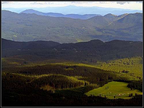
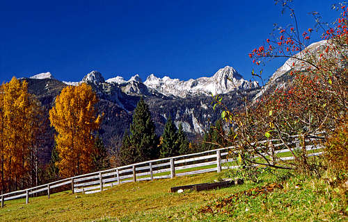
Pokljuka is a nice high plateau, a part of Julian Alps. Above the plateau, on the NW edge, a crest of high mountains is rising, often dubbed as The Pokljuka Chain. So the borders of this area are:
- On the NE the valley of Radovna river and the plane towards Bled lake.
- On the S and SE Bohinj valley and the valley of Sava Bohinjka river.
- On the W the valley of Voje.
- On the NW the valley of Krma.
Geological Overview
Not digging too deep in details, the geology of Pokljuka area is quite simple. The whole plateau and high mountains above it is built of Late and Middle Triassic limestone. In some areas (the highest mountains) it's quite pure Dachstein limestone, elsewhere also massive, thick-bedded limestone, in a bit lower areas (the plateau base) there are also many variants of Middle Triassic limestones, on some areas also to a certain degree dolomitized. Only in the southern areas of the plateau there are variants of Jurassic and even Cretacious rocks (limestones and others). Just as a peculiarity - the sheer rocks above Bohinjska Bela village, hosting the popular climbing center, are much older, even from Paleozoic, made of Permian limestone.
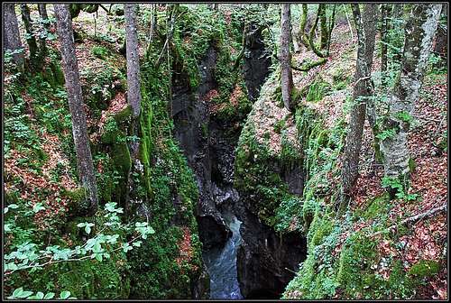
That's about the rocks, but equally important is the more recent geological history of the area. The whole Pokljuka plateau was in the last ice ages covered with glaciers, and a huge glacier was carving the long Bohinj valley. That's why on the mentioned rocks on the Pokljuka plateau there are also considerable layers of Quaternary moraines and other young debris. At the ends of ice ages, strong waters flowing out of glaciers cut deep gorges in soft limestones (Mostnica, Ribnica, Pokljuška soteska).
Getting There
From central Clovenia the A2 highway is reaching past Jesenice town. By both branches of Sava river main regional roads run, local roods run through the valleys of Radovna, Upper Bohinj valley, over the Pokluka plateau and one branch also till Rudno polje. Many mountain roads are open for public traffic, payable is only the road into Voje valley. Have in mind that satellite navigation is not always 100% reliable, but Google mostly brings you where you want to drive. The main roads are depicted on the map beklow - yellow and orange.
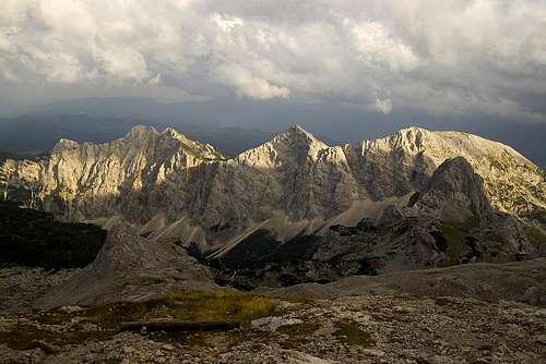
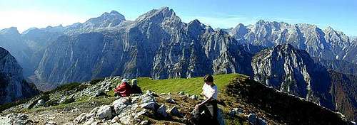
High Mountains
|
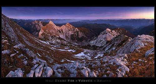
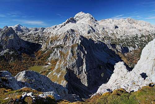
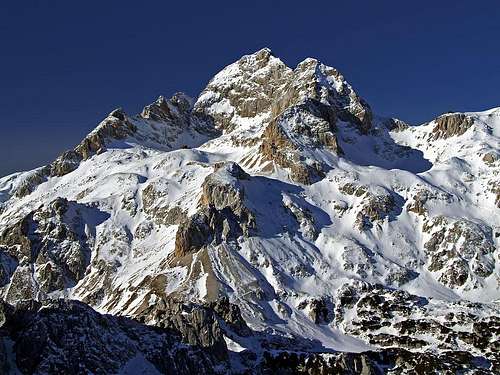
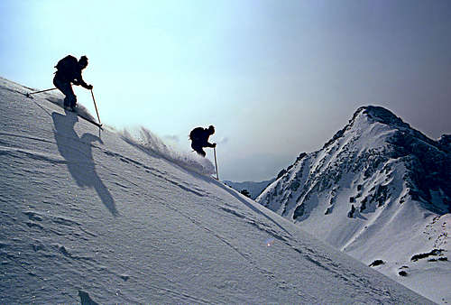
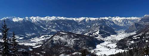
They all rise in the high chain NW of the plateau and have their own SummitPost pages or are described in detail on the pages of neighbouring mountains. Tosc, Veliki Draški vrh, Mali Draški vrh, Viševnik and Debela peč are very popular hiking goals. All except Viševnik have also high rock walls, offering nice and demanding climbs. All of them and some other more gentle summits are also popular goals of tour skiing. Other outdoors activities on mountains are possible as well. The summer routes and ski tours are described on the specific mountain and route pages. But also the map-guidebook on the left gives you overview and in short also all those descriptions. Explore the mountains one by one and learn all about them! Red are officially marked trails, brown are non-marked (trails and pathless routes), blue are ski tours (up to medium difficulty). (The range on the NE is Mežaklja and is not a part of Pokljuka region.) Here are the most important summits: Tosc, 2273 m, |
What Else To Do There
|
|
|
In addition to mountain hiking, climbing and skiing, the area of Pokljuka is very suitable also for the following:
- Hiking in general. It's not only mountain peaks. It's also gorges/canyons, nice woods, beautiful nature, panoramic points, and more. If you are up to mushroom picking, be aware tha 2 kg is the upper allowed limit.
- Cross country skiing - the tracks around Rudno polje are of the highest quality (and payable).
- Paragliding (for example from Studor, Galetovec).
- Biking by many forest roads, doing also considerable heigth differences.
- Cave exploring and canyoning is not so popular here.
Non-mountain Landmarks
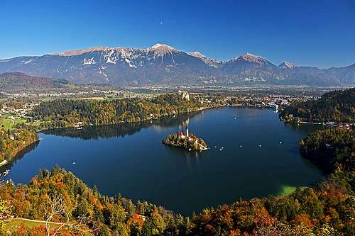
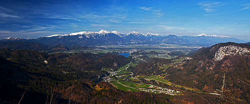
| Bled lake. It's the most famous tourist resort in Slovenia. In the middle of a beautiful glacial lake there's an island with a chursh, on the top of a sheer cliff above the very coast there's an old castle, in the distance are high mountains. |
|
|
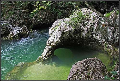
| Pokljuška luknja / Pokljuka gorge. It was formed at the ends of the last ice ages, when waters of melting glaciers were rushing down from Pokljuka plateau. Today, this relic valley is almost dry. It can be easily reached from Krnica, the last village by the Bled - Pokljuka road or from the restaurant on Zatrnik. Through the gorge a secured tourist path is arranged, so we can visit the caves and overcome some spectacular crags. See its course on the online map! |

|

|
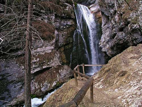
| Waterfalls. Almost all of them are on the creeks, flowing down into Bohinj valley. We can easily visit: Mostnica, Ribnica, Slap pod Iglico, Pirašiški slap. |
|
|
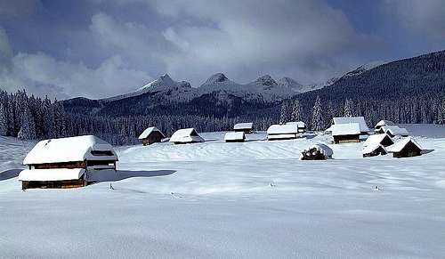
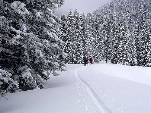
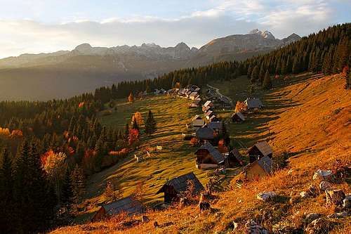
| Pokljuka cross country skiing. Kilometers of nice tracks are arranged through nice forests and over the mountain meadows. Rudno polje is the famous center, hosting every year also world cup events. There's a big parking lot, always reachable, but the use of tracks is payable. Find more information on tourist web sites. |
|
|
|
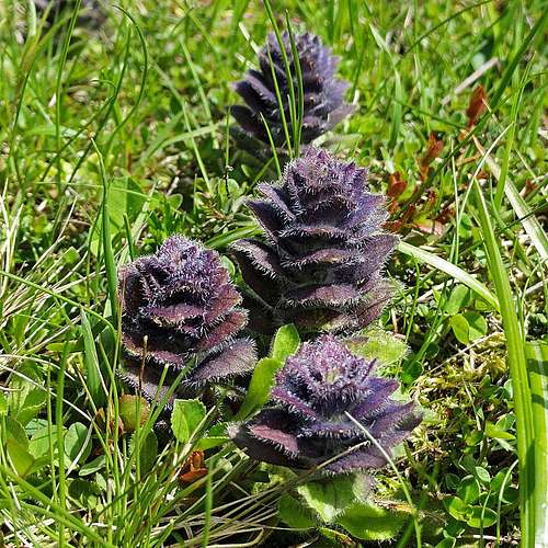
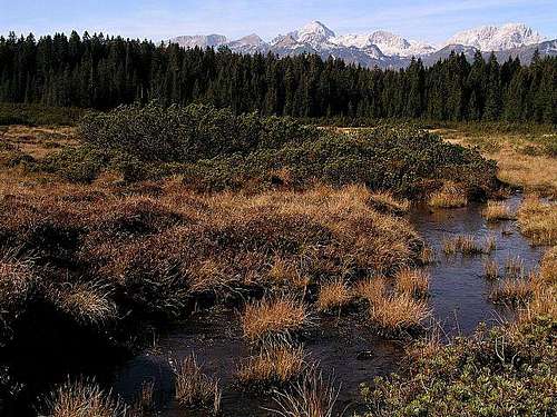
High moors. There are three nice high moors, the southernmost in Europe: Šijec, Veliko Blejsko barje, Barje Goreljek. Supposedly they are the relic from the ice age, but their origin can be also different. The term "high moor" means that there are no streams of fresh water and also no ground water. So rain and melted snow are the only water sources and plants are growing up, while below peat is constantly acumulating. The moors are protected as national values of nature, visit is free of charge. You can enjoy observing specific flora and fauna of wetlands, among them also plants which are feeding with insects. |
|
|
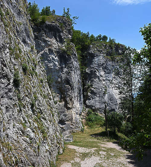
| Crags above Bohinjska Bela. The village is enjoying the neighbourhood of Bled tourist resort, but it is nice itself. Sheer cliffs, formed of paleozoic limestone are rising just behind the houses, through one crack in the cliffs a small waterfall flows, through the other crack we can climb up on top of the cliffs by a series of ladders. The trail continues from there to the Bled lake shore. Climbs are in four sectors/crags, their difficulties vary from 4a to 8c+. |
|
|
| Panoramic points. Great panoramic points are of course all higher summits. They excel especially with views on Triglav and mountains around it, but also in all other directions. But there are also easy to reach view points with wonderful view from the edge of the plateau. Vodnikov razglednik offers you the vest view into Bohinj valley. Galetovec offers you the best view towards Bled and further to the W. Orlov razglednik is less known but has a nice view down towards Bohinjska Bistrica. Check on the online map how to reach them! |
|
|
| Mostnica / Voje valley. It's on the W edge of our area, offering a nice one day hike. There we can enjoy: the view on Devil's bridge, deep, picturesque gorges, lively alpine river, Kropa source, Mostnica waterfall. It's a 2-3 hours walk in one direction, but for visiting landmarks allow some more time. Check on the online map how explore the valley! |
|
|
| Poljčiška / Poglejska cerkev. Well, this cave, carved by a glacier, is nice, but quite degraded, so hardly worth a visit. It's interesting because in neolithic there was a dwelling of stone age people. The place was inhabited thousands of years, because some artefacts were found also from antiquity. | ||
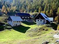
| Alpine meadows. It's too many of them to list them all, but they can be goals of a hike due to nice scenes, views and some still preserved rural architecture. On many high meadows people were living already in the iron age, later transhumance became the basic of rural economy there. |
|
|
Mountain Huts
Official mountain huts of the Slovenian Mountain Organization are:
- Kovinarska koča v Krmi, 870 m.
- Vodnikov dom na Velem polju, 1822 m.
- Voje mountain hut, 692 m.
- Uskovnica mountain hut, 1149 m.
- Blejska koča na Lipanci, 1630 m.
In addition to them there are some private hotels on the plateau of Pokljuka and many more in lower regions and in the surrounding valleys.