
-
 4219 Hits
-
 83.69% Score
-
 17 Votes
|
|
Mountain/Rock |
|---|---|
|
|
61.72650°N / 6.31630°E |
|
|
Sogn og Fjordane |
|
|
Hiking, Scrambling |
|
|
Summer |
|
|
3940 ft / 1201 m |
|
|
Overview
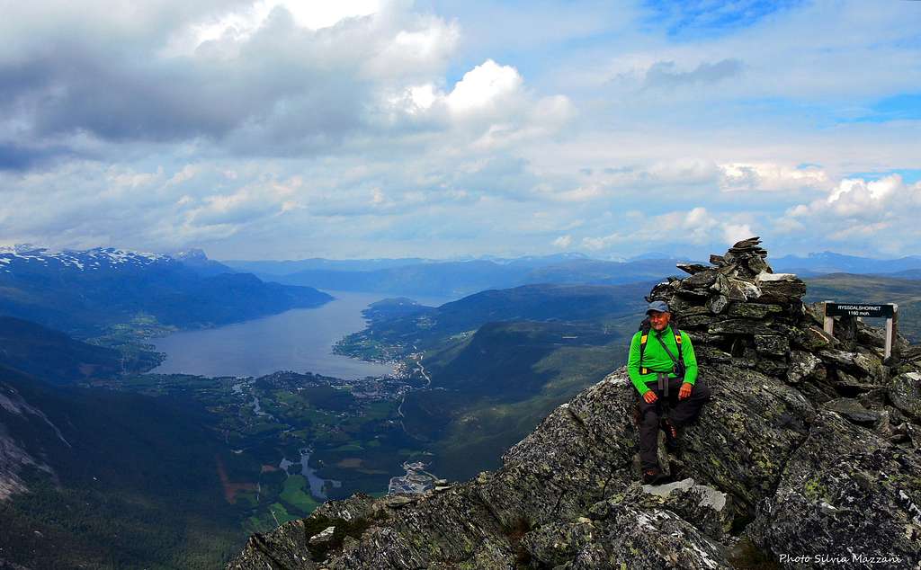
Ryssdalshornet 1201 m
Ryssdalshornet 1201 m is a prominent bicuspidate and pyramid-shaped peak located between the villages of Byrkjelo and Sandane along the E39 Highway in Gloppen municipality, Vestland county, central Norway. It's a charming mountain, surrounded by beautiful mountain lakes, fjords and green valleys, with two summits: a lower Northern top at 1160 meters of altitude and a higher Southern top at 1201 meters.
There are a few routes leading up the summit of Ryssdalshornet, but the far most popular route starts from Ryssdal and approaches the North ridge, along which it reaches the summit.


The Normal route is a pleasant scrambling Class 1 with a short section equipped by fixed ropes classified 2, involving an interesting ascent with spectacular views all around. The panorama from the top is quite spectacular on the vast water-mirror of Breimsvatnet and Gloppe fjorden.
Getting There
The reference point to climb the mountain along the North ridge is the E39 highway between Sandane and Birkjelo, in the Sogn og Fjordane county.


Access
The mountain can be approached both from Byrkijelo and Sandane, in both alternatives take the E39 highway and leave it - turning left (if coming from Byrkijelo) or right (if coming from Sandane) - towards Kandal (signpost). Follow the road about 400 meters reaching a junction, here turn to right (signposts "Ryssdal") and after a bridge turn to left onto an unpaved road leading to a parking lot, where it's situtaed a wide panel explaining the ascent.
Ryssdalshornet North Ridge
Ryssdalshornet North Ridge
Summit Altitude: 1201 m
Difficulty: YDS Class 1, Class 2 (a short section)
Vertical gain: about 1100 m
Exposure: North
This route is a worthwhile hike with some scrambling up the North ridge of Ryssdalshornet to the twin top, which provide a wonderful summit-view over the surrounding mountains and Breimsvatnet water mirror.
Route report
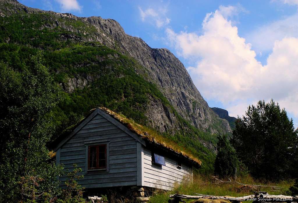
From the parking lot take the forest road closed by a bar 100 meters after the parking lot. Always follow the main forest road, ignoring a branch, getting the nice cabins of the small hamlet of Ryssdalsstøylen 510 m, after about 2 km from the start.


From Ryssdalsstoylen turn sharply to the left taking the path that passes between some cabins and follow it, entering the birch forest. The path begins to rise steeply. After a short stretch on a few granite boulders, it starts an equally short rocky section equipped with some fixed iron ropes.


Just beyond this easy climb, the itinerary exits the woods and after a clear turn to the right it begins to follow the wide Northern crest of the mountain, rising between vegetation and easy rock terrain.

At the end of the ridge the route gets a marked saddle located between the Northern top, just above to the left, home of the summit register, and the Southern top, the highest, farther away to the right. You can choose your personale sequence to climb both the two summits.


The highest top, rising farther from the saddle, is well climbed taking the crest rising to the right of the saddle, following the various elevations to reach the Southern summit, marked by a trigonometric signal. Reversing the route you will come back to the saddle, from where a brief scramble will lead in 5 minutes on the Northern top, where it's placed the summit register.
Descent: reversing the same route
Red Tape
There are not particular restrictions in climbing and hiking.
When to Climb


Best months are June, July, August and September
Accomodation

Campsites in Byrkjelo and Sandane and other different kind of accomodation
Meteo
Meteo Gloppen - Sogn og Fjordane
Norway Weatheronline