
-
 1558 Hits
-
 80.49% Score
-
 12 Votes
|
|
Mountain/Rock |
|---|---|
|
|
59.19370°N / 7.39800°E |
|
|
Agder |
|
|
Hiking, Skiing |
|
|
Summer |
|
|
4521 ft / 1378 m |
|
|
Overview
Svarvarnuten 1378 m
Svarvarnuten 1378 m is a mountain located in the municipality of Valle, Agder county (county = fylke in Norwegian) in the Southern part of Norway. The Agder county borders the counties of Vestfold og Telemark and Rogaland and was established in 2020 by joining the counties of Vest-Agder and Aust-Agder. Svarvarnuten belongs to the Setesdalsheiene mountains, about 7 kilometres West of the village of Valle and about 13 kilometres NW of the village of Rysstad. Svarvarnuten is one of the best panoramic peaks in all directions of Setesdal. There are different routes to summit this interesting mountain. In this page we will describe the shortest one starting from the hamlet of Berg.
Getting There
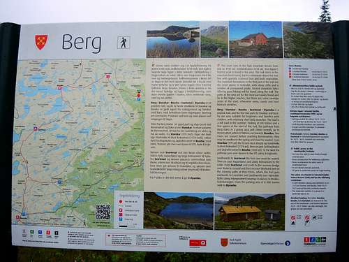
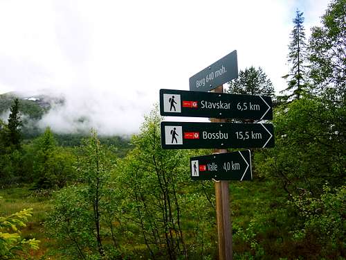
From Rysstad in the main Setesdal valley follow the main road northwards and reach Sandnes, where you leave the Setesdal road and turn left over a bridge. Follow the signs for Berg and after a few kilometers continue on a toll - road, the Hylesdalvegen (in 2018 there were 25 NOK to be paid in the Honesty Box), which leads to Berg, where it is possible to park in a small open space. On the right of the small parking lot it starts a path (signs and info panels) directed to the DNT Stavskardhytta unattended refuge.
Normal Route
Svarvarnuten from Berg route report
Summit altitude: 1378 m
Difficulty: easy
Vertical gain: 1000 m
Starting point: Berg parking lot
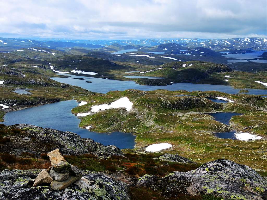
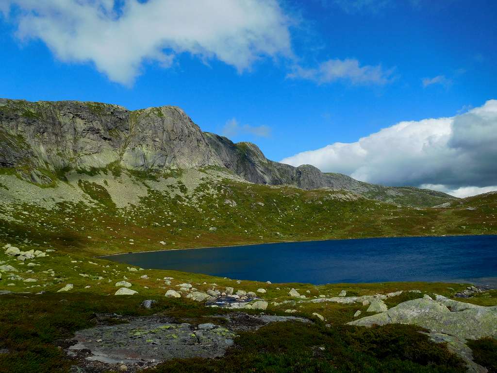
A fine itinerary with magnificent views above a myriad of small lakes and the Setesdalen
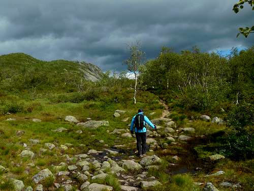
On the right of the small parking area take the path (signs and info panels) directed to the DNT Stavskarhytta unattended cabin. This path climbs briefly to the West in the sparse birch forest, then flattens out continuing to cross the forest (some wooden footbridges).
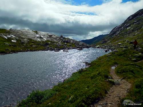
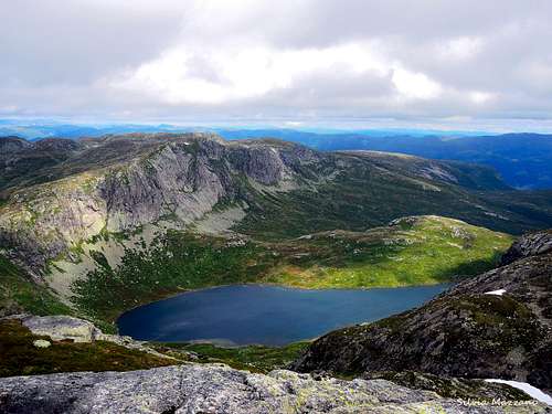
After passing alongside a private cabin, the path starts to rise again to reach the shore of the magnificent Rennevatnet lake, which runs along the left side of the valley enclosed by rocky walls.
On the right stands the beautiful Tverrfjellet with an attractive rocky wall, while our destination, the Svarvarnuten, closes the valley on the left and dominates the Stavskarhytta, the unattended cabin which is reached shortly after the end of the lake.
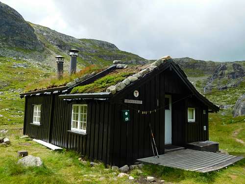
From the refuge the path, which is a T marked trail, continues in the direction of the Bossbu cabin. We take this path, but at a certain point, before it goes up to a pass, at a not very obvious crossroads, marked with an arrow engraved on a stone, we must ignore the main path and turn left onto a track marked with some stone cairns.
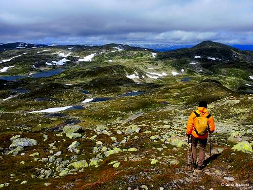
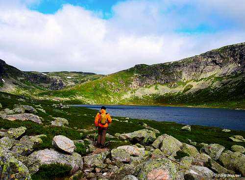
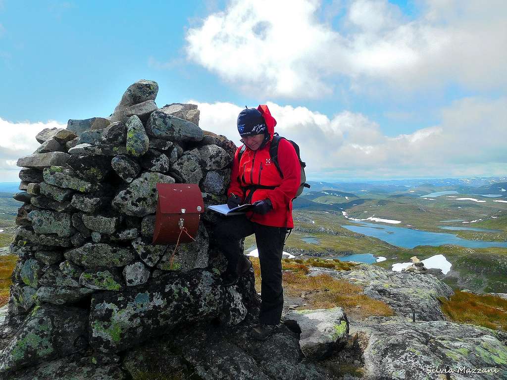
This track, once taken, is well worn and rises to reach a large ledge from which you gain a wide ridge with a breathtaking view of several lakes and ponds. Following this ridge you go up to the panoramic summit with a large cairn and the summit box.
The panorama is wide with superb views in all directions, as to the East to Gaustatoppen or to the west to Urdalsnuten. In the North direction you can see the Southernmost mountains of the Hardangervidda plateau. An old legend says that when a boy sleeps on the top of Svarvarnuten, he will dream of the girl he is going to marry.
Other routes
There is another definitely longer and demanding itinerary starting from Brokke. Connecting it with the itinerary described in the previous point you get a long magnificent ring of 28 km.
Red Tape
There are no permits required. The road to the parking lot in Berg is a toll-road (25 NOK to be paid in the Honesty Box in 2019).
When to Climb
Hiking: summertime
Ski-mountaineering: February to Mid April
Where to stay
Different possibilities of acomodation in Setesdal.