A quick hike to Gannett Peak, by Joseph Bullough and Matt Van Horn
Photos by Jacob Moon
![Wildflowers in Titcomb Basin]() Early morning in Titcomb Basin
Early morning in Titcomb Basin
The Team
Joseph Bullough
Jake Moon
Matt Van Horn
Scott WesemannPlanning
by Joseph Bullough
![Our motel for a few hours (strictly platonic)]() Motel at Pinedale
Motel at Pinedale
I scheduled this trip back in late spring / early summer, trying to pick a time when I thought the mosquitos would be ebbing, yet there would still be enough of a snowbridge over the bergschrund to make the crossing a non-issue. This worked out quite well, with only a few mosquitos in Titcomb Basin and a healthy snowbridge at the bergschrund. The initial group size of six shrank only slightly to four in the final week of planning, and with a good looking forecast the event was on.
Travel Day
by Joseph Bullough
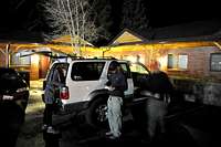
![Checkout at midnight]() Loading up at midnight
Loading up at midnight
We met at my house around noon on Friday 8/6 for the drive to Pinedale Wyoming. The other three hikers were Jake Moon, Matt Van Horn, and Scott Wesemann. Scott had 2 previous Gannett summits under his belt, and I had one, but for Jake and Matt it would be a first time on Gannett.
![Signing in at Elkhart TH]() Signing in at Elkhart TH
Signing in at Elkhart TH With Jake behind the wheel we made short work of the drive to Pinedale Wyoming, arriving around 4:30 pm.
We secured a motel room, then had Subway Sandwiches for dinner. Back in our small motel room Jake and I selected sleeping spots on the floor, while Matt and Scott chose the bed, utilizing the king size to maximize separation distance. We settled on an 11:30 wake up time, and turned in around 7:00 pm for a short night of sleep.
No one managed much sleep, and it was somewhat of a relief to get up and get the day under way at 11:30. We packed up our gear, then made the short drive to the trailhead. A few more minor preparations, then we were off up the dark trail at 12:35 am.
The Hike Up
by Joseph Bullough
Matt began with a blistering pace which I didn't think I could keep up for too long. Fortunately he soon eased up a bit and we settled into a brisk but comfortable pace. A brief rainstorm the "night before" resulted in a lot of trail puddles to be dodged, but other than that the night was uneventful. Approximately 3 hours into the hike we arrived at Seneca Lake, where we stopped briefly to place a cache of unneeded items.
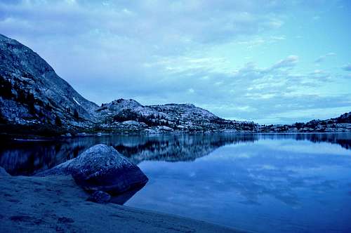
![Blue Morning at Island Lake]() Sandy beach at Island Lake
Sandy beach at Island Lake![Indian Creek crossing]() Approaching Indian Creek crossing
Approaching Indian Creek crossing
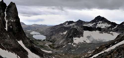
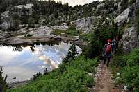
The first light of the day began to make its appearance as we rounded the south shore of Island Lake, and this continued into a beautiful though somewhat cloudy sunrise as we proceeded into Titcomb Basin.
![First view of Titcomb Basin]() First full view of Titcomb Basin
First full view of Titcomb BasinNear the north end of Upper Titcomb Lake we took a break to purify water for the climb to the summit.
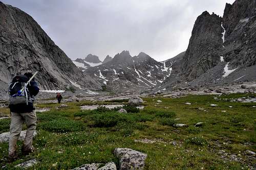
![Hiking toward Bonney Pass]() Toward Bonney Pass
Toward Bonney Pass
Soon we were gaining elevation rapidly as we began the increasingly steep climb up to Bonney Pass. The air became cooler and a stiff breeze began blowing at our backs.
![Hike to Bonney Pass]() Climbing to Bonney Pass
Climbing to Bonney Pass I moved over to the right in a mostly successful effort to stay on rock rather than snow. I noticed that Matt was now moving more slowly, and I began to wonder if he would be able to continue to the summit.
![Mid-morning view of Gannett from Bonney Pass]() Classic view of Gannett Peak
Classic view of Gannett Peak
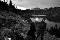
Jake and I arrived at Bonney Pass first at around 10:00 am, and we moved a short distance onto the north slopes to escape the wind and get our first good view of Gannett. Jake expressed concern over our pace and that we might not make the summit, so I suggested setting a 2:00 pm turnaround time. This would give us a solid 4 hours to make the summit. We would obviously be hiking out in the dark, but we had no other plans so continuing to the summit seemed the logical idea.
A few minutes later Matt arrived on Bonney Pass, but still no Scott, which surprised me since Scott had been moving so well down below. About 10 minutes later Scott showed up and voiced his concern that he was moving very slowly and starting to feel the effects of altitude. Jake and I were becoming chilled and began moving down Bonney Pass towards Gannett. Scott made his decision not to continue, and after wavering a bit Matt made the decision to continue.
![Scott at Bonney Pass]() This was as far as Scott went. We met up with him some 7 hours later for the hike out.
This was as far as Scott went. We met up with him some 7 hours later for the hike out.
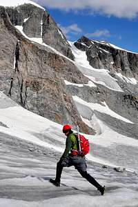
A short distance down the slope, unknown to us at the time, one of Matt's crampons detached from his pack. Although we found the crampon on the return up to Bonney Pass, the end result was that Matt made the entire climb without the use of crampons.
![Joe on Dinwoody glacier]() Joe crossing Dinwoody glacier
Joe crossing Dinwoody glacier![Matt walking above the moat]() Matt on crest of the moat wall
Matt on crest of the moat wall
After making the descent from Bonney Pass, we began the slow climb back up the Gooseneck Glacier.
The snowbridge over the bergschrund was very stout and a non-issue, and we finally trudged onto the summit at 1:01 pm. Our ascent time of 12:26 was not a blazing time, but respectable in our minds nonetheless.
![Snowbridge over bergschrund]() Matt crossing the bergschrund
Matt crossing the bergschrund![Gannett summit ridge]() Gannett Peak summit ridge
Gannett Peak summit ridgeThe Summit
by Matt Van Horn
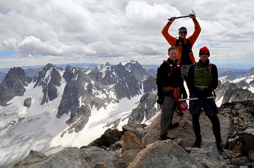
I was surprised at how busy the summit was. When Joe, Jake and and I moved along the summit ridge, we passed 3 climbers roped together who had come up another route. Not far behind us were several climbers, including 3 ultra-marathoners who started the same trail we did some 3 hours after us, making way toward Wyoming's highest point.
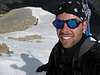
![On the summit of Gannett Peak]() Summit success! Bonney Pass behind and to our right.
Summit success! Bonney Pass behind and to our right.
The view from Gannett Peak lives up to its reputation. While shoving food into my mouth I glanced around at the mountains and glaciers now at my feet. Someone asked if the sky was clear enough to see the Tetons and yes, wow! there they were, standing tall in the distance.
The Descent
by Matt Van Horn
Although weather was very nice at the summit, we made our stay deliberately short. With 20-plus miles between us and our vehicle, we needed to get moving. We retraced our route down the snow-covered ridge, mixing in some rock scrambling when appropriate. Back down the col toward the bergschrund the downclimbing was easy forward-facing steps. At one point I lost sight of Joe and Jake as they moved on while I had a bathroom break.
![Weather on Dinwoody glacier]() Summer storm over Bonney Pass
Summer storm over Bonney Pass
About this time dreaded thunder pounded down from above and echoed off the massive surrounding granite walls of the glacier valleys. Rain and light snow fell and more dreaded were the lightning flashes that now became common for the next 45 minutes as the three of us, Joe and Jake somewhat lower on the Gooseneck Ridge, and I, made our way as quickly as possible to the glacier to start our climb back toward Bonney Pass. For a time I was alone, not knowing where the others were, so when I saw three human figures crossing the dirty ice toward the moat crest, I assumed they were my teammates. I yelled and waved and one waved back, but when I finally caught up, it was two women and another man. I had somehow passed Joe and Jake and soon could see them approaching and where reunited to cross the glacier. They had taken refuge under some rocks to wait out the storm, which explains how I got ahead of them. Fortunately the storm broke and we climbed to Bonney Pass without threat of lightning and rain hanging over us. Being in the lead, I retraced our route from the pass hoping to find my lost crampons and was delighted to find it waiting for me on a rock, no doubt laid there by one of the thoughtful climbers ahead of us. The climb back up and over Bonney Pass was uneventful. A final look at the mountain and we plunged back down toward upper Titcomb basin.
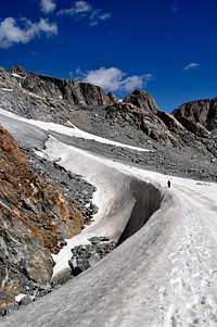
![Titcomb Basin from Bonney Pass]() A view of Titcomb basin from high on Bonney Pass
A view of Titcomb basin from high on Bonney Pass![Late afternoon hike out from Gannett]() Late afternoon death march
Late afternoon death march![Hiking out past many lakes]() Hiking out past lakes we did not see in the early morning darkness
Hiking out past lakes we did not see in the early morning darkness
At the base of the pass we stopped to refill water, which for me was the last time I needed a refill. The weather held all the way for us as we picked up the trail and marched silently mile after mile past the Titcomb lakes. Occasionally I would wonder what became of Scott and where we would see him again. Somewhere near the lower Titcomb lake a familiar figure sat on a rock looking toward us. "There you guys are!", shouted Scott. None of us answered back. From his view on that rock he described the three of us as "shattered", bowed over with fatigue. He would be right because it was at this point I began to feel the weight of the day piled on me and I became a walking deadman.
![Wasted with 10 miles to go]() 10 miles to go and feeling like hell
10 miles to go and feeling like hell![Lamps lit at dusk]() Lamps lit for another night of hiking
Lamps lit for another night of hiking
I cannot speak for the others except to say we were all deeply tired at that point, and I silently wondered if I would be able to hike for 6 more hours. On the other hand, Scott seemed to be dancing around like a sprite, full of energy. Sure, he had hiked 23 miles into the Winds with a fifteen mile hike ahead of him, but he had a nice 6 hour rest watching the lake and waiting for us to come back from the other side of the pass.
There is not much to report for this portion of the trip except to say that it was nice to see some of the scenery that we had missed in the dark hike in. We set into a slower but steady march toward our trailhead goal as the sun went down. We reached Seneca lake at dusk and lit headlamps once again. I remember the last 4 hours as simply staring at the spotlight at my feet, dodging puddles, rocks and horse poop. "Where the hell is the parking lot? Are we on the right trail? I don't remember this dead tree laying across the trail."
Of course we did reach the end of the trail, thank goodness, and our total trip time was just over 25 hours. I'll call that a day hike of Gannett. After a few stops and a quick nap at the side of the road, Jake drove us home in time to go to church Sunday morning.
Not that any of us went.
Miscellaneous Stats
Hike Times
Ascent - 12:26:18
Summit - 0:12:44
Descent - 12:26:57
Total - 25:05:59
Roundtrip miles - ±44


Comments
Post a Comment