
-
 4096 Hits
-
 79.04% Score
-
 10 Votes
|
|
Mountain/Rock |
|---|---|
|
|
39.02120°N / 105.5289°W |
|
|
Download GPX » View Route on Map |
|
|
Parkx |
|
|
Hiking |
|
|
Spring, Summer, Fall, Winter |
|
|
10380 ft / 3164 m |
|
|
Overview
UN 10380 "The Pulverizer" from the parking area described on this page | 3 Nov 2013
Rank: 2094th highest summit in Colorado
Prominence: 560 feet
USGS Quad: Glentivar
Rank & Prominence: Lists of John
Getting There
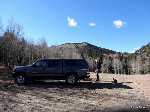
Park here and head west through the trees, avoiding private property | 3 Nov 2013
Route
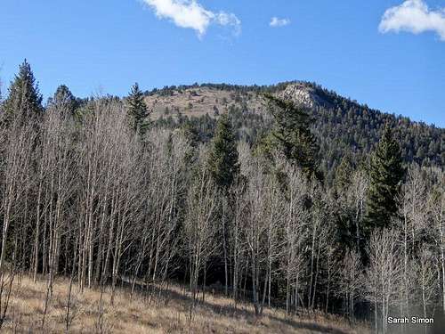
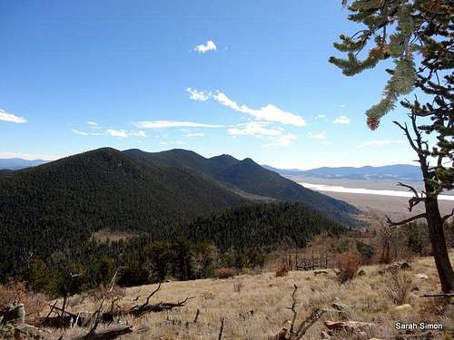
Summit of UN 10380
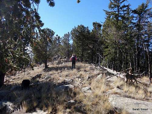
Eastern slopes of "The Pulverizer"
High near the summit
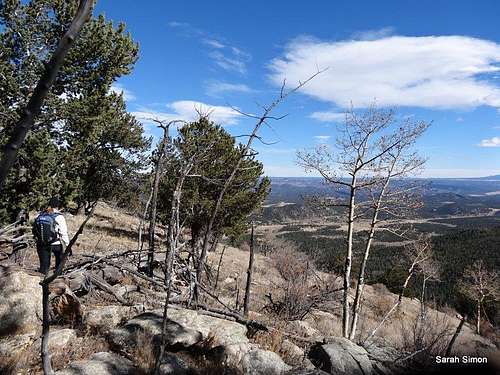
Heading up the eastern slopes
Driving Directions From US Hwy 24 east of Wilkerson Pass
• Head south on Park County 90 (graded dirt).
• Head just 2/10ths of a mile to an un-marked dirt road. (Do not turn onto Pulver Road, which I believe is private.) You may feel at first like you are turning into someone’s rural driveway, but this is a Forest Service road!
o In deep snow or if driving a low-slung vehicle, you may need to park here. Moderate-to-high clearance vehicles will easily reach the upper parking area in dry conditions.
• Follow FS 706, bearing left at junctions, for about 1 ½ miles until it dead-ends in a clearing. Park here.
Hiking Route Details
Roundtrip Distance: 2.4 miles
Elevation Gain: 1000 feet
YDS Class: 2 (off-trail)
Bushwhack Grade: B1+
See attached GPX file for map and elevation profile.
Simply head west from the parking area through the trails toward the summit, avoiding private property by skirting it to the south. Cross a meadow and begin walking more steeply up the southeastern slopes to reach the top.
Red Tape
The summit of “The Pulverizer” and a vast majority of the entire mountain reside within the Pike National Forest. However, there is a lot of private property, specifically residences, to the east and north of the peak. Forest Roads and public land provide all the access you need to reach this summit. Please respect private property, do not use private drives, do not park on private land, watch your vehicle speed through residential areas and be friendly to any locals you may encounter.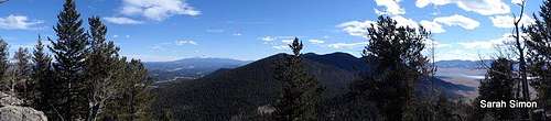
Pulver Mountain and Stoll Mountain from the summit of UN 10380 "The Pulverizer" | 3 Nov 2013
Weather and Seasons
Pulver Mountain and Stoll Mountain
 | In the summer, the area surrounding this peak may get a little hot and dusty, but is still unlikely to be terribly crowded. Fall will bring cooler temperatures and more slender crowds, plus the added bonus of bright golden aspen. This peak would be a delightful winter or spring snowshoe, though the roundtrip distance and overall effort would increase, and finding a safe place to park your vehicle may be a bit more of a challenge in snowseason. |  |
Camping
The National Forest Service has a large selection of campgrounds in and around the Lake George area.| Campground Name | Elevation | Sites | Nightly Rate | Reservations? | Notes |
|---|---|---|---|---|---|
| Blue Mountain | 8,200 ft. | 21 | $12 | Yes | Less than 3 miles as the crow flies from the summit of Blue Mountain near Lake George. |
| Spruce Grove | 8,600 ft. | 27 | $12 | No | Let the gurgling Tarryall Creek sing you to sleep. |
| Twin Eagles | 8,600 ft. | 9 | $8 | No | Must haul or purify drinking water. |
| Happy Meadows | 7,900 ft. | 8 | $12 | No | Situated along the South Platte River. |
| Round Mountain | 8,500 ft. | 16 | $12 | Yes | Drinking water, vault toilet and trash pickup. |
| Springer Gulch | 8,300 ft. | 15 | $12 | Yes | Situated within the Elevenmile Canyon; water, tables, fire grates. |
| Riverside | 8,000 ft. | 19 | $12 | Yes | Situated within Elevenmile Canyon; large grassy meadow with little shade. |