
-
 2161 Hits
-
 81.18% Score
-
 13 Votes
|
|
Mountain/Rock |
|---|---|
|
|
61.85657°N / 5.24604°E |
|
|
Nordfjord |
|
|
Hiking, Trad Climbing, Scrambling |
|
|
Summer |
|
|
2822 ft / 860 m |
|
|
Overview
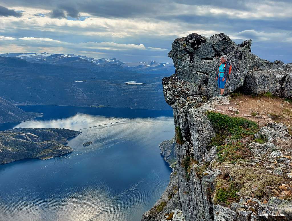
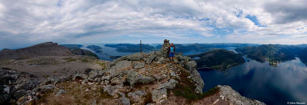
Hornelen 860 m
Hornelen 860 m is the highest sea cliff in Europe, with a spectacular 860 meters drop straight down into the fjord. The mountain is located at the Eastern end of the island of Bremangerlandet along the Frøysjøen strait in the Nordfjord region, Vestland county (Norway). Over the centuries Hornelen has long been used as a landmark for navigation. In ancient times, the mountain was often referred to as Smalsarhorn. Many legends are linked to this mountain and according to some of these it would be a meeting place for witches both on midsummer's eve and on Christmas eve.
The ascent to the summit is an amazing experience and will leave you with indelible memories. There are several trail going to Hornelen, here you will find the description of the two most recommended. You can either start from Hunskår or Berleneset. The two itineraries converge about 1 hour before the summit of the mountain and can be combined by making a loop. The most recommended direction is to start from Hunskår and come back to Berlesenet.
Getting There
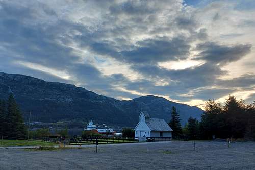
The nearest bigger city is Måløy. From Måløy take the ferry to Oldeide. At Oldeide turn left at the first junction, turn left again at the second junction and drive along the fjord until the road ends at Hunskår (about 7,5 km from Måløy). Parking can be found close to a white chapel at the starting point. Hunskår is situated nearby to the hamlets Klubben and Hamnen.
Route from Hunskår
Hornelen from Hunskår
Summit altitude: 860 m
Difficulty: EE
Vertical gain: 860 meters
Starting point: end of the road at Hunskår
A wonderful and challenging hike!
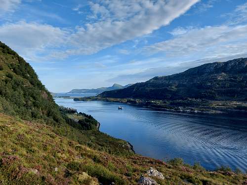
It is a challenging ascent and hikers should be experienced. Start at the end of the road at Hunskar near a white church. A path marked with T marks in red and cairns starts next to the church in the East direction (the same direction as the road to Hunskår). You pass near a shelter on the right and then continue for a flat stretch, followed by a stone stairway. When it gets steeper, exit to the left. The trail makes a turn towards southwest. The trail rise up steeply on rocky and vegetated ground with some wet stretches, reaching a wide saddle. The view to Skatestraumen, Rugsund and Maloy is great. Further up you will reach a lake where it appears a magic sight over a beautiful rock wall. Further there is a part of the trail skirting some smaller ponds and characterized by more rocky terrain.
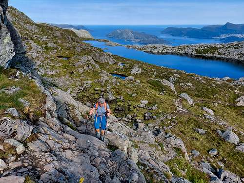
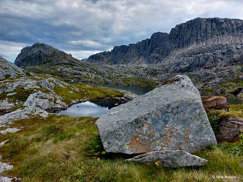
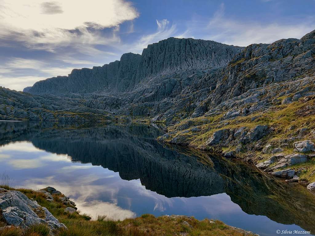
A light descent leads to another lake, then a stretch uphill leads to a wide saddle near the start of a broad rocky plateau. Cross the broad plateau walking on characteristic rock plates following the cairns (about 1 km of walking). The environment is exceptional.
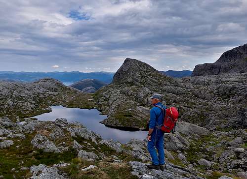
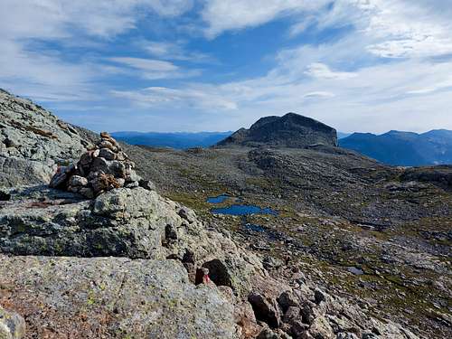
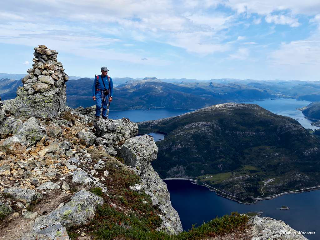
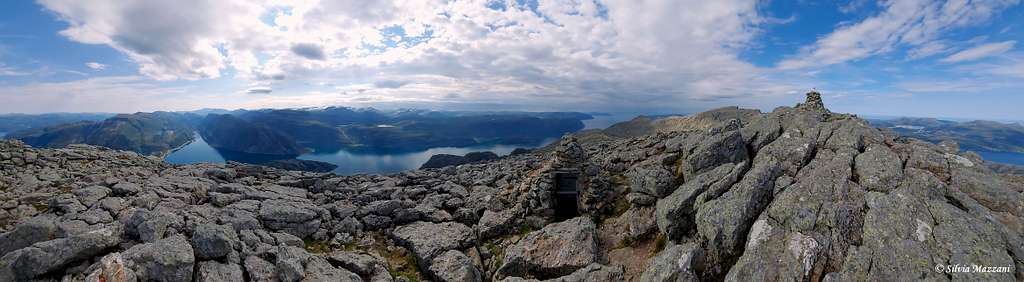
At the end of the plateau we reach the upper edge of a vast rocky walley, the Hornelsdalen, located between Svartevassegga and Hornelen, that can be glimpsed in the distance in the right direction. Here you then descend obliquely to the left on rocky terrain to reach the bottom of the valley, reaching a lake and the confluence with the itinerary coming from Berleneset. The path does not run directly towards Hornelen, but takes a detour to the North before it turns South. Cross the valley and walk up, then oblique to the right in the direction of the summit and starting to climb a steep slope of large boulders. Thus you exit out on the upper shelf, from where you head right to pass a stretch of rocks with some easy passages leading to the summit cairn.
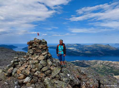
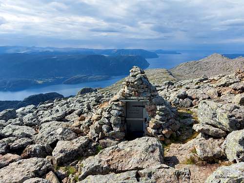
The highest point is a few meters away from the summit cairn. Enjoy the fantastic view over the Nordfjord! You will get a great overview of the varied and scenic landscape in FjordKysten as deep fjords, majestic mountains and small islands far out at sea. There is a small stone cabin at the top, where you will find also the Norwegian flag. The North top of Hornelen is 140 m Northeast of the main summit. A recommendation: don't forget to reach also the North summit because it is from here that you can enjoy the most exciting panorama. The high and spectacular mountain wall is below the North top and from here you can enjoy the most exposed views all around.
Descent: retrace the same route or for a less steep and easier descent with a slightly different view, you can descend to Berleneset taking the SW direction at the crossroad in Hornelsdalen. From thew top follow the same route as the one you came up, reaching the fork where the trail divides in two. The path to Berleneset ends at the eastern side of Berlepollen.
Route from Berleneset
Hornelen from Berleneset
Summit altitude: 860 m
Difficulty: EE
Vertical gain: 860 meters
Starting point: Lisete at Berleneset
This route is a bit longer than the one from Hunskar, but it's easier. However hiking experience is necessary. The hike will give you a fantastic nature experience with a great view! You start out from Lisete at Berleneset. The trail is rather steep in the beginning, but gets flatter after a while. It's in good condition and sign marked. On the last part of the trail you will meet the trail coming from Hunskar.
Red Tape
No fees no permits required
When to Climb
The best period goes from May to October
Accomodation
Måløy offers different kinds of accomodation.