
-
 11568 Hits
-
 85.36% Score
-
 20 Votes
|
|
Mountain/Rock |
|---|---|
|
|
45.95330°N / 9.51690°E |
|
|
Hiking, Trad Climbing, Sport Climbing, Via Ferrata |
|
|
Spring, Summer, Fall, Winter |
|
|
7089 ft / 2161 m |
|
|
Overview
In the Prealpi Lombarde range, North of Resegone and exactly to the East of Grigna Settentrionale, there is a wild and low frequented group that can be understood (I think) only using a map and giving a look to panoramic pics ...it covers a very wide area and has a complex structure with many ridges, summits and routes for hikers.
It is called Campelli
Its boundaries are: to the west the Valsassina (north of Colle del Balisio), to the south the road to Morterone, to the east the Val Brembana and to the North the Valtorta.

Inside this group the main ridge is the one that contains the Zuccone di Campelli and is composed by :
on this ridge main summits are the Zucco di Pesciola (2092m) and an unnamed hub (2151m)
this ridge (cresta Ongania) divides two of the most popular ski areas (in winter) of Lombardia : Piani di Bobbio to the north and Piani di Artavaggio to the south.
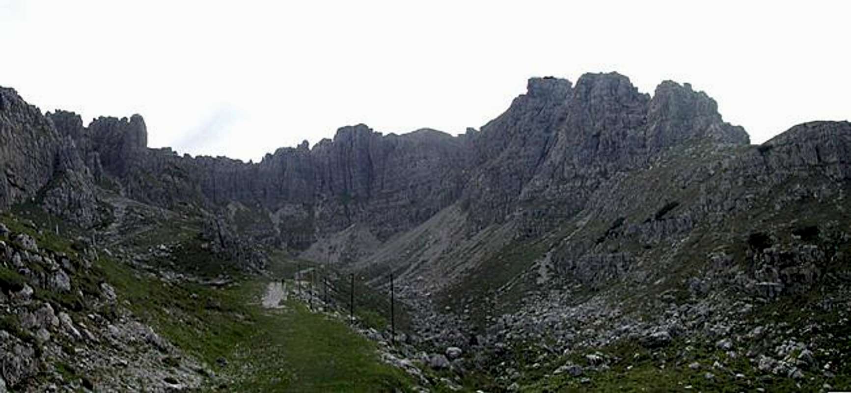
on this ridge the main summits are Zuccone di Campelli and Dente di Campelli (2161m)
It is not easy to speak about Zuccone Campelli ...
When you talk about Zuccone Campelli to climbers they, almost at once, some think to Cresta Ongania that used to be one of the first complete climber experiences they made during the rock-climbing course, some others wry their faces .. out of fashion !
Very few literature about this mountain, summits are often mixed up ... : Zucco di Pesciola, Zuccone Campelli, il Dente, Zucco Barbisino, are the only normally known.
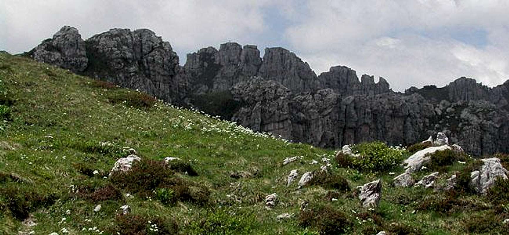
In Lombardia, when you talk about Piani di Bobbio skiers think about a fast to reach, easy and crowded ski area, good only for beginners ... but in spring, summer and fall the whole area (with the exception of the sites closer to Rifuges) is almost desert: only one (very fine) path for hikers : the "Anello di Campelli" (Campelli's ring), but in many points it is not marked or runs through meadows where you must find the track .. so this area is full of wild animals : there is a real "marmot town" in the meadows and slopes descending toward Piani di Artavaggio, vipers (berus) are easy to meet while walking, flora is fantastic
 |  |  |  |
Getting There
3 main accessesFrom Milano - ss 36 (Spluga) till Lecco (at the bottom of the east branch of Como lake) - then till Colle di Balisio, cross it and go along the road about 1 km till a you see indications (on the right) Piani di Bobbio - funivia - wide parking area at the starting point of the cable car that brings to the Piani di Bobbio (2 hours on feet along a wide white road) - cable car is on during the ski season and starting from the middle of june
From Milano - ss 36 (Spluga) till Lecco (at the bottom of the east branch of Como lake) - then till Colle di Balisio, follow (on the right) a road toward Moggio (cable car to Piani di Artavaggio)
Follow the road of Val Brembana passing Piazza Brembana, toward Olmo, just few before Olmo, at Cugno di Sotto, starts the road to Valtorta : here a road (don't know if open to private cars) leads directly to Piani di Bobbio

Routes overview
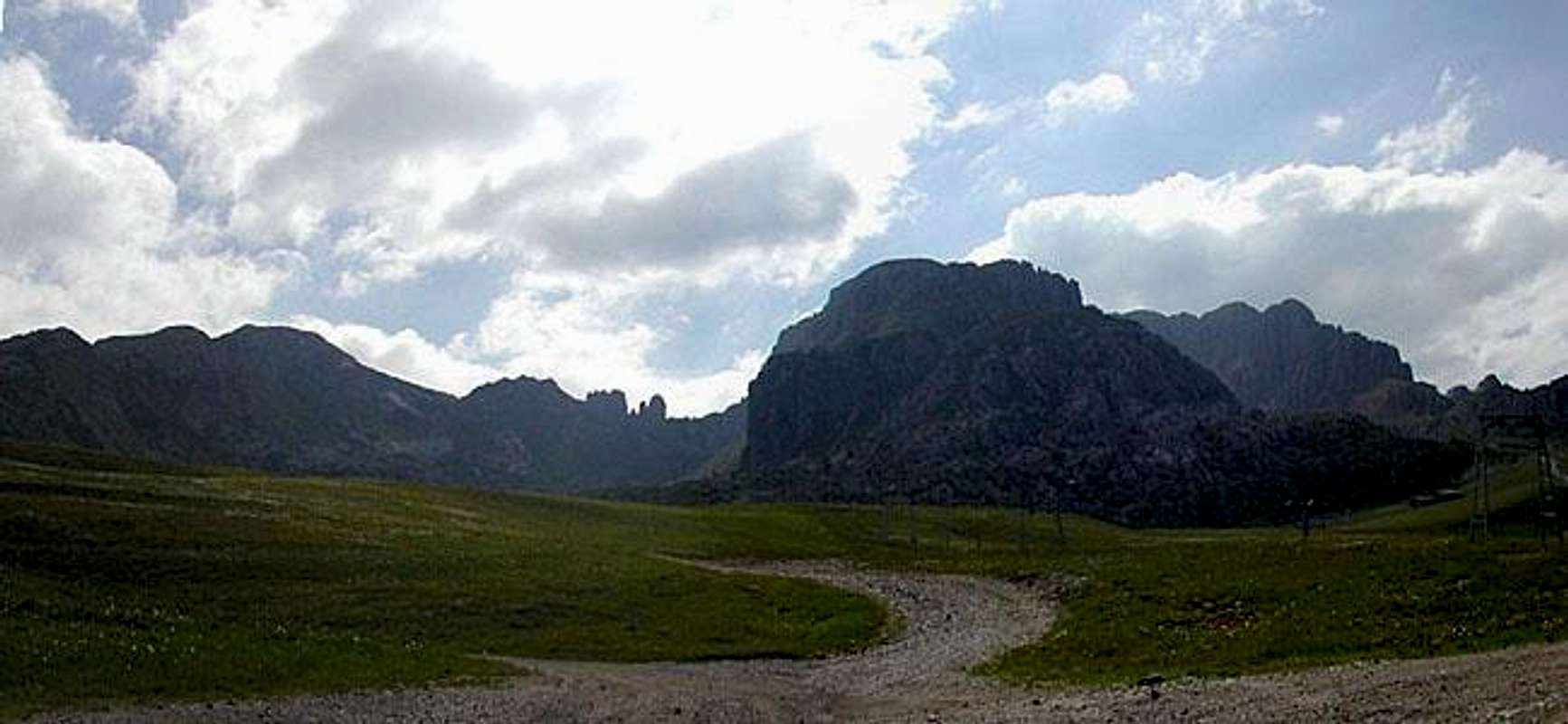
from Piani di Artavaggio an easy path leads to Bocchetta di Campelli then going toward west, along meadows and grassy ridge you can get the summit of the hub 2151m. Here you must follow the ridge toward north, a break on the ridge, just before the main summit is aided with some fixed chains that allow to pass an exposed rocky pass
from Piani di Bobbio along the Vallone dei Camosci till the head of the valley, on the right side 2 channels (fine with good snow, horrible without snow) allow to get the summit ridge that must be followed along a (yellow) marked path
from Piani di Bobbio along the "sentiero degli Stradini" (a path that runs along the south slopes coming down from the main ridge) till the Bocchetta di Campelli and then along the East ridge
from Piani di Bobbio along the Vallone dei Camosci till the head of the valley, on the left side a marked path brings to a "ferrata" leading to the summit ridge
prom Piani di Bobbio along the Sentiero degli Stradini, you can get the starting point of the "ferrata Rebuzzini" that along a spur leads you to the main ridge near the summit of Zucco di Pesciola
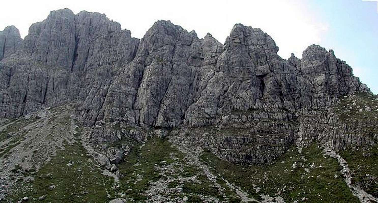
from Piani di Bobbio follow the path to Bocchetta di Pesciola to gain the starting point of the W ridge (Cresta Ongania) that offers a fine (PDsup) rock climbing with difficulty up to 3° (UIAA)
from Vallone dei Camosci
- fine routes on the N wall of Zucco di Pesciola (200 m - AD - AD sup)
- fine routes on the W wall of Zuccone di Campelli (150m AD - D - there is one route opened by Comici)
- difficult routes on the S wall of Zucco Barbisino (120m) and a medium difficulty route that crosses the 2 small pinnacles : "Denti"
 |  |  |  |  |
When To Climb
All year long,avoid sunny summer days and winter season (danger of skiers on your feet)
Camping
no need !accomodations in the Refuges of Piani di Bobbio or Piani di Artavaggio
Red Tape
No fees, no permits requiredPanorama
Zuccone di Campelli, due to his position, is a very fine panoramic point, if weather allows it, of course :)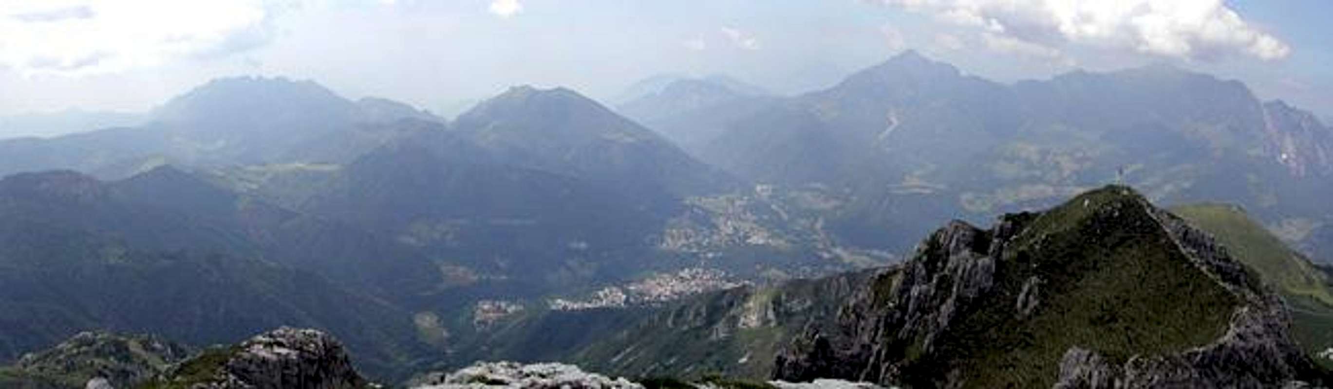
 |  |  |  |
Modern rock routes
near the starting point on the cable car a path, on the left, leads you to the spurs of Zucco dell'Angelone.Here you can find a lot of modern routes.
give a look
Here a small list of routes (difficulties)
Bombay (6+) - Isole (5+) - Marachek (5+) - Sole, Fiabe e Freud (6) - Via del Verme (5-) - Fuga dal cortile (5c ) - Accomodamenti mentali (5b) - La risata triste (4a ) - Karenina (4) - Via del golosastro (4-) - Le forme brevi (4b ) - Le Cirque Immaginaire (6) - Lumache di vetro (5c ) - Foto di gruppo con signorine (5+) - Zero Watt (6+) - Ortofresco (5b) - Il Pilastro del Vampiro (V+) - Cavallo Bolso (5-) - Il nostro maestro e' fuori di testa (6) - Paure Gauntiche (4a) - Microcefalus (4b) - Anabasi- (5c) - Condorpass (5b) - Gli schiavi della pietra (5c) - Manomorta tramviaria (4c) - Buco Profondo - Sassolini Finti (6) - Frigidus (5b) - Torridus (5c) - Maga Magò (6a) - C'est plus facile (6a) - Gesù Frisco Liberaci (4b) - Skizo (5b) - Senza Nome (5b) - NBC (V+) - Il Muro di Velluto (5+) - I ritmi di Onan (6a) - Cotonati i capelli (5c, p. 6a+) - Cicino se ne va (4c) - L'enfant prodige (5a) - Merry Christmas (5b) - Canna primordiale (5c) - Yoyomundi (3) - New Joe (4c) - Mystic Man (5a) - Karol Wojtyla (5b) - Autunno (4a) - Notte (5a) - Strapiombo (5a) - Paula Ridens (5a) - La Lama (5a)