Intro
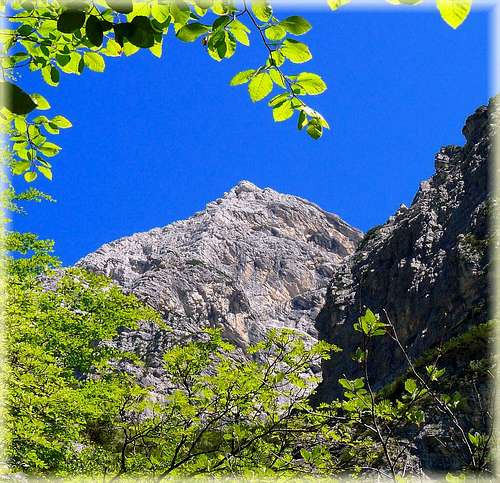
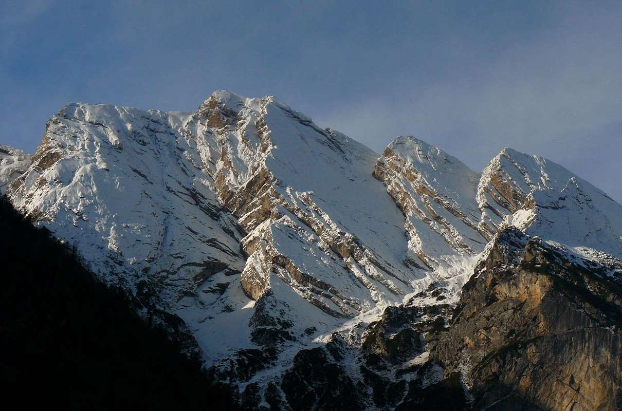
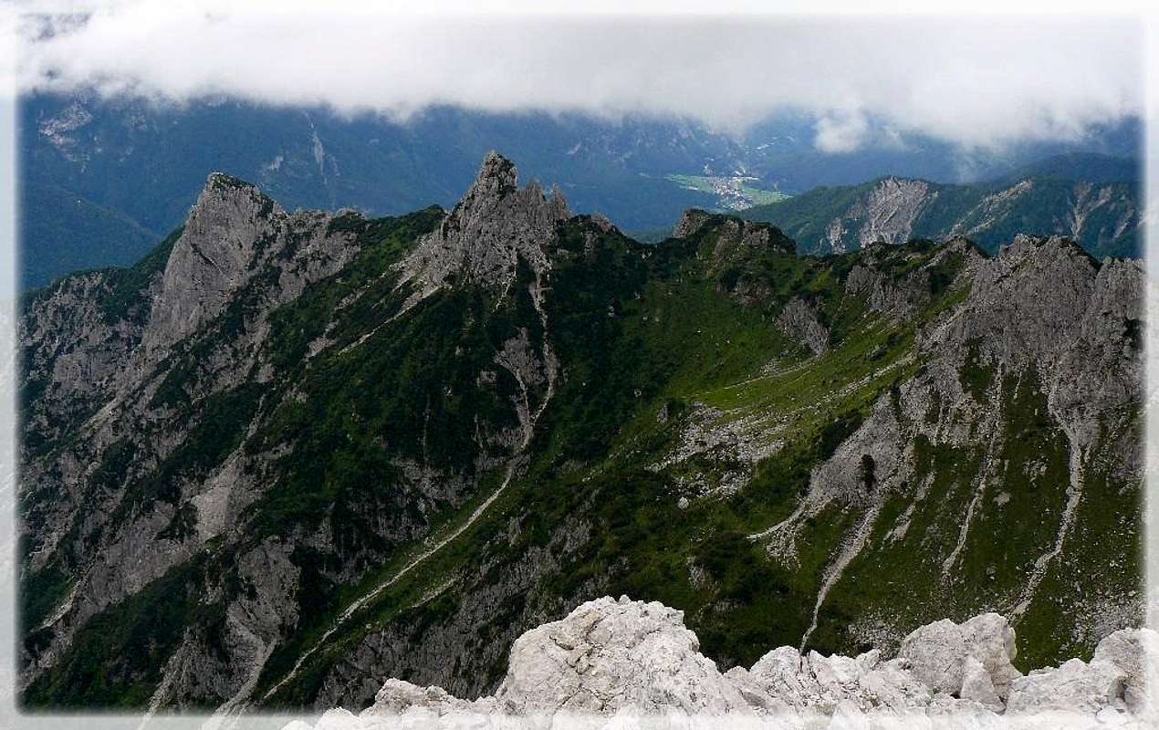
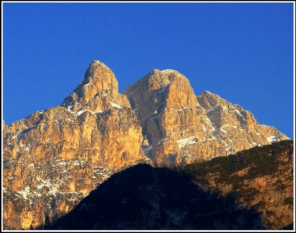
![Cima dei Cantoni]() Cima dei Cantoni
Cima dei CantoniAs a broad mountain area we divided Carnic Alps on the Carnic Main Ridge (western and eastern part), Southern Carnic Alps (southern just because they are south of the main ridge, otherwise my proposal would be to name them Central Carnic Alps) and Carnic Pre-Alps. The latter have two distinct parts - the bigger northern part and the smaller southern part (Monte Cavallo - Col Nudo group). I must say it again: It is very unproper to call the whole area south of Tagliamento river Prealpi. Its summits are high and the whole area is a very desirable mountaineering destination. But on the other hand the naming is understandable. Italian naming uses the name Prealpi for mountains in the whole southern part of the big arc of Alpes. So, let's stick to the official naming.
Overview
The Nature Of Mountains
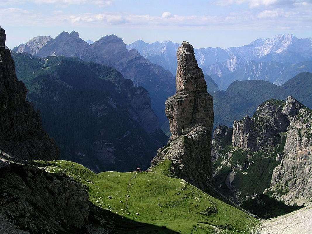
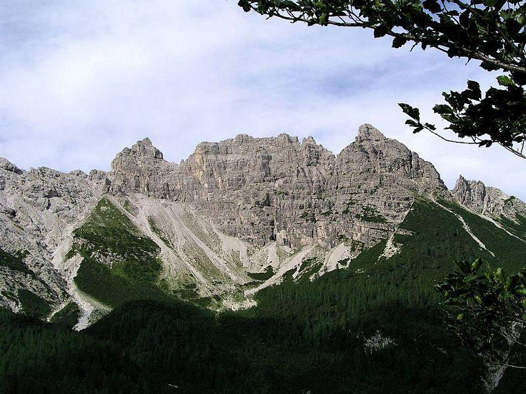
![Campanile di Val Montanaia]() Campanile di Val Montanaia - the landmark of Dolomiti Friulane
Campanile di Val Montanaia - the landmark of Dolomiti Friulane![monte duranno]() Monte Duranno
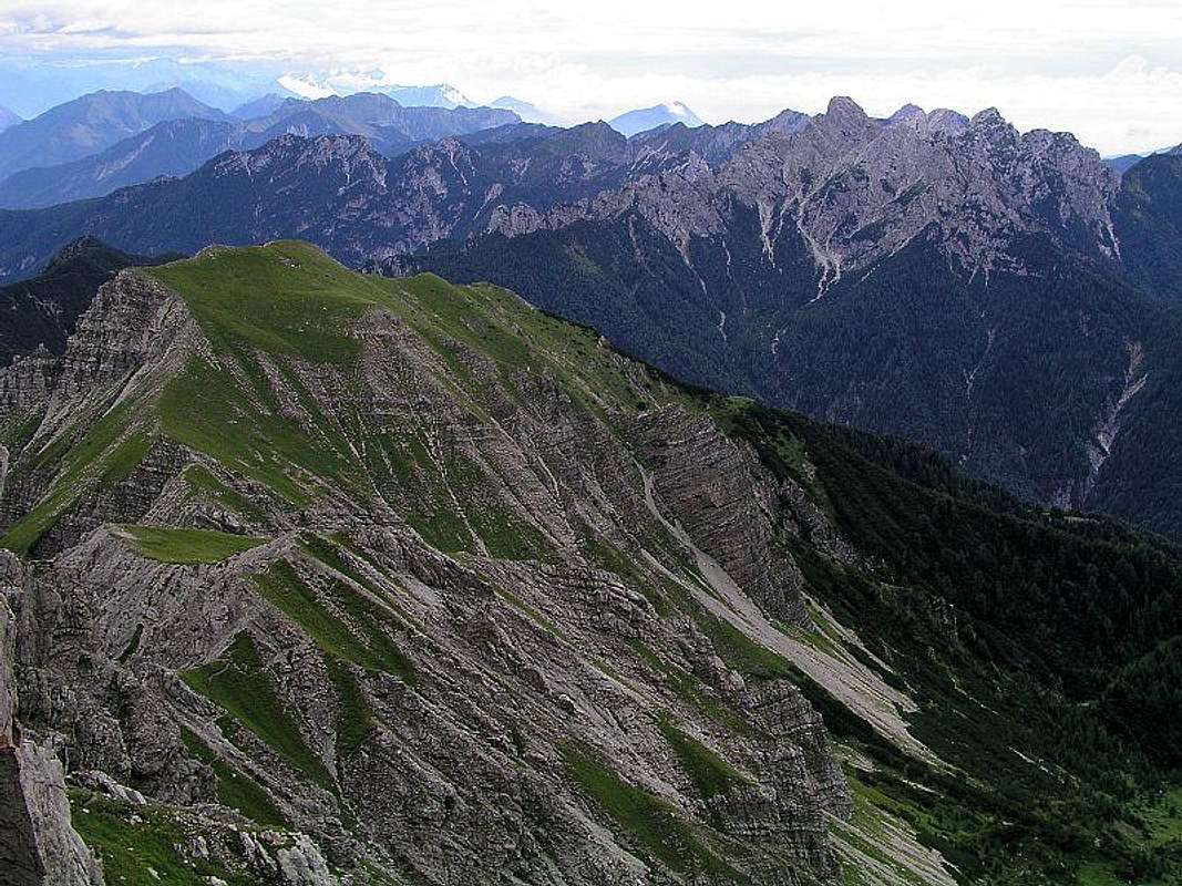
Monte DurannoIn the Eastern Alps the southern chain is mostly made of limestone, dolomite and similar non-metamorphous rock structures. So, also the Carnic Pre-Alps are similar to the Dolomites to their west and the Julian Alps on their east. More specifically - their very western mountain chain (Cima dei Preti - Monfalcon - Cridola) is a true Dolomites world. Wild, sharp towers, as beautiful as any other area in the 'true Dolomites'. That's why this group is also dubbed as Dolomiti Friulane or Dolomites beyond Piave (Dolomiti d'oltre Piave). Very similar to the area, a bit north-east of it, the chain above Val Pesarina is often dubbed as Dolomiti Pesarini. To attract tourists today almost every rock is called 'dolomiti'. But the Monfalcon area justifies this name completely. East of Val Cimoliana Carnic Pre-Alps are more like the rest of Carnic Alps. The first groups: Monte Pramaggiore, Monte Turlon and Monte Cornaget are still densely packed with summits. More towards the East the summits are more and more stand-alone or in separate mountain chains. The whole area of Carnic Pre-Alps is very lonesome, on many places this is a true mountain wilderness. I'm sure there are still many worthwhile places where no man hasn put its foot yet. All the highest summits are great panoramic points (though they are are hard to reach), the lower parts of mountains are covered with dense vegetation. In the valleys crystal clear rivers flow, their riverbeds are often long and wide white scree fields, seen from the summits almost like glacier flows. Above the valleys there are many green meadows. On these mountain pastures old and picturesque shepherds huts are standing, some of them today are converted into mountaineers bivouacs. All the lakes in the group are in or close to Tramontina valley and are of artificial origin.
![Monfalconi Group]() Dolomiti Friulane - Monfalcon group, one of the most beautiful areas of Carnic Pre-Alps
Dolomiti Friulane - Monfalcon group, one of the most beautiful areas of Carnic Pre-AlpsParco Naturale Dolomiti Friulane
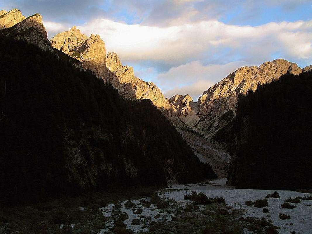
![Evening in Canale di Meduna]() In Canale di Meduna
In Canale di Meduna![Val Postegae]() In Val Postegae
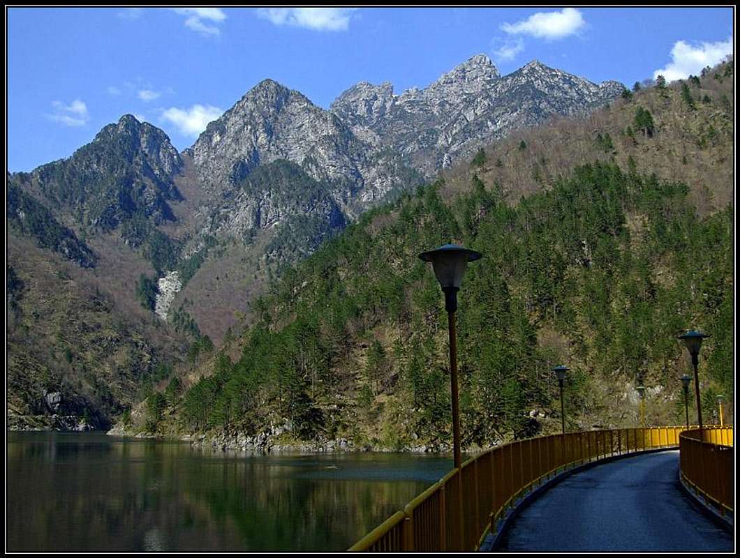
In Val PostegaeIt's a great luck that a very broad area of these mountains is protected as a natural parc. Here is the link to the official page in English: Parco Naturale Regionale delle Dolomiti Friulane. Once there, don't click the link to the parc page, but follow the links to English chapters. Establishing a natural parc here was really a great idea. Yes, the real Dolomites on the other side of the Piave river are great. One of the greatest mountain areas in Europe. But nature is not preserved there. Once and forever it's gone in its original form, with the exception of few areas. So we can only hope that the wilderness of 'Dolomiti Friulane' will be preserved. And, if anything, we can admire how this big area is protected. It stretches from the main crest on the West almost to the valley of Tramonti on the East, and from above the Tagliamento river on the North down to the forehills near Cimolais, Claut and Andreis. The central office of the parc is in Cimolais, info poits are in many other towns around the parc. Attached to this natural parc is also the beautiful area of the Cellina canyon below the lake of Barcis. The road along the canyon is now closed (in renovation), the canyon parc info point is by the lake of Barcis.
Geography of Carnic Pre-Alps
![Carnic Pre-Alps - Northern Part]() Carnic Pre-Alps subgroups
Carnic Pre-Alps subgroupsThe mountain area stretches from the river Piave on the West to the river Tagliamento on the East. The northern border is also Tagliamento river (it makes a big turn at Venzone) and Passo della Mauria, 1298m, near its source. On the South Val Cellina and Passo di San Osvaldo, 828m, are dividing the northern part of Carnic Pre-Alps from the southern part (Monte Cavallo - Col Nudo range). Between Cellina and Tagliamento the southern border is of course also the big river Po plane. So, the borders are very clear. Only two roads cross the northern part of Carnic Pre-Alps, both in its eastern part. From Ampezzo in the valley of Tagliamento the road goes towards the South over Passo di Monte Rest, 1060m. The road is generally good, but narrow and hard to maintain after winter damages. I found it often closed even in summer. The second pass is even further to the East - Sella Chianzutan, 955m, and is less significant for tourist transfer. Just to slice the whole area into smaller groups and so make the chunks smaller to swallow, I propose the following grouping - from the West towards the East (I have no idea if this is justified officially - it's just upon a look on the map):
1. Cima dei Preti - Monfalcon - Cridola Range (west of Val Cimoliana and Passo Lavinal, 1972m) 2. Monte Pramaggiore Group (between Val Cimoliana and Val Settimana, so between Passo Lavinal and Forcella Lareseit, 1749m) 3. Monte Cornaget Group (between Val Settimana and Val Tramonti, so between Forcella Lareseit and Passo di Monte Rest, 1060m) 4. Monte Verzegnis Group (between Val Tramonti and Val d'Arzino, so between Passo di Monte Rest and Sella Chianzutan, 955m) 5. Monte Piombada Group (between Val d'Arzino and Tagliamento, so east of Sella Chianzutan) Let's see some of the most characteristic features of each group.
Cima Dei Preti - Monfalcon - Cridola Group
See also Fabrizio's great 'subgroup' page: Spalti di Toro - Monfalconi!
![]()
Fabrizio: Spalti di Toro - Monfalconi group
As already said this is the highest and most beautiful group of the whole Carnic Pre-Alps. It is 'pure Dolomites'. With a few exceptions of side mountains and fore-summits all peaks in the group are hardly accessible. Some ascents are of UIAA II degree (if you find the easiest passages), all others are harder. Marked paths are mainly crossing the saddles and notches of the group. Some paths are also very hard, requiring climbing skills. Others are protected, real dolomites ferratas. And all of them are very worth to ascend, because even if not reaching the summits you are all the time moving through a very picturesque mountain world. With marked paths only a few side summits are accessible.
![Monte Pramaggiore Summit View]() Dolomiti Friulane Dolomiti Friulane |
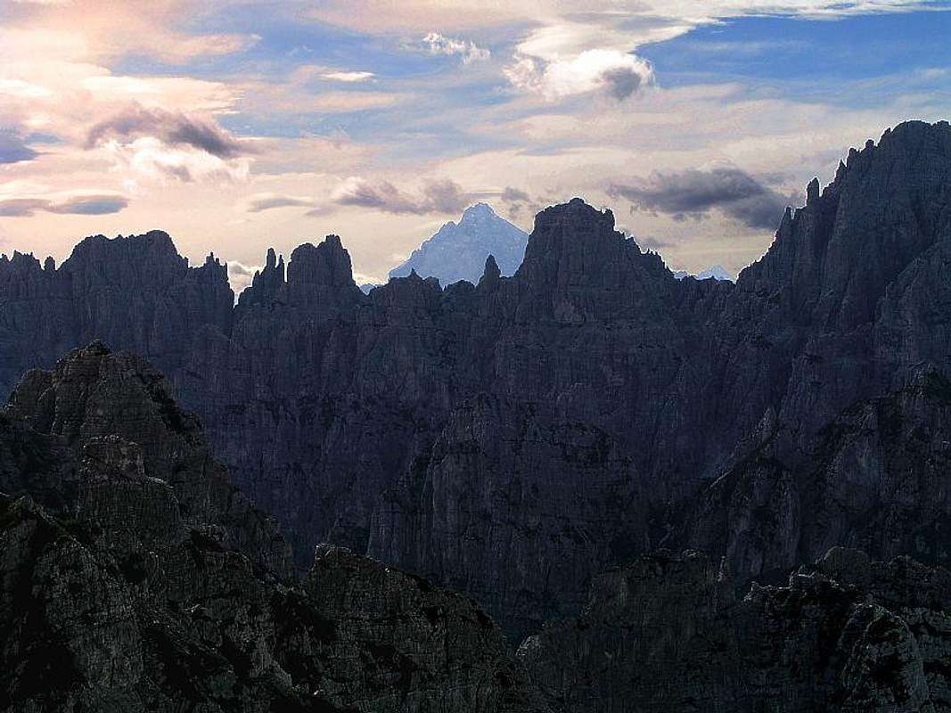
![Crìdola at sunrise]() Monte Cridola Monte Cridola |
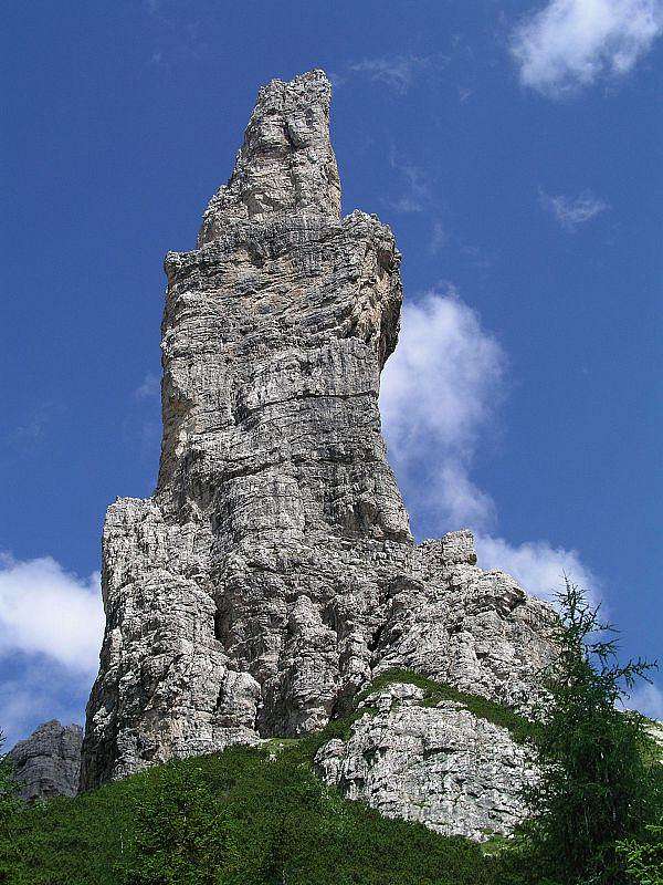
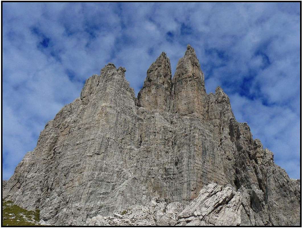
![Campanile di Val Montanaia]() Campanile di Val Montanaia Campanile di Val Montanaia |
Summits
The chain and its side ridges has from the South towards the North the following more important summits: M. Borgà, 2228m. Marked path n°393 from Casso.
![]() |
La Palazza, 2210m. Marked path n°381 from Casera bedìn ( Val Zemola ), M. Zita, 2191m. Easy ascent on the SE crest from Casera Bedìn. Not marked path. |
Cima dei Rodi Segre, 2132m. Ferrata crosses its summit.
![]() |
![]() |
![]() |
M. Duranno, 2652m. One of the highest summits in Carnic Pre-Alps. Alpinistic ascent with difficulty around the II UIAA degree with a passage of the III+ degree. Ferrata ascends only its western shoulder - Spalla del Duranno, 2234m. |
![]() |
![]() |
![]() |
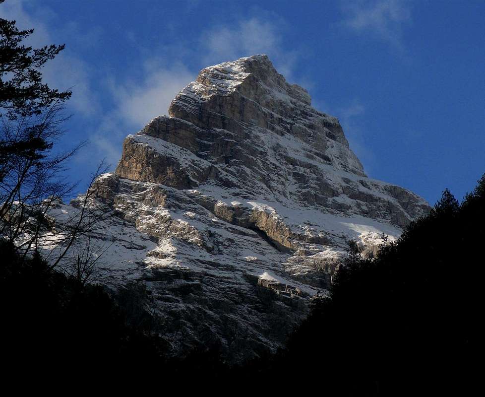
Cima dei Preti, 2706m. The highest summit in the group. The normal route goes up from south ( Val Compòl-Bivacco Greselin ). Difficulty around the I UIAA degree with a couple of passages of the II UIAA degree. Some very exposed passages, a rope can be useful for th descent. The route from Forcella Compòl through the SE crest should be slightly easier. Both routes are very hard if done in one day . |
![]() |
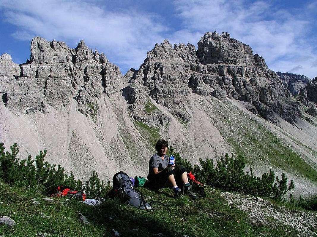
Cima Laste, 2555m, not marked path from Casera Laghet di Sora ( Val Frassin ). Difficulty around the UIAA I degree. Cima Sella, 2334m, not marked path from Casera del Cavalletto ( NW ). Difficulty around the UIAA I degree. M. Pera, 2334m, Cima Spe, 2314m, not marked path from Forcella Spe. Difficulty around the I/II UIAA degree. |
Picco di Roda, 2206m. In a NW side ridge, a marked path crosses it just below the summit.
![]() |
![]() |
![]() |
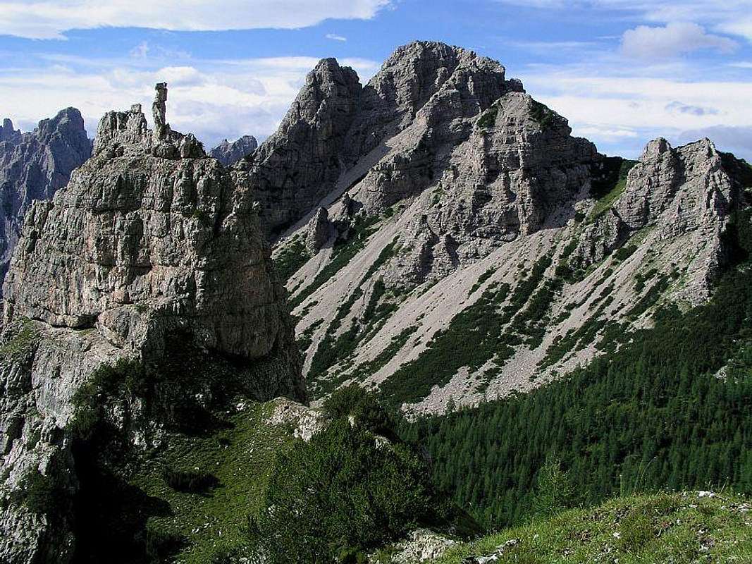
Cima Cadin di Toro, 2386m, Pala Grande, 2385m, Cima Toro, 2355m. Summits in a wild ridge west of the famous Val Montanaia. A marked path crosses the ridge north of Cima Toro. |
![]() |
![]() |
![]() |
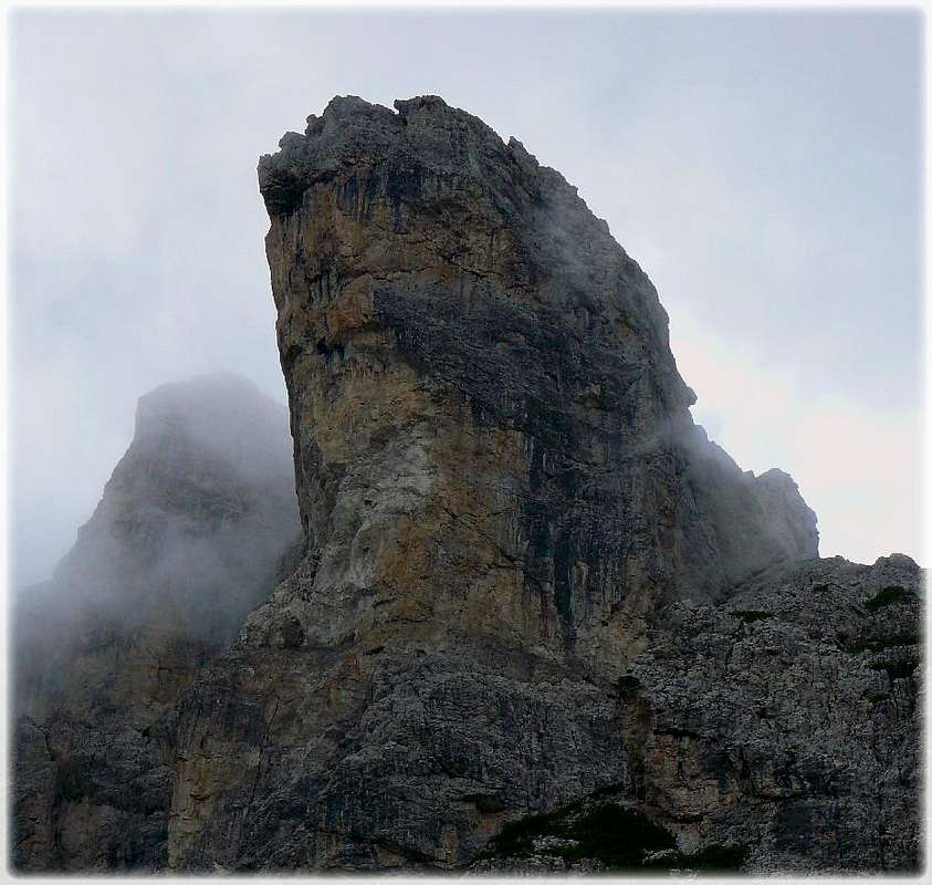
Monfalcòn di Montanaia, 2548m. The crossing point of ridges above Val Montanaia. A marked path crosses the Forcella Montanaia (notch) west of the summit, another one crosses the south ridge (connecting Val Montanaia and Val Monfalcon di Cimoliana). |
![]() |
![]() |
![]() |
Monfalcon di Forni, 2453m. Another wild, fairy-tale castle, SE of M. Cridola. Normal route is an easy climb of UIAA II+. |
![]() |
![]() |
![]() |
Monte Crìdola, 2581m. A wild crest mountain in the North, marked path n°346 from Rifugio Giàf through Tacca del Cridola, difficulty around the I/II UIAA degree with a key passage of the II+. First ascended by Julius Kugy and his guide P. Orsolina in August 4th, 1884. |
![]() |
![]() |
Montanel, 2440m. A fore-summit in Cridola's NW ridge. Marked path n°345 from Rifugio Cercenà-Bivacco Montanel ( NW ). Easy ascent with only a short passage of the I UIAA degree. |
![]() |
M. Miaron, 2132m. A fore-summit in the northern part of Cridola group. Marked path from Passo della Mauria. Difficulty around the I UIAA degree. Exposed passages. |
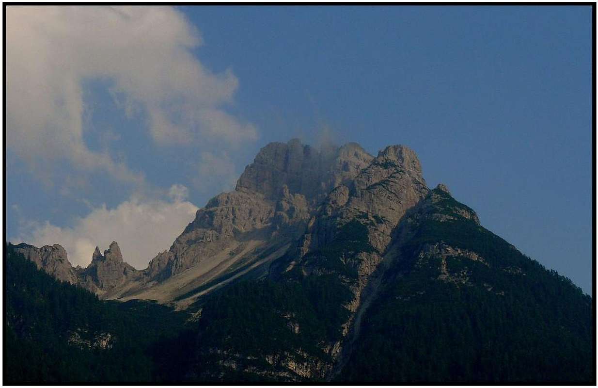
![Duranno]() Monte Duranno Monte Duranno |
![Cima dei Preti]() Cima dei Preti Cima dei Preti |
![Forcella Montanaia]() Val Montanaia Val Montanaia |
Huts and Bivouacs
Besides ordinary huts in the group there are many ex shepherds huts, now used as bivouacs. Some can be used only in emergency, others are well equipped and permanently opened. Check their status in valleys before using.
- Rifugio Maniago, 1730m. Stands above Val Zemola, SW below Monte Duranno. Accessible from the parking place above Erto, 1180 m in 1 h 30 min.
- Ricovero Casera Bedin di Sopra, 1711 m. Stands NW above Val Zemola.
- Ricovero Casera Galvana, 1613 m. Stands E above Val Zemola.
- Ricovero Casera Lodina, 1567 m. Stands SE of M. Duranno, above Cimolais.
- Bivouac Baroni, 1732 m. Stands below the N face of M. Duranno.
- Bivouac Greselin, 1988 m. Stands S of Cima dei Preti.
- Ricovero Casera Laget de Sora, 1871 m. Stands at the end of Val dei Frassin, NE of Cima Laste.
- Bivouac G. Gervasutti, 1940 m. Stands S of Cima Cadin di Toro.
- Rifugio Tita Barba, 1821 m. Stands NW of Cima Cadin di Toro.
- Rifugio Padova, 1287 m. Excellend western trailhead for Monfalcon and Cridola group. Reachable by car from Piave valley.
- Bivouac Montanel, 2048 m. Stands S of the summit of Montanel.
- Rifugio Pordenone, 1249 m. Stands 100 m above the end parking place in Val Cimoliana. It serves all tours in the upper part of this nice valley.
- Bivouac Perugini, 2060 m. Stands on a grassy shoulder just N of the famous Campanile di Val Montanaia.
- Bivouac Marchi-Granzotto, 2152 m. Stands NE of Cima Monfalcon di Montanaia.
- Ricovero Casera Valbinon, 1778 m. Stands on a nice alpine meadow in Val Binon.
- Rifugio Giaf, 1400 m. Stands in the upper part of Val di Giaf. Excellently serves climbs in the nearby walls and the ascent on M. Cridola. Reachable from Tagliamento valley, the parking place in the lower part of Val di Giaf is on 1025 m.
- Bivouac A. Vaccari, 2050 m. Stands below the N face of M. Cridola, NE of the summit.
Click on the maps below to enlarge:
Monte Pramaggiore Group
This nice group is already a little different from the dolomite-like towers of Monfalconi group. It is still packed with wild rocky summits, having nice vertical walls appropriate for hard climbing, but limestone is already prevailing. The most beautiful part is the very northern one. Between Forni di Sopra in Tagliamento valley and Val Cimoliana wild mountain ridges are swirling in all directions. Again, all summits in this part are hardly reachable. Just a bit towards the South Monte Pramaggiore itself stands. It's a massive piece of rocks, a fine panoramic shoulder, which is ascendable in an easy climb. The southern part is a broad mountain area around M. Turlon. A very remote, wild area, no marked path in it, no huts and no bivouacs whatsoever. Let's name all more important summits from the North towards the South.
![Monte Turlon group]() Monte Turlon Group Monte Turlon Group |
Summits
![]() |
![]() |
![]() |
Monte Cimacuta, 2058m, Cime Fantulina, 2283m. In a western side ridge Crodon di Brica, 2243m. |
![]() |
![]() |
![]() |
Cima Brica, 2362m, Punte di Brica, 2186m, north of them Campanile Gambet, 2025m. |
![]() |
![]() |
![]() |
Torrione Comici, 2220m. A nice tower above Val di Suola, reachable by a very hard modern ferrata (UIAA III-IV). |
![]() |
Cima Val di Guerra, 2353m, Croda del Sion, 2410m. |
![]() |
![]() |
![]() |
Monte Pramaggiore, 2478m. The notch below it easily reachable from three valleys, then an easy climb to the summit (UIAA I). |
![]() |
![]() |
![]() |
Cime Postegae, 2358m, Torri Postegae, 2346m, in a SW side ridge M. Ferrara, 2258m. |
Pale Candele, 2251m.
![]() |
M. Turlon, 2312m. |
Cima dei Vieres, 2310m.
![]() |
M. Vacalizza, 2266m. |
![Cime Fantulina]() Cime Fantulina Cime Fantulina |
![Torrione Comici]() Cima Val di Guerra and Torrione Comici Cima Val di Guerra and Torrione Comici |
![Postegae group]() Torri Postegae and Monte Ferrara Torri Postegae and Monte Ferrara |
Huts and Bivouacs
Besides ordinary huts in the group there are many ex shepherds huts, now used as bivouacs. Some can be used only in emergency, others are well equipped and permanently opened. Check their status in valleys before using. Listed in a north-south direction:
- Ricovero Casera Valbinon, 1778 m. Stands on a nice alpine meadow in Val Binon.
- Rifugio Flaiban-Pacherini, 1587 m. Stands in the upper Val di Suola, excellently serves climbs in the walls above the valley, and also the ascent on M. Pramaggiore. In 2006 it is in renovation. Accessed from Forni di Sopra in Tagliamento valley in 1 h 30 min.
- Ricovero Cason di Brica, 1745 m. Stands in Val di Brica.
- Rifugio Pordenone, 1249 m. Stands 100m above the end parking place in Val Cimoliana. It serves all tours in the upper part of this nice valley.
- Ricovero Casera Roncada, 1781 m. Stands west of Postegae group.
- Ricovero Casera Masons, 1553 m. Stands in the very NE part of this subgroup, above Val Poschiedea.
- Ricovero Casera Pramaggiore, 1812 m. Stands SE of M. Pramaggiore, above Val Settimana.
- Ricovero Casera Bregolina Grande, 1858 m. Stands SW of Cima Postegae.
- Ricovero Casera Bregolina Piccola, 1746 m. Stands SE of Cima Postegae.
Monte Cornaget Group
This is the central and the broadest group in the Carnic Pre-Alps. Its summits are remote, scattered in the broad area. Except for a few examples they hardly ever see a visit of a mountaineer. Among their massifs deep valleys are cut. The old paths through these valleys are not marked and it can take very long to reach the end of such a valley from its mouth. Looks like a pure nature area, very suitable for longer trekkings. Here are some summits, starting from the South.
Summits
![]() |
M. Raut, 2025m. One of the southernmost summits in the whole group, an excellent panoramic point. Very popular for ascending. From Forzella di Pala Branzana, 840m, a saddle, over which a decent road goes, it is reachable by a steep, on a few places exposed marked path. |
The complete map - guidebook!
The map below is a rather complete guidebook - compilation of web descriptions and own experiences about the area. Click on mountains, routes, route points etc. to get more information, descriptions and pictures! See the map on full screen, if needed.
See full screen
|
| |
M. Castello,1937m. Rising NW of M. Raut, also accessible by a marked path from Andreis, 456m. |
| |
M. Ressetum, 2067m. Rising in a SW part of the group. |
![]() |
M. Dosaip, 2062m. Standing east of the upper Cellina valley. |
| |
M. Cornaget, 2323m. A powerful summit in the log ridge between Val Settimana and Val Cellina. The highest in the group. |
![]() |
M. Caserine Alte, 2306m. With its two fore-summits: M. Caserine Basse, 2255m, and M. Burlaton, 2121m, forms a group in the centre of the area. |
![]() |
M. Chiarescons, 2168, and Vetta Fornezze, 2110m, are two sharp peaks in the northern part. |
| |
Punta del Mezzodi, 1923m. Serves as a noon marker for Forni di Sotto, in Tagliamento valley. |
| |
Cimon di Agar, 1932m. A marked path crosses the slopes just N of the summit. |
![]() |
M. Frascola, 1961m. Nice, sharp summit, reachable by marked paths (not to the very summit!), but remote from wherever you arrive. |
![Monte Raut]() Monte Raut Monte Raut |
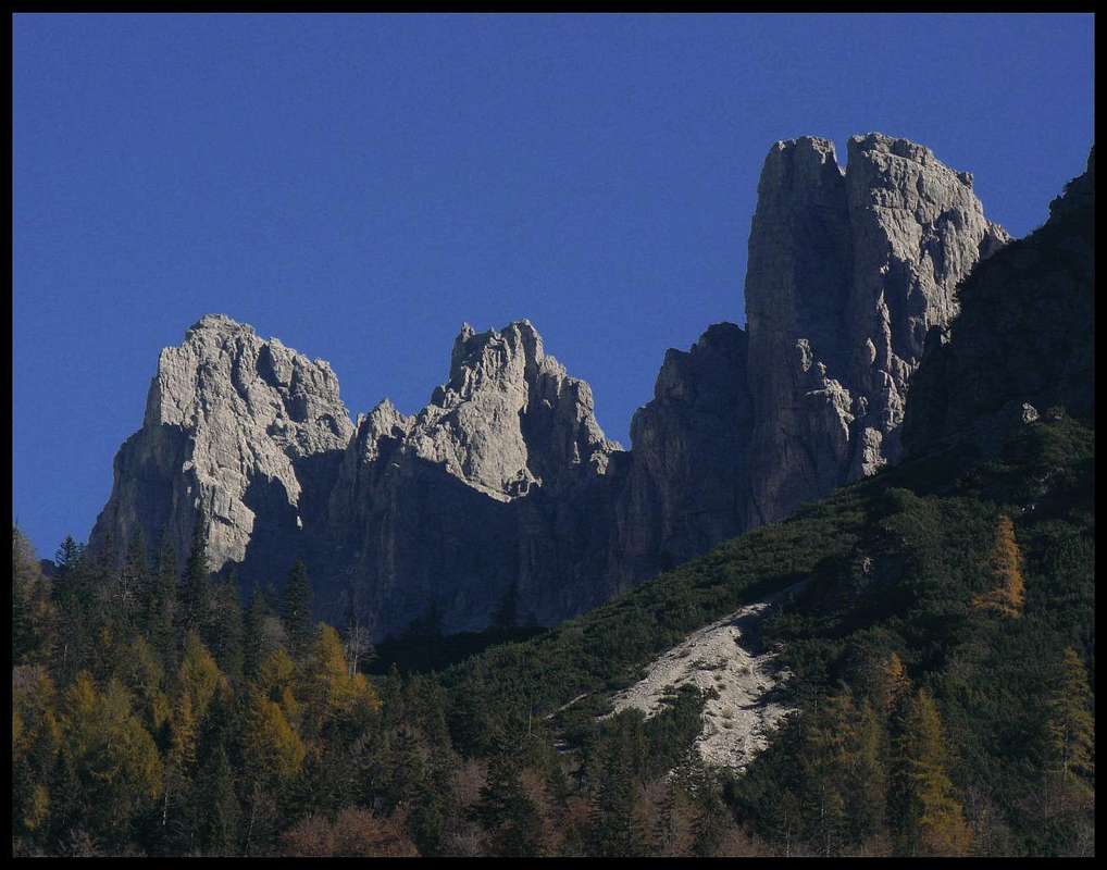
![Monte Caserine Alte]() Monte Caserine Alte Monte Caserine Alte |
![On Forcella Pramaggiore]() Monte Chiarescons Monte Chiarescons |
Huts and Bivouacs
- Ricovero Casera Podestine, 1024 m. Stands in the valley of upper Cellina.
- Ricovero Casera Caserata, 1479 m. Stands between M. Dosaip and M. Caserine Basse.
- Bivouac A. Goitan, 1810 m. Stands in the upper basin of Val de la Meda, below the N face of M. Cornaget.
- Rifugio Pussa, 940 m. Stands by the end parking place in Val Settimana.
- Ricovero Casera Chiampiuz, 1696 m. Stands NW of Cimon di Agar and S of Punta del Mezzodi.
- Ricovero Casera Chiampis, 1236 m. Stands in the upper Val Viellia, NE of M. Frascola. 16 places, in a very good condition.
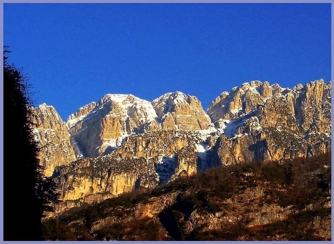
Monte Verzegnis Group
East of Passo di Monte Rest and the Tramonti Valley the summits don't reach 2000 meters any more. Still they are nice panoramic points scattered over a broad area.
Summits
![]() |
Monte Rest, 1780 m. Nice panoramic summit E of Passo di M. rest. reachable by a steep path from the saddle in 2 hours. |
![]() |
M. Valcalda, 1908 m. In the middle of the group, quite long ascents by marked, not just easy paths. |
![]() |
Monte Verzegnis, 1914 m. The highest summit stands on the very N of the group, just above Villa Santina. |
Zuc di Santis, 1309 m. High below its summit comes a narrow road from Tramonti. M. Taiet, 1369 m. High below its summit comes a narrow road fromPielungo. M. Ciaurlec, 1148 m. On the very south of the group, with Monte Valinis, 1102 m, and its popular paragliding take-off point.
![Monte Amariana West View]() Monte Verzegnis Monte Verzegnis |
Huts and Bivouacs
- Rifugio Grasia, 634 m. Stands N of Passo di M. Rest, by the road.
- Rifugio on Sella Chianzutan, 955 m. Stands on the road pass between M. Verzegnis and to the SE standing M. Piombada.
- Casera Sopareit, 1529 m. Bivouac on the ex shepherd hut (below M. Valcalda). 8 places, no blankets.
Grotte di Pradis
![Grotte di Pradis]() In Cosa creek canyon
In Cosa creek canyon![Grotte di Pradis]() In Cosa creek canyon
In Cosa creek canyonIn the southern part of the group, below Monte Taiet, the creek of Cosa carved a nice canyon. A part of it, near Pradis village, is arranged for tourists visit. In caves above the creek remains of Neanderthal Man were discovered, together with bones of cave bear. The narrow canyon is very picturesque, but for my taste the whole area is too artificially changed (bridges, steps, religion symbols etc. Entrance fee is 7 EUR (2014).
Monte Piombada Group
![Tagliamento]() Tagliamento south of M. Cuar
Tagliamento south of M. CuarTwo higher mountains in the northern part, the nice panoramic M. Cuar in the south and the remote island of M. San Simeone on the far East. The group lies in the big knee of Tagliamento river. Especially interesting is the area, where the river exits the mountains. There is a broad hilly area which was originated in Wurm period, when up to 1500 m thick glaciers covered Southern Alps. Today it is interesting to observe how the big river gets released and starts flowing in many channels towards the south.
Summits
|
|
M. Piombada, 1744 m. Standing on the very N, just above Sella Chianzutan (saddle). |
M. Piciat, 1615 m. M. San Simeone, 1505 m. Rising as an isolated island on the very eastern part of the group. It's a great mountain bike goal and a nice panoramic point. The road reaches it from the south. There also one funny town lies - Bordano, the town of butterfies. People there really seem obsessed with butterflies. Their pictures are across all the walls of the town, they have a permanent opened museum of butterflies and they organise different events. M. Cuar, 1478 m. Standing on the southern part of the group. Roads come high on its slopes, nice panoramic point.
![The Southern Route on Monte Amariana]() Monte Piombada Monte Piombada |
![Monte Amariana South View]() Monte San Simeone Monte San Simeone |
Huts and Bivouacs
- Rifugio on Sella Chianzutan, 955 m. Stands on the road pass between M. Verzegnis and to the SE standing M. Piombada. I have no data about ex shepherds huts.
Getting There
![Overview map of the Carnic...]() Carnic Alps - main groups. Carnic Pre-Alps group, N part is No. 4.
Carnic Alps - main groups. Carnic Pre-Alps group, N part is No. 4.See the main page of Carnic Alps for the broader overview! See there also links on web pages of some surrounding towns. Carnic Pre-Alps - The northern part can be reached from the West from the valley of Piave and over the two passes (Passo della Mauria and Passo di San Osvaldo). From the East the group is reached along the valley of Tagliamento. From the South you reach the group along many valleys, the waters of which which flow down towards the Po river plane: Val d'Arzino, Val Tramontina and Val Cellina with its side valleys Val Settimana and Val Cimoliana. The inner valleys of the group are not reachable by car.
When to Climb and Weather Conditions
In such a broad area you will find something to do in any time of the season. So there's no best time for the visit. But the wilderness of the area requires that you take necessary prerequisites when arriving outside the summer and autumn season. See the main page of Carnic Alps for links on weather stations!
Maps And Books
See the main page of Carnic Alps for a few hints! Regarding maps it is best to rely on Tabacco maps, 1:25000. They are very accurate. For the western part is perhaps the best choice the double-face 'Parco Naturale Dolomiti Friulane' map, costing around 10 EUR (while other maps, covering smaller areas are 6.5 EUR.
Your Help Is Needed
Who, oh who will post the pages of great mountains, such as:
- Cima dei Preti,
- Monte Duranoo. and others...

 26310 Hits
 96.63% Score
 61 Votes
 Cima dei Cantoni
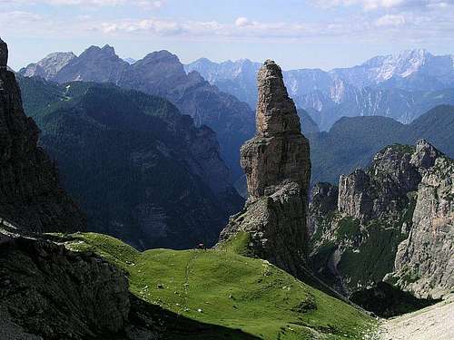 Campanile di Val Montanaia - the landmark of Dolomiti Friulane
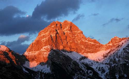 Monte Duranno
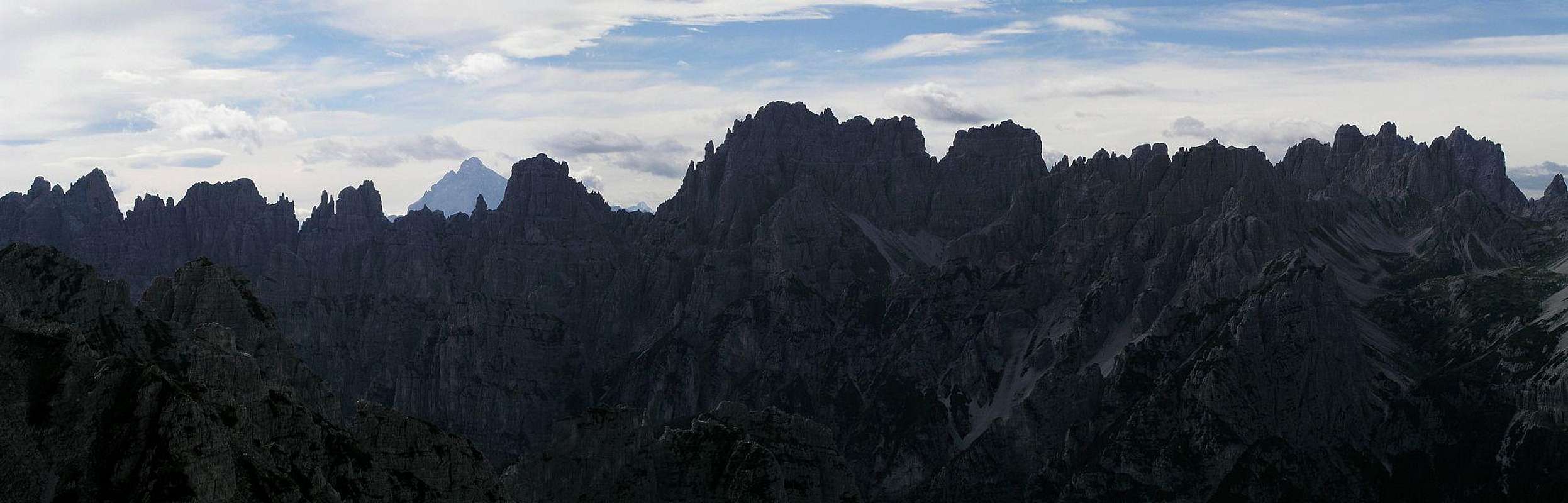 Dolomiti Friulane - Monfalcon group, one of the most beautiful areas of Carnic Pre-Alps
 In Canale di Meduna
 In Val Postegae
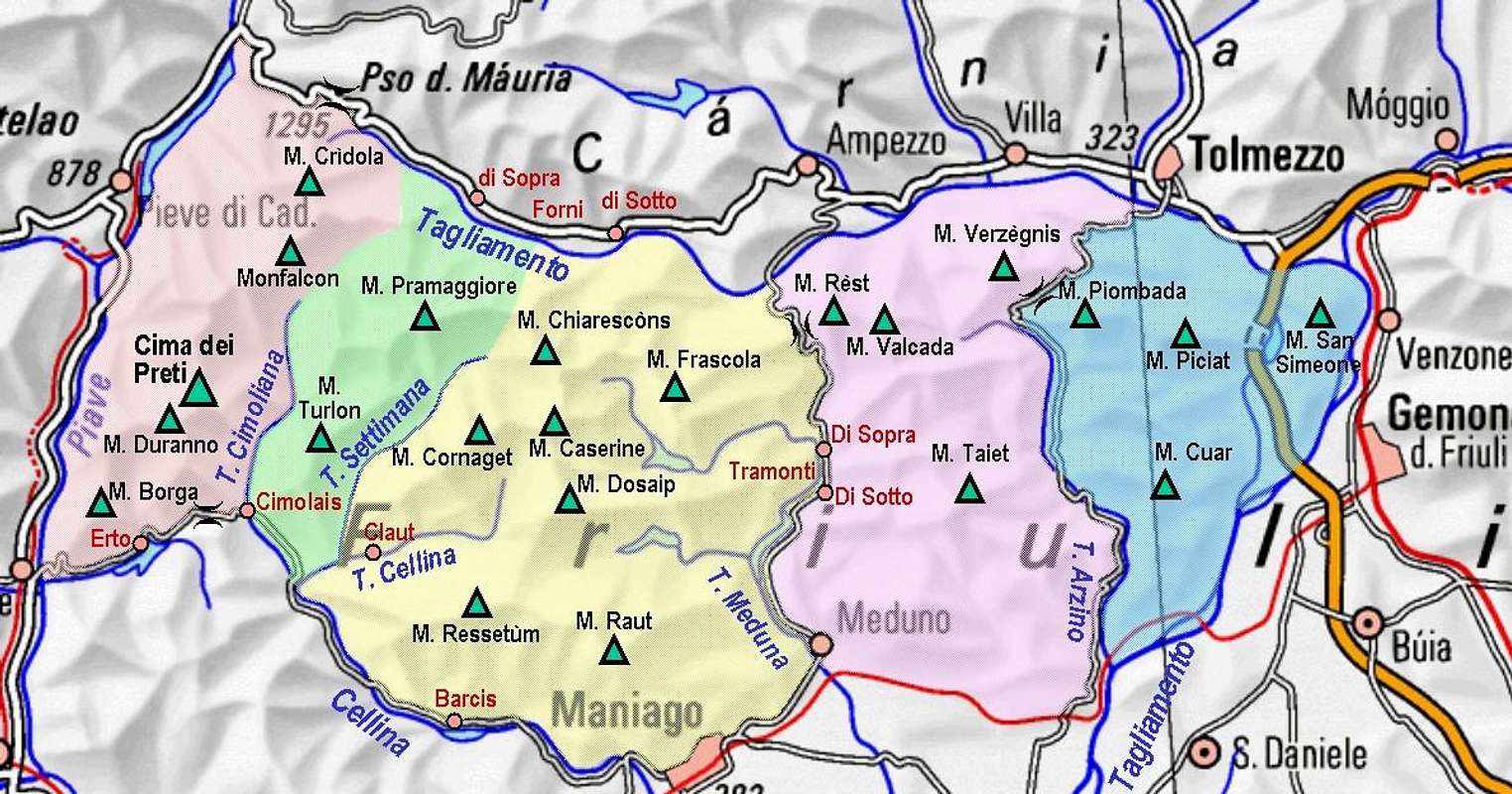 Carnic Pre-Alps subgroups
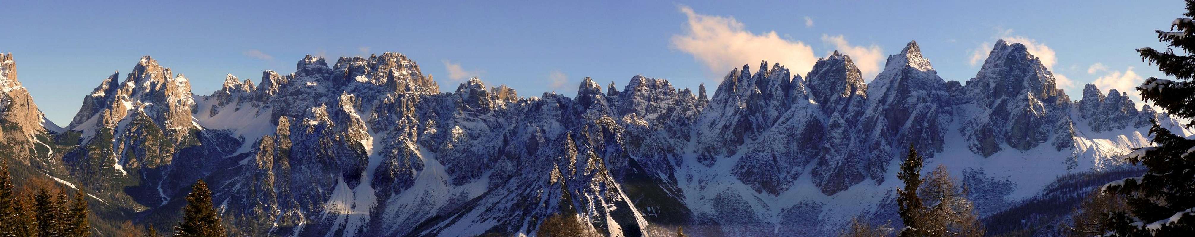
 Dolomiti Friulane
 Monte Cridola
 Campanile di Val Montanaia


 Monte Duranno
 Cima dei Preti
 Val Montanaia
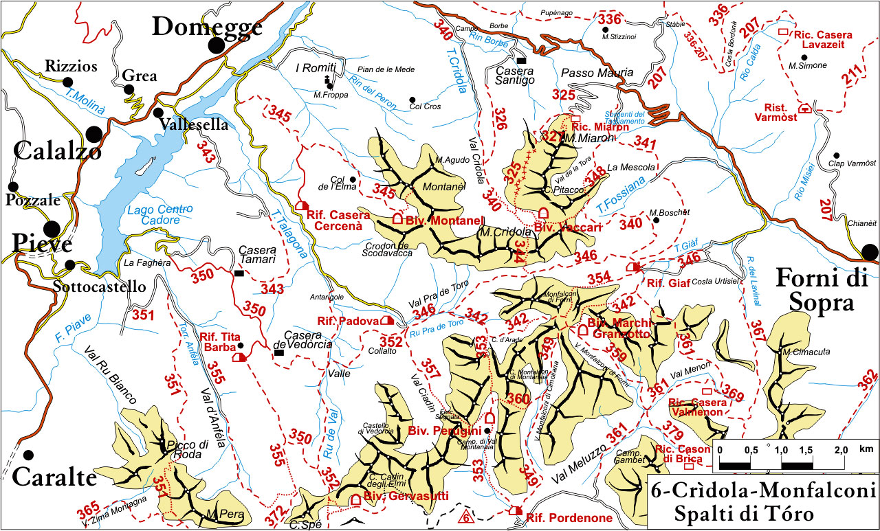
 Monte Turlon Group


 Cime Fantulina
 Cima Val di Guerra and Torrione Comici
 Torri Postegae and Monte Ferrara


 Monte Raut
 Monte Caserine Alte
 Monte Chiarescons


 Monte Verzegnis
 In Cosa creek canyon
 In Cosa creek canyon
 Tagliamento south of M. Cuar
 Monte Piombada
 Monte San Simeone
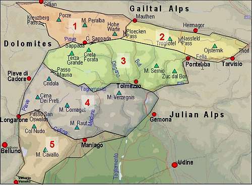 Carnic Alps - main groups. Carnic Pre-Alps group, N part is No. 4.