-
 12627 Hits
-
 86.37% Score
-
 22 Votes
|
|
Mountain/Rock |
|---|---|
|
|
43.37312°N / 109.5584°W |
|
|
Summer |
|
|
11588 ft / 3532 m |
|
|
Overview
Anybody at all familiar with the Wind River Range knows that with few exceptions, its peaks, both walk-ups and technical ones, come with a price-- long approaches. Only a handful of named or otherwise-notable peaks are accessible to even well-conditioned day climbers.
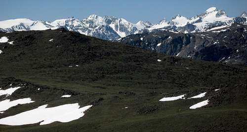
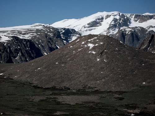
Arrow Mountain is one such peak. Situated in the Fitzpatrick Wilderness in the northeastern section of the Winds, its summit is a strenuous but technically simple affair that serves up spectacular views of the alpine heart of the Winds-- Gannett Peak and the spires of Upper Titcomb Basin-- and provides a fine sampling of the windy, big-sky country that is so much of Wyoming. And to the north, the rugged Absaroka Range rises like a dark wall protecting, or restraining, what to this writer is the greatest pure mountain wilderness in the Lower 48.
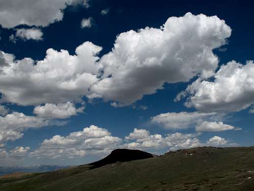
Arrow Mountain probably gets its name from its appearance from certain perspectives, though no picture on this page will show such a perspective. On topographical maps, the shape of the eastern face is also arrow-like.
Some maps indicate that the long ridgeline containing Point 10,902 is also part of Arrow Mountain. It is even possible that Point 11,696, south of Arrow along the Ridge system, is part of Arrow and its true summit, but prominence and maps do not support this; Arrow has enough prominence from that higher point to qualify as a separate peak.
Route Information
The Basics: By the shortest route-- about 5.1 miles with approximately 4000' of elevation gain.
Most of the route is on a trail. There are two trails one can use: the Old Glacier Trail and the Glacier Trail. The former is shorter and more direct, but it is steeper and starts with a ford of Torrey Creek that can be dangerous or impossible in early summer. The latter is a little longer, is not quite as steep as the latter (but is still steep), and does not involve a creek ford. Musicman82 and I opted for the Old Glacier Trail and fortunately found the creek crossing only dangerous instead of impossible.
Via Old Glacier Trail
The "new" Glacier Trail begins from the wilderness trailhead at road's end; the Old Glacier Trail does not. To find that trail, which does not have signage at the main trailhead and is not signed from the road in, hike downhill and across a spur road toward Torrey Creek. Along a dirt road, look for a sign pointing to the Old Glacier Trail, which once was a major access route for the Fitzpatrick Wilderness and Gannett Peak until a landslide wiped out a large section, prompting a relocation of the trail. But the old trail still exists and is used primarily by stock parties.
If you have the Earthwalk Press Northern Wind River Range map, you should have no trouble locating the Old Glacier Trail.
The crux of this route is at the very start; it is a crossing of Torrey Creek. In late summer, this is nothing worse than a knee-deep matter, but in early summer or in a heavy snow year, this can be a serious undertaking. In late June 2009, the water was waist-deep in spots and had a very strong current, especially near the far side. The creek was also 10-15 yards wide; there were narrower sections, but the current was much swifter through them.
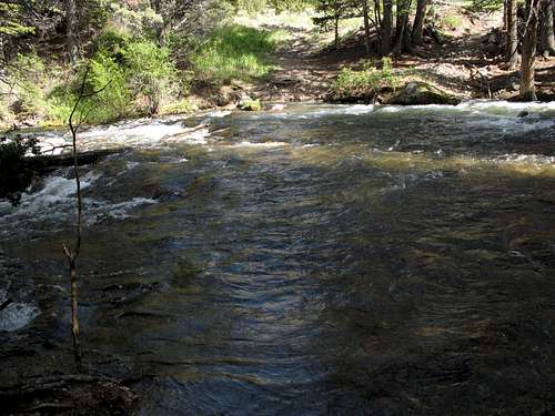
After crossing the creek, the trail climbs, sometimes very steeply, through switchbacks and relentless uphill grades to treeline, where the difficulty abates markedly.
Soon, you will notice some highpoints along the ridge to your left. None of these summits are Arrow's, but you should strike out here and ascend to the crest of the ridge, where you will have a view of Arrow Mountain. Your best bet is to leave the trail somewhere in the immediate vicinity of Point 10,902. From the crest of the ridge, take any of a variety of ways to the summit. There is a cliff band on the western face, but there are one or two Class 3 breaks in it, and the band can be bypassed on either end anyway.
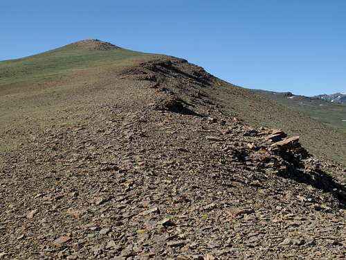
At the top, there is a cairn but no register, typical of Wyoming summits.
If you don't have a good topo map with you, do one of the following: at the junction of the Old Glacier Trail and the Glacier Trail (the sign marking the junction was on the ground in June 2009), head east for a saddle, north of which is Arrow Mountain's summit; or continue past the junction to the 10,895' pass above Burro Flats, where you should head east to Point 11,696 and then follow the ridge north to Arrow Mountain.
Via Glacier Trail
This trail starts from the trailhead and has a bridged crossing of Torrey Creek. To climb Arrow Mountain, use the instructions in the preceding paragraph. Depending on the guidebook you read, the distance to the 10,895' pass is anywhere from 7 to almost 9 miles. It feels like about 8.
Getting There
About 4 miles east of Dubois on U.S. 287, just east of a bridged crossing of the Wind River, turn south onto a signed road that indicates access to Dubois Fish Hatchery and Whiskey Basin Wildlife Habitat Management Area. Follow signs for Ring Lake Ranch and the Fitzpatrick Wilderness. At about 6 miles, bear right instead of going left to Ring Lake Ranch. Now the road gets rougher, becoming rocky with potholes, but it is still passable to almost any vehicle. There is a large parking area at the end of the road. The total distance from 287 to the trailhead is about 9 miles.
Red Tape, Camping, and More Information
There are no fees or permits required. Please read the wilderness regulations that are clearly posted at the trailhead. Grizzlies are back in the Northern Winds, so special precautions apply.
There are campgrounds at Ring Lake and Trail Lake. Permits are not required for backcountry camping.


