
-
 38048 Hits
-
 85.87% Score
-
 21 Votes
|
|
Mountain/Rock |
|---|---|
|
|
43.31000°N / 109.672°W |
|
|
Hiking, Mountaineering, Scrambling, Skiing |
|
|
Spring, Summer, Fall |
|
|
13355 ft / 4071 m |
|
|
Overview
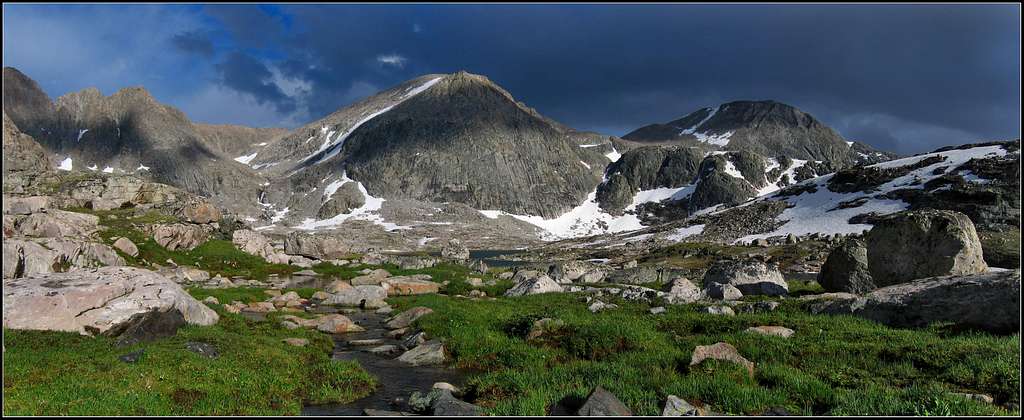
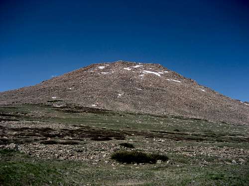
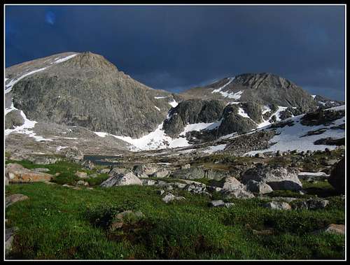
Downs Mountain is a thirteener in the Wind River Range of Wyoming. It is the 15th highest in the state and the northernmost thirteener of the Continental Divide in all of North America. The most massive of the state's high peaks, the summit area is a scree lump that survived the last ice age glaciation therefore, much of the upper part of the mountain is gentle and allows for awesome trekking and hiking up to a beautiful summit. Downs can be climbed at Class 2 from any direction and has seen just a few technical ascents on the peak proper. These are really only found on the buttresses and towers at the head of Torrey Creek or the towers at Downs Lake.
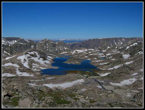
Downs Mountain is also the home of six glaciers and several permanent snowfields. The eastern shoulder of the mountain extends into a vast high-altitude frost-plain of windy slabs known as Goat Flat. It is here that Downs receives its just reputation as a study location for a large herd of Bighorn Sheep. The east side of the six-square-mile Goat Flat contains the Double Lakes cirque, a common stopover point on the Glacier Trail.
The moraines for Downs and Torrey Glaciers are reputed to be the largest and most unstable in the range. The tarns along the edge of Continental Glacier, that appear each summer, are the highest bodies of water in both Wyoming and the Central Rockies at 12620 feet in elevation. In recent years they have become larger than shown on the current USGS topographic map. Due to the remote but gentle nature of this area, Downs is one of the more "popular" peaks in the state and is a destination for a surprising amount of hunters and back-country trekkers.
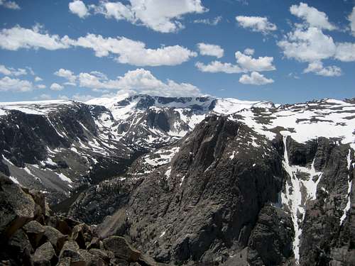
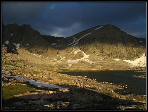
 Looking east towards Downs Mountain from Bear Basin at sunset
Approaches
There are many different options for approaching Downs Mountain and just as many ways to ascend the upper mountain once a camp is established. Really it is up to you to find the path of least resistance from your chosen camp. Approaching this peak really is the hardest part of the climb but you are surrounded by beautiful remote country so it is all worth the effort. If you come from the east side, you need to get to No Mans Pass which separates the East Torrey Creek drainage to the north from the Downs Lake drainage to the south. This is a wild and remote place and people have camped here. If you approach from the west side of the range you need to get to Bear Basin (Bear Lake) ad there are a few ways to do this. Described below are a handful of your approach options.
East Side Approach - Bomber Trail to Bomber Lake
One way distance to Bomber Lake - 9.5 miles and 2,500 feet elevation gain
Four miles east of Dubois on US Highway 26, turn south and follow the recently improved dirt road (FS #411), which is passable for cars eight miles to Trail Lake Ranch (elev. 7,600 feet) where the road ends. The new Glacier Trail is then taken for about a mile to a junction with the Lake Louise Trail veers to the right. Continue left and stay on the glacier trail and cross the bridge over the deep gorge and parallel the East Fork of Torrey Creek for another 2.5 miles to a meadow where there is a second junction. Here the Glacier Trail veers left and begins climbing steeply up the hill.
The Bomber Trail continues along the creek and after another mile (4.5 miles from the trailhead) you'll reach Bomber Falls. This is the end of the maintained trail but a path continues south up the valley above the falls along the east side of the creek. It soon becomes harder to find under lots of deadfall but it never gets horrid. As you come to a 90 degree bend in the creek to the west cross the creek to avoid the huge loose moraine and finish the approach to Bomber Lake. Don't miss the B-17 wreckage near the path just above the falls. Bomber Lake at 10,162 feet makes a great camp and is an additional 4 miles from Bomber Falls.
Views from the lake are amazing with 12,212 foot Spider Mountain making a breathtaking backdrop across the lake. See this link for a great trip report description of this approach! From Bomber Lake you can head southeast up a prominent gully for 1,600 feet to reach Goat Flat and continue across the plateau to No Mans Pass. This is the easiest way to reach No Mans Pass as the route past Turquoise Lake to the pass involves hiking over many more miles of very rough talus and climbing a steep icy snow couloir to reach the pass.
 East Torrey Creek from the bridge at the 1st junction East Torrey Creek from the bridge at the 1st junction |
 Bomber Lake and Spider Mountain Bomber Lake and Spider Mountain |
 Bomber Lake Bomber Lake |
East Side Approach Variation - Talus Mountain (Point 11695) and Goat Flat
One way distance to No Mans Pass - 12 miles
This approach is only recommended in times of perfect weather since you walk on a high plateau well above treeline for a long time. The views are spectacular and Downs Mountain can be seen much earlier giving you a better perspective on how far away this peak really is from the nearest road. You also get the chance to bad another peak along the way.
Start this approach at the same Trail Lake Ranch trailhead as described above and follow the New Glacier Trail to the meadow and the second junction. Instead of continuing south up the valley to the falls, take the steep trail left as it switchbacks up the hill for 2.5 miles rising nearly 2,000 feet and passing treeline along the way. You will reach the Old Glacier Trail in a wide open plateau and your cross country exposed walk across Goat Flat begins! Follow the Old Glacier Trail south for a half mile then leave it and aim southwest heading for Talus Mountain.
This 11,695 foot peak gives awesome views of the entire Bomber Basin below you, Torrey Peak across the valley and Downs way to the west. You can also skirt around this peak along its east slopes. Continue south and follow the high plateau as it curves rightward towards the west and continues to No Mans Pass 6 miles from the Old Glacier Trail. You might have to camp somewhere along the plateau so be prepared for winds, thunderstorms, and rain.
 Looking at the east side of Talus Mountain Looking at the east side of Talus Mountain |
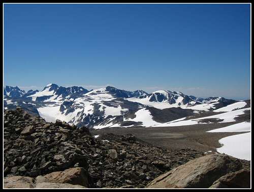
 Looking over Bomber Basin to Downs Mountain from Talus Mountain Looking over Bomber Basin to Downs Mountain from Talus Mountain |
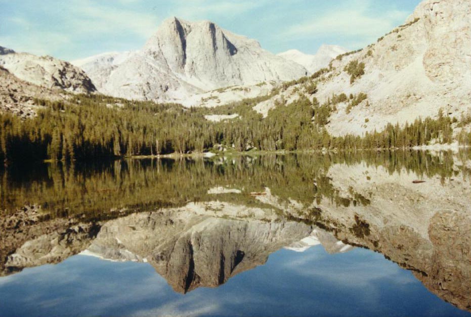
West Side Approach - Clear Lake to Bear Basin
One way distance to Upper Bear Basin - 10 miles
This approach starts at the popular Green River Lakes trailhead (elev. 8,100 feet). From Pinedale, follow Highway 191 to the northwest for 6 miles to Cora Road. Turn north here and follow it for 45 miles to the Green River Lakes trailhead. This road has been known to be heavily wash-boarded so plan extra time to drive this road. The Clear Creek Trail leaves the Highline trail on the SE end of Lower Green River Lake after 3 miles. It ascends to the natural bridge (where the maintained trail ends) and onward for 4 miles to the upper end of Clear Lake (elev. 8,900 feet) below Bear Basin. Beyond Clear Lake, follow the inlet stream coming from the north to the south end of Faler Lake (elev. 10,200 feet) and continue up a talus gully heading ESE towards Bear Lake.
Reach a small saddle where you can look down on the massive Bear Lake and route-find a way to the east locating a way through some cliffy terrain to reach Bear Basin (no more than class 3; good map certainly required). You can also stop by the south end of Daphne Lake if you have time...it's a brilliant sight to see. This is one of my all time favorite places I have ever been to. Camping here is incredible! Plan for an entire LONG day to reach Bear Basin and don't be surprised if you find yourself on some tough Class 3 terrain here and there.
|
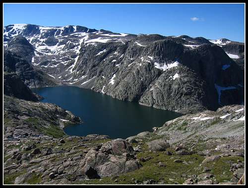
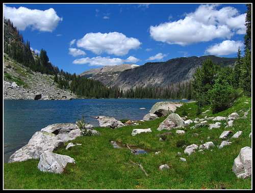
 Hunters Hump from Bear Basin Hunters Hump from Bear Basin |
 Daphne Lake Daphne Lake |
 Bear Basin sunset Bear Basin sunset |
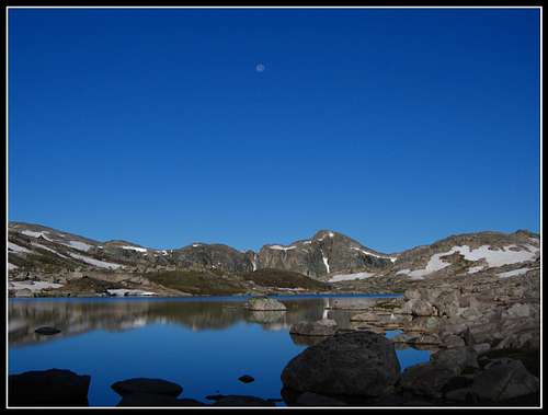
 Bear Basin Bear Basin |
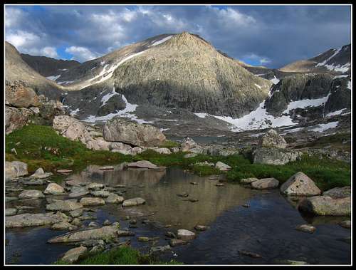 Bear Basin reflection Bear Basin reflection |
West Side Approach - Roaring Fork to Bear Basin
One way distance to Upper Bear Basin - 15 miles
This approach is longer however both more scenic and has much less bushwhacking than the Clear Lake approach described above. From the Green River Lakes trailhead, cross the Green River on the nice bridge and locate the Roaring Fork trail heading north. This trail is much less traveled and not maintained but offers beautiful hiking and much less bushwhacking. It starts paralleling a fence and passing by the old Osborn Cabin and slowly ascending to a small ridge.
Views down to the Green River to the west are great the whole way to this ridge. Cross over the ridge on the easily followed trail and through a nice meadow until you reach the Roaring Fork where we found the old log bridge to cross on. Contrary to what is published in maps, this trail will not go the entire way to Native Lake but ends in the Roaring Fork valley about 500 feet below Native Lake. Years of having no maintenance have taken its toll on the trail.
Follow it as much as you can as it heads along the north side of the creek. You will lose it around 9,400 feet where you will have to cross the creek again (shoes off...no bridge) and continue south up the stream draining Native Lake. This section heads up some steep terrain so use caution climbing the final 500 feet to Native Lake (which is 9 miles from the trailhead; 10,000 feet).
Fantastic camping can be found here but you can continue cross country above treeline to the south, then east for 1.3 more miles to Crescent Lake (elev. 10,750 feet) where there is endless great camping. From Crescent Lake you will need a map and good route-finding skills but your goal is to reach the southwest end of Daphne Lake and meet the Clear Lake approach just before reaching Bear Basin.
There are many ways to do this and I won't bore you with the route I chose...explore this wild alpine environment for yourself! Another option if you want a quicker way to Downs which avoids Bear Basin is to head due east from Crescent Lake and hit the continental divide sooner but this would require good weather without the chance for thunderstorms. Again, map and route-finding required...however the area is very gentle.
|
|
 Native Lake Native Lake |
 Crescent Lake Crescent Lake |
 View just above Crescent Lake View just above Crescent Lake |
North Approach - Sandra Lake
One way distance to Sandra Lake - 14 miles
If you wish to approach from the north be prepared for lots and lots of trailed hiking. You want to get to Sandra Lake via Sandra Pass at the head of Jakeys Fork (reached from either the Simpson Lake Trail or from Seven Lakes Pass via Union Pass). To reach the Simpson Lake trail up Jakeys Fork, turn off Highway 26 as for the Torrey/Glacier Trail. Two miles up the road is the newer Whiskey Basin trailhead, just past the Bighorn Sheep viewing platform. I have not done this approach so I can't say much more other than it is lots of hiking in the forest. From Sandra Lake you can ascend easy slopes to the southeast to the continental divide, passing Dads Lake and follow the divide for 6 miles to the summit of Downs Mountain.
Routes
Now that the hard part is done and you have finished the approach (whatever one you chose) you have the rest of the climb to do. Below is a description of the routes from each side of Downs Mountain.
East Side - Class 2: One way from No Mans Pass - 1.3 miles and 1,100 feet
From No Mans pass either accessed via the Bomber Lake or Goat Flat approach, head southwest over flat terrain to a small tarn at 12,218 feet and continue west up gentle talus to the summit. Really this is a very simple climb never exceeding Class 2 however there can be snowfields to cross/ascend so maybe have an ice axe.
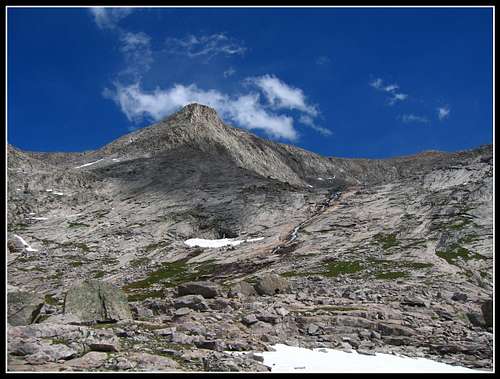
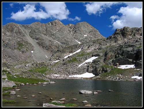
West Side - Class 2: One way from Bear Basin - 2.5 miles and 2,100 feet
From camp in Bear Basin, head due east just north of the long lake towards the big waterfall coming down. Cross the creek on a big slab of rock and climb up very loose Class 2+ terrain on the right (south) side of the waterfall. Extreme care should be taken ascending these rocks. Once in the upper section of the drainage, cross back to the north side of the stream and head up a steep permanent snowfield as the valley curves to the left (north). When you reach 12,700 feet, head east again and ascend talus for 700 feet to the summit.
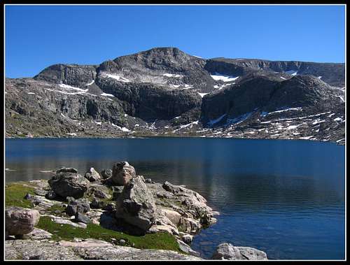
 Bear Basin from the waterfall Bear Basin from the waterfall |
 Bear Basin morning reflection Bear Basin morning reflection |
North Side - Class 2: One way from Sandra Lake - 7 miles and 3,100 feet
![Heart of the Winds]() View to the south from the summit of Downs Mountain
View to the south from the summit of Downs Mountain
From Sandra Lake head up to the continental divide passing by Dads Lake and follow the divide to the summit. Lots of talus!
 View to the south from the summit of Downs Mountain
Camping/Red Tape
The west side is managed by the Bridger Wilderness and National Forest. The east side is managed by the Fitzpatrick Wilderness of Shoshone National Forest. Wilderness regulations apply for camp locations, group size, campfire restrictions and ethics. There are no permit requirements in these two wildernesses.Grizzlies have re-migrated to this part of the range. Take the necessary precautions. Food caching is prohibited and minimum-impact camping and travel ethics are increasingly important at Double Lakes cirque. Backpacking stoves and water filtration are required. A fee-based campground exists at the Green River Lakes trailhead and there is undeveloped camping at the Torrey trailhead.
Map
Interactive map of all the routes on Downs Mountains and key features along the way.
Seasonal Conditions
Summer season in the Wind Rivers is generally July-September with snow lingering on the higher trails into July. A snow storm is traditional between the last week of August and the second week of September. This is normally followed by a dry period with crisp temperatures for 1-4 weeks. On glacier routes crevasses are hidden in June and begin opening sometime in July.Because the Trail Lake/Torrey trailhead is below 8000' on the dry side of the range (the glaciers above absorb the majority of the storms, causing a rain shadow near Dubois), the trailhead can surprisingly be reached almost year round, the exception being during heavy spring storms. The downside for ski approaches is that several miles must often be hiked before significant snow is reached.
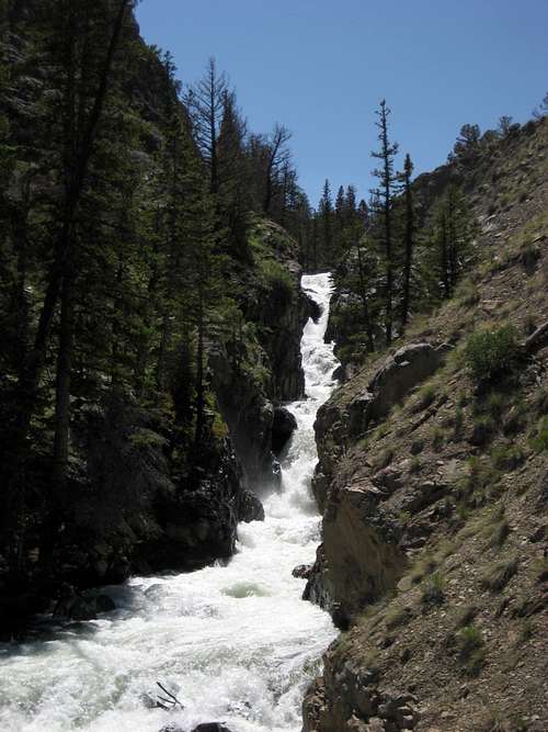
The approaches can be heavy with mosquitos June through August. Water must be carried the first 10 miles of the Glacier Trail.
An area webcam depicts current conditions.
Etymology & Trivia
- John Downs was a Lander resident and early 20th century trophy hunter/guide who explored the area. The name is also attached to Downs Fork (of the Dinwoody).
- First ascent by T.M. Bannon and survey crew during the 1906 topographical surveys.
- The Downs Mountain 7.5 minute quad, in lieu of a Roads and Trails key, was published with the simple statement "No Roads or Trails in this Area". The only such topo in the contig, it illustrates the remoteness of this region. Nonetheless, use trails do exist in most of the drainages.
- Downs has a dominance of over five miles (from a higher neighbor), is two miles from another thirteener and has 1500' of prominence.
- The northwest summit goes by the name 'Northwest Peak'. Other subsidiary summits include Jeralee (12731), Gjetetind (13202), and a tower known as Rundblick (12058).
- The 3 mile-long north ridge creates a shelter for the formation of Continental Glacier. Continental is the widest single (morainal) glacier in the American Rockies (4 miles wide) and is unique in that it laps over the continental divide. This location likely contributes to its designation as one of the fastest shrinking in the Rockies, as a recent expedition discovered.
- Tarns on the Continental Glacier shelf are the highest bodies of water in the state.
- Downs has the largest amount of land above 13k in the Central Rockies.
- Below the Torrey Glacier is a nunatak with the reputation of having some of the best rock in the region. Spider Peak is a favorite of regional guides and wilderness climbing schools.
- Downs is also the home of massive, iceberg-laden lakes including Downs, Bear, Rocking Horse and Daphne.
- Bear Basin, below the west faces, is popular with hunting guides who survey the area not only for Rams but for Black Bears. It is difficult to reach.
- The herd is renowned to ram-trophy hunters and biologists alike and winters with other herds below snowline, adjacent to Dubois. It is the largest winter herd on the continent.
- The summit cairn is several feet tall and has accumulated over the one originally built by Finis Mitchell.
- The southernmost 13er on the Continental Divide is almost the exact same altitude.
- No Mans Pass, the dip between the East Slope and Goat Flat is not used as a pass but as a saddle.
- There are no goats on Goat Flat.
The Grasshopper jokulhlaup. In the summer of 2003, one end of the Grasshopper Glacier (near the head of Downs Fork), which has been recently receding, reached the point where it could no longer hold back the adjacent ice-lake. The end of the glacier burst (a jokulhlaup) and the lake water ran 2 miles down the glacier towards Downs Mountain, melting a trough and accumulating 800 million gallons of mud and water which crashed into the Downs Fork.
The barrage of water, silt and debris descended for miles through the wilderness. It deposited mud into Dinwoody Lakes, and was registered in the Wind River itself. Unlike in other places around the world where this is happening (like the threats experienced in Macugnaga) there was no property destruction. Because of the natural destruction (on the sides of the canyon in some spots) this drainage is a more difficult route in places than it was previously.
This is also the route to Bears Tooth. The glacial debris is currently apparent where the Glacier Trail crosses Downs Fork Meadows. There are several other glaciers in the Winds holding back lakes. In March 2005, $9 million was approved at the state level for a cloud-seeding study over the Winds to try to stabilize the glaciers.
STW - Aug 23, 2010 2:39 pm - Hasn't voted
Additional Info - Summer 2010We were in this area summer 2010. We went for Downs when we were camped at Faler Lake. Climbed up the drainage (cairn-marked trail) below Faler and up from there. We had been advised to head up to Bear Lake, on to Daphne Lake, then up to Downs from there. Won't work. Skip these lakes and head directly up from the top of the drainage above Faler. There is a hard-to-follow set of cairns that takes you up the most direct way through the sections that are not obvious. Note also that the hike up/down from Natural Bridge to Clear Lake and Faler Lake is trickier than expected. It is all non-maintained. There is a faint cairn-marked path, but lots and lots of deadfall trees interrupt the path continuously making for hard route-finding and slow progress. A spectactular area, but a climb that required more time and effort than we expected.
carljm - Aug 13, 2020 5:45 pm - Hasn't voted
Thanks! And a note about the east routeWe did the east route to Downs via base camp at Bomber Lake Aug 10-12. This route guide was very helpful, thank you! One clarification that would have helped us a lot is that you should cross Torrey Creek from east bank to west bank a lot sooner than when it finally turns west toward Bomber Lake. We ended up doing a lot of very slow bushwhacking along the southern portion of the east bank when (as we discovered on the way down) there was a nice trail on the west bank. I’d advise crossing the creek from east to west before the chain of little lakes formed along the creek in the southern portion of the leg from Bomber falls. Also, don’t assume the bomber wreckage will be visible from the trail. If you want to see it, look up coordinates in advance; you’ll likely have to venture off trail to find it. Amazing views from half way up the east ascent of Downs, both southeast to Downs Lake (and a horizon of high peaks) and northeast down to Turquoise and Bomber lakes. Almost better than the summit views which are more obscured by rocky shoulders.
Matt Lemke - Aug 17, 2020 9:46 pm - Hasn't voted
Re: Thanks! And a note about the east routeThank you for posting this update! I am glad you had a great trip. It's a great area in the Winds.