
|
|
List |
|---|---|
|
|
Overview
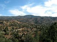
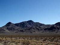
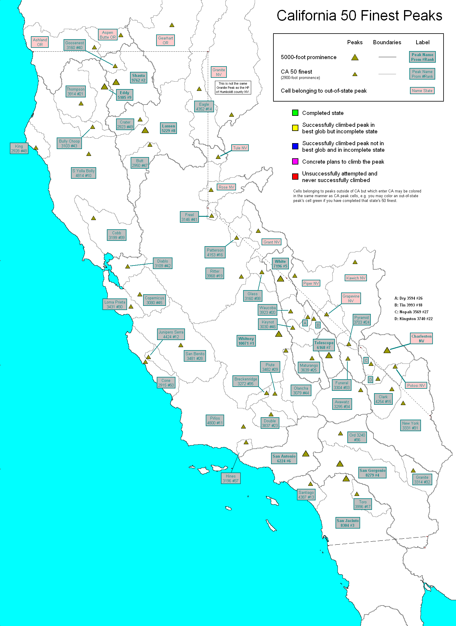
 The fifty most prominent peaks in California are collectively known as the California Fifty Finest. These fifty peaks are spread across California and represent the wide range of geological areas throughout the state: the Coastal Ranges (9), Sierra Nevada (7), Mojave Desert (7), Cascades (5), Transverse Ranges (4), Peninsular Ranges (3), Klamath Mountains (3), Warner Mountains (1), and various other desert ranges (11) are all included. The geological diversity and widespread nature of the Fifty Finest contributes to them being a desired objective for some peakbaggers.
Nine of these peaks have a prominence of over 5,000 feet and as a result are known as Ultra-prominence peaks. The last peak on this list, Cone Peak, has a prominence of 2,925 feet, making this a subset of California's 2,000 foot Prominence Peaks.
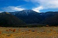
Most of the peaks are not technically challenging and private property and permitting issues tend to be minimal. Only five peaks require class 3 skills (see table below), with Mount Shasta being the most difficult. Mount Copernicus and Mount Diablo are near driveups, and with a good 4x4 Mount Patterson and San Benito Mountain are as well. Some of the peaks, however, remain strenuous undertakings. Several are very remote, lack water, and require significant mileage and elevation gain.
Private Property: Six of these summits lie on private property or have restricted access (Toro Peak, Double Mountain, Maturango Peak, Loma Prieta, Cobb Mountain, and Copernicus Peak). For most of these peaks this is a non-issue, either no one is around or no one bothers hikers approaching the peaks. In other cases there is, or more specifically there potentially is, the possibility of being hassled or turned away. I have only heard of this occurring at Toro Peak and Loma Prieta- if anyone has had any encounters at the other summits please let me know. Even so trespassing carries some risk of being prosecuted. Specifics of the private property characteristics of each peak are well documented on their individual SummitPost pages.
The California Fifty Finest
| Rank | Peak | Elevation | Mean Prominence | Usual Route | Class | County | Mountain Range | Latitude | Longitude | Quad |
|---|---|---|---|---|---|---|---|---|---|---|
| 1 | Mount Whitney | 14,495 | 10,080 | Whitney Trail | 1 | Inyo, Tulare | Sierra Nevada | 36.5785 | -118.2924 | Mount Whitney |
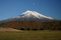
| 2 | Mount Shasta | 14,162 | 9,832 | Avalanche Gulch | 3 | Siskiyou | Cascades | 41.4089 | -122.1949 | Mount Shasta |
| 3 | San Jacinto Peak | 10,804 | 8,304 | Round Valley | 1 | Riverside | Peninsular Ranges | 33.8147 | -116.6795 | San Jacinto Peak |
| 4 | San Gorgonio Mountain | 11,499 | 8,289 | South Fork | 1 | San Bernardino | Transverse Ranges | 34.0992 | -116.8249 | San Gorgonio Mountain |
| 5 | White Mountain Peak | 14,246 | 7,196 | White Mountain Road | 1 | Mono | White Mountains | 37.6341 | -118.2556 | White Mountain Peak |
| 6 | Mount San Antonio | 10,064 | 6,244 | Devil's Backbone | 1 | Los Angeles, San Bernardino | Transverse Ranges | 34.2892 | -117.6462 | Mount San Antonio |
| 7 | Telescope Peak | 11,048 | 6,188 | Mahogony Flat | 1 | Inyo | Panamint Range | 36.1698 | -117.0892 | Telescope Peak |
| 8 | Lassen Peak | 10,457 | 5,237 | Lassen Peak Trail | 1 | Shasta | Cascades | 40.4881 | -121.5048 | Lassen Peak |
| 9 | Mount Eddy | 9,025 | 5,125 | From the PCT | 1 | Siskiyou, Trinity | Klamath Mountains | 41.3196 | -122.4791 | Mount Eddy |
| 10 | South Yolla Bolly Mountain | 8,094 | 4,854 | East Ridge | 2 | Tehama | Northern CA Coast Ranges | 40.0364 | -122.8543 | South Yolla Bolly Mountains |
| 11 | Mount Piños | 8,831 | 4,800 | Service Road | 1 | Ventura | Transverse Ranges | 34.8128 | -119.1454 | Sawmill Mountain |
| 12 | Junipero Serra Peak | 5,862 | 4,472 | Santa Lucia Trail | 1 | Monterey | Central CA Coast Ranges | 36.1456 | -121.4191 | Junipero Serra Peak |
| 13 | Santiago Peak | 5,687 | 4,397 | Holy Jim Trail | 1 | Orange, Riverside | Peninsular Ranges | 33.7106 | -117.5342 | Santiago Peak |
| 14 | Eagle Peak | 9,892 | 4,362 | Poison Flat Trail | 2 | Modoc | Warner Mountains | 41.2835 | -120.2006 | Eagle Peak |
| 15 | Clark Mountain | 7,929 | 4,288 | East Ridge | 3 | San Bernardino | Mojave Desert Ranges | 35.5256 | -115.5886 | Clark Mountain |
| 16 | Mount Patterson | 11,673 | 4,173 | Road 115 | 1 | Mono | Sweetwater Mountains | 38.4367 | -119.3052 | Mount Patterson |
| 17 | Toro Peak | 8,716 | 4,016 | Forest Road 7S02 | 1 | Riverside | Peninsular Ranges | 33.5235 | -116.4257 | Toro Peak |
| 18 | Tin Mountain | 8,953 | 4,013 | West Slopes | 2 | Inyo | Panamint Range | 36.8866 | -117.4561 | Tin Mountain |
| 19 | Mount Ritter | 13,143 | 3,969 | Southeast Glacier | 3 | Madera | Sierra Nevada | 37.6891 | -119.1996 | Mount Ritter |
| 20 | Waucoba Mountain | 11,123 | 3,943 | Northeast Ridge | 2 | Inyo | Inyo Mountains | 37.0218 | -118.0078 | Waucoba Mountain |
| 21 | Thompson Peak | 8,994 | 3,934 | Grizzly Lake | 3 | Trinity | Klamath Mountains | 41.0005 | -123.0484 | Thompson Peak |
| 22 | Double Mountain | 7,981 | 3,841 | Via Tehachapi Mtn | 2 | Kern | Sierra Nevada | 35.0322 | -118.4851 | Tehachapi South |
| 23 | Kingston Peak | 7,336 | 3,754 | North Ridge | 2 | San Bernardino | Mojave Desert Ranges | 35.7267 | -115.9156 | Kingston Peak |
| 24 | Pyramid Peak | 6,703 | 3,723 | Southeast Ridge | 2 | Inyo | Amargosa Range | 36.3918 | -116.6122 | East of Echo Canyon |
| 25 | Maturango Peak | 8,839 | 3,659 | Bendire Canyon | 2 | Inyo | Argus Range | 36.1199 | -117.4956 | Maturango Peak |
| 26 | Dry Mountain | 8,674 | 3,614 | East Slope | 2 | Inyo | Last Chance Range | 36.9091 | -117.5979 | Dry Mountain |
| 27 | Nopah Point | 6,386 | 3,581 | Chicago Valley | 2 | Inyo | Mojave Desert Ranges | 36.0176 | -116.0842 | Nopah Peak |
| 28 | Piute Peak | 8,460 | 3,507 | South Slope | 2 | Kern | Sierra Nevada | 35.4493 | -118.3883 | Piute Peak |
| 29 | San Benito Mountain | 5,241 | 3,491 | OHV Trail | 1 | San Benito | Central CA Coast Ranges | 36.3697 | -120.6444 | San Benito Mountain |
| 30 | Loma Prieta | 3,786 | 3,436 | Loma Prieta Road | 1 | Santa Clara | Central CA Coast Ranges | 37.1111 | -121.8442 | Loma Prieta |
| 31 | New York Mountains HP | 7,532 | 3,349 | Keystone Canyon | 3 | San Bernardino | Mojave Desert Ranges | 35.2587 | -115.3112 | Ivanpah |
| 32 | Granite Mountains HP | 4,347 | 3,347 | South Trailhead | 2 | Riverside | Mojave Desert Ranges | 33.9702 | -115.0728 | Palen Pass |
| 33 | Funeral Peak | 6,384 | 3,324 | East Ridge | 2 | Inyo | Amargosa Range | 36.1032 | -116.6239 | Funeral Peak |
| 34 | Avawatz Mountain | 6,154 | 3,304 | East Ridge | 1 | San Bernardino | Mojave Desert Ranges | 35.5127 | -116.3316 | Sheep Creek Spring |
| 35 | Breckenridge Mountain | 7,548 | 3,271 | Forest Road 28S07 | 1 | Kern | Sierra Nevada | 35.4507 | -118.5843 | Breckenridge Mountain |
| 36 | Ord Mountain | 6,309 | 3,259 | Ord Mountain Road | 1 | San Bernardino | Mojave Desert Ranges | 34.6749 | -116.8151 | Ord Mountain |
| 37 | Cobb Mountain | 4,740 | 3,219 | Pinewood Way | 1 | Lake | Northern CA Coast Ranges | 38.8075 | -122.7406 | Whispering Pines |
| 38 | Glass Mountain | 11,180 | 3,210 | East Slopes | 1 | Mono | Glass Mountain Range | 37.7749 | -118.7086 | Glass Mountain |
| 39 | Hines Peak | 6,716 | 3,208 | Sisar Canyon | 1 | Ventura | Transverse Ranges | 34.5107 | -119.0756 | Topatopa Mountains |
| 40 | Goosenest | 8,280 | 3,180 | Bob Rath Road Trail | 1 | Siskiyou | Cascades | 41.7202 | -122.2225 | Grass Lake |
| 41 | Freel Peak | 10,881 | 3,146 | Trout Creek | 1 | Alpine, El Dorado | Sierra Nevada | 38.8576 | -119.9002 | Freel Peak |
| 42 | Bully Choop Mountain | 6,974 | 3,136 | Bully Choop Mtn Rd | 1 | Shasta, Trinity | Klamath Mountains | 40.5552 | -122.7669 | Bully Choop Mountain |
| 43 | Copernicus Peak | 4,380 | 3,120 | Mt Hamilton Road | 1 | Santa Clara | Central CA Coast Ranges | 37.3469 | -121.6299 | Lick Observatory |
| 44 | Mount Diablo | 3,849 | 3,119 | Summit Trail | 1 | Contra Costa | Central CA Coast Ranges | 37.8816 | -121.9141 | Clayton |
| 45 | Olancha Peak | 12,123 | 3,103 | From the PCT | 2 | Inyo, Tulare | Sierra Nevada | 36.2651 | -118.1181 | Olancha |
| 46 | Keynot Peak | 11,101 | 3,063 | Union Wash | 2 | Inyo | Inyo Mountains | 36.7076 | -117.9624 | New York Butte |
| 47 | Butt Mountain | 7,870 | 2,970 | Carter Creek Trail | 1 | Tehama | Cascades | 40.2176 | -121.3859 | Humboldt Peak |
| 48 | King Peak | 4,088 | 2,948 | Lightning Trail | 1 | Humboldt | Northern CA Coast Ranges | 40.1568 | -124.1242 | Honeydew |
| 49 | Crater Peak | 8,683 | 2,943 | Thousand Lakes Valley | 2 | Shasta | Cascades | 40.6981 | -121.6189 | Thousand Lakes Valley |
| 50 | Cone Peak | 5,155 | 2,925 | Cone Peak Trail | 1 | Monterey | Central CA Coast Ranges | 36.0519 | -121.4963 | Cone Peak |
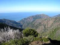
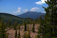
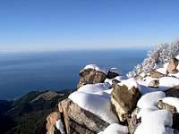
Album
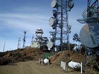
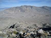
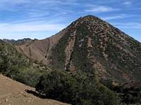
 Double Mountain Double Mountain | ||
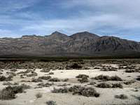
| [img:116377:aligncenter:small:Cone Peak ] |


Resources
The peak list provided here is based on data from USGS Topographic Maps, SummitPost Pages, and these links:COHP page on California prominence (including CA completion maps) by Adam Helman and Edward Earl
Lists of John by John Kirk
Peakbagger page on California prominence by Greg Slayden
Peaklist page on California prominence by Aaron Maizlish