
|
|
List |
|---|---|
|
|
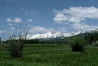
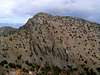
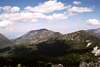
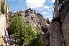
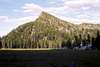
The Elkhorns
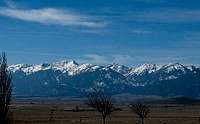
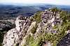
 West Side. Fred photo
Criteria:
>= to 8,000 and named
or
>= 8,000 feet and >= 300 feet of prominence
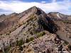
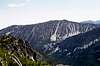
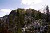
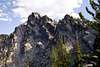
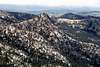
 East Side. Dean photo
Each entry includes:
*Name - with rank
*Elevation
*Prominence
*Location
*Photos
There are worthwhile peaks below 8,000 feet that are not included, but the list had to be broken off somewhere. Each entry includes the elevation, prominence, location and photos if they are available. Elevations may vary slightly from other sources for a variety of reason. Primarily if no stated elevation can be found, the value halfway between the highest elevational line and the next line that would be above it is used as an estimate. This list is similar to the one on the Elkhorn Mountains area page, but was created to include the same information with many more photos made available.
If you have a good photo of a mountain on this list, especially if the mountain is lacking a photo, please call it to my attention and I will be happy to add it.
The List
Rock Creek Butte -1
9,106 - elevation
4,466 - prominence
44.817N -118.104W
 |
 |
 |
 |

Elkhorn Peak -2
8,931
711
44.810N -118.075W
 |
 |
 |
 |
 |
 |
Red Mountain - 3
8,928
1,068
44.884N -118.170W
Twin Mountain - 4
8,897
1,477
44.928N -118.165W
 |
 |
Peak 8,878 (Cougar Basin cirque east) - 5
8,878
738
44.834N -118.096W
Peak 8,875 (Cougar Basin cirque west) - 6
8,875
455
44.831N -118.096W
Van Patten Butte - 7
8,729
1,309
44.950N -118.203W
 |
|
 |
 |
 |
 |
 |
 |
Maxwell Mountain (Willow Lake cirque) - 8
8,709
484
44.862N -118.090W
Angell Peak - 9
8,646
706
44.942N -118.230W

 |
 |
 |
 |

Lees Peak - 10
8,626
286
44.943N -118.238W
 |
 |
 |
 |
 |
 |
 |
 |
Mount Ruth - 11
8,600
780
44.894N -118.232W
 |
 |
 |
 |

Peak 8,564 (Chloride Ridge west) - 12
8,564
384
44.869N -118.166W
Peak 8,538 (Antone Ck head) - 13
8,538
358
44.937N -118.224W
 |
 |

 |
 |
 |
 |
Peak 8,525 (Dutch Flat head) - 14
8,525
625
44.924N -118.232W
 |
 |
 |
 |
The Lakes Lookout - 15
8,522
222
44.944N -118.243W
 |
 |
 |
 |
 |
 |
 |
 |
Peak 8,486 (Summit Lake cirque) - 16
8,486
466
44.869N -118.193W

Peak 8,428 (Dutch/Powder divide) - 17
8,428
528
44.917N -118.207W
Peak 8,419 (Chloride ridge east) - 18
8,419
479
44.870N -118.136W
Van Patten Ridge east - 19
8,412
312
44.948N -118.136W

Peak 8,357 (NF Rock Ck) - 20
8,357
637
44.848N -118.165W
Gunsight Mountain - 21
8,342
242
44.951N -118.228W
 |
 |
|
|
 |
 |
 |
Mount Ireland - 22
8,321
1,061
44.837N -118.228W
 |
 |

Hunt Mountain - 23
8,225
505
44.871N -118.063W
Columbia Hill - 24
8,117
537
44.865N -118.228W
Peak 8,116 - 25
8,116
336
44.926N -118.244W
Crown Point - 26
8,006
546
44.853N -118.294W
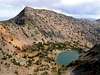
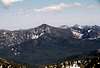
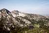
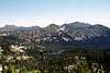
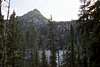
 Gunsight Mountain, Lees Peak and The Lakes Lookout over Anthony Lake