
|
|
List |
|---|---|
|
|
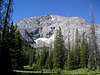
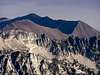
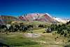
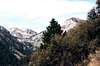
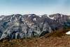
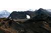
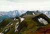
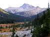
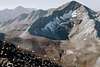
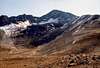
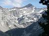
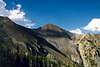
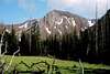
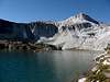
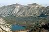
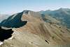
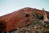
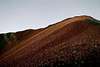
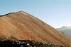
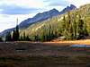
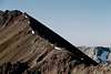
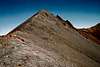
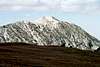
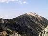
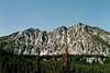
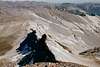
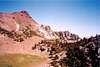
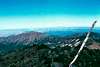
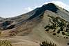
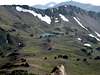
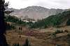
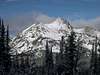
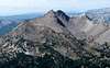
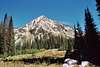
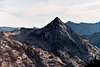
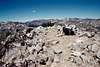
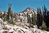
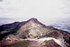
Wallowa Mountains
Criteria:
>= to 8,600 and named
or
>= 8,600 feet and >= 300 feet of prominence
Each entry includes:
*Name - with rank
*Elevation
*Prominence
*Location
*Photos
There are many worthwhile peaks below 8,600 feet that are not included, but the list had to be broken off somewhere. Elevations may vary slightly from other sources for a variety of reason. Primarily if no stated elevation can be found, the value halfway between the highest elevational line and the next line that would be above it is used as an estimate. This list is similar to the one on the Wallowa Mountains area page, but was created to include the same information with many more photos made available.
If you have a good photo of a mountain on this list, especially if the mountain is lacking a photo, please call it to my attention and I will be happy to add it.
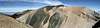
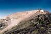
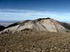
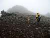
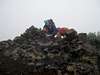
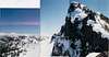
The List
Sacajawea Peak - 1
9,838 - elevation
6,388 - prominence
45.245N -117.293W
 |
 |
 |
 |
 |
 |
Matterhorn - 2
9,826
306
45.228N -117.299W
 |
 |
 |
 |
 |
 |
 |
 |
Hurwall Divide - 3
9,776
876
45.260N -117.265W
 |
 |
 |
 |
 |
 |
Aneroid Mountain - 4
9,702
2,122
45.203N -117.175W
 |
 |
 |
 |
 |
 |
 |
 |
Petes Point - 5
9,675
1,255
45.190N -117.221W
 |
 |
 |
 |
 |
 |
 |
 |
Twin Peaks - 6
9,673
1,973
45.304N -117.345W
 |
 |
 |
 |
 |
 |
 |
Hurricane Divide north - 7
9,620
480
45.280N -117.341W
 |
 |
 |
|
Chief Joseph Mountain - 8
9,617
797
45.286N -117.262W
 |
 |
 |
 |
 |
Eagle Cap - 9
9,572
1,232
45.164N -117.246
 |
 |
 |
 |
 |
 |
 |
 |
Red Mountain - 10
9,555
1,970
45.065N -117.246W
 |
 |
 |
 |
Cusick Mountain - 11
9,518
898
45.138N -117.246W
 |
 |
 |
 |
 |
 |
 |
Hurwal Divide south - 12
9,509
409
45.240N -117.273W
 |
 |
Glacier Peak - 13
9,495
315
45.155N -117.294W
 |
 |
 |
 |
 |
 |
|
 |
Hidden Peak - 14
9,460
640
45.226N -117.172W
 |
 |
 |
 |
 |
Sentinel Peak - 15
9,401
501
45.164N -117.226W
 |
 |
 |
 |
 |
 |
 |
 |
Polaris Point - 16
9,395
495
45.178N -117.224W
 |
 |
 |
 |
 |
 |
 |
 |
Hurricane Divide south - 17
9,386
886
45.219N -117
East Peak - 18
9,380
400
45.237N -117.177W
|
|
 |
 |
 |
 |
North Imnaha - 19
9,340
280
45.153N -117.237W
 |
 |
 |
 |
 |
 |
 |
Peak (S of Ice Lk) - 20
9,314
374
45.217N -117.271W
Elkhorn Mountain - 21
9,233
1,860
45.222N -117.395W

Craig Mountain - 22
9,204
504
45.222N -117.263W
 |
 |
Mount Bonneville (W Fk/E Fk Wallowa divide) - T23
9,180
520
45.216N -117.212W
 |
 |
 |
 |
 |
 |
 |
Peak (Mid Fk Imnaha) - T23
9,180
360
45.149N -117.230W
 |
 |
 |
 |
 |
 |
Sawtooth Peak - 25
9,174
159
45.320N -117.345W
 |
 |
 |
 |
Glacier Mountain - 26
9,169
933
45.189N -117.381W

Peak (Mount Melissa/McCully/ Little Sheep divide) - 27
9,128
548
45.219N -117.135W
 |
 |
Dollar Ridge (Erics Peak) - 28
9,100
600
45.185N -117.187W
 |
 |
 |
 |
 |
 |
 |
Traverse Ridge - 29
9,085
505
45.338N -117.637W

Krag Peak - 30
9,048
1,280
45.065N -117.289W
 |
 |
 |
Peak (Glacier Pass) - 31
9,020
480
45.1716 -117.2791

Needle Point - 32
9,018
1,478
45.128N -117.353W
 |
 |
 |
 |
 |
 |
 |
 |
Peak (S Fk Imnaha/Cliff Ck divide) - 33
8,993
493
45.099N -117.261W
Horn - 34
8,949
1,249
45.120N -117.429W
Brown Mountain - 35
8,944
244
45.180N -117.370W
Peak (head of Copper Ck) - 36
8,940
500
45.107N -117.425W
Peak (between Echo/Tombstone Lks) - 37
8,934
794
45.127N -117.463W
Peak (Eagle Lk cirque) - 38
8,924
484
45.128N -117.329W
Marble Mountain - 39
8,921
701
45.118N -117.193W

Peak (west of Horton Pass) - 40
8,910
450
45.174N -117.330W
Ruby Peak - 41
8,884
664
45.353N -117.355W
 |
 |
Peak (Granite Gulch/Copper divide) - 42
8,861
561
45.195N -117.411W
Peak (SW Blue LK) - 43
8,839
539
45.162N -117.369W
Lookout Mountain - 44
8,831
1,011
45.292N -117.444W
Peak (Cheval Lk headwall) - T45
8,820
520
45.204N -117.440W
Sturgil Ridge highpoint - T45
8,820
520
45.219N -117.444W
Peak (Granite Gulch/Elkhorn Ck divide) - 47
8,787
587
45.207N -117.421W
Bear Lake cirque - 48
8,721
501
45.105N -117.334W
Maxwell Lake points - 49
8,684
424
45.261N -117.410W

Granite Butte - 50
8,679
699
45.135N -117.500W
Peak (Culver Lake cirque) - 51
8,676
736
45.086N -117.349W
Peak (N of Chimney Lk) - 52
8,675
624
45.297N -117.427W
China Cap - 53
8,656
596
45.156N -117.510W
 |
 |
 |
 |
 |
Cornucopia Peak - 54
8,643
423
45.020N -117.239W
Peak (Granite Ck/Lostine divide) - 55
8,627
567
45.337N -117.449W
Jackson Peak - 56
8,602
302
45.127N -117.282W