Overview
Now why did someone have to go make it all confusing up there. Maps show Glenwood Mountain but the highest point is called Signal Peak. Trail signs say Signal while others say Glenwood, books and climbing lists vary with Glenwood or Signal. What should I have it on Summitpost? Leave a comment, I'll change it to whomever has the best argument. To make matters worse, the summit benchmark is labeled Monroe. Geeze, now Monroe Peak is the next big mountain to the south and 15th most prominent in Utah. It's the one with over 2,000 feet of prominence, who's elevation is 11,227 feet, only one foot higher than this peak. Many go up both to be sure they got the highest one. Glenwood Mountain/Signal Peak has 1,846 feet of prominence, making it the 95th most prominent peak in Utah. I should also mention there is already another 2,000 prominent Signal Peak in Utah, down by St. George. Two Signal Peaks on the top 100 prominent list? Makes me want to use the name Glenwood Mountain more than Signal. Lets move on....
This is the northern end of the Sevier Plateau, one of the many high plateaus of the region, full of high vistas, open meadows, wildlife, ATV and off road trails. Of the two big mountains....only one foot apart in elevation, this one is the hiker destination. Monroe Peak has a road that will take you to the summit where you'll find several communication stations on and around the summit area. So Glenwood is the place, with a good number of hiking trails and access points, you'll find the summit register is chalked full of name entries from peakbaggers to hunters to girl scout troops. This area of Glenwood Mountain is most recently famous for the largest elk ever produced in the wild, the bull was found and shot in 2008 by a hunter. Just google "Spider bull" and you can learn all about it. This certainly attests to the quality of wildlife in the area, we could hear elk all around us on the rut. This is when the huge bulls become very vocal and constantly bellow out screams of anguish and anger in their lust to find a receptive female.
![elk]() The "Spider Bull"
The "Spider Bull"![Glenwood Mountain]() Glenwood Mountain on approach from north
Glenwood Mountain on approach from northGetting There
There are so many different ways to reach this mountain. Below are the most popular:
From Monroe
Michael Kelsey's book recommends this access as best for passenger cars but the hiking gain and distance is much greater. From Monroe, take a public road up Monroe Canyon to Monrovian Park. There is an old road just before and Kelseys guide suggests walking this road as it turns into trails that reach the peak. Several summit entries used this route.
From Glenwood
I used this access and as long as it hasn't rained, anyone in any vehicle could access the trail on the north side of the mountain. This puts you much closer and way higher then anywhere else. In the small town of Glenwood, turn east at the first stop sign. A sign indicates as well to turn left for Cove Mountain road. From the stop sign, it's 2.2 miles to a T, go left staying on Cove Mountain road. At the intersection on the far end of Big Lake, be sure to turn left as well. It's about 15 miles to the trailhead from Glenwood. The road is well graded the whole way. The trailhead sign is on the right, easy to miss. A second trailhead is reached if you continue up the Cove Mountain road. There is a trail from Magleby Pass. (Both areas shown on map provided).
Radio Tower Access
This is another suggestion by Kelsey, using the road that goes to a radio facility on the west slopes of the mountain. The 4WD road leaves from near Annabella.
From Koosharem
The south end of the Cove Mountain Road can be reached by heading west out of the little town of Koosharem. Signed.
![Whooton Spring trail]() Trailhead Sign
Trailhead Sign![Glenwood Mountain Map]() Glenwood Mountain Map
Glenwood Mountain MapRed Tape
Logging in the area often closes side roads. Roads shown on maps are often abandoned as well.
Whooton Spring Trail Route
Start up the trail and within a minute it disappears. Get use to this because this will happen to you a dozen times in the next mile. Thinning and dead tree removal logging has obliterated the trail at first. Right above you is a ridgeline, get to the ridge where you'll find the trail again. Mark this spot with flagging. Follow the trail southwest on the ridge. Soon you'll enter a nice green meadow with a huge rock face on the far end. Find the trail again well to the left of the big rock climbing the hillside. Interestingly, even where trail tread has disappeared someone recently cut all the logs out helping one find the way. Soon the route enters big meadows and the open ridgelines to the right are what you are looking for. Leave what trail you think you might be on and climb the ridge making a direct shot for the summit. Once on the ridge, you'll see Signal Peak. It's an easy walk to the top from there. No trail, a bit uneven but brush free.
![Signal Peak]() First view of Signal Peak
First view of Signal Peak![Glenwood North route]() Open meadows & ridgeline
Open meadows & ridgeline![Glenwood & Signal]() Panorama of Glenwood Mountain from Signal Peak
Panorama of Glenwood Mountain from Signal Peak![Monroe Peak]() Monroe Peak to the south
Monroe Peak to the south![Tushar Fire]() Fire in the Tushars
Fire in the Tushars![Pahvant Range]() View to Pahvant Range
View to Pahvant Range![View North]() View North
View North

 The "Spider Bull"
 Glenwood Mountain on approach from north
 Trailhead Sign
 Glenwood Mountain Map
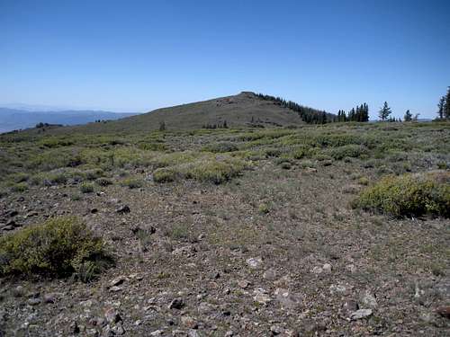 First view of Signal Peak
 Open meadows & ridgeline
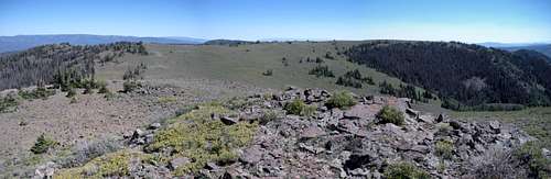 Panorama of Glenwood Mountain from Signal Peak
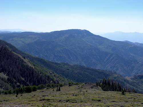 Monroe Peak to the south
 Fire in the Tushars
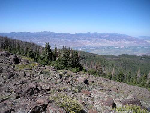 View to Pahvant Range
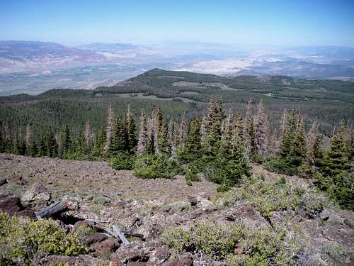 View North
Dean - Aug 17, 2015 6:40 am - Voted 10/10
Update is in orderIf you check peakbagger.com, a couple have mentioned that the sign that marked the trailhead is no longer there. Ken Jones has a good trip report that discusses this and I recommend reading it. The sign was there at the time of my visit in 2010 but not any longer. Richard Carey hiked it from the pass so I'd check out his trip report as well. Copy and paste to get peakbagger page: http://www.peakbagger.com/peak.aspx?pid=21525