
|
|
Mountain/Rock |
|---|---|
|
|
38.60820°N / 111.7396°W |
|
|
Sevier |
|
|
Hiking, Bouldering |
|
|
Spring, Summer, Fall, Winter |
|
|
11633 ft / 3546 m |
|
|
Overview
Fish Lake Hightop is the highest point of Sevier County, Utah. The actual highest point is on a large boulder the size of a house. Bouldering opportunities are possible near the summit area, although I have never done this myself.When approaching from the Sevier valley on US 24, the Fish Lake plateau appears to rise with great relief from its surroundings. It has 4153 feet of prominence, which rates it #14 in Utah.
The Fish Lake mountains contain some signs of past volcanic activity, but I'm not entirely sure how they were formed. If anyone can shed light on the geology of these mountains, please post!
Fish Lake is the largest natural freshwater mountain lake in Utah. Not surprisingly, there are less natural lakes in Utah than man-made, so this might be a reason for the popularity of the Fish Lake area. Fishing, hunting, ATVing, Snowmobiling are all popular activities for this area. It is possible to get within a few thousand feet of the top on an ATV, 4wd or snowmobile should you feel less inclined to walk up. For an overall wilderness experience, this place is decent, but not the best in the state. The proximity of lodges, vacation homes, and a plethora of people cleaning fish makes Fish Lake a little busy.
A strange bit of trivia: the oldest living Aspen "clone" known today lives in Fishlake NF and is over 80,000 years old.
Getting There
If anyone can update mile marker information for the new Utah state system, please post!Utah has many decent quality routes to Fish Lake from almost any direction. These are just a sample of ways to get to it.
North
From Salt Lake City, head south on I-15 to Scipio/US-50. Take US-50 for approximately 30 miles south/east to UT-28. On UT-28, head south/west for approximately 7 miles when you should cross interstate 70 and go through Sigurd. Take UT-24 south now for ~28 miles. You will be heading towards Capitol Reef NP, Bicknell, Loa, Torrey, and Hanksville. UT-24 has beautiful scenery, so don't drive too fast! You should see signs for Fish Lake- eventually a left turn will put you on UT-25 towards Fish Lake.
South
From St. George, take I-15 north to UT-20, about 34 miles from Cedar City. Take UT-20 east to US-89 and turn left/north. Follow US-89 to Kingston or where UT-62 intersects and goes east. After about 10 miles, turn left/north and continue on UT-62 towards UT-24. Once at UT-24, turn right and watch for UT-25 on the left side in just a few miles.
East
From Colorado, take I-70 west past Green River through over a hundred miles of desolate country and no towns/services to the town of Sigurd. Utah has such strange names sometimes. From Sigurd, follow the directions in the Salt Lake/North section.
 Pelican Canyon trailhead
Once you get to Fish Lake, continue towards the northwest side of the lake, looking for the Pelican Canyon overlook turnout. Turn left and head up this moderately bumpy gravel road for about a mile.
US-25 is plowed to the Bowery Haven Resort near the southwest side of the lake during winter, making an ascent possible when the snow flies.
------------------------
With high clearance and possibly 4wd, one can get on to the Fish Lake plateau and get very close to the summit. From UT-25 between UT-24 and Fish Lake, watch for FS road 352. On Forest Service maps, this road goes right by the summit rocks. I have not driven it so I can't attest to its quality or whether or not it is gated at any point. If anyone has experience with this road, please post.
------------------------
The Hike
For Pelican Canyon, head through the fence on a good trail from the parking area on Pelican Promintory. About a hundred yards past the fence, take the left trail. Keep heading up the canyon, until you reach a signed junction approximately two miles into the hike. Take a right. Left still goes up to Fish Lake plateau, but goes further west than you want to go. A ways up, you'll find switchbacks, and not too far from them the trail will peter out and become shallower. Keep an eye out for cairns on the way to the highpoint boulders. You should pass a Forest Service sign near the 4wd road that crosses the plateau. Scamper up the highest boulders and bask in all their glory.
Camping
Fish Lake is a hugely popular summer destination for fishermen and fisherwomen from all over the state. Folks with RVs frequent this area to fish and ride ATVs. In order of appearance on UT-25 when coming northwest:Doctor Creek
Mackinaw
Bowery Creek
Frying Pan
Tasha Equestrian
Piute
Red Tape/Current Conditions
Within the Fish Lake basin, ATVs are restricted to summer homes, developed campgrounds/trailheads and water-based support areas.Check with the Forest Service for current restrictions and conditions:
Fishlake National Forest
Fremont River/Loa Ranger District
138 South Main
Loa, UT 84747
(435) 836-2811
Current Weather:
National Weather Forecast for Fish Lake
Fishlake National Forest Recreation Report - Very helpful!
External Links
Fishlake National ForestCounty Highpointers
Books
High in Utah (ISBN 0874805880)
Hiking Utah's Summits (ISBN 1560445882)
Maps
Thanks to Dean!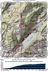 4WD road and Pelican Canyon trail
[img:177830:aligncenter:small:4WD road and Pelican Canyon trail]
Scott - Mar 1, 2006 10:40 pm - Voted 10/10
Here's what I knowThe Fish Lake mountains contain some signs of past volcanic activity, but I'm not entirely sure how they were formed. If anyone can shed light on the geology of these mountains, please post! I believe that the Fish Lake Hightop is what remains of a huge volcanic plateau from frissure eruptions. Thousand Lake Mountain, Boulder Mountain, and Fish Lake High Tops are all isolated remains of this old volcanic plateau. The mountains are now seperated, and are plateaus, because the basalt caps protect the soft sedementary rocks underneath, and what is left and hasn't eroded away are high plateaus. If not for the basalt caps, the mountains would have eroded away a long time ago.