
-
 14296 Hits
-
 80.33% Score
-
 12 Votes
|
|
Mountain/Rock |
|---|---|
|
|
47.66555°N / 120.93313°W |
|
|
Chelan |
|
|
Hiking |
|
|
Spring, Summer, Fall |
|
|
7708 ft / 2349 m |
|
|
Overview
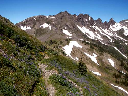
Ladies Peak and craggy north ridge (right)
Looking for a place to take your girlfriend for the weekend? Take her to Ladies Peak! If that doesn't please her, then it's back to the grindstone, Grindstone Mountain that is... Cheesy I know, but it's hard to resist with a name like Ladies Peak. So why is it called Ladies you might ask. The answer is that it's surrounded by 6 lakes all bearing ladies names; Flora, Margaret, Mary, Upper Florence, Lower Florence, and Brigham. Mrs. Brigham? Well uh, we won't talk about her.
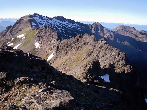
Snowgrass Mountain seen from the summit
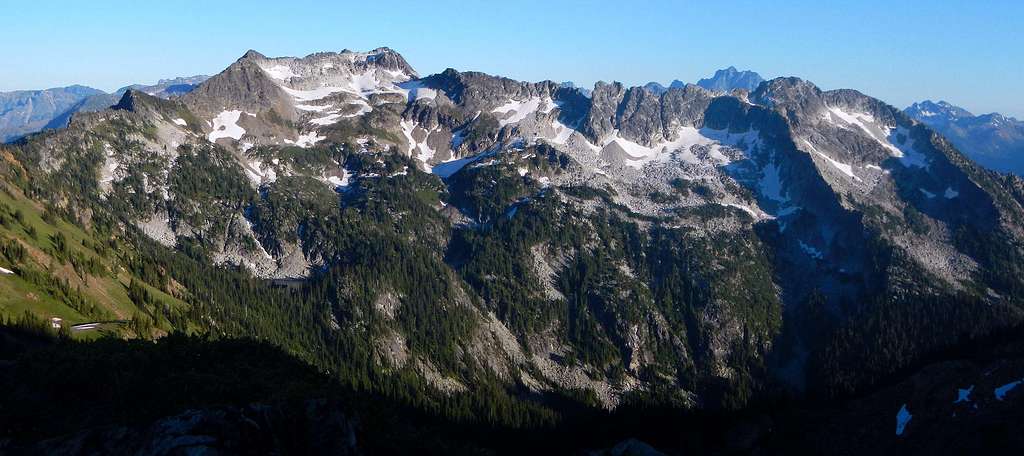
At 7708 feet, Ladies Peak is the seventh highest point in the Chiwaukum Mountains, hosting to a few small glacier remnants on the northeast face. The north ridge is exceptionally craggy with a number of large rocky spires. It's located in the Alpine Lakes Wilderness 15 miles northwest of the town of Leavenworth on a ridge between Snowgrass Mountain and Cape Horn. Due to the fact that the peak is not officially named, it sees fewer ascents compared to other Leavenworth area peaks. It's not clear whether Ladies is part of Icicle Ridge or Chiwaukum Ridge since it lies in between the two in an area densely packed with multiple summits.
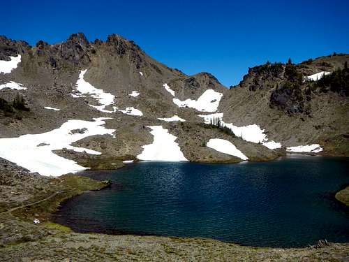
Lake Edna
The Chiwaukum mountains are an ideal location to spend a summer weekend bagging multiple summits, if you're into that sort of thing. Both the southwest and southeast ridges of Ladies Peak are easily navigable and trails pass within 500 vertical feet of the summit. These ridges are primarily class 2 with optional class 3 spots which can likely be bypassed. The approach has a variety of terrain including forest, creek crossings, high passes, small lake basins and finally open alpine slopes. There is some scree to contend with near the end but it isn't bad. The standard route begins at the Scatter Creek trailhead, goes over several passes and takes you past lovely Lake Edna which is a special home for mosquitoes.
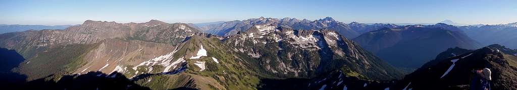
180 degree panorama from the summit
Views from the summit are especially good, including but not limited to Big Jim, Big Lou, Cape Horn, Cashmere, Grindstone, Dragontail, Colchuck, Argonaut, Eightmile, Stuart, Ingalls, Highchair, The Cradle, and Rainier, Daniel, Snowgrass, Sloan, Pugh, White Chuck, and Baker.
![Silhouette Ridges]()
Summit View North
A viable option would be to start at the end of Icicle Creek road and then follow the trail to the Doughgod Creek junction, turn right and follow the trail a short distance to the Frosty Creek junction, turn right and then follow that trail over to Frosy Pass junction, turn right and then and then follow that trail to Frosty Pass where the peak is easily accessible. So do 3 rights make a wrong or just a run-on sentence? This option would have less accumulative gain than the Scatter Creek option but more distance (~22 miles round-trip).
Another approach comes from the north along the Whitepine Creek drainage and crosses Frosty Pass on the way to the peak (20 miles round-trip).
You could follow the South Fork Chiwaukum Creek drainage all the way from Chiwaukum Creek campground, an unreasonably long distance (~25 miles round-trip). A climb of Big Chiwaukum could be added to this route with an overnight stay.
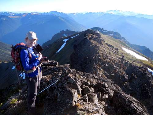
![A Lady on Ladies Peak]()
A Lady on Ladies Peak
Scatter Creek Trail - Sandard route (~13 miles round-trip)
From the Chatter Creek trailhead follow the trail through forest to 4370 feet. Cross the creek and continue along the trail on the east side of the creek. Break out of the trees at 5000 feet and you will have a view of the east face of Grindstone Mountain. Continue through meadows and then brushy slopes towards the pass at 6660 feet, northeast of Grindstone Mountain.
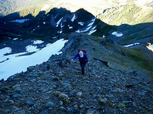
![Fading Light]()
Ascending the southeast ridge
Just before the pass, at 6200 feet, the trail passes near Chatter creek and crosses some rocky slabs. Be careful not to lose the sight of the route here and if in doubt, head straight uphill until the trail is visible again. When you reach the pass at 6660 feet you will have a view of Big Jim Mountain to the northeast and the Index Creek drainage down below.
Follow the trail down 540 feet to a junction at 6140 feet and turn left onto the Icicle Ridge trail. You will have to regain this 540 feet on the trek out. Snow and tarns linger in this area late into the summer. Continue east on the trail and gain another 600 vertical feet to reach Lake Edna with plentiful camping spots.
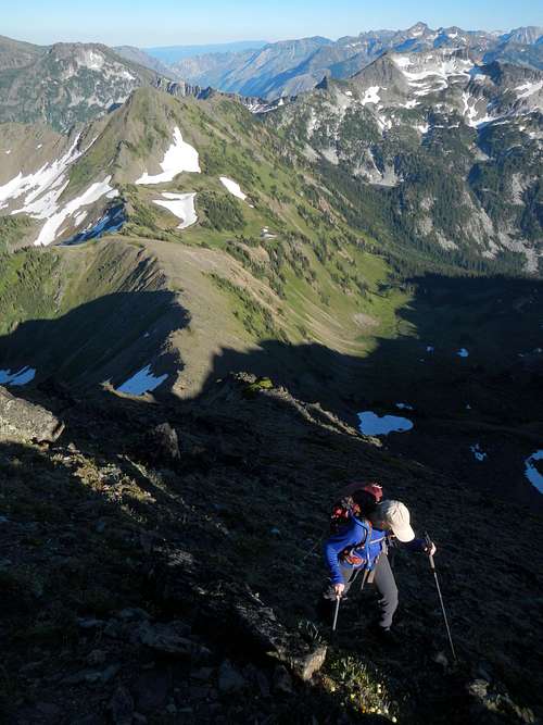
![Ladies East Ridge]()
Ascending the southeast ridge
Follow the trail beyond Lake Edna to another pass located at 7000 feet. From here you will have your first view of Ladies Peak as well as Snowgrass Mountain. Continue beyond the pass and down to Ladies Pass. Beyond the junction leave the trail and follow the southeast ridge all the way to the summit. There is some scree and a few short scramble sections which can be avoided if you so choose. As of July 2013 there was no summit register present, so bring one if you know how to make them.
Route Options
There are at least 4 ways you could approach Ladies Peak by trail. Only the most direct will be described here in detail (see the Scatter Creek section). But let's briefly touch on the other alternatives in case you are a trail runner.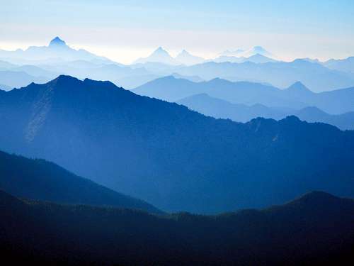
Summit View North
A viable option would be to start at the end of Icicle Creek road and then follow the trail to the Doughgod Creek junction, turn right and follow the trail a short distance to the Frosty Creek junction, turn right and then follow that trail over to Frosy Pass junction, turn right and then and then follow that trail to Frosty Pass where the peak is easily accessible. So do 3 rights make a wrong or just a run-on sentence? This option would have less accumulative gain than the Scatter Creek option but more distance (~22 miles round-trip).
Another approach comes from the north along the Whitepine Creek drainage and crosses Frosty Pass on the way to the peak (20 miles round-trip).
You could follow the South Fork Chiwaukum Creek drainage all the way from Chiwaukum Creek campground, an unreasonably long distance (~25 miles round-trip). A climb of Big Chiwaukum could be added to this route with an overnight stay.
A Lady on Ladies Peak
From the Chatter Creek trailhead follow the trail through forest to 4370 feet. Cross the creek and continue along the trail on the east side of the creek. Break out of the trees at 5000 feet and you will have a view of the east face of Grindstone Mountain. Continue through meadows and then brushy slopes towards the pass at 6660 feet, northeast of Grindstone Mountain.
Ascending the southeast ridge
Just before the pass, at 6200 feet, the trail passes near Chatter creek and crosses some rocky slabs. Be careful not to lose the sight of the route here and if in doubt, head straight uphill until the trail is visible again. When you reach the pass at 6660 feet you will have a view of Big Jim Mountain to the northeast and the Index Creek drainage down below.
Follow the trail down 540 feet to a junction at 6140 feet and turn left onto the Icicle Ridge trail. You will have to regain this 540 feet on the trek out. Snow and tarns linger in this area late into the summer. Continue east on the trail and gain another 600 vertical feet to reach Lake Edna with plentiful camping spots.
Ascending the southeast ridge
Follow the trail beyond Lake Edna to another pass located at 7000 feet. From here you will have your first view of Ladies Peak as well as Snowgrass Mountain. Continue beyond the pass and down to Ladies Pass. Beyond the junction leave the trail and follow the southeast ridge all the way to the summit. There is some scree and a few short scramble sections which can be avoided if you so choose. As of July 2013 there was no summit register present, so bring one if you know how to make them.
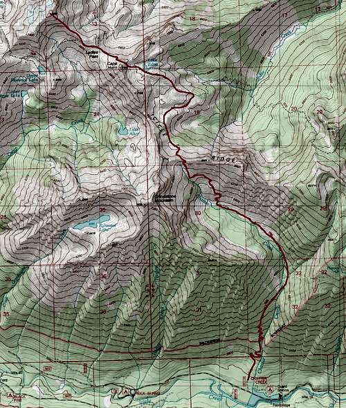
Route Map
Getting There / Driving Directions
From the town of Leavenworth on Highway 2, take Icicle Creek road 15 miles to the Chatter Creek trailhead located on the right (north) side of the road.Red Tape / Camping
A northwest Forest pass required to park at the Chatter Creek trailhead. DO NOT camp on the shore of Lake Edna. Regulations require require a distance of at least 500 feet to reduce soil erosion. Also remember to fill out the free Alpine Lakes Wilderness permit at the trailhead and carry it with you.External Trip Reports
Grindstone Mountain as viewed from Ladies Peak
- Our July 2013 trip report including Snowgrass, Ladies, Cape Horn and Grindstone
- Eric Willhite's trip report including Ladies and Cape Horn
- Gil's July 2008 trip report including Ladies and Cape Horn
- Randy's July 2007 trip report including Ladies, Cape Horn and Grindstone
- A September 2006 trip report by b00 including Ladies and Cape Horn