
|
|
Mountain/Rock |
|---|---|
|
|
40.88530°N / 113.8341°W |
|
|
Tooele |
|
|
Hiking |
|
|
Spring, Fall, Winter |
|
|
6284 ft / 1915 m |
|
|
Overview
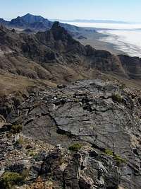 Northeast view from near the summit of Lamus Peak
 View south towards Lamus
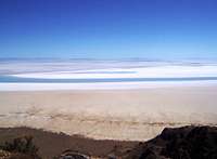 View East, Bonneville Salt Flats
 Bonneville Salt Flats 2000 feet below
Lamus Peak and the rest of the Silver Island Mountains rise straight out of the Bonneville Salt Flats, one of the flattest places on earth. Lamus Peak is one of the more interesting peaks in the Silver Island Mountains. The peak is geologically spectacular while being very rugged on all sides. The peak is about 10.5 miles (as the crow flies) from the interstate. Layers of white, red and dark grey rock can be seen from the interstate, making Lamus Peak stand out. Lamus Peak is located at the southern tip of the northern half of the Silver Island Mountains. At 6284 feet high, Lamus Peak is the 5th highest out of the 8 named summits in the Silver Island Mountain Range. Lamus Peak and the Silver Island Mountains are part of the Silver Island Mountains Wilderness. The Bonneville Speedway, is only a couple miles from the peak and can easily be seen from the top.
Feeling lucky and heading to West Wendover? Or perhaps you’re taking a drive on I-80 west towards West Wendover, consider this peak as a nice objective. Lamus Peak is about a 30 minute excursion from the interstate and will take a few hours to hike. The route to the top is class 2. The route up takes you past several abandoned mines and the geology present makes the route very scenic.
Though Lamus Peak is small, the views from the top are excellent, stretching miles in every direction. Looking north towards Jenkins Peak is a geological treat, though the view is partially blocked in this direction. Panoramic views are in every other direction. Rock formations, layers of rock and the different colors of rock are a sharp contrast to the white Bonneville Salt Flats. To the northwest, Pilot Peak, rising over 6000 feet from the flat desert and only 16 miles from the peak.
Getting There
This route does not require 4wd or high clearance to reach the start of the hike. If high clearance is available you will be able to save some time (see route page).From Salt Lake City (130 miles) :
Head west on I-80 towards West Wendover, NV. Continue for about 117 miles to exit #4, for the Bonneville Speedway. Take a right and continue almost 1.5 miles where the road bends and there is an intersection. Go left, and follow the paved road for just under a mile to the Silver Island Mountains loop road. Take a right on this dirt road. Continue going straight for just over 10.5 miles where you reach the 4WD trail, the start of the hike. If a GPS is available you can use it to find the start of the hike.
The coordinates for the start of the 4WD trail: N 40.8674, W -113.8504 (WGS 84)
 Looking North from the saddle, Bonneville Salt Flats are almost 2000 feet below
When To Climb
This small peak can be easily hiked year round. Unless there have been recent storms in the area, snow does not stay on this mountain for long. Fall through spring is the best time of the year for this hike. The summer is usually hot with temperatures in the 90’s.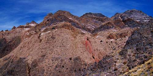 View North Towards Jenkins Peak, Abandoned mines are seen with red dirt below.
Camping
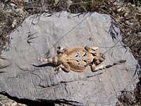 Desert Horned Lizard
Throughout the Silver Island Mountain range undeveloped camping is permitted. There are no trees, water in the range, with an exception of a few junipers in the north end.
If you’re looking for trees, water and a campground, the closest is at Angel Creek campground, near Wells, NV. This campground is 70 miles away and about an hour drive, more information here.
West Wendover, NV has a lot of reasonably prices hotels.
Red Tape & USGS Quads
 View northeast from the near the summit
No permits are required. Please follow wilderness area rules.
USGS Quads
Mountain Conditions
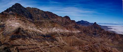
 North half of the Silver Island Mountains
A predicted forecast for the area can be found here.
Local weather for West Wendover, NV can be found here.