
-
 5297 Hits
-
 81.84% Score
-
 14 Votes
|
|
Mountain/Rock |
|---|---|
|
|
45.04670°N / 109.97636°W |
|
|
Mountaineering, Scrambling |
|
|
Summer, Fall |
|
|
10460 ft / 3188 m |
|
|
Overview
Many outdoor enthusiasts detest the idea of mining in the midst of beautiful mountains, but the silver lining (pun intended) in the mining legacy around Cooke City, Montana, is that there are numerous dirt roads that climb high into the mountains and offer short, easy access to the alpine world.
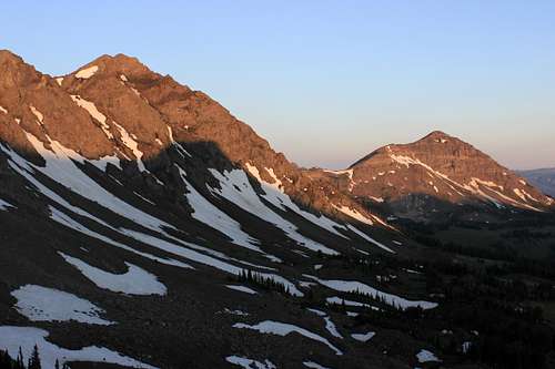
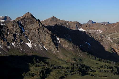
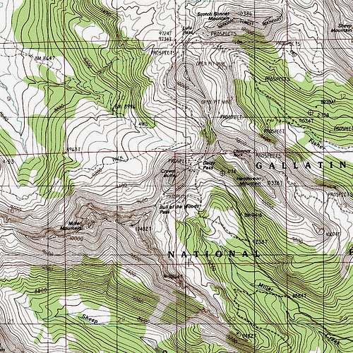
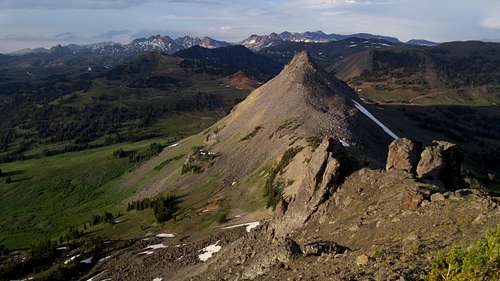
One such excellent access point is Bull of the Woods Pass. At about 9740' and reachable with 4wd, it sits between Crown Butte just to the northeast and Miller Mountain to the west. With a total RT distance for both of 3-4 miles, it is not much of a commitment to climb both in a day. Alternatively, head up in the afternoon and climb one, spend the night, and then climb the other the next morning.
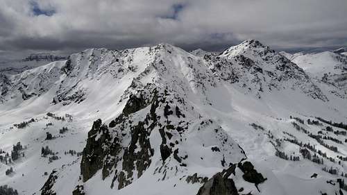
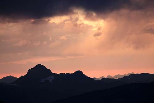
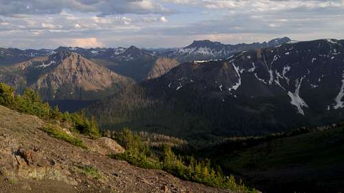
Of the two, Miller Mountain is higher and a little more challenging, but its craggy appearance is somewhat deceiving since it can go at no harder than Class 3 on rock that sometimes is fairly sketchy. Summit views take in rugged mountains in all directions, including some seldom-trod areas of northeastern Yellowstone and the Absaroka-Beartooth Wilderness; the peak lies along the boundary of the latter.
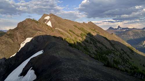
Additional appeal about Bull of the Woods Pass and Miller is that they can be take-off points for longer days that include Sunset Peak (an unranked peak directly west of Miller), Wolverine Peak (north of Sunset), and Mineral Mountain and Meridian Peak (south of Sunset). All of those peaks are on the Yellowstone boundary.
Getting There
Just east of Cooke City, turn onto the dirt road for Daisy Pass. You can drive to either Daisy Pass or Bull of the Woods Pass (both are about 5 miles from the pavement), and you will need high clearance for either. The road to Bull of the Woods Pass is rough and steep in places and will require 4wd; although the approach from Daisy Pass is a little longer, you should not need 4wd unless conditions are wet or snowy. There is also a road connecting Daisy and Bull of the Woods. When clear of snow, it, too, is an easier alternative to the road up to Bull of the Woods.
Route
There isn't much to say. Follow the ridgeline, surmounting or bypassing obstacles as necessary. It is not necessary to climb the false summit directly south of the pass.
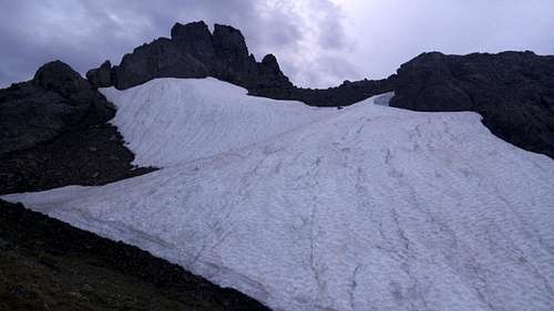
One-way distance is about 1.25 mi with 700-800' of elevation gain. There will be some Class 3 terrain, but you should be able to avoid anything harder than that.
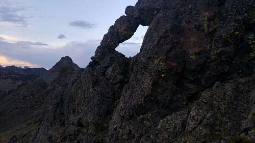
Look for interesting rock formations, including arches, along the way.
Red Tape
There are some private mining claims about; try to avoid them.
This is grizzly country.
When to Climb
Summer and early fall are best. Because of heavy ATV and snowmobile usage around Cooke City, the passes may be accessible in winter.
Camping
Plenty of dispersed camping.