Overview
![South from Leviathan Peak]() South from Leviathan Peak
South from Leviathan Peak
Monitor Pass is a mountain pass in the eastern Sierra front, about 10 miles east of the Sierra crest at Ebbetts Pass. Unlike Ebbetts Pass, Carson Pass, Sonora Pass, or Luther Pass, the Monitor Pass area is not a base for much larger mountains.
The Monitor Pass area is almost entirely within Alpine County, although the road heading up from the east is in Mono County. No major summits are in Mono County. The area is within a transition zone. It isn't as desert-like as its neighbors to the east, but is clearly distinct from the Sierra Nevada to the west. There is very little water, with a few minor lakes currently going dry. Snowfall here is vastly lower than its western neighbors.
While Monitor Pass is at 8,314, the highest mountains above the pass are just below 9,000’. Three prominent mountains rise directly north and south of the plateau at the pass, while a few other prominent summits are accessible from or near Heenan Lake about 4 miles west of the pass.
Views from Monitor Pass and the mountains around it are pretty spectacular, especially in springtime. The mountains around Ebbetts Pass, Sonora Pass, Carson Pass adorn the skyline to the west. While the Sweetwater Mountains are located east, along with Nevada desert peaks.
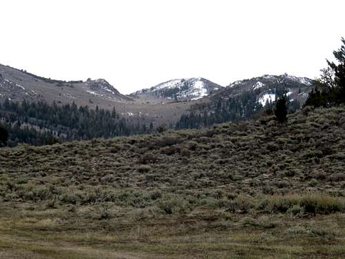
![Silver Peak and Highland Peak from south of Monitor Pass]() Silver Peak and Highland Peak from south of Monitor Pass
Silver Peak and Highland Peak from south of Monitor Pass![Round Top 10,381 seen from the east from Leviathan Peak 8,960']() Round Top 10,381 seen from the east from Leviathan Peak 8,960'
Round Top 10,381 seen from the east from Leviathan Peak 8,960'
The gentle nature of mountains at the pass makes this an ideal area for snowshoe hikers. Although the road is often closed during times of the heaviest snowfall, it is typically open when there is enough snow on the ground to allow for snowshoe hikers.
Getting There
From the west: From the junction of Highway 4 with Highway 89 five miles south of Markleeville continue east on Hwy. 89 for eight miles to Monitor Pass. Heenan Lake is four miles east of the Highway 4/Highway 89 Junction and four miles west of Monitor Pass.
![Leviathan Peak from the west]() Leviathan Peak from the west
Leviathan Peak from the west
From the east: From the junction with Hwy. 395 south of Topaz Lake, enter California from the north and drive a few miles to the sign for Hwy 89 west. Take this road as it winds up to Monitor Pass, which is about 10 miles up the road.
From the Reno/Carson City area, one can approach Monitor Pass via Highway 88 through Markleeville or via 395. Both are equidistant. It is shorter if hiking mountains near Heenan Lake.
Mountains
Around Monitor Pass are three prominent summits:
Leviathan Peak – 8,960’*
South Monitor Pass Peak – 8,930’
Dome 2 Benchmark – 8,315’
*Leviathan Peak has various assumptions of its height. On topographic maps, and overlook at 8,942’ is referenced, while other assumptions have been made that the peak is 8,960’ or 8,980’. Google Earth™ indicates about 8,960’ just above the summit tower. Regardless, it is definitely at least 8,960’ and definitely less than 9,000’.
![View to Leviathan Peak from Big Springs Road en route to Dome 2]() View to east side of Leviathan Peak from Big Springs Road
View to east side of Leviathan Peak from Big Springs Road
South Monitor Pass Peak is accessed from a road about ½ mile west of Monitor Pass, and Dome 2 is accessed from Big Springs Road about two miles east of Monitor Pass. Another destination is High Peak 8,519’, which is a named point about 2 miles north of Monitor Pass, but it isn’t a stand alone mountain, with a prominence of less than 300'.
![South Monitor Pass Peak from the north]() South Monitor Pass Peak from the north
South Monitor Pass Peak from the north![High Peak 8,519' from Leviathan Peak]() High Peak 8,519' from Leviathan Peak
High Peak 8,519' from Leviathan Peak![Dome 2 from south summit ridge]() Dome 2 from south summit ridge
Dome 2 from south summit ridge
Further west are a few other summits that can be considered part of the Monitor Pass area.
Colorado Hill 7,482’ is on the north side of Highway 89, about 5 miles west of the pass as the crow flies. If coming from the west, it is less than two miles up Highway 89 from the junction with Highway 4, on the north side. Mining roads head up the south face of the mountain, as well as roads on the north side.
About 4 miles west of Monitor Pass on Highway 89 is Heenan Lake 7,097’.
![Heenan Lake]() Heenan Lake - May 2018
Heenan Lake - May 2018
Heenan Lake can be used as a starting point to access South Monitor Pass Peak from the west, via a four mile one-way route.
Northwest of Heenan Lake is Peak 7779 on the north side of Highway 89, which has about 450’ of prominence. Directly west of Heenan Lake is Silver Peak 8,090', which actually has a prominence of over 930’.
Both of these peaks can be accessed by parking at Heenan Lake. Peak 8090 should be accessed from the southeast side where you need to scramble up for half a mile from the road past Heenan Lake to reach the road to the summit. Peak 7779 is a steep scramble from any direction.
Red Tape
During winter months Monitor Pass may be closed. It typically opens in springtime, but can be open during winter months, depending on snow conditions. Check the
California DOT for road conditions.

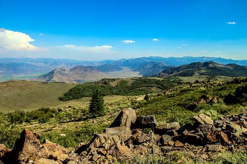 South from Leviathan Peak
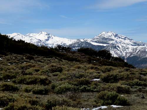 Silver Peak and Highland Peak from south of Monitor Pass
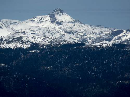 Round Top 10,381 seen from the east from Leviathan Peak 8,960'
 Leviathan Peak from the west
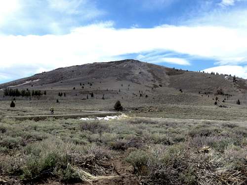 View to east side of Leviathan Peak from Big Springs Road
 South Monitor Pass Peak from the north
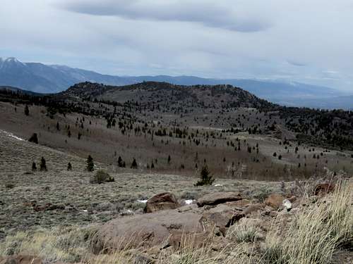 High Peak 8,519' from Leviathan Peak
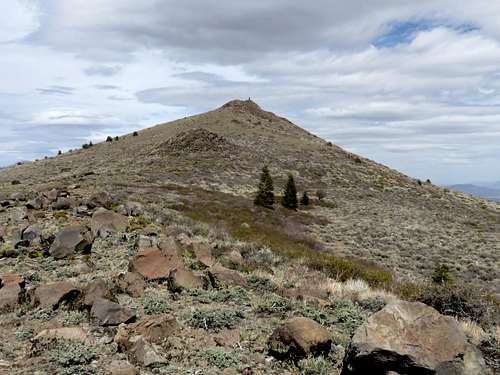 Dome 2 from south summit ridge
 Heenan Lake - Photo by California Department of Fish and Game
 Heenan Lake - May 2018