
-
 8550 Hits
-
 88.19% Score
-
 26 Votes
|
|
Mountain/Rock |
|---|---|
|
|
50.89957°N / 114.99252°W |
|
|
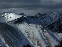
Kananaskis |
|
|
Scrambling |
|
|
Summer, Fall |
|
|
9111 ft / 2777 m |
|
|
Overview

Getting There
There are several possible approaches.The easiest and shortest being...
From Calgary head towards Bragg Creek. Passing through the centre of town follow signs for K-Country and Elbow falls. Take route 66 towards "Elbow Falls" and "Little Elbow". Just past "Powderface Trail" use the day paring at the "Little Elbow" day use area. Follow the signed Nihahi Creek trail north for 4-5 hours till you reach the bowl at the end of the trail. ascend the ridge and follow this west towards the two summits of Mount Howard. The eastern one is the true summit making for a somewhat long easy ridge walk. The only difficulty you may encounter on the route is the high winds wind that may prevent you form achieving the summit. Return the same way.
A longer three-day approach is:
"From Calgary, Alberta. Take the Trans-Canada Highway west to Hiway 40. Then head south to just the Wasootch Creek day area. Park here and make your way in along the flood plain cutting more to your left after 4-5 hours. Gain the ridge following mostly animal trails. From here you will see "Moose Mountain" and Prairie Peak to your left (or east). Drop down to the lake below (Bryant Lake) and continue east along the animals trails till you reach another, flood plain. Here you head right (west) and then left along the valley behind "Nihahi ridge" to another campsite below a huge cave seen to the east. Camp here. The next day keep following the trail south and gain the ridge of Mount Howard folow the ridge to the summit and then retrace your step till it is an easy drop over the other side (south) for the final 5 hours of the walk-out to the "Little Elbow day use area. You will have to have left a car here as well to make your escape. We did the whole route in 4 days and 3 nights of camping. We of course had heavy packs in winter conditions.
High winds are common in this area.
One item of note is the route in on the road from "Elbow Falls" to "Little Elbow" is closed during the winter months. December till May 15th. (Dates to be confirmed)
Red Tape

Check at the information centre for bear activity in the area. We saw black bear tracks near Prairie creek. Carry bear spray.
Elbow Information Centre 403 949-4261
Peter Lougheed Visitor Centre 403 591-6322
Elbow Valley Office 403 949-4941
Sheep River Office 403 933-7172
Police or Ambulance 911
Mountain rescue call 911 and ask for Kananaskis Emergency Dispatch 403 591-7767
Report a poacher 1 800-942-3800
Camping
At "Little Elbow" there are compgrounds
Gooseberry recreation area
McLean Creek recreational area
Paddy's Flats recreational Area
Big Elbow
to name a few.
Reservations would be advised by contacting:
Elbow Valley Campgrounds 403-949-3132
Elbow Information Centre 403 949-4261