
|
|
Mountain/Rock |
|---|---|
|
|
50.84417°N / 114.8498°W |
|
|
Kananaskis Country |
|
|
Hiking |
|
|
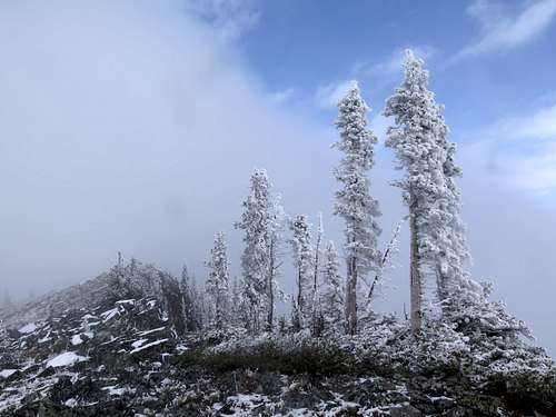
Spring, Summer, Fall, Winter |
|
|
7231 ft / 2204 m |
|
|
Overview
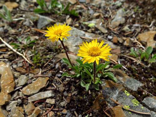
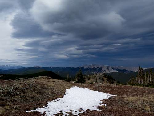
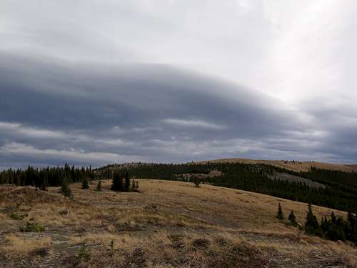
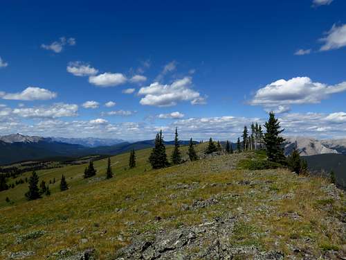
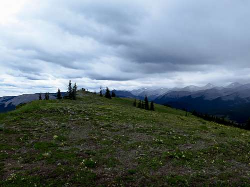
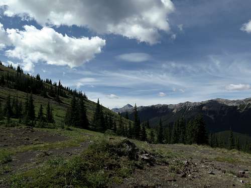
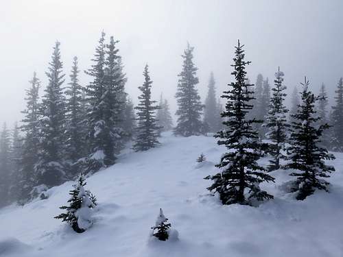
This alpine ridge just east of the Front Ranges is an extremely popular hike and a favorite for many locals. Rising prominently above Highway 66 and the very popular Forgetmenot Pond picnic area, Powderface's open grassy slopes are a real come-on to hikers. Several official trails provide access ranging from an easy hike short hike up the west side from Powderface Trail to an all-day walk up Powderface Creek. The summit stands alone, so it is an excellent viewpoint for the Front Ranges and the prairies. Like many of the high ridges along the eastern slopes, lush forest reaches up the shaded east slope but the summit is in alpine meadows with only little krumholz trees (and great flowers in early summer!)

Getting There
The different trails/routes start from different trailheads.
From the hamlet of Bragg Creek (20 minutes west of Calgary), drive south on Highway 22 (the Cowboy Trail) to the large T intersection and turn right (west) on Highway 66 (Elbow Falls Trail). Continue past the Kananaskis Country boundary and over the Elbow River. The highway curves around to the left past the south end of the Moose Mountain massif, dips into the valley of Canyon Creek, and continues to the winter gate and the Elbow Falls turnoff. Just past the gate is Powderface Creek parking lot on the right, which is the trailhead for the Powderface Creek trail.
For other trailheads, continue on Highway 66. The road veers away from the river and climbs steeply up to a pass known as Rainy Summit, with a pullout on the right. This is the trailhead for the Sunrise Hill/east ridge route.
The highway then descends steeply back to the river, with a fine view ahead of the foursome Banded Peak, Outlaw Peak, Mount Cornwall and Mount Glasgow. Shortly after reaching the river, the highway ends at a T-intersection with a narrower paved road to the left and the gravel Powderface Trail ahead. This is where the standard trail starts.
For the short west slopes trail, continue on Powderface Trail, which bears an ominous "Road Not Recommended for Vehicles" sign. However, since being fixed up after the 2013 floods this road is driveable by any vehicle, although it is narrow and steep. A short distance past the start it traverses a steep slope with a sharp drop on the left, then climbs up an open willowy valley with a view of Nihahi Ridge before reaching a pass. There is no signage, but you should park here in a bit of a pullout. A well-defined trail departs the east side of the road into a pines.
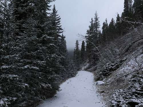
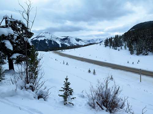
Note: The winter gate just befor Powderface Creek trailhead is closed December 1-May 15. You can still access the Powderface Creek trail as it's only a couple hundred metres past the gate, but all other trailheads are innaccessible between these dates.
Route
There are a number of official trails and established routes up Powderface. The most popular seems to be the "standard" trail starting from the end of Highway 66. About as popular is the short, easy trail up the west slopes from Powderface Trail the road. A much longer but quite enjoyable trail is the Powderface Creek trail, which runs all the way up the cool, shady valley of Powderface Creek to Three Trail Pass on the ridge and is also good for skiing in winter. The east ridge route is a fun, unnofficial trail that starts from Rainy Summit and climbs up the rocky east ridge over a hump known as Sunrise Hill.
West slopes (short) trail
From the pass on Powderface Trail the road, a well-defined trail heads east into an open pine forest with numerous arnica flowers. Shortly it meets an equestrian trail come up from the left and becomes official. The well-maintained trail zigs right, then left across a tiny creek.
Then it turns right and climbs alongside the creek before breaking out into the open just below Three Trail Pass at a coal dust corner. Shortly, you reach Three Trail Pass at an elevation of 2027 metres (6650 feet). The trail come up the other side is Powderface Creek trail, while the trail to the summit turns right. An unnoffical trail turns left onto North Powderface.
Turn right and shortly enter a lush, mossy subalpine fir forest on the left side of the ridge. The trail then turns right and climbs back to the ridgecrest at a col between the main ridge to your left and a knob to your right (which is worth a 10 minute detour). Entering alpine meadows, the trail turns left and wanders across a scenic flat section of ridge with flowers.
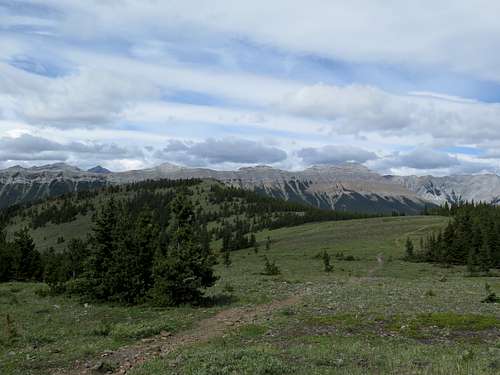
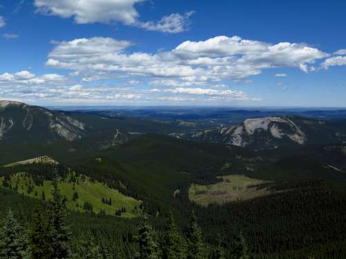
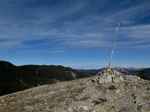
It then climbs up right into a patch of mini pine trees. As you leave the mini pine trees, it becomes apparent that the trail traverses below the summit on the right-hand slope before reaching the ridge crest and the "standard" trail come up the other side. The summit is the rocky knob just up to your left and is a panaromic viewpoint taking in the prairies, Moose Mountain, Nihahi and Compression ridges, numerous other Fisher Range peaks, and the Forgetmenot foursome (Banded Peak, Outlaw Peak, Mount Cornwall and Mount Glasgow), to name a few. Unfortunately, it now includes extensive logging below you to the east. On the way back, you can make a bit of a loop by following the ridge crest (way better views than the trail) back to the flat just before the north end and angling back left to meet the trail.
Powderface Creek trail
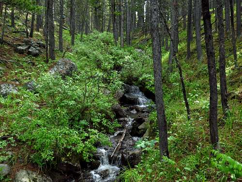
From Powderface Creek day-use area, follow the old exploration road in steep, stony waves up a hill from the back of the parking lot. Not a very nice start! (It gets better though.) The trail then descends to a bit of a rocky area. Past a fancy wooden bridge over a nonexistent creek, the trail passes through a gate in a fence and begins a gradual climb through shady trees on the right side of the valley. En route, you pass the Corri Robb trail climbing Vents Ridge to your right.
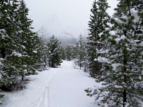
After around 2 kilometres it rounds a corner and over a hill into broad, willowy flats with a view of Powderface Ridge ahead. In a meadow is a sign marking the junction with Prairie Link trail. Continue ahead. The trail re-enters forest, gradually climbing through pines and strips of meadow. Eventually it enters lush Douglas-fir forest and turns left up a steep, stony hill past a boulder field. You turn right and cross a fledgling creek (not Powderface Creek), then climb up again onto a long traverse through very mossy forest. The trail descends a little, crosses the real Powderface Creek, enters a more open area of small pines, becomes singletrack and turns sharp left in quick succession. You are now in a small, wooded hanging valley above the main Powderface Creek valley and are feeling quite high up. The trail runs up the right side of the little valley, periodically travelling through patches of flowery meadow and mossy forest, before finally emerging from the trees at Three Trail Pass and meeting the short trail described above. The remainder of the route is the same as the west slopes approach.
East Ridge route
Starting from the pullout at Rainy Summit, cross the meadow behind the sign (on the west side of the road - the side you are parked on) to an obvious doubletrack trail (old logging road) going into the trees. It curves around to the right and meets another old logging road heading uphill to the left. Turn left on this trail and climb up the hill through small pines and aspens. The trail then veers right into a small clearing and ends.
A singletrack trail carries on at the end of the meadow. Initially heading north, it turns left and climbs uphill before entering mature forest and traversing to the left to the end of a rocky section of ridge. Now under small pines, it runs up the entertaining little ridge before the ridge ends at a small, slabby top which though still in the pines has a view out over the Elbow Valley. The trail carries on into a meadow, then climbs steeply up onto a sort of shelf at about 2000 metres with a better view across the valley.
Still the trail carries on across the shelf to the bottom of a very steep slope of scree, juniper and small trees which it procedes to zig up. After a bit of gasping you arrive at the summit of the bump known as Sunrise Hill, with its signature Canada flag (okay, Prairie Mountain has one too) flapping in the breeze. The view to the east is very panoramic, and includes Moose Mountain and Prairie Mountain to the northeast, but the view west is blocked by the crest of Powderface Ridge which you are just below. So head up there!
Walk down the gently inclined west slope of Sunrise Hill to an open col where you meet the "standard" trail. Either turn right and follow the official trail, which traverses through forest underneath the crest of the ridge before popping onto the open crest and meeting the trail come up the other side, or cross the trail and climb onto the ridge crest immediately. At this point, the crest is still more or less forested (albeit with open patches). On reaching the crest, turn right and follow the ridge over the craggy south summit (still treed though). Past the south-north summit saddle, the ridge turns alpine as a trail develops and you climb over a boulder field and across an open flat to meet the trail. As mentioned the summit is just beyond to the north.
Map
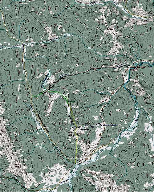
Here's a map showing the different routes. Green is the west slopes trail, red is the Powderface Creek trail, yellow is the standard trail (not described), dark blue is the east ridge route, and light blue is the diversion along North Powderface Ridge (also not described). Routes are approximate. I cannot get this map to display at a higher resolution.
Base map is a Government of Canada topo, © Her Majesty the Queen in right of Canada. See licence here: https://open.canada.ca/en/open-government-licence-canada
Land Management/Red Tape
Powderface Ridge is located in the multi-use area Kananaskis Country. There are no special regulations affecting non-motorized users. Unfortunately, despite very high recreational use, clearcutting is still allowed in the Elbow Valley (as you'll see from the summit).
When to Climb
As mentioned, Highway 66 and Powderface Trail the road are closed past Elbow Falls from December 1st to May 15th. Between those dates, you can use Powderface Creek trail which makes a nice off-track ski trail. In November when the roads are open, be prepared for at least some snow, wind, cold and short daylight.
Camping
There are a number of campgrounds in the Elbow Valley. The nearest campground to most of the routes up Powderface is Little Elbow campground, which is probably also the most popular campground in the valley. Other campgrounds include Beaver Flats, Paddy's Flat, and Gooseberry. All of these campgrounds are quite popular and will likely be full if you don't prebook on summer weekends.
Reccommended Resources
Gillean Daffern's superb 5-volume Kananaskis Country Trail Guide covers this area in great detail. Highly recommended, and available at any outdoor store in the Calgary area and at most bookstores. Volume 2 covers this area.
The Gem Trek topo/trail maps (specifically the Bragg Creek-Sheep Valley map) provide the best coverage of this area, with all official trails marked.
External Links
Kananaskis Country, Alberta Parks: https://albertaparks.ca/parks/kananaskis/kananaskis-country/
Campground links: Little Elbow, Beaver Flats, Paddy's Flat and Gooseberry.
Kananaskis Country updates by guidebook authors Tony and Gillean Daffern: kananaskistrails.com. Their website also has their complete GPS'd trail and route maps, with numbers corresponding to the numbers in their guidebooks.
The summit elevation of 2204 m was measured to an accuracy of 1 metre by Dr Gérard Lachapelle and his team from the University of Calgary's Department of Geomatics Engineering. Here is a list of his team's results for various summits in the area.